Castle Wood

Wood, Forest in Staffordshire Stafford

England

Castle Wood

Former Fisher's Lock, Shrewsbury and Newport Canal
Former Fisher's Lock, Shrewsbury and Newport Canal Credit: David Martin

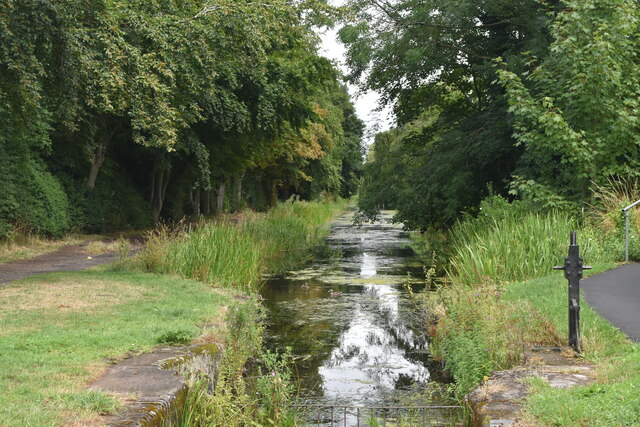
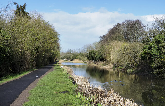
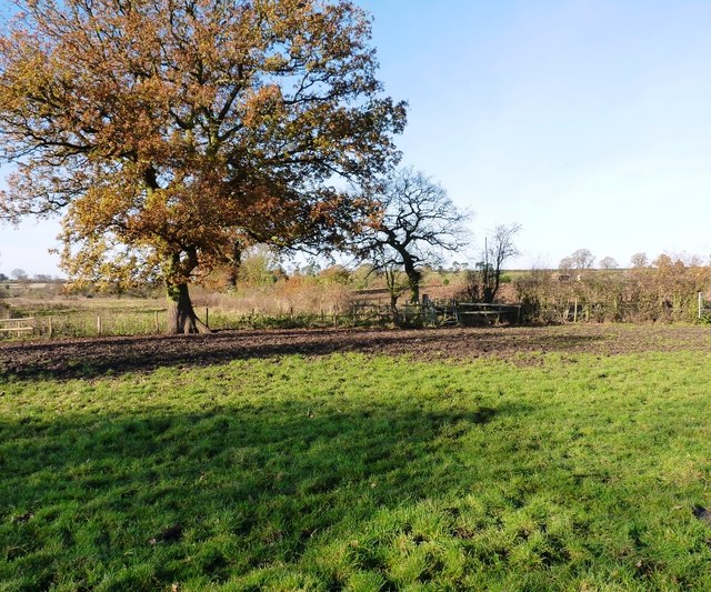
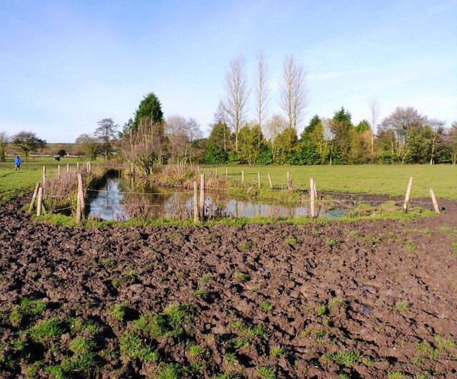
Castle Wood is a beautiful forest located in Staffordshire, England. Covering an area of approximately 50 acres, it is a popular destination for nature enthusiasts and outdoor activities. The wood is named after the ruins of a medieval castle that can be found within its boundaries.

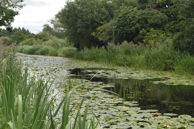
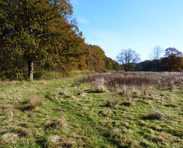
The forest is predominantly made up of oak and beech trees, creating a dense and enchanting canopy overhead. In addition to these dominant species, there are also various other types of trees such as birch, ash, and hawthorn, adding to the diversity of the woodland.

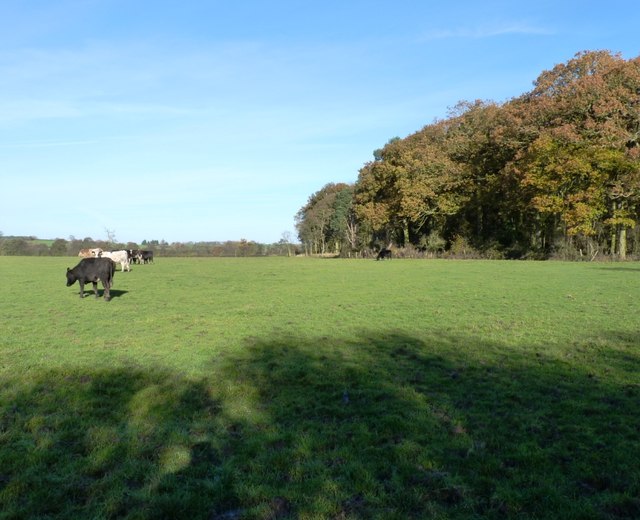
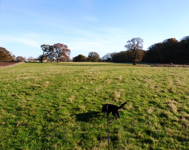
Castle Wood offers a network of well-maintained walking trails, allowing visitors to explore the tranquil surroundings at their own pace. These trails provide ample opportunities for birdwatching, with a wide range of avian species inhabiting the area, including woodpeckers, jays, and various types of songbirds.

The wood is also home to a variety of wildlife, including squirrels, rabbits, and foxes. The presence of these animals adds to the sense of natural beauty and wilderness that can be experienced within Castle Wood.

The ruins of the castle, believed to date back to the 12th century, add a touch of history and intrigue to the woodland. Visitors can explore the remnants of the castle walls, towers, and even a moat, gaining insights into the area's rich past.

In conclusion, Castle Wood in Staffordshire offers a delightful escape into nature, showcasing the beauty of a woodland ecosystem alongside the remnants of a medieval castle. It is a must-visit destination for those seeking tranquility, outdoor activities, and a glimpse into the region's history.

If you have any feedback on the listing, please let us know in the comments section below.

Castle Wood Images

Images are sourced within 2km of 52.770906/-2.3483654 or Grid Reference SJ7619. Thanks to Geograph Open Source API. All images are credited.

Former Fisher's Lock, Shrewsbury and Newport Canal
Lily pads on the former Shrewsbury and Newport Canal
Willow tree and houses across the Shrewsbury & Newport Canal The tree is assumed to be a 'weeping willow', Salix babylonica, or at least some variant or hybrid of it.
The canal was abandoned by stages through the 20th. century but the section through Newport has been restored to an extent as it passes through the town.
Willow tree and houses across the Shrewsbury & Newport Canal
The tree is assumed to be a 'weeping willow', Salix babylonica, or at least some variant or hybrid of it. The canal was abandoned by stages through the 20th. century but the section through Newport has been restored to an extent as it passes through the town.
Shrewsbury & Newport Canal heading north-east The Shrewsbury & Newport Canal has been partly restored as it passes through Newport but more as a feature in a linear park than as a navigable canal. Here the canal is seen to the north of the main part of the town, heading towards Meretown.
Shrewsbury & Newport Canal heading north-east
The Shrewsbury & Newport Canal has been partly restored as it passes through Newport but more as a feature in a linear park than as a navigable canal. Here the canal is seen to the north of the main part of the town, heading towards Meretown.
Almshouses of 1836, Vineyard Road Dated 1836, and bearing a plaque which states that they were funded by the rent of several pieces of land and property, given by a number of donors, for the benefit of 'four Poor Women'. They were Grade II listed <span class="nowrap"><a title="https://historicengland.org.uk/listing/the-list/list-entry/1188036" rel="nofollow ugc noopener" href="https://historicengland.org.uk/listing/the-list/list-entry/1188036">Link</a><img style="margin-left:2px;" alt="External link" title="External link - shift click to open in new window" src="https://s1.geograph.org.uk/img/external.png" width="10" height="10"/></span> & <span class="nowrap"><a title="https://britishlistedbuildings.co.uk/101188036-the-almshouses-newport/upload-photo#.ZFjLQnbMLIU" rel="nofollow ugc noopener" href="https://britishlistedbuildings.co.uk/101188036-the-almshouses-newport/upload-photo#.ZFjLQnbMLIU">Link</a><img style="margin-left:2px;" alt="External link" title="External link - shift click to open in new window" src="https://s1.geograph.org.uk/img/external.png" width="10" height="10"/></span> in 1978.
Almshouses of 1836, Vineyard Road
Dated 1836, and bearing a plaque which states that they were funded by the rent of several pieces of land and property, given by a number of donors, for the benefit of 'four Poor Women'. They were Grade II listed LinkExternal link & LinkExternal link in 1978.
54 High Street, Newport A Regency building of some style, which once had a distinguished doorcase and a bow window when it was a house; it was Grade II listed <span class="nowrap"><a title="https://britishlistedbuildings.co.uk/101054366-54-high-street-newport" rel="nofollow ugc noopener" href="https://britishlistedbuildings.co.uk/101054366-54-high-street-newport">Link</a><img style="margin-left:2px;" alt="External link" title="External link - shift click to open in new window" src="https://s1.geograph.org.uk/img/external.png" width="10" height="10"/></span> & <span class="nowrap"><a title="https://historicengland.org.uk/listing/the-list/list-entry/1054366" rel="nofollow ugc noopener" href="https://historicengland.org.uk/listing/the-list/list-entry/1054366">Link</a><img style="margin-left:2px;" alt="External link" title="External link - shift click to open in new window" src="https://s1.geograph.org.uk/img/external.png" width="10" height="10"/></span> in 1952.
54 High Street, Newport
A Regency building of some style, which once had a distinguished doorcase and a bow window when it was a house; it was Grade II listed LinkExternal link & LinkExternal link in 1952.
Start of the Newport to Stafford Greenway A very good path / cycle path which was completed around eight years ago.
Start of the Newport to Stafford Greenway
A very good path / cycle path which was completed around eight years ago.
Former railway bridge on Newport to Stafford cycle path A bit different to <a href="https://www.geograph.org.uk/photo/4095986">SJ7618 : Spruced up a bit</a> and even more so to <a href="https://www.geograph.org.uk/photo/1072938">SJ7618 : A railway line no more.</a>. The cycle path is well used and established now.
Former railway bridge on Newport to Stafford cycle path
A bit different to SJ7618 : Spruced up a bit and even more so to SJ7618 : A railway line no more.. The cycle path is well used and established now.
Looking south from the cycle path
Newport LIDL Built in 2018
Newport LIDL
Built in 2018
Newport to Stafford Greenway cycle path Looking west towards Newport.
Newport to Stafford Greenway cycle path
Looking west towards Newport.
Newport to Stafford Greenway cycle path Looking east. A great cycle route along the disused railway line, there should be more of these.
Newport to Stafford Greenway cycle path
Looking east. A great cycle route along the disused railway line, there should be more of these.
A41 Newport bypass in cutting
Bridleway gate and fence south of Sutton Yes, it was as muddy as it looks, the cattle in the fields here had seen to that.
Bridleway gate and fence south of Sutton
Yes, it was as muddy as it looks, the cattle in the fields here had seen to that.
There's no avoiding it... Try as we might (and Daft Dog didn't try very hard), walking through here on the bridleway means that you're going to get filthy. All good fun.
There's no avoiding it...
Try as we might (and Daft Dog didn't try very hard), walking through here on the bridleway means that you're going to get filthy. All good fun.
The west side of Thistleyfield Covert These cattle are responsible for some fine muddy stretches in the field to the left, but this end of it seemed rather more grassy.
The west side of Thistleyfield Covert
These cattle are responsible for some fine muddy stretches in the field to the left, but this end of it seemed rather more grassy.
Bridleway on the south side of Thistleyfield Covert This area borders part of the Aqualate Mere National Nature Reserve, which surrounds the mere itself. It's leased from the estate by Natural England, and has a network of bridleways providing access around the reserve.
Bridleway on the south side of Thistleyfield Covert
This area borders part of the Aqualate Mere National Nature Reserve, which surrounds the mere itself. It's leased from the estate by Natural England, and has a network of bridleways providing access around the reserve.
Bridleway heading towards Aqualate Mere Daft Dog remains on the lead, as the next field holds a flock of sheep that he's not yet spotted.
Bridleway heading towards Aqualate Mere
Daft Dog remains on the lead, as the next field holds a flock of sheep that he's not yet spotted.
Show me another place!

Castle Wood is located at Grid Ref: SJ7619 (Lat: 52.770906, Lng: -2.3483654)

Administrative County: Staffordshire

District: Stafford

Police Authority: Staffordshire

What 3 Words

///pits.piglets.work. Near Newport, Shropshire

Related Wikis

Aqualate Hall

Aqualate Hall, a 20th-century country house, is located in Forton, Staffordshire, England, some 2 miles (3.2 km) east of the market town of Newport, Shropshire...

Aqualate Mere

Aqualate Mere, in Staffordshire, is the largest natural lake in the English Midlands and is managed as a national nature reserve (NNR) by Natural England...

Back Brook, English Midlands

The Back Brook is a minor watercourse in the English counties of Shropshire and Staffordshire, in places forming the boundary between the two, and located...

Newport railway station (Shropshire)

Newport (Shropshire) station was a railway station serving Newport in Shropshire. that was situated on the Stafford to Shrewsbury Line via Wellington....

Nearby Amenities

Located within 500m of 52.770906,-2.3483654
Bus Stop
Aqualate Park
Bus: yes
Naptan AtcoCode: 3800C751800
Naptan Bearing: E
Naptan CommonName: Aqualate Park
Naptan Indicator: adj
Naptan Landmark: Walkley Bank
Naptan NaptanCode: stadadmw
Naptan Street: Newport Road
Naptan Verified: no
Public Transport: platform
Source: naptan_import
Lat/Long: 52.7703546/-2.3531118
Bus Stop
Aqualate Park
Bus: yes
Naptan AtcoCode: 3800C751801
Naptan Bearing: W
Naptan CommonName: Aqualate Park
Naptan Indicator: opp
Naptan NaptanCode: stadagjg
Naptan Street: Newport Road
Naptan Verified: no
Public Transport: platform
Source: naptan_import
Lat/Long: 52.7701144/-2.352265
Give Way
Direction: forward
Lat/Long: 52.7702009/-2.35247
Barrier: cattle_grid
Lat/Long: 52.7704564/-2.3520124
The data included in this document is from www.openstreetmap.org. The data is made available under ODbL.

Have you been to Castle Wood?

Leave your review of Castle Wood below (or comments, questions and feedback).