Read Wood

Wood, Forest in Lancashire Ribble Valley

England

Read Wood

Old Milestone, Read Currently located in Whins Lane, Read. 

Inscription: To / Whalley / 2 Miles / To Clitheroe / 6 Miles // 
             To / Padiham / 2 Miles / to Burnley / 3½ Miles

Milestone Society National ID: LA_BUCL06
Old Milestone, Read Credit: David Phillips

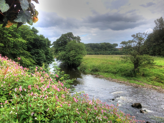
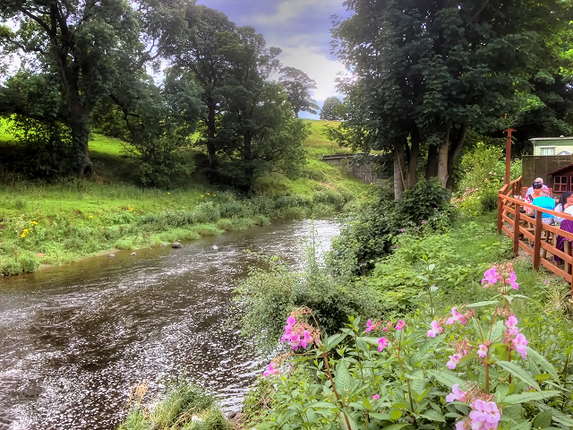
Read, also known as Read Wood, is a small village located in the county of Lancashire in England. Situated in the Forest of Pendle, Read Wood is surrounded by picturesque landscapes and lush greenery, making it an ideal destination for nature lovers and outdoor enthusiasts.

The village is primarily residential, with a population of around 3,000 people. It offers a peaceful and tranquil atmosphere, away from the hustle and bustle of larger towns and cities. The charming countryside setting and close-knit community make Read Wood an attractive place to live.

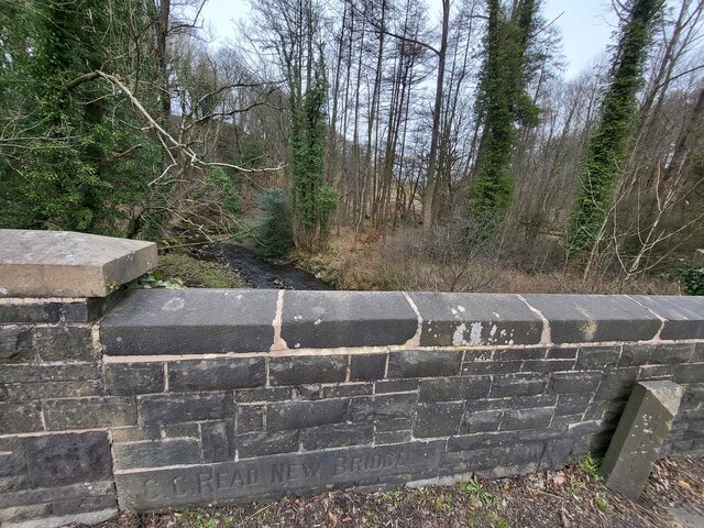
Read Wood is known for its historical significance, with evidence of human settlement in the area dating back to the prehistoric era. The village has a rich heritage and is home to several listed buildings, including St. John's Church, which dates back to the 16th century.

Although small, Read Wood boasts a range of amenities and services to cater to the needs of its residents. There are local shops, a post office, a primary school, and a community center. Additionally, the village has several pubs and restaurants where locals and visitors can enjoy a meal or a drink.

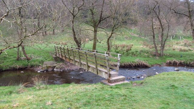
The surrounding Forest of Pendle provides ample opportunities for outdoor activities such as hiking, cycling, and bird-watching. The area is also renowned for its connections to the Pendle Witches, a group of women who were accused of witchcraft in the 17th century. Visitors can explore the Pendle Witch Trail, which passes through Read Wood and other nearby villages, to learn more about this dark period in history.

In summary, Read Wood is a charming village nestled in the Forest of Pendle, offering a peaceful lifestyle, a rich history, and stunning natural scenery.

If you have any feedback on the listing, please let us know in the comments section below.
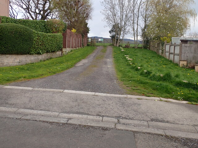
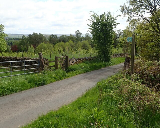
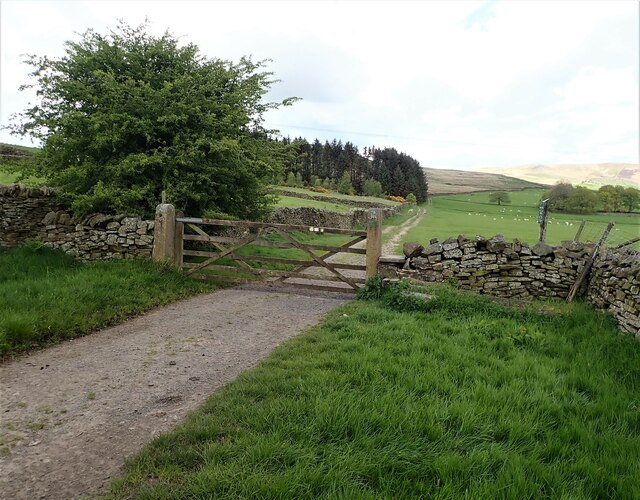
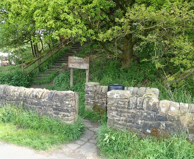
Read Wood Images

Images are sourced within 2km of 53.816791/-2.3703676 or Grid Reference SD7535. Thanks to Geograph Open Source API. All images are credited.

Old Milestone, Read Currently located in Whins Lane, Read. 

Inscription: To / Whalley / 2 Miles / To Clitheroe / 6 Miles // 
             To / Padiham / 2 Miles / to Burnley / 3½ Miles

Milestone Society National ID: LA_BUCL06
Old Milestone, Read
Currently located in Whins Lane, Read. Inscription: To / Whalley / 2 Miles / To Clitheroe / 6 Miles // To / Padiham / 2 Miles / to Burnley / 3½ Miles Milestone Society National ID: LA_BUCL06
Spring Wood Information Centre
Park Head
Park Head
Old Wayside Cross off Trapp Lane Simon's Cross, the base of a wayside cross. Set beside a footpath leaving a gate on the east side of Trapp Lane on the boundary of Simonstone and Read parishes. See also  <span class="nowrap"><a title="https://thejournalofantiquities.com/2016/06/15/simons-cross-simonstone-near-padiham-lancashire/" rel="nofollow ugc noopener" href="https://thejournalofantiquities.com/2016/06/15/simons-cross-simonstone-near-padiham-lancashire/">Link</a><img style="margin-left:2px;" alt="External link" title="External link - shift click to open in new window" src="https://s1.geograph.org.uk/img/external.png" width="10" height="10"/></span> and <a title="https://www.geograph.org.uk/photo/1122007" href="https://www.geograph.org.uk/photo/1122007">Link</a>.

Milestone Society National ID: LARV_SIM
Old Wayside Cross off Trapp Lane
Simon's Cross, the base of a wayside cross. Set beside a footpath leaving a gate on the east side of Trapp Lane on the boundary of Simonstone and Read parishes. See also LinkExternal link and Link. Milestone Society National ID: LARV_SIM
Footbridge over Sabden Brook below Hodgeon Stone Plantation
Old Bridge Marker on the A671 Whalley Road Bridge Marker set in the parapet of Read New Bridge, Sabden Brook, next to boundary marker LA_BUCL06pb, on the north side of the A671 Whalley Road. On the boundary of Whalley and Read parishes.

Milestone Society National ID: LA_WHAREA01br
Old Bridge Marker on the A671 Whalley Road
Bridge Marker set in the parapet of Read New Bridge, Sabden Brook, next to boundary marker LA_BUCL06pb, on the north side of the A671 Whalley Road. On the boundary of Whalley and Read parishes. Milestone Society National ID: LA_WHAREA01br
Village Signpost on the A671 Whalley Road near Read New Bridge Located on the northeast side of the A671 Whalley Road at the east end of Read New Bridge in Read parish. 

Milestone Society National ID: LA_SD7434V
Village Signpost on the A671 Whalley Road near Read New Bridge
Located on the northeast side of the A671 Whalley Road at the east end of Read New Bridge in Read parish. Milestone Society National ID: LA_SD7434V
Village Signpost on the A671 Whalley Road on Read New Bridge Located on the southwest side of the A671 Whalley Road on Read New Bridge in Read parish. 

Milestone Society National ID: LA_SD7434W
Village Signpost on the A671 Whalley Road on Read New Bridge
Located on the southwest side of the A671 Whalley Road on Read New Bridge in Read parish. Milestone Society National ID: LA_SD7434W
Footpath off Carleton Road The entrance leading to the footpath from Carleton road Simonstone.
Footpath off Carleton Road
The entrance leading to the footpath from Carleton road Simonstone.
Gate for path off Clerk Hill Road The gate for the footpath on Clerk Hill Road leading to Lower Clerk Hill and Hollins Farm.
Gate for path off Clerk Hill Road
The gate for the footpath on Clerk Hill Road leading to Lower Clerk Hill and Hollins Farm.
Gate on Clerk Hill Road The gateway just past Wiswell Moor Houses on Clerk Hill Road, a view of this gate from the opposite direction can be seen here - <a title="https://www.geograph.org.uk/photo/3358541" href="https://www.geograph.org.uk/photo/3358541">Link</a>.  Description regarding footpaths here -<a title="https://www.geograph.org.uk/photo/2266920" href="https://www.geograph.org.uk/photo/2266920">Link</a>
Gate on Clerk Hill Road
The gateway just past Wiswell Moor Houses on Clerk Hill Road, a view of this gate from the opposite direction can be seen here - Link. Description regarding footpaths here -Link
Gateway for steps leading to Viaduct The gateway leading to the 74 steps providing access from Martholme Lane up to the Viaduct and Martholme Greenway.
Gateway for steps leading to Viaduct
The gateway leading to the 74 steps providing access from Martholme Lane up to the Viaduct and Martholme Greenway.
Access to Martholme Viaduct The barrier with gateway providing access to Martholme Viaduct from Martholme Greenway. The path leading off on the left leads to the 74 steps going down to Martholme Lane.
Access to Martholme Viaduct
The barrier with gateway providing access to Martholme Viaduct from Martholme Greenway. The path leading off on the left leads to the 74 steps going down to Martholme Lane.
Wooden Benches on Martholme Viaduct The benches on the path over Martholme Viaduct. Access beyond the viaduct has been closed off see closer view here - <a title="https://www.geograph.org.uk/photo/7483819" href="https://www.geograph.org.uk/photo/7483819">Link</a>
Wooden Benches on Martholme Viaduct
The benches on the path over Martholme Viaduct. Access beyond the viaduct has been closed off see closer view here - Link
End of Access from Martholme Viaduct A closer view of the barrier erected at the end of the path leading over Martholme Viaduct towards Read and Simmonstone.
End of Access from Martholme Viaduct
A closer view of the barrier erected at the end of the path leading over Martholme Viaduct towards Read and Simmonstone.
Martholme Gatehouse and outer archway Martholme manor house dates from the 13th century when the house belonged to the de Fitton family. It was passed through marriage to the Hesketh family and re-built in 1577 during the reign of Queen Elizabeth I. During that time the Lords of the Manor would carry out their own code of justice on local law breakers and this was dispensed at the Gatehouse. The Gatehouse can be seen in the picture with the Outer Archway which was added in 1607. The remaining buildings are located off to the left and obscured by trees.
Manor House - <span class="nowrap"><a title="https://redrosecollections.lancashire.gov.uk/view-item?i=274760&WINID=1690967778154" rel="nofollow ugc noopener" href="https://redrosecollections.lancashire.gov.uk/view-item?i=274760&WINID=1690967778154">Link</a><img style="margin-left:2px;" alt="External link" title="External link - shift click to open in new window" src="https://s1.geograph.org.uk/img/external.png" width="10" height="10"/></span>
Martholme Gatehouse and outer archway
Martholme manor house dates from the 13th century when the house belonged to the de Fitton family. It was passed through marriage to the Hesketh family and re-built in 1577 during the reign of Queen Elizabeth I. During that time the Lords of the Manor would carry out their own code of justice on local law breakers and this was dispensed at the Gatehouse. The Gatehouse can be seen in the picture with the Outer Archway which was added in 1607. The remaining buildings are located off to the left and obscured by trees. Manor House - LinkExternal link
River Calder, Looking Upstream from Read Garden Centre
River Calder, Looking Downstream from Read Garden Centre
Show me another place!

Read Wood is located at Grid Ref: SD7535 (Lat: 53.816791, Lng: -2.3703676)

Administrative County: Lancashire

District: Ribble Valley

Police Authority: Lancashire

What 3 Words

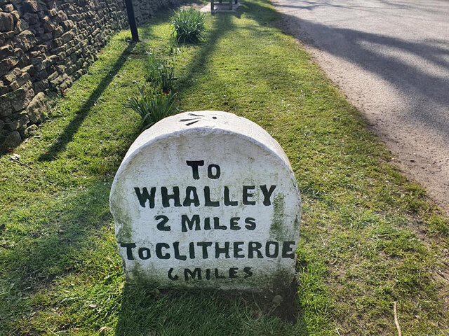
///defected.dolphins.chilled. Near Whalley, Lancashire

Related Wikis

Read Hall and Park

Read Hall and Park is a manor house with ornamental grounds of about 450 acres (180 ha) in Whalley Road, Read, a few miles west of Padiham, Lancashire...

Portfield Hillfort

Portfield also known as Planes Wood Camp is a late Bronze Age or Iron Age hillfort situated close to the town of Whalley in Lancashire, Northern England...

Read, Lancashire

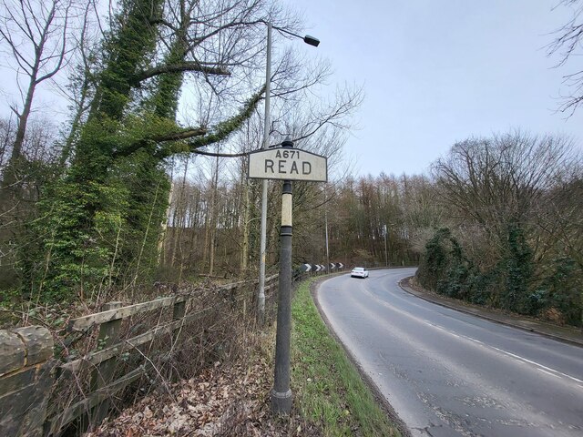
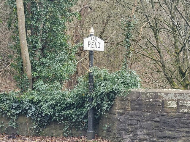
Read is a village in Lancashire 5 miles west northwest of Burnley and 2 miles east of Whalley. It is on the A671 which is the main road between Burnley...

Sabden Brook

Sabden Brook is a small river running through Lancashire in England. It is 7.59 miles (12.21 km) long and has a catchment area of 6.84 square miles (17...

Martholme Viaduct

Martholme Viaduct is a 19th-century railway viaduct in the English county of Lancashire. It lies between the town of Great Harwood and the village of Read...
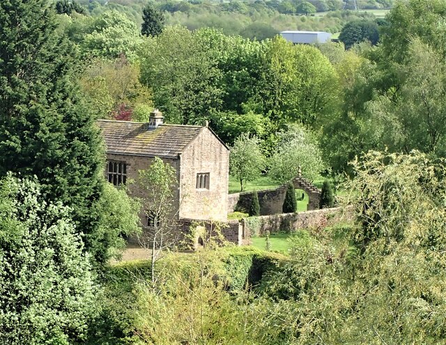
Martholme

Martholme is a Grade I listed medieval manor house standing on the banks of the River Calder 1+1⁄4 miles (2 km) from Great Harwood, Lancashire, England...

Wiswell

Wiswell is a small village and civil parish in the Ribble Valley, Lancashire, England, close to Whalley and Clitheroe at the foot of Wiswell Moor. At the...

Simonstone, Lancashire

Simonstone is a small village and civil parish in the Ribble Valley district of Lancashire, England. The population of the civil parish taken at the 2011...

Nearby Amenities

Located within 500m of 53.816791,-2.3703676
Brocklehurst Wood
Natural: wood
Source: OS_OpenData_StreetView
Lat/Long: 53.8156274/-2.376023
Read Wood
Natural: wood
Source: OS_OpenData_StreetView
Lat/Long: 53.8168182/-2.3698217
The data included in this document is from www.openstreetmap.org. The data is made available under ODbL.

Have you been to Read Wood?

Leave your review of Read Wood below (or comments, questions and feedback).