Greens Wood

Wood, Forest in Shropshire

England

Greens Wood

Wheatsheaf Public House 1GL Benchmark This benchmark, cut into the Wheatsheaf Public House on Pave Lane, Telford,  was used during the First Primary Levelling, England & Wales. It was included on the Llandysilio to Stafford line as "No. 84. Mark on East angle of the Wheat Sheaf Inn, Field Aston ; 1.07 ft. above surface. (p587)" at 292.343 feet above Liverpool datum.
Wheatsheaf Public House 1GL Benchmark Credit: Anthony Rowley

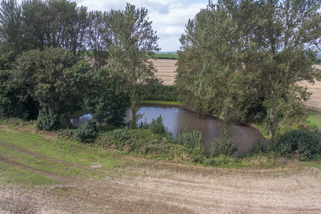
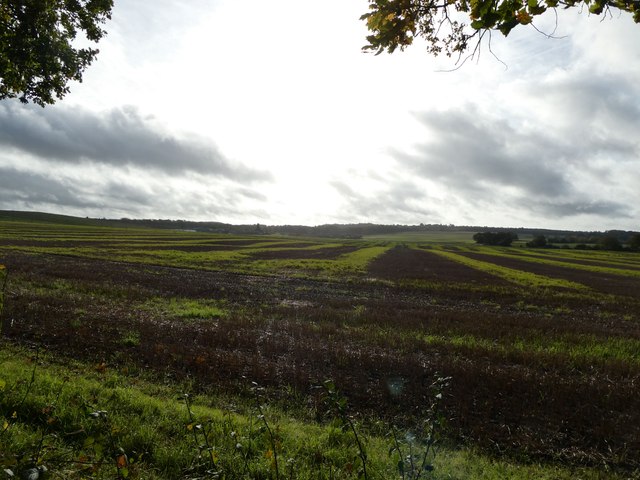
Green's Wood is a picturesque forest located in the county of Shropshire, England. Spanning over an area of approximately 100 acres, this serene woodland is an idyllic retreat for nature enthusiasts and outdoor adventurers.

The wood is characterized by its dense canopy of various tree species, including oak, beech, and ash, which provide a haven for an array of wildlife. The forest floor is adorned with a vibrant carpet of moss and ferns, creating a soothing and enchanting atmosphere. Visitors can enjoy leisurely walks along the well-maintained trails that wind through the wood, immersing themselves in the tranquility and beauty of the surroundings.

Green's Wood is also home to a diverse range of flora and fauna. Birdwatchers can delight in spotting a variety of species, such as woodpeckers, owls, and finches, while lucky visitors may even catch a glimpse of elusive creatures like deer and foxes. The forest is teeming with life, providing a valuable habitat for both common and rare species.

In addition to its natural beauty, Green's Wood offers recreational amenities to cater to the needs of visitors. Picnic areas and benches are strategically placed throughout the wood, providing perfect spots for relaxation and enjoying the stunning views. Educational signage is also erected along the trails, offering valuable information about the woodland's history, ecology, and conservation efforts.

Overall, Green's Wood in Shropshire is a captivating destination where visitors can unwind, connect with nature, and appreciate the wonders of the natural world.

If you have any feedback on the listing, please let us know in the comments section below.
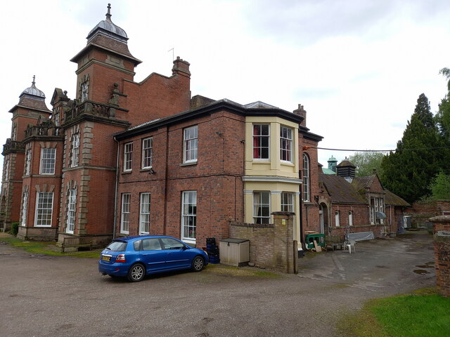
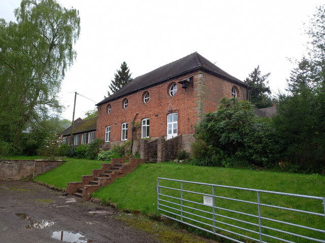
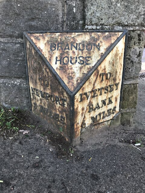
Greens Wood Images

Images are sourced within 2km of 52.740824/-2.3612783 or Grid Reference SJ7515. Thanks to Geograph Open Source API. All images are credited.

Wheatsheaf Public House 1GL Benchmark This benchmark, cut into the Wheatsheaf Public House on Pave Lane, Telford,  was used during the First Primary Levelling, England & Wales. It was included on the Llandysilio to Stafford line as "No. 84. Mark on East angle of the Wheat Sheaf Inn, Field Aston ; 1.07 ft. above surface. (p587)" at 292.343 feet above Liverpool datum.
Wheatsheaf Public House 1GL Benchmark
This benchmark, cut into the Wheatsheaf Public House on Pave Lane, Telford, was used during the First Primary Levelling, England & Wales. It was included on the Llandysilio to Stafford line as "No. 84. Mark on East angle of the Wheat Sheaf Inn, Field Aston ; 1.07 ft. above surface. (p587)" at 292.343 feet above Liverpool datum.
Littlehales Road Benchmark The Ordnance Survey Benchmark cut into the wall that runs alongside Littlehales Road, Lilleshall, Telford. The benchmark was cut & levelled in the 19th Century and was last verified by the OS in 1961. Its recorded height above the Ordnance Datum at Newlyn is 93.0798-metres.
Littlehales Road Benchmark
The Ordnance Survey Benchmark cut into the wall that runs alongside Littlehales Road, Lilleshall, Telford. The benchmark was cut & levelled in the 19th Century and was last verified by the OS in 1961. Its recorded height above the Ordnance Datum at Newlyn is 93.0798-metres.
OS benchmark - Chetwynd Aston, on The Wheatsheaf PH Taken a little bit over a year after <a href="https://www.geograph.org.uk/photo/7127384">SJ7517 : Wheatsheaf Public House 1GL Benchmark</a>, this is the same mark in 2023. It was last levelled by the OS in 1958 at 88.950m above Ordnance Datum Newlyn, but is actually much older than that, dating back to the 1st Primary Levelling of the country in 1858, at which time it was recorded as 292.343ft Liverpool datum.
OS benchmark - Chetwynd Aston, on The Wheatsheaf PH
Taken a little bit over a year after SJ7517 : Wheatsheaf Public House 1GL Benchmark, this is the same mark in 2023. It was last levelled by the OS in 1958 at 88.950m above Ordnance Datum Newlyn, but is actually much older than that, dating back to the 1st Primary Levelling of the country in 1858, at which time it was recorded as 292.343ft Liverpool datum.
Aston Manor house, Chetwynd Aston Described in its 1983 Grade II listing <span class="nowrap"><a title="https://historicengland.org.uk/listing/the-list/list-entry/1367439" rel="nofollow ugc noopener" href="https://historicengland.org.uk/listing/the-list/list-entry/1367439">Link</a><img style="margin-left:2px;" alt="External link" title="External link - shift click to open in new window" src="https://s1.geograph.org.uk/img/external.png" width="10" height="10"/></span> & <span class="nowrap"><a title="https://britishlistedbuildings.co.uk/101367439-aston-manor-chetwynd-aston-and-woodcote#.ZFkJC3bMLIU" rel="nofollow ugc noopener" href="https://britishlistedbuildings.co.uk/101367439-aston-manor-chetwynd-aston-and-woodcote#.ZFkJC3bMLIU">Link</a><img style="margin-left:2px;" alt="External link" title="External link - shift click to open in new window" src="https://s1.geograph.org.uk/img/external.png" width="10" height="10"/></span> as dating from around the early 18th century; it has been altered over the years but the rear staircase apparently retains one of the original newel posts with its finial.
Aston Manor house, Chetwynd Aston
Described in its 1983 Grade II listing LinkExternal link & LinkExternal link as dating from around the early 18th century; it has been altered over the years but the rear staircase apparently retains one of the original newel posts with its finial.
28 Chetwynd Aston A fine conversion of a terrace of small 17th or 18th century cottages, now with an additional range added to the far end in a sympathetic style. They were Grade II listed <span class="nowrap"><a title="https://historicengland.org.uk/listing/the-list/list-entry/1206109" rel="nofollow ugc noopener" href="https://historicengland.org.uk/listing/the-list/list-entry/1206109">Link</a><img style="margin-left:2px;" alt="External link" title="External link - shift click to open in new window" src="https://s1.geograph.org.uk/img/external.png" width="10" height="10"/></span> & <span class="nowrap"><a title="https://britishlistedbuildings.co.uk/101206109-28-chetwynd-aston-and-woodcote#.ZFkK6HbMLIU" rel="nofollow ugc noopener" href="https://britishlistedbuildings.co.uk/101206109-28-chetwynd-aston-and-woodcote#.ZFkK6HbMLIU">Link</a><img style="margin-left:2px;" alt="External link" title="External link - shift click to open in new window" src="https://s1.geograph.org.uk/img/external.png" width="10" height="10"/></span> in 1983.
28 Chetwynd Aston
A fine conversion of a terrace of small 17th or 18th century cottages, now with an additional range added to the far end in a sympathetic style. They were Grade II listed LinkExternal link & LinkExternal link in 1983.
Upper Farmhouse at Chetwynd Aston More accurately, a rather obscured view of the early 19th century Upper Farmhouse, particularly of its Victorian side-porch. It was Grade II listed <span class="nowrap"><a title="https://historicengland.org.uk/listing/the-list/list-entry/1054122" rel="nofollow ugc noopener" href="https://historicengland.org.uk/listing/the-list/list-entry/1054122">Link</a><img style="margin-left:2px;" alt="External link" title="External link - shift click to open in new window" src="https://s1.geograph.org.uk/img/external.png" width="10" height="10"/></span> & <span class="nowrap"><a title="https://britishlistedbuildings.co.uk/101054122-upper-farmhouse-chetwynd-aston-and-woodcote#.ZFkMhXbMLIV" rel="nofollow ugc noopener" href="https://britishlistedbuildings.co.uk/101054122-upper-farmhouse-chetwynd-aston-and-woodcote#.ZFkMhXbMLIV">Link</a><img style="margin-left:2px;" alt="External link" title="External link - shift click to open in new window" src="https://s1.geograph.org.uk/img/external.png" width="10" height="10"/></span> in 1983.
Upper Farmhouse at Chetwynd Aston
More accurately, a rather obscured view of the early 19th century Upper Farmhouse, particularly of its Victorian side-porch. It was Grade II listed LinkExternal link & LinkExternal link in 1983.
St Peter's chapel at Woodcote Sadly it's very neglected at present, but this building dates back in parts to the 12th century, and is described in its 1959 Grade II* listing <span class="nowrap"><a title="https://britishlistedbuildings.co.uk/101292305-parish-church-chapel-chetwynd-aston-and-woodcote" rel="nofollow ugc noopener" href="https://britishlistedbuildings.co.uk/101292305-parish-church-chapel-chetwynd-aston-and-woodcote">Link</a><img style="margin-left:2px;" alt="External link" title="External link - shift click to open in new window" src="https://s1.geograph.org.uk/img/external.png" width="10" height="10"/></span> & <span class="nowrap"><a title="https://historicengland.org.uk/listing/the-list/list-entry/1292305" rel="nofollow ugc noopener" href="https://historicengland.org.uk/listing/the-list/list-entry/1292305">Link</a><img style="margin-left:2px;" alt="External link" title="External link - shift click to open in new window" src="https://s1.geograph.org.uk/img/external.png" width="10" height="10"/></span> as having a king-post roof and a series of wall tablets and graves for the Cotes family.
St Peter's chapel at Woodcote
Sadly it's very neglected at present, but this building dates back in parts to the 12th century, and is described in its 1959 Grade II* listing LinkExternal link & LinkExternal link as having a king-post roof and a series of wall tablets and graves for the Cotes family.
Woodcote Hall Currently a nursing home for elderly people, Woodcote Hall as seen now is primarily a late 19th century building, constructed in Jacobean style to replace an earlier house which was destroyed by fire. A few traces of the earlier building's fabric remain in parts, but much was burnt beyond repair. As it stands now, it was Grade II listed <span class="nowrap"><a title="https://britishlistedbuildings.co.uk/101351992-woodcote-hall-chetwynd-aston-and-woodcote" rel="nofollow ugc noopener" href="https://britishlistedbuildings.co.uk/101351992-woodcote-hall-chetwynd-aston-and-woodcote">Link</a><img style="margin-left:2px;" alt="External link" title="External link - shift click to open in new window" src="https://s1.geograph.org.uk/img/external.png" width="10" height="10"/></span> & <span class="nowrap"><a title="https://historicengland.org.uk/listing/the-list/list-entry/1351992" rel="nofollow ugc noopener" href="https://historicengland.org.uk/listing/the-list/list-entry/1351992">Link</a><img style="margin-left:2px;" alt="External link" title="External link - shift click to open in new window" src="https://s1.geograph.org.uk/img/external.png" width="10" height="10"/></span> in 1981, and retains a number of worthy internal features.
Woodcote Hall
Currently a nursing home for elderly people, Woodcote Hall as seen now is primarily a late 19th century building, constructed in Jacobean style to replace an earlier house which was destroyed by fire. A few traces of the earlier building's fabric remain in parts, but much was burnt beyond repair. As it stands now, it was Grade II listed LinkExternal link & LinkExternal link in 1981, and retains a number of worthy internal features.
Churchyard walls to St Peter's chapel Dated to the late 17th or early 18th century, and built of local sandstone with a coping. The wall surrounds the chapel, and was Grade II listed <span class="nowrap"><a title="https://britishlistedbuildings.co.uk/101033340-churchyard-boundary-wall-chetwynd-aston-and-woodcote" rel="nofollow ugc noopener" href="https://britishlistedbuildings.co.uk/101033340-churchyard-boundary-wall-chetwynd-aston-and-woodcote">Link</a><img style="margin-left:2px;" alt="External link" title="External link - shift click to open in new window" src="https://s1.geograph.org.uk/img/external.png" width="10" height="10"/></span> & <span class="nowrap"><a title="https://historicengland.org.uk/listing/the-list/list-entry/1033340" rel="nofollow ugc noopener" href="https://historicengland.org.uk/listing/the-list/list-entry/1033340">Link</a><img style="margin-left:2px;" alt="External link" title="External link - shift click to open in new window" src="https://s1.geograph.org.uk/img/external.png" width="10" height="10"/></span> in 1981.
Churchyard walls to St Peter's chapel
Dated to the late 17th or early 18th century, and built of local sandstone with a coping. The wall surrounds the chapel, and was Grade II listed LinkExternal link & LinkExternal link in 1981.
Woodcote Coach House A rear view of the building that was once the coach house to the main hall, now converted to residential use. It consists of an 18th century brick construction over a (possibly older) sandstone plinth or foundation, with stone quoins and a hipped, tiled roof, and was Grade II listed <span class="nowrap"><a title="https://britishlistedbuildings.co.uk/101210109-stable-and-coach-house-range-immediately-west-north-west-of-woodcote-hall-chetwynd-aston-and-woodcote" rel="nofollow ugc noopener" href="https://britishlistedbuildings.co.uk/101210109-stable-and-coach-house-range-immediately-west-north-west-of-woodcote-hall-chetwynd-aston-and-woodcote">Link</a><img style="margin-left:2px;" alt="External link" title="External link - shift click to open in new window" src="https://s1.geograph.org.uk/img/external.png" width="10" height="10"/></span> & <span class="nowrap"><a title="https://historicengland.org.uk/listing/the-list/list-entry/1210109" rel="nofollow ugc noopener" href="https://historicengland.org.uk/listing/the-list/list-entry/1210109">Link</a><img style="margin-left:2px;" alt="External link" title="External link - shift click to open in new window" src="https://s1.geograph.org.uk/img/external.png" width="10" height="10"/></span> in 1981, along with the associated former stable buildings. Those are not visible from this direction.
Woodcote Coach House
A rear view of the building that was once the coach house to the main hall, now converted to residential use. It consists of an 18th century brick construction over a (possibly older) sandstone plinth or foundation, with stone quoins and a hipped, tiled roof, and was Grade II listed LinkExternal link & LinkExternal link in 1981, along with the associated former stable buildings. Those are not visible from this direction.
Old Milestone by the road (was A41), Pave Lane; by No. 58 The Milestone is located against wall on the West of the road.  Parish of Chetwynd Aston And Woodcote (Telford & Wrekin District). Cast iron post, Salop iron T-post design, erected by the Council in the 19/20th Century. An earlier photograph can be found here: <a title="https://www.geograph.org.uk/photo/6037215" href="https://www.geograph.org.uk/photo/6037215">Link</a> 

Inscription reads:- 
TO / NEWPORT / 2 MILES : : TO / IVETSEY / BANK / 6 MILES  

Milestone Society National ID: SA_NPIV02
Old Milestone by the road (was A41), Pave Lane; by No. 58
The Milestone is located against wall on the West of the road.  Parish of Chetwynd Aston And Woodcote (Telford & Wrekin District). Cast iron post, Salop iron T-post design, erected by the Council in the 19/20th Century. An earlier photograph can be found here: Link  Inscription reads:- TO / NEWPORT / 2 MILES : : TO / IVETSEY / BANK / 6 MILES Milestone Society National ID: SA_NPIV02
Old Milestone by A41, Brandon House, East of Woodcote Hall The Milestone is located against wall on the West of the road.  Parish of Chetwynd Aston And Woodcote (Telford & Wrekin District). Cast iron post, erected by the Wolverhampton, Albrighton district turnpike trust in the 19th Century. An earlier photograph can be found here: <a title="https://www.geograph.org.uk/photo/6044196" href="https://www.geograph.org.uk/photo/6044196">Link</a> 

Inscription reads: 
TO / NEWPORT / 3 MILES : : TO / IVETSEY / BANK / 5 MILES: : BRANDON / HOUSE 

Milestone Society National ID: SA_NPIV03
Old Milestone by A41, Brandon House, East of Woodcote Hall
The Milestone is located against wall on the West of the road.  Parish of Chetwynd Aston And Woodcote (Telford & Wrekin District). Cast iron post, erected by the Wolverhampton, Albrighton district turnpike trust in the 19th Century. An earlier photograph can be found here: Link  Inscription reads: TO / NEWPORT / 3 MILES : : TO / IVETSEY / BANK / 5 MILES: : BRANDON / HOUSE Milestone Society National ID: SA_NPIV03
Pond in a field
Pond in a field
Wide open fields near Lilleshall Almost like downland except for the cultivated element.
Wide open fields near Lilleshall
Almost like downland except for the cultivated element.
Car parked where old lane used to run An old single lane road remains here. Blocked off by a fence. I assume it was an old access road to a local farm.
Car parked where old lane used to run
An old single lane road remains here. Blocked off by a fence. I assume it was an old access road to a local farm.
Footpath across farmland near Pitchcroft The dog walker pottered off this way, probably to complete his route back home . It looks a tempting route. I always gaze longingly at routes off my intended route, wistfully imagining their possibilities. I tear myself away and slog on.
Footpath across farmland near Pitchcroft
The dog walker pottered off this way, probably to complete his route back home . It looks a tempting route. I always gaze longingly at routes off my intended route, wistfully imagining their possibilities. I tear myself away and slog on.
Access barrier across a farm access track It is a poultry farm I think. Two massive feed lorries drove down there seconds after I took this shot. They were Lloyds Animal Feeds from near Oswestry. Could be turkeys this time of year. Looks a big operation.
Access barrier across a farm access track
It is a poultry farm I think. Two massive feed lorries drove down there seconds after I took this shot. They were Lloyds Animal Feeds from near Oswestry. Could be turkeys this time of year. Looks a big operation.
Distant view towards Lilleshal Hill and The Wrekin Over the roofs of the poultry farm.
Distant view towards Lilleshal Hill and The Wrekin
Over the roofs of the poultry farm.
Show me another place!

Greens Wood is located at Grid Ref: SJ7515 (Lat: 52.740824, Lng: -2.3612783)

Unitary Authority: Telford and Wrekin

Police Authority: West Mercia

What 3 Words

///ropes.drips.group. Near Woodcote, Shropshire

Nearby Locations

Cotes Pool Greens Wood

Related Wikis

Pave Lane

Pave Lane is a hamlet in Shropshire, England, 1.5 miles (2.4 km) south of Newport, just outside the small village of Chetwynd Aston. It is an affluent...

Woodcote Hall

Woodcote Hall is a nursing home situated on the edge of Newport, Shropshire, England, on the Staffordshire border. == House == It was until the early 20th...

Lilleshall Hall

Lilleshall Hall is a large former country house and estate in the fields of Lilleshall, Shropshire, England. It is run by Serco Leisure Operating Ltd...

Church Aston

Church Aston is a village and parish in Shropshire, England. The population of the civil parish at the 2011 census was 1,354.It is to the south of Newport...

Nearby Amenities

Located within 500m of 52.740824,-2.3612783
The data included in this document is from www.openstreetmap.org. The data is made available under ODbL.

Have you been to Greens Wood?

Leave your review of Greens Wood below (or comments, questions and feedback).