Madam's Wood

Wood, Forest in Gloucestershire Forest of Dean

England

Madam's Wood

St Mary the Virgin Church, Upleadon
St Mary the Virgin Church, Upleadon Credit: Chris Allen

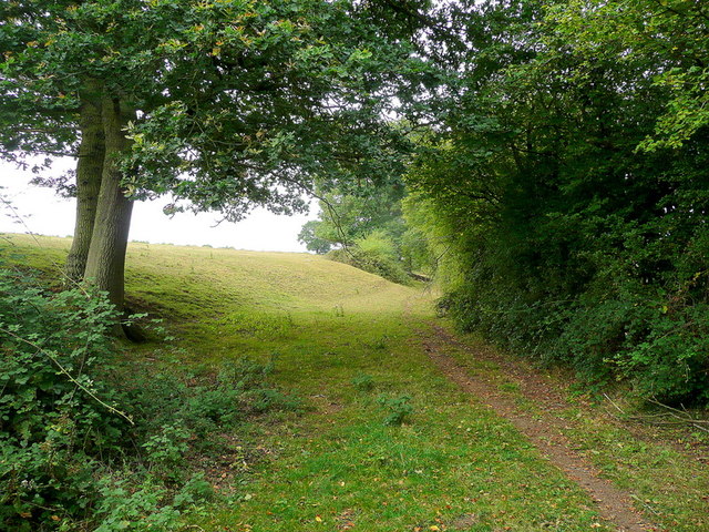
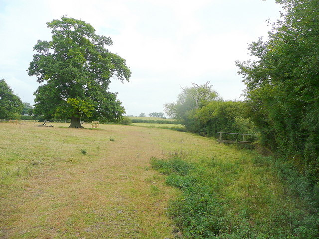
Madam's Wood is a picturesque woodland located in the county of Gloucestershire, England. Situated within the larger Forest of Dean, this ancient wood boasts a rich history and diverse range of flora and fauna. Covering an area of approximately 100 hectares, it offers visitors a serene and tranquil escape from the hustle and bustle of modern life.

The wood is predominantly made up of oak and beech trees, with their towering canopies providing a sheltered habitat for a variety of woodland creatures. Wildlife enthusiasts can spot an array of bird species, including woodpeckers and owls, as well as mammals such as deer, foxes, and badgers.

Madam's Wood is crisscrossed by a network of well-maintained footpaths, making it easily accessible for walkers and hikers of all abilities. These trails wind their way through the enchanting woodland, offering visitors the chance to immerse themselves in its natural beauty. Along the way, there are several designated picnic areas where visitors can rest and enjoy the peaceful surroundings.

The wood is also home to a diverse range of plant life, with vibrant bluebells carpeting the forest floor in the springtime. In addition to the flora and fauna, Madam's Wood holds historical significance, as it is believed to have been used for charcoal production during the medieval period.

Overall, Madam's Wood is a hidden gem within the Forest of Dean, offering visitors a chance to reconnect with nature and experience the tranquility of a traditional English woodland.

If you have any feedback on the listing, please let us know in the comments section below.
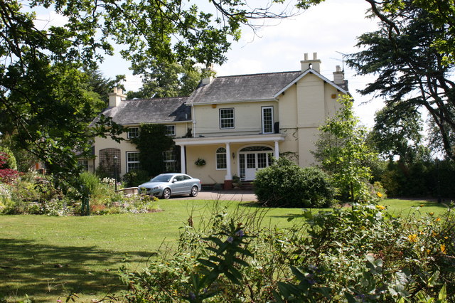
Madam's Wood Images

Images are sourced within 2km of 51.943782/-2.3661389 or Grid Reference SO7427. Thanks to Geograph Open Source API. All images are credited.

St Mary the Virgin Church, Upleadon
Upleadon Court
Upleadon Court
Upleadon - Church of St Mary
Upleadon Village, Detached dwelling Detached dwelling on the outskirts of Upleadon village, Gloucestershire.
Upleadon Village, Detached dwelling
Detached dwelling on the outskirts of Upleadon village, Gloucestershire.
Upleadon Crossroads Upleadon Crossroads, Gloucestershire. Note the Public telephone box. Most of these are disappearing due to the dominance of mobile phones.
Upleadon Crossroads
Upleadon Crossroads, Gloucestershire. Note the Public telephone box. Most of these are disappearing due to the dominance of mobile phones.
Upleadon Court Upleadon Court with Church - Note the timber framing within the church building.
Upleadon Court
Upleadon Court with Church - Note the timber framing within the church building.
St. Mary's church and Upleadon Court Viewed from the north, across the gridline.
St. Mary's church and Upleadon Court
Viewed from the north, across the gridline.
Edge of pasture The public footpath from the Leadon to Upleadon follows the field edge here.
Edge of pasture
The public footpath from the Leadon to Upleadon follows the field edge here.
Collinpark Wood 1 Straight path through the wood looking north-east.
Collinpark Wood 1
Straight path through the wood looking north-east.
Collinpark Wood 2 The opposite view to <a href="https://www.geograph.org.uk/photo/2549365">SO7527 : Collinpark Wood 1</a>.
Collinpark Wood 2
The opposite view to SO7527 : Collinpark Wood 1.
Wheat field in the Vale of Leadon The footpath follows the field edge to the right.
In the distance is Chase End Hill - the southerly outpost of the Malvern Hills.
Wheat field in the Vale of Leadon
The footpath follows the field edge to the right. In the distance is Chase End Hill - the southerly outpost of the Malvern Hills.
Footpath junction ahead Looking north-east towards the Leadon Bridge just beyond the oak.
The path to Upleadon joins at the footbridge to the right.
Footpath junction ahead
Looking north-east towards the Leadon Bridge just beyond the oak. The path to Upleadon joins at the footbridge to the right.
Pastoral land To the east of Everes's Farm; the footpath to Witherdine follows the field edge.
Pastoral land
To the east of Everes's Farm; the footpath to Witherdine follows the field edge.
The Vale of Leadon Watermeadows south of Everes's Farm.
The Vale of Leadon
Watermeadows south of Everes's Farm.
Fallen oak By the path to Upleadon from Witherdine.
Fallen oak
By the path to Upleadon from Witherdine.
View from Eden's Hill Looking south-west towards the ubiguitous view of May Hill.
View from Eden's Hill
Looking south-west towards the ubiguitous view of May Hill.
Bridleway by The Woodings Eden's Hill forms the backdrop to the scene.
Bridleway by The Woodings
Eden's Hill forms the backdrop to the scene.
Stormclouds gather, St Mary Upleadon Hailstones clattered down within minutes of taking this.
Stormclouds gather, St Mary Upleadon
Hailstones clattered down within minutes of taking this.
Show me another place!

Madam's Wood is located at Grid Ref: SO7427 (Lat: 51.943782, Lng: -2.3661389)

Administrative County: Gloucestershire

District: Forest of Dean

Police Authority: Gloucestershire

What 3 Words

///bowls.ponies.wolves. Near Newent, Gloucestershire

Nearby Locations

Madam's Wood

Related Wikis

Collinpark Wood SSSI

Collinpark Wood (grid reference SO750278) is a 66.69-hectare (164.8-acre) biological Site of Special Scientific Interest in Gloucestershire, notified in...

Brand Green

Brand Green is a village in Gloucestershire, England. == References == == External links == Media related to Brand Green at Wikimedia Commons

Upleadon

Upleadon is a village and civil parish situated 10.5 km north-west of Gloucester. Soon after the Norman conquest Upleadon became part of the estates of...

Malswick Halt railway station

Malswick Halt was a request stop on the former Ledbury and Gloucester Railway. It opened on 1st February 1938 and was closed in 1959 when the line was...

Newent Town F.C.

Newent Town Association Football Club is a football club based in Newent, Gloucestershire, England. They were established in 1920. Affiliated to the Gloucestershire...

Okle Green

Okle Green is a village in Gloucestershire, England.

Newent

Newent (; originally called "Noent") is a market town and civil parish in the Forest of Dean in Gloucestershire, England. The town is 11 miles (18 km)...

Newent railway station

Newent railway station served the town of Newent in Gloucestershire, England. It opened on 27 July 1885 when the Newent Railway and the Ross and Ledbury...

Nearby Amenities

Located within 500m of 51.943782,-2.3661389
Public Bookcase
Upleadon Book Box
Booth: K6
Disused Amenity: telephone
Man Made: telephone_box
Public Bookcase Type: phone_box
Lat/Long: 51.9412354/-2.3626367
Bus Stop
The Cross
Naptan AtcoCode: 1600GL4965
Naptan Bearing: NW
Naptan CommonName: The Cross
Naptan NaptanCode: gloapmam
Naptan Street: Gloucester Rd
Naptan Verified: no
Source: naptan_import
Lat/Long: 51.9411729/-2.3625666
Bus Stop
The Cross
Naptan AtcoCode: 1600GL4966
Naptan Bearing: SE
Naptan CommonName: The Cross
Naptan NaptanCode: gloapmdm
Naptan Street: Gloucester Rd
Naptan Verified: no
Source: naptan_import
Lat/Long: 51.9410391/-2.3622309
Bus Stop
Brand Green Fruit Farm
Naptan AtcoCode: 1600GL607
Naptan Bearing: NW
Naptan CommonName: Brand Green Fruit Farm
Naptan NaptanCode: gloapgja
Naptan Street: Upleadon Rd
Naptan Verified: no
Source: naptan_import
Lat/Long: 51.9467961/-2.3700467
Bus Stop
Brand Green Fruit Farm
Naptan AtcoCode: 1600GL608
Naptan Bearing: SE
Naptan CommonName: Brand Green Fruit Farm
Naptan NaptanCode: gloapgdt
Naptan Street: Upleadon Rd
Naptan Verified: no
Source: naptan_import
Lat/Long: 51.9469484/-2.3702225
Bus Stop
The Cross
Naptan AtcoCode: 1600GLN096
Naptan Bearing: S
Naptan CommonName: The Cross
Naptan NaptanCode: glogmagj
Naptan Street: Eden's Hill
Naptan Verified: no
Source: naptan_import
Lat/Long: 51.941353/-2.3624808
Kennels
Bullar Trees Kennels & Cattery
Source: OS OpenData StreetView
Source Name: local knowledge
Lat/Long: 51.9424548/-2.3693651
Post Box
Post Box Type: wall
Ref: GL18 41
Royal Cypher: VR
Royal Cypher Wikidata: Q33102356
Lat/Long: 51.941297/-2.3624352
Historic: memorial
Memorial: war_memorial
Lat/Long: 51.9411595/-2.3623272
Colin Park Wood
Power: pole
Transformer: distribution
Voltage Primary: 11000
Lat/Long: 51.9465167/-2.3676798
Power: pole
Lat/Long: 51.9465878/-2.3682189
Power: pole
Lat/Long: 51.9466812/-2.3688425
Power: pole
Lat/Long: 51.9468011/-2.3697008
Power: pole
Lat/Long: 51.9465928/-2.3704357
Power: pole
Lat/Long: 51.9464068/-2.3710768
Power: pole
Lat/Long: 51.9462208/-2.3717192
Madams Wood Reservoir
Power: pole
Transformer: distribution
Voltage Primary: 11000
Lat/Long: 51.9431257/-2.3639515
Location Transition: yes
Power: pole
Lat/Long: 51.9424635/-2.3636498
Buller Trees
Power: pole
Transformer: distribution
Voltage Primary: 11000
Lat/Long: 51.9425296/-2.3691309
Power: pole
Lat/Long: 51.9426156/-2.3677804
Power: pole
Lat/Long: 51.9424693/-2.3667544
Power: pole
Lat/Long: 51.942332/-2.3658009
Power: pole
Lat/Long: 51.9421708/-2.3646945
Edens Hill
Power: pole
Transformer: distribution
Voltage Primary: 11000
Lat/Long: 51.9421005/-2.3631616
Power: pole
Lat/Long: 51.9420212/-2.3636659
Power: pole
Lat/Long: 51.9415991/-2.3637121
Location Transition: yes
Power: pole
Lat/Long: 51.9412618/-2.3634861
Upleadon
Power: pole
Transformer: distribution
Voltage Primary: 11000
Lat/Long: 51.9406318/-2.3618487
The data included in this document is from www.openstreetmap.org. The data is made available under ODbL.

Have you been to Madam's Wood?

Leave your review of Madam's Wood below (or comments, questions and feedback).