Bagburrow Wood

Wood, Forest in Worcestershire

England

Bagburrow Wood

Birches Farm In the valley of the Whippets Brook between the limestone ridge to the west and the granite of the Malvern Hills to the east.
Birches Farm Credit: Bob Embleton

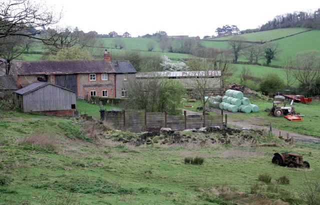
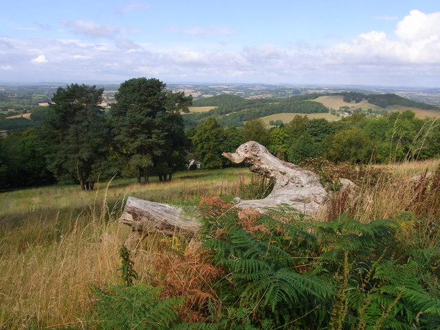
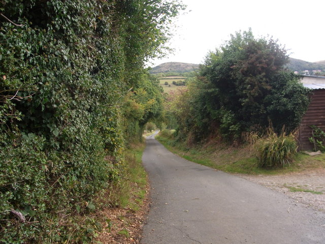
Bagburrow Wood is a picturesque forest located in Worcestershire, England. Covering an area of approximately 50 acres, it is characterized by its lush greenery, diverse wildlife, and tranquil atmosphere. The wood is situated near the village of Bagburrow, which adds to its charm and accessibility.

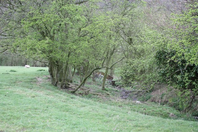
The forest boasts an impressive variety of trees, including oak, beech, ash, and birch, which contribute to its dense canopy and provide a natural habitat for numerous animals and birds. Walking through the wood, visitors can spot squirrels darting between branches, hear the melodic songs of birds such as thrushes and woodpeckers, and occasionally catch a glimpse of elusive deer grazing in the undergrowth.

Trails and footpaths wind their way through Bagburrow Wood, offering visitors the opportunity to explore the area at their own pace. The woodland floor is carpeted with a rich assortment of wildflowers, creating a vibrant and colorful display during the spring and summer months. It is also a popular spot for mushroom enthusiasts, as various species can be found sprouting from fallen logs and damp forest floors.

Bagburrow Wood is not only a haven for nature lovers but also a valuable conservation area. The forest is managed by local authorities to maintain its ecological balance and protect its diverse flora and fauna. It is a popular destination for educational visits, where visitors can learn about the importance of woodland ecosystems and the efforts being made to preserve them.

Overall, Bagburrow Wood is a captivating woodland retreat that offers visitors a chance to reconnect with nature, experience its beauty, and appreciate the importance of its conservation.

If you have any feedback on the listing, please let us know in the comments section below.

Bagburrow Wood Images

Images are sourced within 2km of 52.104764/-2.3679823 or Grid Reference SO7445. Thanks to Geograph Open Source API. All images are credited.

Birches Farm In the valley of the Whippets Brook between the limestone ridge to the west and the granite of the Malvern Hills to the east.
Birches Farm
In the valley of the Whippets Brook between the limestone ridge to the west and the granite of the Malvern Hills to the east.
Young lambs near Birches Farm The lambs are numbered to match their mothers.
They seemed to gather on the footpath and appeared more curious than cautious - until their anxious mothers called to them.
Young lambs near Birches Farm
The lambs are numbered to match their mothers. They seemed to gather on the footpath and appeared more curious than cautious - until their anxious mothers called to them.
Field boundary and stream near Birches Farm The trees are slowly spreading into the field.
Field boundary and stream near Birches Farm
The trees are slowly spreading into the field.
West of the Worcestershire Beacon This autumn view west from the ridge-top encompasses much of Herefordshire. On the left is Oyster Hill and beyond sticking out of the mist is the Marcle Ridge.
West of the Worcestershire Beacon
This autumn view west from the ridge-top encompasses much of Herefordshire. On the left is Oyster Hill and beyond sticking out of the mist is the Marcle Ridge.
The toposcope on the Worcester Beacon Looking north-west with Table Hill on the right. In the middle distance the Suckley Hills poke out of the mist and at the back are the Abberley Hills. The inscription reads "Erected in commemoration of the sixtieth year of Queen Victoria's reign 1897".
The toposcope on the Worcester Beacon
Looking north-west with Table Hill on the right. In the middle distance the Suckley Hills poke out of the mist and at the back are the Abberley Hills. The inscription reads "Erected in commemoration of the sixtieth year of Queen Victoria's reign 1897".
Worcestershire Beacon from Sugarloaf Hill Worcestershire Beacon, the highest hill in the Malvern range, beneath threatening cloud.
Worcestershire Beacon from Sugarloaf Hill
Worcestershire Beacon, the highest hill in the Malvern range, beneath threatening cloud.
Path up Green Valley joins Worcestershire Way Contour path from North Hill.
Path up Green Valley joins Worcestershire Way
Contour path from North Hill.
View from contour path below Worcestershire Beacon A dragon from Herefordshire ?
View from contour path below Worcestershire Beacon
A dragon from Herefordshire ?
Bridleway below Hayslad (Spout) Building may have been a pumphouse for the local natural water supply.
Bridleway below Hayslad (Spout)
Building may have been a pumphouse for the local natural water supply.
Old cider press at Park Farm Near West Malvern.
Old cider press at Park Farm
Near West Malvern.
Drive at Bank Farm, West Malvern
Gateway on path above Bank Farm What used to hang here ?
Gateway on path above Bank Farm
What used to hang here ?
Path to Netherley Hall On a very steep bank below Cockshot Hill.
Path to Netherley Hall
On a very steep bank below Cockshot Hill.
Cottages near Mathon Lodge
Slatch Coppice in the snow (2009) This photo is taken from in front of my house. Note the neighbours dog in the snow!
Slatch Coppice in the snow (2009)
This photo is taken from in front of my house. Note the neighbours dog in the snow!
West of England Quarry, below Summer Hill A disused quarry on the west side of the hills. There's little, if any, climbing potential that I could see, and it's not listed in the printed guidebook 'West Midlands Rock' (admittedly this is long since out of publication). The walls are heavily vegetated.
West of England Quarry, below Summer Hill
A disused quarry on the west side of the hills. There's little, if any, climbing potential that I could see, and it's not listed in the printed guidebook 'West Midlands Rock' (admittedly this is long since out of publication). The walls are heavily vegetated.
Nearly at the top The path on the western side of Worcestershire Beacon, and a grand day for my elderly father to walk up the hill.
Nearly at the top
The path on the western side of Worcestershire Beacon, and a grand day for my elderly father to walk up the hill.
A lonely trig point It only looks lonely because I waited until the hordes were out of shot - there was no shortage of people up the hills on this decent mid October day.
A lonely trig point
It only looks lonely because I waited until the hordes were out of shot - there was no shortage of people up the hills on this decent mid October day.
Show me another place!

Bagburrow Wood is located at Grid Ref: SO7445 (Lat: 52.104764, Lng: -2.3679823)

Unitary Authority: County of Herefordshire

Police Authority: West Mercia

What 3 Words

///offline.coil.books. Near Great Malvern, Worcestershire

Related Wikis

Mathon, Herefordshire

Mathon is a small village and civil parish in eastern Herefordshire, England, lying just to the west of the Malvern Hills between Malvern and Ledbury....

Regents Theological College

Regents Theological College is a theological college in Malvern, Worcestershire, England. It is the training centre of the Elim Pentecostal Church. First...

Sugarloaf Hill, Malvern

Sugarloaf Hill lies between the Worcestershire Beacon and North Hill in the range of Malvern Hills that runs about 13 kilometres (8 mi) north-south along...

Worcestershire Beacon

Worcestershire Beacon, also popularly known as Worcester Beacon, or locally simply as The Beacon, is a hill whose summit at 425 metres (1,394 ft) is the...

West Malvern

West Malvern is a village and a civil parish on the west side of the north part of the Malvern Hills, on the western edge of Worcestershire, England. It...
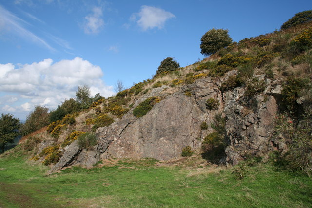
Table Hill

Table Hill is situated in the range of Malvern Hills that runs about 13 kilometres (8 mi) north-south along the Herefordshire-Worcestershire border. It...

Malvern water

Malvern water is a natural spring water from the Malvern Hills on the border of the counties of Herefordshire and Worcestershire in England. The Hills...

Downs Light Railway

The Downs Light Railway is the world's oldest private miniature railway, with a track gauge of 9+1⁄2 in (241 mm). The railway is located within the grounds...

Related Videos

Malvern Hills Walk: Hiking 10 Hills in 1 Day #greenspaces

This hike over the Malvern Hills, dubbed the 'spine', was so unique. A rollercoaster line of Hills that let us see over the three ...

Hiking The Malvern Hills End to End (IN WINTER)

Today I explore the Malvern Hills! I walked 10 miles, End to End and summited as many hills as I could on this extremely misty bad ...

Malvern Hills | Hiking 12 Miles on the Malvern Hills

The gang met up in 29 degree weather in the town of Great Malvern to go for a socially distanced hike along the Malvern Hills ...

Nearby Amenities

Located within 500m of 52.104764,-2.3679823
Power: pole
Lat/Long: 52.1085858/-2.3667672
Power: pole
Lat/Long: 52.1090001/-2.3686172
Power: pole
Lat/Long: 52.1084433/-2.3661348
Power: pole
Lat/Long: 52.108767/-2.3675819
Mathon Court
Power: pole
Transformer: distribution
Voltage Primary: 11000
Lat/Long: 52.1062956/-2.3733117
Power: pole
Lat/Long: 52.1065023/-2.3726378
Power: pole
Lat/Long: 52.1068594/-2.3714228
Rose Farm
Power: pole
Transformer: distribution
Voltage Primary: 11000
Lat/Long: 52.1073066/-2.3709957
Power: pole
Lat/Long: 52.1077992/-2.3705129
Power: pole
Lat/Long: 52.1083478/-2.3702057
Power: pole
Lat/Long: 52.1088416/-2.3699174
The data included in this document is from www.openstreetmap.org. The data is made available under ODbL.

Have you been to Bagburrow Wood?

Leave your review of Bagburrow Wood below (or comments, questions and feedback).