Redhill Wood

Wood, Forest in Worcestershire Forest of Dean

England

Redhill Wood

The River Leadon at Payford Bridge Looking upstream. It is marginal as to whether the river here is in SO7429 or SO7430, but I am relying on my GPS reading.

The Explorer map has this as 'Playford Bridge', but the Landranger has 'Payford'. As the Explorer has 'Payford Mill' nearby, I have assumed this to be the correct name.
The River Leadon at Payford Bridge Credit: David Purchase

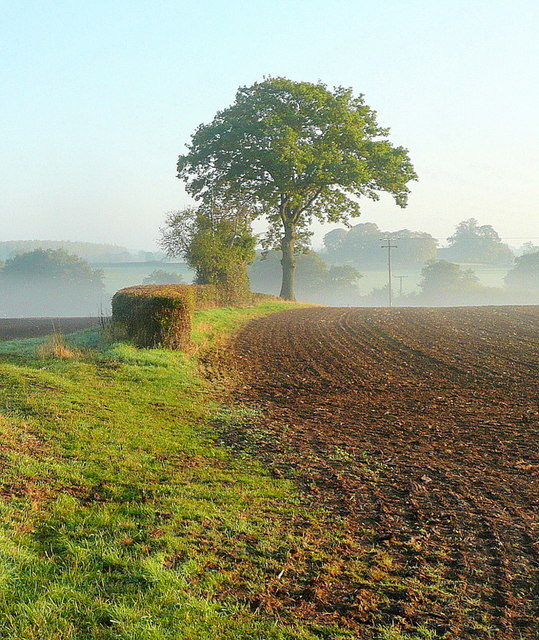
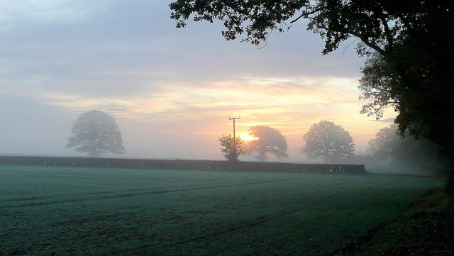
Redhill Wood is a picturesque forest located in the county of Worcestershire, England. Covering an area of approximately 100 acres, it is a popular destination for nature enthusiasts and walkers alike. The wood is situated in the Redditch borough, near the town of Redditch, and is easily accessible by road.

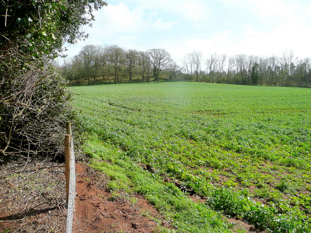
Redhill Wood boasts a diverse range of flora and fauna, making it a haven for wildlife. The woodland is predominantly made up of broadleaf trees such as oak, beech, and birch, which provide a lush and vibrant canopy throughout the year. The forest floor is carpeted with an array of wildflowers, including bluebells, primroses, and wood anemones, creating a stunning display of colors in the springtime.

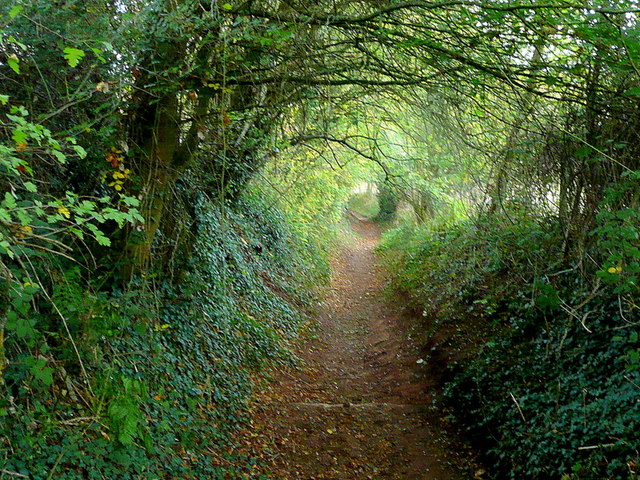
The wood is crisscrossed by a network of well-maintained footpaths, allowing visitors to explore its beauty and discover its hidden treasures. These paths wind through the forest, leading to tranquil clearings and secluded spots, perfect for picnics or simply immersing oneself in the peaceful surroundings. Additionally, there are several benches strategically placed along the trails, providing opportunities for rest and reflection.

Redhill Wood is also home to a variety of wildlife, including deer, foxes, and a wide range of bird species. Birdwatchers can often spot woodpeckers, nuthatches, and tawny owls among the trees, while lucky visitors may catch a glimpse of the elusive red squirrel, a rare sight in many parts of the country.

Overall, Redhill Wood offers a serene and enchanting escape from the hustle and bustle of everyday life. Its natural beauty, diverse ecosystem, and peaceful atmosphere make it a must-visit destination for those seeking solace in nature.

If you have any feedback on the listing, please let us know in the comments section below.

Redhill Wood Images

Images are sourced within 2km of 51.984667/-2.367914 or Grid Reference SO7431. Thanks to Geograph Open Source API. All images are credited.

The River Leadon at Payford Bridge Looking upstream. It is marginal as to whether the river here is in SO7429 or SO7430, but I am relying on my GPS reading.

The Explorer map has this as 'Playford Bridge', but the Landranger has 'Payford'. As the Explorer has 'Payford Mill' nearby, I have assumed this to be the correct name.
The River Leadon at Payford Bridge
Looking upstream. It is marginal as to whether the river here is in SO7429 or SO7430, but I am relying on my GPS reading. The Explorer map has this as 'Playford Bridge', but the Landranger has 'Payford'. As the Explorer has 'Payford Mill' nearby, I have assumed this to be the correct name.
Weir on the River Leadon I guess it's all relative. At this point the River Leadon barely counts as a river being little more than a metre wide so a weir that's maybe 15cm high is just right proportionately (though the water has found a way round it).
Weir on the River Leadon
I guess it's all relative. At this point the River Leadon barely counts as a river being little more than a metre wide so a weir that's maybe 15cm high is just right proportionately (though the water has found a way round it).
M50 looking west at junction 2
M50 looking west
M50 looking west
M50 westbound at Bromsberrow Heath
Wild daffodils by the M50 These Narcissus pseudonarcissus clothe the slopes surrounding the Highways Authority depot at Junction 2 of the M50.
Wild daffodils by the M50
These Narcissus pseudonarcissus clothe the slopes surrounding the Highways Authority depot at Junction 2 of the M50.
Bridleway to Ever Hill Coppice Deeply indented green lane popular with dog-walkers.
Bridleway to Ever Hill Coppice
Deeply indented green lane popular with dog-walkers.
Ryton Coppice View from the bridleway east of Ryton.
Ryton Coppice
View from the bridleway east of Ryton.
Cutmill Farm Cutmill Farm viewed across a barley field in the Leadon valley.
Cutmill Farm
Cutmill Farm viewed across a barley field in the Leadon valley.
Farmland near Cutmill Farm The prolonged dry period is evident here with what appears to be a dried up pool.
Farmland near Cutmill Farm
The prolonged dry period is evident here with what appears to be a dried up pool.
Hay bales near Cutmill Farm Hay bales protected from rain by a sheet beside a footpath near Cutmill Farm.
Hay bales near Cutmill Farm
Hay bales protected from rain by a sheet beside a footpath near Cutmill Farm.
Tree on a ridge Tree on a ridge in a field viewed from one of the Poets Path emanating from the nearby village of Dymock.
Tree on a ridge
Tree on a ridge in a field viewed from one of the Poets Path emanating from the nearby village of Dymock.
Weatherboard cottage By the lane from Redmarley to Newent.
Weatherboard cottage
By the lane from Redmarley to Newent.
Autumn edge The morning mist in the shallow Glynch valley is burning off on this fine September day.
Autumn edge
The morning mist in the shallow Glynch valley is burning off on this fine September day.
Redmarley bridleway A country route to Ryton.
Redmarley bridleway
A country route to Ryton.
Tunnel-like bridleway Heading west from Redmarley towards Ryton.
Tunnel-like bridleway
Heading west from Redmarley towards Ryton.
Autumnal dawn The line of the public path from Pound House to Parkgate.
Autumnal dawn
The line of the public path from Pound House to Parkgate.
Sunrise over the M50 Early morning commuters and delivery drivers are out on the nation's road system.
Sunrise over the M50
Early morning commuters and delivery drivers are out on the nation's road system.
Show me another place!

Redhill Wood is located at Grid Ref: SO7431 (Lat: 51.984667, Lng: -2.367914)

Administrative County: Gloucestershire

District: Forest of Dean

Police Authority: Gloucestershire

What 3 Words

///showcases.neckline.udder. Near Donnington, Herefordshire

Nearby Locations

Redhill Wood Grove Coppice

Related Wikis

Redmarley D'Abitot

Redmarley D'Abitot is a civil parish and village in the Forest of Dean district, Gloucestershire, South West England. In addition to the village of Redmarley...

Bromsberrow

Bromsberrow (or Bromesberrow) is part of the Forest of Dean district. The village is close to the meeting point between Gloucestershire, Herefordshire...

Ketford Bank

Ketford Bank (grid reference SO723308) is a 0.69-hectare (1.7-acre) nature reserve in Gloucestershire.The site is owned and managed by the Gloucestershire...

Three Counties (Gloucestershire, Herefordshire and Worcestershire)

The Three Counties of England are traditionally the three agrarian counties of Gloucestershire, Herefordshire and Worcestershire.Including towns and cities...

Gadfield Elm Chapel

The Gadfield Elm Chapel near the village of Pendock in Worcestershire, England, is the oldest extant chapel of the Church of Jesus Christ of Latter-day...

Pendock

Pendock is a village and civil parish in the Malvern Hills district in the county of Worcestershire, England, situated about halfway between the towns...

Vell Mill Daffodil Meadow

Vell Mill Daffodil Meadow (grid reference SO710314) is a 2.1-hectare (5.2-acre) nature reserve in Gloucestershire.The site is owned and managed by the...

Brand Green

Brand Green is a village in Gloucestershire, England. == References == == External links == Media related to Brand Green at Wikimedia Commons

Nearby Amenities

Located within 500m of 51.984667,-2.367914
Man Made: water_well
Source: OS 1:25k
Lat/Long: 51.9887105/-2.3670801
Power: pole
Lat/Long: 51.9875792/-2.3633386
Pfera Hall
Power: pole
Transformer: distribution
Voltage Primary: 11000
Lat/Long: 51.9868277/-2.3639066
Power: pole
Lat/Long: 51.9885455/-2.364382
Fairfields House
Power: pole
Transformer: distribution
Voltage Primary: 11000
Lat/Long: 51.9883845/-2.365587
Power: pole
Lat/Long: 51.9886161/-2.3673472
Power: pole
Lat/Long: 51.9888441/-2.3690557
Location Transition: yes
Power: pole
Lat/Long: 51.9841818/-2.3734774
Power: pole
Lat/Long: 51.9848609/-2.3731967
Power: pole
Lat/Long: 51.9858775/-2.3727733
Power: pole
Lat/Long: 51.9865097/-2.3725171
Power: pole
Lat/Long: 51.987305/-2.3721832
Power: pole
Lat/Long: 51.9878774/-2.3719512
Fox Cottage
Power: pole
Transformer: distribution
Voltage Primary: 11000
Lat/Long: 51.9824551/-2.3630007
The data included in this document is from www.openstreetmap.org. The data is made available under ODbL.

Have you been to Redhill Wood?

Leave your review of Redhill Wood below (or comments, questions and feedback).