Callow Coppice

Wood, Forest in Worcestershire Malvern Hills

England

Callow Coppice

Meadow in the Teme valley Meadow in the Teme valley near Ham Farm.
Meadow in the Teme valley Credit: Philip Halling

Callow Coppice is a picturesque wood located in Worcestershire, England. Covering an area of approximately 50 acres, it is renowned for its natural beauty and diverse ecosystem. The coppice is situated near the village of Callow Hill, surrounded by rolling hills and lush countryside.

The wood is predominantly composed of deciduous trees such as oak, beech, and ash, creating a dense and vibrant canopy that provides shelter for a variety of wildlife. The forest floor is carpeted with an array of wildflowers, including bluebells and primroses, adding bursts of color to the landscape during the spring months.

Callow Coppice offers a haven for nature enthusiasts and walkers, with numerous trails meandering through the woodland. These paths wind through the trees, allowing visitors to immerse themselves in the peaceful ambiance and discover the hidden treasures of the forest. Along the way, one may encounter a range of wildlife, including deer, foxes, and a plethora of bird species.

The wood is also home to a small stream that trickles gently through the undergrowth, adding to the tranquility of the surroundings. This stream is a vital water source for the local wildlife and creates small pools where visitors can observe frogs, newts, and other aquatic creatures.

Callow Coppice is a cherished natural gem in Worcestershire, attracting visitors year-round who seek solace in its serene and idyllic setting. With its rich biodiversity and stunning landscapes, it offers a truly enchanting experience for all who venture within its boundaries.

If you have any feedback on the listing, please let us know in the comments section below.

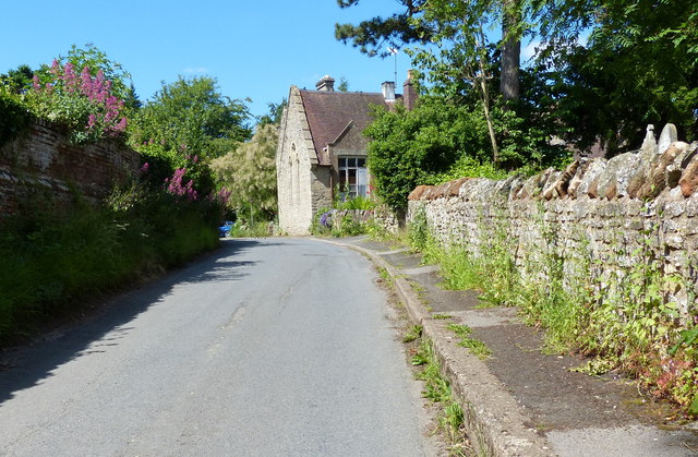
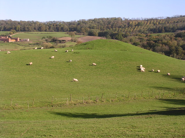
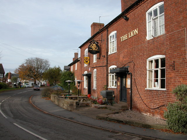
Callow Coppice Images

Images are sourced within 2km of 52.251534/-2.3704415 or Grid Reference SO7461. Thanks to Geograph Open Source API. All images are credited.

Meadow in the Teme valley Meadow in the Teme valley near Ham Farm.
Meadow in the Teme valley
Meadow in the Teme valley near Ham Farm.
Timber framed barn, Ham Farm A traditional old timber-framed barn at Ham Farm in the Teme valley near Clifton upon Teme.
Timber framed barn, Ham Farm
A traditional old timber-framed barn at Ham Farm in the Teme valley near Clifton upon Teme.
Old farm building, Ham Farm Until recently a partial roof was still intact above the wall on the left of the red-brick building, see: <a href="https://www.geograph.org.uk/photo/62881">SO7359 : Ham Farm</a>
Old farm building, Ham Farm
Until recently a partial roof was still intact above the wall on the left of the red-brick building, see: SO7359 : Ham Farm
The Crown (1), Martley, Worcs The Crown is a large and much extended public house and restaurant in the village of Martley, on the B4197 road. Photographed early on a Saturday afternoon, the pub looked firmly closed but apparently on most days it does not open until 6pm, and on Mondays it doesn't open at all.

<a href="https://www.geograph.org.uk/photo/3426691">SO7559 : The Crown (2) - sign, Martley, Worcs</a>.
<a href="https://www.geograph.org.uk/photo/3426723">SO7559 : The Crown (3), Martley, Worcs</a>.
The Crown (1), Martley, Worcs
The Crown is a large and much extended public house and restaurant in the village of Martley, on the B4197 road. Photographed early on a Saturday afternoon, the pub looked firmly closed but apparently on most days it does not open until 6pm, and on Mondays it doesn't open at all. SO7559 : The Crown (2) - sign, Martley, Worcs. SO7559 : The Crown (3), Martley, Worcs.
The Crown (2) - sign, Martley, Worcs The pub is not a Marston's house, according to the brewery website, although it may well sell their beer.

The name of the Crown indicates loyalty to the reigning monarch. It has been used as an inn or pub sign for hundreds of years. In the past, when most people were illiterate, the sign was easily recognised by people. The Crown is almost as popular as the Red Lion as a pub name.

<a href="https://www.geograph.org.uk/photo/3426671">SO7559 : The Crown (1), Martley, Worcs</a>.
<a href="https://www.geograph.org.uk/photo/3426723">SO7559 : The Crown (3), Martley, Worcs</a>.
The Crown (2) - sign, Martley, Worcs
The pub is not a Marston's house, according to the brewery website, although it may well sell their beer. The name of the Crown indicates loyalty to the reigning monarch. It has been used as an inn or pub sign for hundreds of years. In the past, when most people were illiterate, the sign was easily recognised by people. The Crown is almost as popular as the Red Lion as a pub name. SO7559 : The Crown (1), Martley, Worcs. SO7559 : The Crown (3), Martley, Worcs.
The Crown (3), Martley, Worcs Viewed from this side, the considerable extension to the original building can clearly be seen. The pub is adjacent to some farmland. There is currently a very controversial planning application to build fifty one houses on some of this.

<a href="https://www.geograph.org.uk/photo/3426671">SO7559 : The Crown (1), Martley, Worcs</a>.
<a href="https://www.geograph.org.uk/photo/3426691">SO7559 : The Crown (2) - sign, Martley, Worcs</a>.
The Crown (3), Martley, Worcs
Viewed from this side, the considerable extension to the original building can clearly be seen. The pub is adjacent to some farmland. There is currently a very controversial planning application to build fifty one houses on some of this. SO7559 : The Crown (1), Martley, Worcs. SO7559 : The Crown (2) - sign, Martley, Worcs.
Martley Post Office and Off-licence, Martley, Worcs The Post Office and Off-licence is next door to the garage and petrol station, and opposite to the junction of the B4197 and B4204 roads.
Martley Post Office and Off-licence, Martley, Worcs
The Post Office and Off-licence is next door to the garage and petrol station, and opposite to the junction of the B4197 and B4204 roads.
St Peter's church in Martley Looking north from Hopehouse Lane.
St Peter's church in Martley
Looking north from Hopehouse Lane.
Track past St Peter's church in Martley
Lane in the village of Martley St Peter's churchyard is to the right of the wall.
Lane in the village of Martley
St Peter's churchyard is to the right of the wall.
The Crown public house in Martley Along the B4197.
The Crown public house in Martley
Along the B4197.
The Hopyard, Martley A recent modern Taylor Wimpey housing development named The Hopyard beside the B4197 at Martley.  These appear to be premium homes which unusually have space and are not tightly built like many modern developments.
The Hopyard, Martley
A recent modern Taylor Wimpey housing development named The Hopyard beside the B4197 at Martley. These appear to be premium homes which unusually have space and are not tightly built like many modern developments.
Taylor Wimpey development at Martley A recent modern Taylor Wimpey housing development named The Hopyard beside the B4197 at Martley.  These appear to be premium homes which unusually have space and are not tightly built like many modern developments.
Taylor Wimpey development at Martley
A recent modern Taylor Wimpey housing development named The Hopyard beside the B4197 at Martley. These appear to be premium homes which unusually have space and are not tightly built like many modern developments.
The Hopyard, Martley A recent modern Taylor Wimpey housing development named The Hopyard beside the B4197 at Martley.  These appear to be premium homes which unusually have space and are not tightly built like many modern developments.
The Hopyard, Martley
A recent modern Taylor Wimpey housing development named The Hopyard beside the B4197 at Martley. These appear to be premium homes which unusually have space and are not tightly built like many modern developments.
Martley, 1949: Post Office at cross-roads View westwards, at junction of A4197 and B4204. Note vintage petrol-pumps on left and my vintage bike (no gears, either). (Cf. <a href="https://www.geograph.org.uk/photo/904345">SO7559 : Martley - the village stores</a> and <a href="https://www.geograph.org.uk/photo/3426795">SO7559 : Martley Post Office and Off-licence, Martley, Worcs</a>).
Martley, 1949: Post Office at cross-roads
View westwards, at junction of A4197 and B4204. Note vintage petrol-pumps on left and my vintage bike (no gears, either). (Cf. SO7559 : Martley - the village stores and SO7559 : Martley Post Office and Off-licence, Martley, Worcs).
St Peter's Church, Martley, Worcestershire St Peter's Church in Martley. The Church also has an Ordnance Survey bench mark.
<a href="https://www.geograph.org.uk/photo/6931913">SO7559 : Ordnance Survey Bench Mark</a>
St Peter's Church, Martley, Worcestershire
St Peter's Church in Martley. The Church also has an Ordnance Survey bench mark. SO7559 : Ordnance Survey Bench Mark
Ordnance Survey Bench Mark This mark is located on St Peter's Church in Martley, Worcestershire. These marks were used by Ordnance Survey for mapping purposes. <a href="https://www.geograph.org.uk/photo/6931905">SO7559 : St Peter's Church, Martley, Worcestershire</a>
Ordnance Survey Bench Mark
This mark is located on St Peter's Church in Martley, Worcestershire. These marks were used by Ordnance Survey for mapping purposes. SO7559 : St Peter's Church, Martley, Worcestershire
Entrance gates to St. Peter's church (Martley) These wrought iron gates leads the walker in the grounds of St. Peter's parish church from the south, and these were built to celebrate the Diamond Jubilee of Queen Victoria in 1897.
Entrance gates to St. Peter's church (Martley)
These wrought iron gates leads the walker in the grounds of St. Peter's parish church from the south, and these were built to celebrate the Diamond Jubilee of Queen Victoria in 1897.
Show me another place!

Callow Coppice is located at Grid Ref: SO7461 (Lat: 52.251534, Lng: -2.3704415)

Administrative County: Worcestershire

District: Malvern Hills

Police Authority: West Mercia

What 3 Words

///rescuer.anguished.presuming. Near Lower Broadheath, Worcestershire

Related Wikis

Ham Castle

Ham Castle (also known as Home or Homme Castle) is located in Worcestershire at the bottom of a wooded escarpment (and close to the River Teme), within...

The Chantry School

The Chantry School is a mixed gender secondary school with academy status located in Martley, Worcestershire, England. The school has about 700 students...

Martley

Martley is a village and civil parish in the Malvern Hills district of the English county of Worcestershire. It is approximately nine miles north-west...

Shelsley Beauchamp

Shelsley Beauchamp or Great Shelsley is a village and civil parish 9 miles (14 km) north west of Worcester, in the Malvern Hills district, in the county...

Woodbury Hill

Woodbury Hill is a hill near the village of Great Witley, about 5 miles (8 km) south-west of Stourport-on-Severn in Worcestershire, England. It is the...

Shelsley Walsh

Shelsley Walsh is a small village and civil parish in Worcestershire, England, on the western side of the River Teme. For administrative purposes it is...

Clifton upon Teme

Clifton upon Teme is a village and civil parish in the Malvern Hills District in the county of Worcestershire, England. == Amenities == Named after the...

Berrow Green

Berrow Green is a village in Worcestershire, England. == Berrow Hill Camp == Berrow Green is situated just below Berrow Hill Camp, an Iron Age encampment...

Nearby Amenities

Located within 500m of 52.251534,-2.3704415
Barrier: stile
Foot: yes
Lat/Long: 52.2552861/-2.3702841
Power: pole
Lat/Long: 52.2493034/-2.3661233
Power: pole
Lat/Long: 52.2496205/-2.3676585
Power: pole
Lat/Long: 52.2499446/-2.3692854
Power: pole
Lat/Long: 52.2506088/-2.3705111
Power: pole
Lat/Long: 52.2508729/-2.3710388
Power: pole
Lat/Long: 52.2513938/-2.3719905
Power: pole
Lat/Long: 52.2515158/-2.3701103
Power: pole
Lat/Long: 52.2519249/-2.3729698
Power: pole
Lat/Long: 52.2523122/-2.3694876
Callow Farm
Power: pole
Transformer: distribution
Voltage Primary: 11000
Lat/Long: 52.2529183/-2.369408
Crossing
Lat/Long: 52.2475349/-2.3673528
Power: pole
Lat/Long: 52.2555889/-2.3734251
Power: pole
Lat/Long: 52.2545085/-2.3732856
Power: pole
Lat/Long: 52.2524889/-2.3730308
Power: pole
Lat/Long: 52.2536251/-2.3731837
Pudford Farm
Design: one-level
Material: wood
Power: pole
Transformer: distribution
Voltage Primary: 11000
Voltage Secondary: 230
Lat/Long: 52.2517803/-2.3764801
Power: pole
Lat/Long: 52.2520521/-2.3751926
Quarry Farm Bungalow
Power: pole
Transformer: distribution
Voltage Primary: 11000
Lat/Long: 52.2482992/-2.3662071
Location Transition: yes
Power: pole
Lat/Long: 52.2486934/-2.36582
Power: pole
Lat/Long: 52.2478927/-2.3666015
Power: pole
Lat/Long: 52.2483303/-2.3656467
Penny Hill Quarry
Power: transformer
Transformer: distribution
Voltage Primary: 11000
Lat/Long: 52.2491567/-2.3654348
Power: pole
Lat/Long: 52.2489293/-2.3654696
Location Transition: yes
Power: pole
Lat/Long: 52.2490935/-2.3655991
The data included in this document is from www.openstreetmap.org. The data is made available under ODbL.

Have you been to Callow Coppice?

Leave your review of Callow Coppice below (or comments, questions and feedback).