Pitstead Covert

Wood, Forest in Cheshire

England

Pitstead Covert

Dunham Massey Part of the group of buildings by Dunham Massey Hall
Dunham Massey Credit: Paul Ashwin

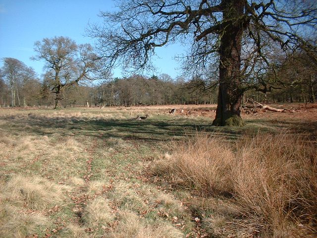
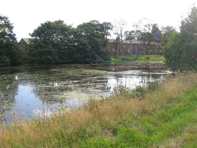
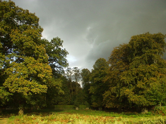
Pitstead Covert is a picturesque woodland area located in the county of Cheshire, England. Covering approximately 100 acres, this ancient forest is known for its natural beauty and diverse wildlife.

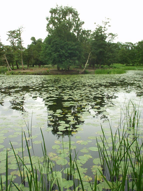
Situated near the village of Pitstead, the covert is a popular destination for nature enthusiasts and outdoor lovers. The woodland is predominantly composed of native tree species such as oak, ash, beech, and birch, creating a dense canopy that provides shade and shelter for countless plants and animals.

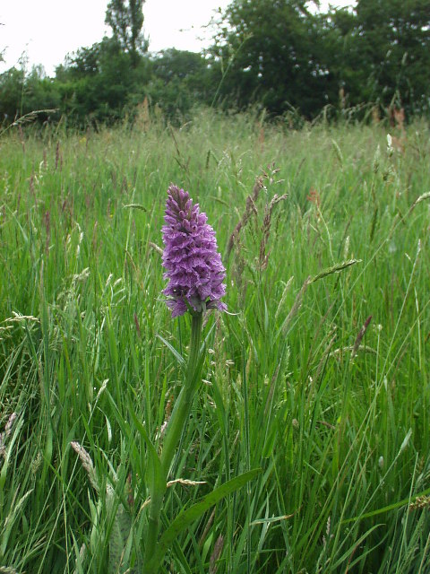
The forest floor is adorned with a rich carpet of wildflowers, including bluebells, primroses, and wood anemones, which bloom in vibrant colors during the spring months. The area is also home to a variety of ferns, mosses, and fungi, adding to its enchanting atmosphere.

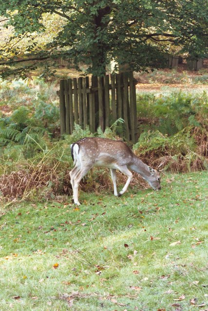
Pitstead Covert is a haven for wildlife, with numerous species calling it home. Birdwatchers can spot a wide range of avian inhabitants, including woodpeckers, owls, and warblers. Mammals such as deer, foxes, and squirrels can be spotted among the trees, while the nearby streams attract amphibians and reptiles like frogs and newts.

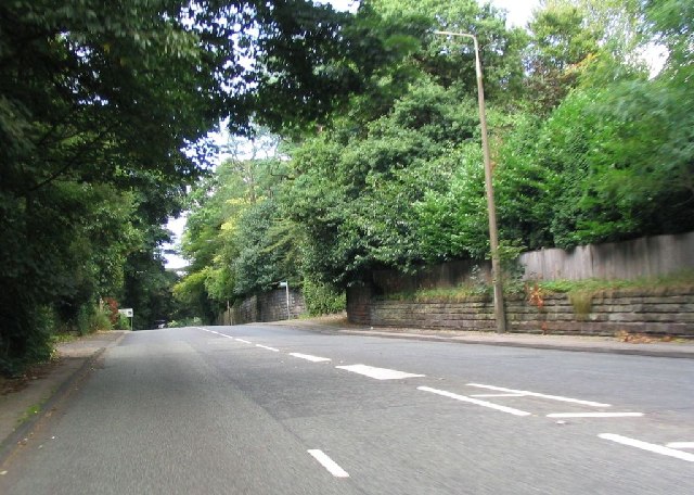
The woodland offers several walking trails and paths, allowing visitors to explore its serene surroundings. With its tranquil ambiance and natural beauty, Pitstead Covert is a cherished local gem that offers a peaceful retreat from the hustle and bustle of everyday life.

If you have any feedback on the listing, please let us know in the comments section below.

Pitstead Covert Images

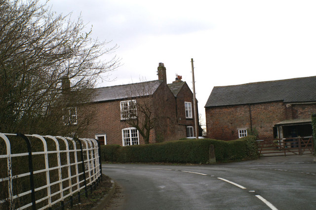
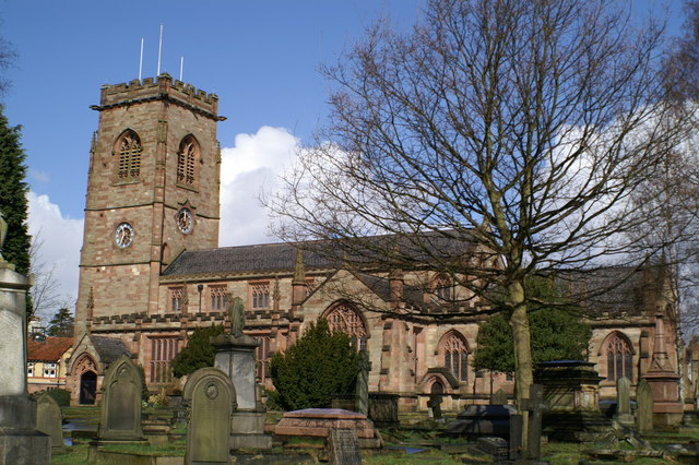
Images are sourced within 2km of 53.377436/-2.3808674 or Grid Reference SJ7486. Thanks to Geograph Open Source API. All images are credited.

Dunham Massey Part of the group of buildings by Dunham Massey Hall
Dunham Massey
Part of the group of buildings by Dunham Massey Hall
Dunham Park This shot was taken at the eastern end of the deer park - you can even see some of the deer grazing.
Dunham Park
This shot was taken at the eastern end of the deer park - you can even see some of the deer grazing.
Dunham Massey Hall
Dunham Massey Hall
Home Farm This picture was taken from SJ744864 looking SW across the pond to Home Farm, this farm has been previously known as Dunham Farm.
Home Farm
This picture was taken from SJ744864 looking SW across the pond to Home Farm, this farm has been previously known as Dunham Farm.
A556 This is the view from SJ752872 looking NE along the A556 heading towards Altrincham.
A556
This is the view from SJ752872 looking NE along the A556 heading towards Altrincham.
Rear of Dunham Massey Hall in the winter
Beech Trees at Dunham Park In the north east corner of the deep park at Dunham Massey.
Beech Trees at Dunham Park
In the north east corner of the deep park at Dunham Massey.
Meadow at The Devisdale The Devisdale is an area of open fields near Bowdon, surrounded on all sides by housing. Can any one identify the species of this orchid?
Meadow at The Devisdale
The Devisdale is an area of open fields near Bowdon, surrounded on all sides by housing. Can any one identify the species of this orchid?
Island Pool, Dunham Massey A small lake with the deer park. National Trust property.
Island Pool, Dunham Massey
A small lake with the deer park. National Trust property.
Evening Sunset on Bridgewater Canal Summer's evening sunset on the Bridgewater Canal.
Evening Sunset on Bridgewater Canal
Summer's evening sunset on the Bridgewater Canal.
If the Romans could see it now The A560, Watling Street, raised on an embankment to clear the M56
If the Romans could see it now
The A560, Watling Street, raised on an embankment to clear the M56
Headlight code Wet and gloomy view eastwards on the M56
Headlight code
Wet and gloomy view eastwards on the M56
Bowdon Parish Church Well worth a visit just for its extensive and spectacular graveyard
Bowdon Parish Church
Well worth a visit just for its extensive and spectacular graveyard
Seamons Moss Bridge Over the Bridgewater Canal, looking east
Seamons Moss Bridge
Over the Bridgewater Canal, looking east
Across Cheshire to Lancashire The Bridgewater Canal is behind the hedge at the bottom of the field. The Manchester Ship Canal is lined with works beyond that, and Winter Hill lies in the far distance
Across Cheshire to Lancashire
The Bridgewater Canal is behind the hedge at the bottom of the field. The Manchester Ship Canal is lined with works beyond that, and Winter Hill lies in the far distance
Bowgreen Farm, Bow Lane, Bowdon
Pylons near New Farm Little Bollington
Pylons near New Farm
Little Bollington
Dunhan Massey Deer park
Show me another place!

Pitstead Covert is located at Grid Ref: SJ7486 (Lat: 53.377436, Lng: -2.3808674)

Unitary Authority: Trafford

Police Authority: Greater Manchester

What 3 Words

///flipping.bets.nanny. Near Bowdon, Manchester

Related Wikis

Watch Hill Castle

Watch Hill Castle (also known as Yarwood Castle, Castle Hill, and Bowdon Watch) is a medieval motte-and-bailey on the boundary of Bowdon and Dunham Massey...

Dunham Massey POW Camp

Dunham Massey POW Camp was a POW camp detaining German prisoners of war. It was located in the eastern corner of Dunham Massey Home Park in an area which...

Bowdon Urban District

Bowdon Urban District is a former Urban District in Cheshire, based in the village of Bowdon. It was created in 1894 and abolished in 1974 when it was...

Bowdon, Greater Manchester

Bowdon is a suburb of Altrincham and electoral ward in the Metropolitan Borough of Trafford, Greater Manchester, England. == History == Within the boundaries...

Nearby Amenities

Located within 500m of 53.377436,-2.3808674
Traffic Signals
Traffic Signals: signal
Traffic Signals Direction: backward
Lat/Long: 53.3804907/-2.3753391
Fuel
Shell
Addr City: Altrincham
Addr Postcode: WA14 4SN
Brand: Shell
Brand Wikidata: Q110716465
Operator: Texaco
Phone: +44 161 941 3554
Ref Navads: NVDS353_12038439
Website: https://find.shell.com/gb/fuel/12038439-shell-little-waitrose-bowdon
Lat/Long: 53.3763046/-2.3786795
Bus Stop
Bowdon Vale, Dunham Road / near Bow Green Road
Bus: yes
Naptan AtcoCode: 1800SJ10701
Naptan Bearing: SW
Naptan CommonName: Dunham Road/Bow Green Road
Naptan Indicator: O/s House 6
Naptan Landmark: STREETHEAD LDGE
Naptan NaptanCode: manjptmd
Naptan PlusbusZoneRef: MNCRPIC
Naptan ShortCommonName: Bow Green Road
Naptan Street: DUNHAM ROAD
Naptan Verified: no
Network: TfGM
Operator: TfGM
Public Transport: platform
Shelter: no
Source: naptan_import
Lat/Long: 53.3744529/-2.3808908
Bus Stop
Dunham Road/Bow Green Road
Bus: yes
Naptan AtcoCode: 1800SJ10711
Naptan Bearing: NE
Naptan CommonName: Dunham Road/Bow Green Road
Naptan Indicator: Op Cottages
Naptan Landmark: OP COTTAGES
Naptan NaptanCode: manjptmg
Naptan PlusbusZoneRef: MNCRPIC
Naptan ShortCommonName: Bow Green Road
Naptan Street: DUNHAM ROAD
Naptan Verified: no
Network: TfGM
Public Transport: platform
Source: naptan_import
Lat/Long: 53.3746142/-2.3810726
Traffic Signals
Traffic Signals: signal
Lat/Long: 53.3801275/-2.3748251
Give Way
Lat/Long: 53.3801191/-2.3749633
Traffic Signals
Traffic Signals: signal
Lat/Long: 53.3801672/-2.3751945
Traffic Signals
Traffic Signals: signal
Lat/Long: 53.3801442/-2.3751152
Little Waitrose
Branch: Bowdon
Brand: Little Waitrose
Brand Wikidata: Q771734
Contact Facebook: https://www.facebook.com/109188374539589
Opening Hours: 24/7
Phone: +44 161 941 3554
Shop: convenience
Website: https://www.waitrose.com/find-a-store/bowdon
Lat/Long: 53.3762549/-2.3787278
The data included in this document is from www.openstreetmap.org. The data is made available under ODbL.

Have you been to Pitstead Covert?

Leave your review of Pitstead Covert below (or comments, questions and feedback).