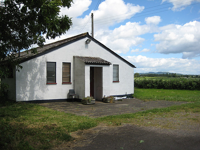
Cobhill Rough

Wood, Forest in Worcestershire Forest of Dean

England

Cobhill Rough
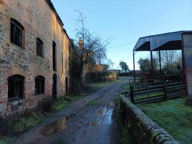
Durbridge Mill buildings Buildings alongside the track through Durbridge Mill Farm.
Durbridge Mill buildings Credit: Pebble

Cobhill Rough is a picturesque woodland located in the county of Worcestershire, England. Situated in the heart of the county, it is known for its natural beauty and rich biodiversity. Covering an area of approximately 200 acres, this ancient forest is a popular destination for outdoor enthusiasts and nature lovers.

The woodland is characterized by its dense canopy of trees, predominantly consisting of oak, beech, and birch. These towering trees provide a habitat for a variety of wildlife, including birds, mammals, and insects. Visitors to Cobhill Rough may spot species such as woodpeckers, deer, foxes, and butterflies, among others.

Traversing through the woodland, visitors can explore a network of well-maintained trails, which offer opportunities for walking, hiking, and cycling. These paths wind their way through the forest, providing stunning views of the surrounding landscape and the chance to immerse oneself in nature. In spring, the forest floor comes alive with vibrant wildflowers, creating a colorful carpet beneath the towering trees.

Cobhill Rough is not only a haven for wildlife but also a site of historical significance. Evidence of ancient settlements and burial mounds can be found within the woodland, offering a glimpse into the area's past.

The forest is easily accessible, with parking facilities available nearby. It is open to the public year-round, with no admission fees. Whether seeking tranquility, wildlife spotting, or a peaceful stroll, Cobhill Rough provides a serene and captivating escape into nature's embrace.

If you have any feedback on the listing, please let us know in the comments section below.

Cobhill Rough Images

Images are sourced within 2km of 51.976051/-2.3714393 or Grid Reference SO7430. Thanks to Geograph Open Source API. All images are credited.

Durbridge Mill buildings Buildings alongside the track through Durbridge Mill Farm.
Durbridge Mill buildings
Buildings alongside the track through Durbridge Mill Farm.
Footbridge over the River Leadon There are a number of footpaths in the area, this footbridge enables walkers to cross the River Leadon near Durbridge Farm.
Footbridge over the River Leadon
There are a number of footpaths in the area, this footbridge enables walkers to cross the River Leadon near Durbridge Farm.
River Leadon near Durbridge Mill Trees reflected in the River Leadon which is flowing at a very low level after a prolong period of low rainfall. Note the exposed tree roots on the riverbank.
River Leadon near Durbridge Mill
Trees reflected in the River Leadon which is flowing at a very low level after a prolong period of low rainfall. Note the exposed tree roots on the riverbank.
Bridge reflected in the River Leadon Bridge reflected in the River Leadon near Durbridge Mill.
Bridge reflected in the River Leadon
Bridge reflected in the River Leadon near Durbridge Mill.
Building at Durbridge Mill The remains of a round building at Durbridge Mill near Poolhill, not sure what its original purpose was.
Building at Durbridge Mill
The remains of a round building at Durbridge Mill near Poolhill, not sure what its original purpose was.
Former mill buildings Former mill buildings at Durbridge Mill beside the River Leadon.
Former mill buildings
Former mill buildings at Durbridge Mill beside the River Leadon.
Old millwheel, Durbridge Mill
Traditional farm buildings, Durbridge Mill Traditional red-brick farm buildings at Durbridge Mill.
Traditional farm buildings, Durbridge Mill
Traditional red-brick farm buildings at Durbridge Mill.
Road to Durbridge Mill Road to Durbridge Mill which appears now to be a farm.
Road to Durbridge Mill
Road to Durbridge Mill which appears now to be a farm.
Green Lane at Chapel Farm There is some confusion about the name of this lane. The map shows 'Green Lane' here, but 'Chapel Lane' a short distance north. The lane to the east is clearly labelled 'Chapel Lane' on the ground (not on the map). I am unable to explain this apparent anomaly.
Green Lane at Chapel Farm
There is some confusion about the name of this lane. The map shows 'Green Lane' here, but 'Chapel Lane' a short distance north. The lane to the east is clearly labelled 'Chapel Lane' on the ground (not on the map). I am unable to explain this apparent anomaly.
The River Leadon at Payford Bridge Looking upstream. It is marginal as to whether the river here is in SO7429 or SO7430, but I am relying on my GPS reading.

The Explorer map has this as 'Playford Bridge', but the Landranger has 'Payford'. As the Explorer has 'Payford Mill' nearby, I have assumed this to be the correct name.
The River Leadon at Payford Bridge
Looking upstream. It is marginal as to whether the river here is in SO7429 or SO7430, but I am relying on my GPS reading. The Explorer map has this as 'Playford Bridge', but the Landranger has 'Payford'. As the Explorer has 'Payford Mill' nearby, I have assumed this to be the correct name.
St John the Evangelist church, Pauntley
Pauntley Court, the Dovecote Dating from the 17th century, this splendid dovecote stands between the ancient church and the Court, the birthplace of Dick Whittington.
Pauntley Court, the Dovecote
Dating from the 17th century, this splendid dovecote stands between the ancient church and the Court, the birthplace of Dick Whittington.
St John the Evangelist, Pauntley The South side of Dick Whittington's local church.
St John the Evangelist, Pauntley
The South side of Dick Whittington's local church.
St John the Evangelist, Pauntley Dick Whittington's local church - he was born at the Court next door.
St John the Evangelist, Pauntley
Dick Whittington's local church - he was born at the Court next door.
St John the Evangelist, Pauntley The North porch, 14th century, protects an original 13th century door, complete with contemporary ironwork. Dick Whittington, born next door at the Court, would no doubt have passed through here.
St John the Evangelist, Pauntley
The North porch, 14th century, protects an original 13th century door, complete with contemporary ironwork. Dick Whittington, born next door at the Court, would no doubt have passed through here.
St John the Evangelist, Pauntley The remarkable Norman South doorway.
St John the Evangelist, Pauntley
The remarkable Norman South doorway.
Farming ducks at Pauntley Free range ducks (but not that free!).
Farming ducks at Pauntley
Free range ducks (but not that free!).
Show me another place!

Cobhill Rough is located at Grid Ref: SO7430 (Lat: 51.976051, Lng: -2.3714393)

Administrative County: Gloucestershire

District: Forest of Dean

Police Authority: Gloucestershire

What 3 Words

///usage.reassured.munch. Near Donnington, Herefordshire

Related Wikis

Redmarley D'Abitot

Redmarley D'Abitot is a civil parish and village in the Forest of Dean district, Gloucestershire, South West England. In addition to the village of Redmarley...

Ketford Bank

Ketford Bank (grid reference SO723308) is a 0.69-hectare (1.7-acre) nature reserve in Gloucestershire.The site is owned and managed by the Gloucestershire...

Brand Green

Brand Green is a village in Gloucestershire, England. == References == == External links == Media related to Brand Green at Wikimedia Commons

Collinpark Wood SSSI

Collinpark Wood (grid reference SO750278) is a 66.69-hectare (164.8-acre) biological Site of Special Scientific Interest in Gloucestershire, notified in...

Bromsberrow

Bromsberrow (or Bromesberrow) is part of the Forest of Dean district. The village is close to the meeting point between Gloucestershire, Herefordshire...

Three Counties (Gloucestershire, Herefordshire and Worcestershire)

The Three Counties of England are traditionally the three agrarian counties of Gloucestershire, Herefordshire and Worcestershire.Including towns and cities...

Vell Mill Daffodil Meadow

Vell Mill Daffodil Meadow (grid reference SO710314) is a 2.1-hectare (5.2-acre) nature reserve in Gloucestershire.The site is owned and managed by the...

Pauntley

Pauntley is a village and civil parish in the district of Forest of Dean, Gloucestershire, England. In 2019 it had a population of 304. == School == Pauntley...

Nearby Amenities

Located within 500m of 51.976051,-2.3714393
Bus Stop
Durbridge Rd Corner
Naptan AtcoCode: 1600GLN078
Naptan Bearing: SW
Naptan CommonName: Durbridge Rd Corner
Naptan NaptanCode: gloapjma
Naptan Street: Rock Ln
Naptan Verified: no
Source: naptan_import
Lat/Long: 51.9749354/-2.3651247
Natural: spring
Source: OS 1:25k
Lat/Long: 51.9743578/-2.3695048
Natural: spring
Source: OS 1:25k
Lat/Long: 51.980147/-2.3698052
Man Made: water_well
Source: OS 1:25k
Lat/Long: 51.9789179/-2.3738393
Natural: spring
Source: OS 1:25k
Lat/Long: 51.9745032/-2.3697623
Power: pole
Lat/Long: 51.9725794/-2.3668288
Information: map
Tourism: information
Lat/Long: 51.9753758/-2.3662885
Durbridge Road Nursery
Power: pole
Transformer: distribution
Voltage Primary: 11000
Lat/Long: 51.9739846/-2.3667309
Power: pole
Lat/Long: 51.973795/-2.3671239
Power: pole
Lat/Long: 51.9733237/-2.3662334
The data included in this document is from www.openstreetmap.org. The data is made available under ODbL.

Have you been to Cobhill Rough?

Leave your review of Cobhill Rough below (or comments, questions and feedback).