Aird Fheàrna

Settlement in Argyllshire

Scotland

Aird Fheàrna

View towards Loch Melfort Looking over woodlands beside Gemmell towards the island of Eilean Arsa and smaller islands beyond. Craobh Haven and its marina is just visible above the trees on the right.
View towards Loch Melfort Credit: Richard Sutcliffe

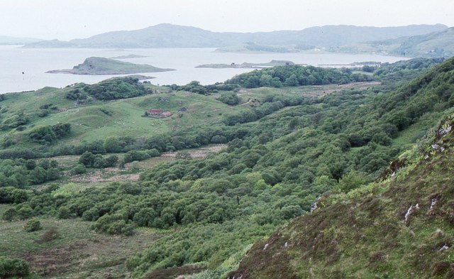
Aird Fheàrna is a small coastal village located in Argyllshire, a historic county in western Scotland. Situated on the shores of Loch Fyne, it is surrounded by breathtaking natural beauty and offers a peaceful and idyllic setting for residents and visitors alike.

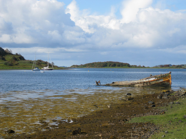
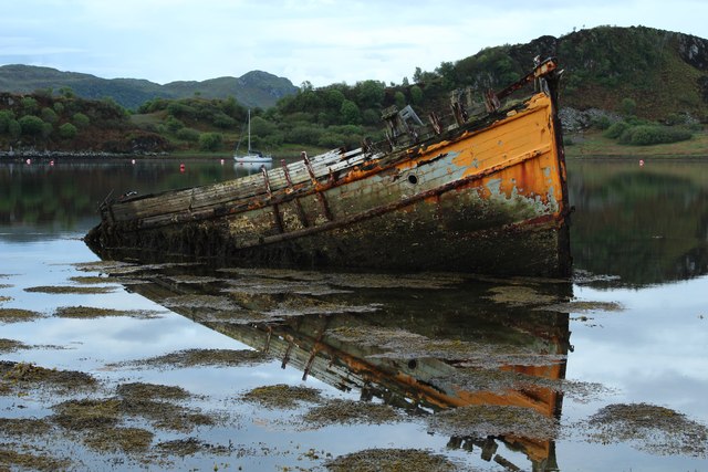
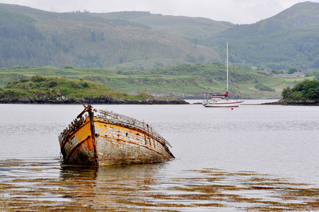
The village is characterized by its picturesque landscape, with rolling hills and stunning views of the loch. It is a popular destination for outdoor enthusiasts, with opportunities for hiking, fishing, sailing, and wildlife spotting. The area is also known for its rich history, with nearby ancient ruins and archaeological sites that provide a glimpse into the region's past.

Despite its small size, Aird Fheàrna boasts a tight-knit and friendly community. The village has a close relationship with its neighbors and holds regular events and gatherings, fostering a sense of unity among its inhabitants. The local economy is primarily based on fishing and tourism, with a few small businesses catering to the needs of residents and visitors.

Aird Fheàrna offers a range of amenities, including a local pub, a community center, and a primary school. For further amenities, residents can access nearby towns such as Inveraray, which is approximately 10 miles away.

Overall, Aird Fheàrna is a charming village that combines natural beauty, outdoor activities, and a strong sense of community. It is an ideal destination for those seeking a peaceful retreat in the heart of the Scottish countryside.

If you have any feedback on the listing, please let us know in the comments section below.
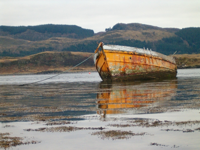
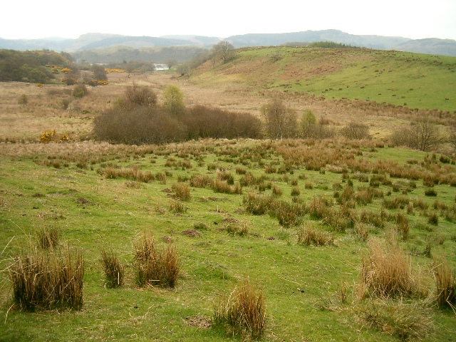
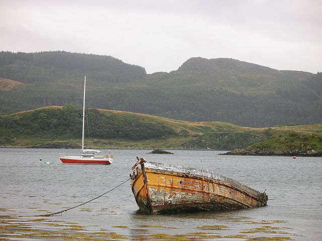
Aird Fheàrna Images

Images are sourced within 2km of 56.1811/-5.536526 or Grid Reference NM8004. Thanks to Geograph Open Source API. All images are credited.

View towards Loch Melfort Looking over woodlands beside Gemmell towards the island of Eilean Arsa and smaller islands beyond. Craobh Haven and its marina is just visible above the trees on the right.
View towards Loch Melfort
Looking over woodlands beside Gemmell towards the island of Eilean Arsa and smaller islands beyond. Craobh Haven and its marina is just visible above the trees on the right.
Sunken fishing boat Just off the shore of Loch Craignish.
Sunken fishing boat
Just off the shore of Loch Craignish.
Sheltered mooring behind Eilean Mhic Chrion
High tide at Herons Cottage
Loch Craignish The much photographed half submerged hulk on the shore of Loch Craignish with yachts at their moorings beyond and the island of Eilean Mhic Chrion in the distance.
Loch Craignish
The much photographed half submerged hulk on the shore of Loch Craignish with yachts at their moorings beyond and the island of Eilean Mhic Chrion in the distance.
Rotting hulk in Loch Craignish Viewed from the minor road that leads to Kirkton, with Eilean Dubh in the background.
Rotting hulk in Loch Craignish
Viewed from the minor road that leads to Kirkton, with Eilean Dubh in the background.
Decaying wreck in Loch Craignish
Decaying Hull - 2014 Its interesting to see the stages of decay over the years.
Decaying Hull - 2014
Its interesting to see the stages of decay over the years.
Loch Craignish Decaying remains of the fishing boat 'Our Atlanta' in the shallows of Loch Craignish.  In the background are the two islands of Eilean Mhic Chrion (left) and Eilean Dubh.
Loch Craignish
Decaying remains of the fishing boat 'Our Atlanta' in the shallows of Loch Craignish. In the background are the two islands of Eilean Mhic Chrion (left) and Eilean Dubh.
Wrecked fishing boat When you see this shot from August 1994 <a href="https://www.geograph.org.uk/photo/3289005">NM7902 : Beached fishing boat beside Loch Craignish</a>, the current shot is very depressing. It appears a perfectly good boat was simply abandoned.
Wrecked fishing boat
When you see this shot from August 1994 NM7902 : Beached fishing boat beside Loch Craignish, the current shot is very depressing. It appears a perfectly good boat was simply abandoned.
Hulk in Loch Craignish
Loch Fada The main reservoir for the Ardfern water treatment works.
Loch Fada
The main reservoir for the Ardfern water treatment works.
Lochan Tigh Choinnich The lochan feeds Loch Fada and is a catchment for the water supply to Ardfern.
Lochan Tigh Choinnich
The lochan feeds Loch Fada and is a catchment for the water supply to Ardfern.
Forestry at Lunga Looking north east from a small hill at NM791051.
Forestry at Lunga
Looking north east from a small hill at NM791051.
Heathery hilltop View south east over Lochan Tigh Choinnich and Loch Fada, with Loch Craignish in the distance.
Heathery hilltop
View south east over Lochan Tigh Choinnich and Loch Fada, with Loch Craignish in the distance.
Rough grazing above Barfad Looking east to Barfad.
Rough grazing above Barfad
Looking east to Barfad.
Cup-marked rock This rock has a large number of cup marks on its eastern face.
Cup-marked rock
This rock has a large number of cup marks on its eastern face.
Old and new, Loch Craignish
Show me another place!

Aird Fheàrna is located at Grid Ref: NM8004 (Lat: 56.1811, Lng: -5.536526)

Unitary Authority: Argyll and Bute

Police Authority: Argyll and West Dunbartonshire

Also known as: Ardfern

What 3 Words

///mothering.working.frowns. Near Lochgilphead, Argyll & Bute

Related Wikis

Ardfern

Ardfern (Scottish Gaelic: Aird Fheàrna, meaning "the head-land of alder-trees") is a village in Argyll and Bute, Scotland. It lies on the south coast of...

Eilean Mhic Chrion

Eilean Mhic Chrion is a tidal island sheltering Ardfern in Loch Craignish, Scotland. Eilean Mhic Chrion is one of 43 tidal islands that can be walked to...

Craignish

Craignish (Scottish Gaelic, Creiginis) is a peninsula in Argyll, on the west coast of Scotland. It lies around 25 miles (40 km) south of Oban, and 10 miles...

Eilean Rìgh

Eilean Rìgh is an island in the Inner Hebrides of the west coast of Scotland. It lies in Loch Craignish, about 300 metres (1⁄8 mile) off the Argyll coastline...

Craobh Haven

Craobh Haven Scottish Gaelic pronunciation: [kɾɯːv] is a small purpose-built village and sailing port on the west coast of Argyll and Bute, Scotland. It...

Dunan Aula

Dunan Aula, also known in Scottish Gaelic as Dùnan Amhlaidh, is the site of an exposed cist, located in the parish of Craignish, in Argyll and Bute, Scotland...

Loch Craignish

Loch Craignish is a sea loch on the mid-Argyll coast. == Geography == Loch Craignish lies between Oban and the Crinan Canal. Its opens into the Sound of...

Craignish Castle

Craignish Castle is located on the Craignish peninsula in Argyll, western Scotland and is a category B listed building. The present castle includes a 16th...

Nearby Amenities

Located within 500m of 56.1811,-5.536526
Source: PGS
Lat/Long: 56.1777522/-5.5414288
Source: PGS
Lat/Long: 56.1778302/-5.5412968
Source: PGS
Lat/Long: 56.178844/-5.5404679
Source: PGS
Lat/Long: 56.1789938/-5.5398225
Source: PGS
Lat/Long: 56.1791031/-5.5392373
Source: PGS
Lat/Long: 56.1788903/-5.5383153
Source: PGS
Lat/Long: 56.1784777/-5.5380822
Source: PGS
Lat/Long: 56.1788346/-5.537778
Source: PGS
Lat/Long: 56.1792021/-5.5371124
Source: PGS
Lat/Long: 56.1793683/-5.5367904
Source: PGS
Lat/Long: 56.1795643/-5.5364593
Source: PGS
Lat/Long: 56.1803239/-5.5354818
Source: PGS
Lat/Long: 56.180532/-5.5353642
Source: PGS
Lat/Long: 56.1816068/-5.5346868
Source: PGS
Lat/Long: 56.1818701/-5.5332588
Source: PGS
Lat/Long: 56.1827012/-5.5314878
Source: PGS
Lat/Long: 56.182784/-5.5317087
Source: PGS
Lat/Long: 56.1833466/-5.5311608
Source: PGS
Lat/Long: 56.1838404/-5.5304214
Ardfern
Is In: Argyll & Bute
Name En: Ardfern
Name Gd: Àird Fheàrna
Place: village
Lat/Long: 56.1816488/-5.5349163
Noexit: yes
Lat/Long: 56.1823024/-5.5378459
Noexit: yes
Lat/Long: 56.1826899/-5.5386812
Noexit: yes
Lat/Long: 56.1828604/-5.5393231
Public Bookcase
Ardfern Book Swap
Booth: K6
Disused Amenity: telephone
Man Made: telephone_box
Public Bookcase Type: phone_box
Lat/Long: 56.1803436/-5.5380045
Leisure: slipway
Lat/Long: 56.1824529/-5.531678
Noexit: yes
Lat/Long: 56.1829866/-5.5396105
Defibrillator
Direction: 320
Emergency: defibrillator
Indoor: no
Ref GB The Circuit: F3D473FE-615B-45A1-948C-AADC00AA5EDD
Support: fence
Lat/Long: 56.1816643/-5.5349334
Bus Stop
Ardfern, Craignish Primary School
Public Transport: platform
Lat/Long: 56.1813304/-5.5360683
Power: pole
Lat/Long: 56.1840566/-5.5325009
Power: pole
Lat/Long: 56.1828327/-5.53541
Power: pole
Lat/Long: 56.1821293/-5.5370917
Power: pole
Lat/Long: 56.1809145/-5.5399941
Power: pole
Lat/Long: 56.1827939/-5.5372012
Power: pole
Lat/Long: 56.1832241/-5.5382991
Power: pole
Lat/Long: 56.1824541/-5.5363153
Power: pole
Lat/Long: 56.18509/-5.5394718
Power: pole
Lat/Long: 56.184287/-5.5394386
Entrance: main
Lat/Long: 56.1804716/-5.537777
Post Box
Collection Times: Mo-Fr 09:00; Sa 07:00
Operator: Royal Mail
Operator Wikidata: Q638098
Post Box Type: lamp
Ref: PA31 36D
Royal Cypher: scottish_crown
Lat/Long: 56.1815372/-5.5353297
Historic: memorial
Inscription: In the Great War 1914-1919 They died for Freedom and for Honour
Material: stone
Memorial: war_memorial
Lat/Long: 56.1795849/-5.5395291
Power: pole
Lat/Long: 56.1804891/-5.5410179
Power: pole
Lat/Long: 56.1818572/-5.5377417
Power: pole
Lat/Long: 56.1813928/-5.5388513
Power: pole
Lat/Long: 56.1837082/-5.5333291
Power: pole
Lat/Long: 56.1832566/-5.5344025
Power: pole
Lat/Long: 56.1847361/-5.5319749
Bus Stop
Bus: yes
Departures Board: no
Public Transport: platform
Shelter: yes
Lat/Long: 56.1808764/-5.5368391
Bicycle Repair Station
Service Bicycle Pump: yes
Service Bicycle Stand: yes
Service Bicycle Tools: yes
Lat/Long: 56.1808689/-5.536907
Board Type: notice
Direction: 025
Information: board
Tourism: information
Lat/Long: 56.1815515/-5.5351996
Grit Bin
Colour: yellow
Material: plastic
Lat/Long: 56.181132/-5.5366695
Waste Basket
Colour: black
Material: plastic
Waste: trash
Lat/Long: 56.1808689/-5.536868
Bicycle Parking
Bicycle Parking: stands
Capacity: 8
Covered: no
Lat/Long: 56.180433/-5.5379881
Waste Basket
Colour: black
Material: plastic
Waste: trash
Lat/Long: 56.1803318/-5.5380616
Bench
Backrest: yes
Direction: 145
Material: wood
Lat/Long: 56.1792687/-5.5398698
Booth: K6
Colour: green
Covered: booth
Man Made: telephone_box
Lat/Long: 56.1827511/-5.5318534
Ardfern Village Store
Check Date: 2023-11-19
Opening Hours: Mo-Sa 08:00-18:30; Su 09:00-18:00; Nov-Mar Su 09:00-13:00
Shop: convenience
Lat/Long: 56.1815215/-5.5351101
Entrance: shop
Lat/Long: 56.1815528/-5.5351639
The data included in this document is from www.openstreetmap.org. The data is made available under ODbL.

Have you been to Aird Fheàrna?

Leave your review of Aird Fheàrna below (or comments, questions and feedback).