Stone Plantation

Wood, Forest in Staffordshire Stafford

England

Stone Plantation

Driveway and path to Ellerton Grange
Driveway and path to Ellerton Grange Credit: Row17

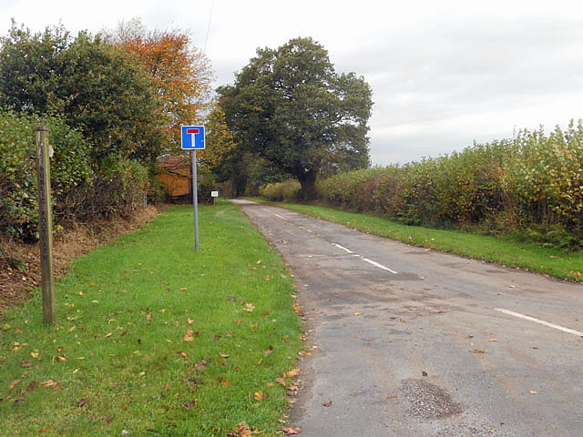
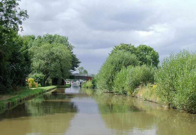
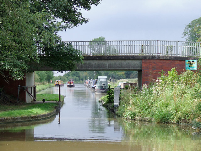
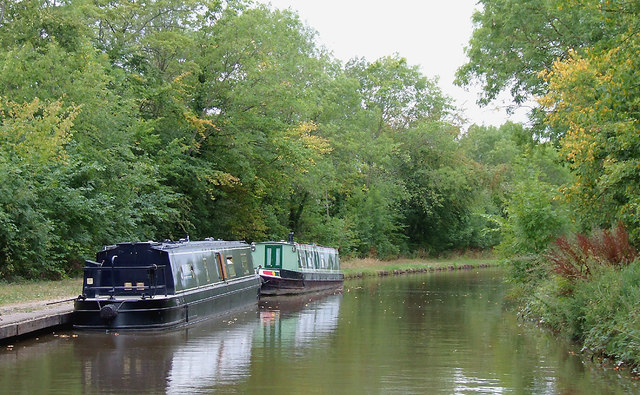
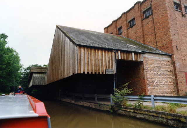
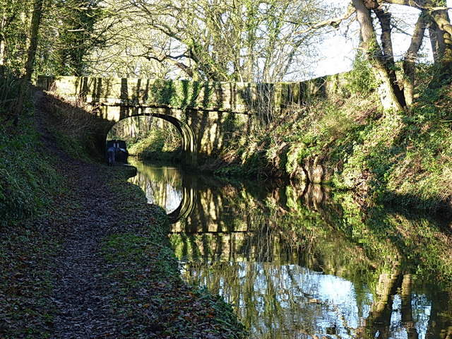
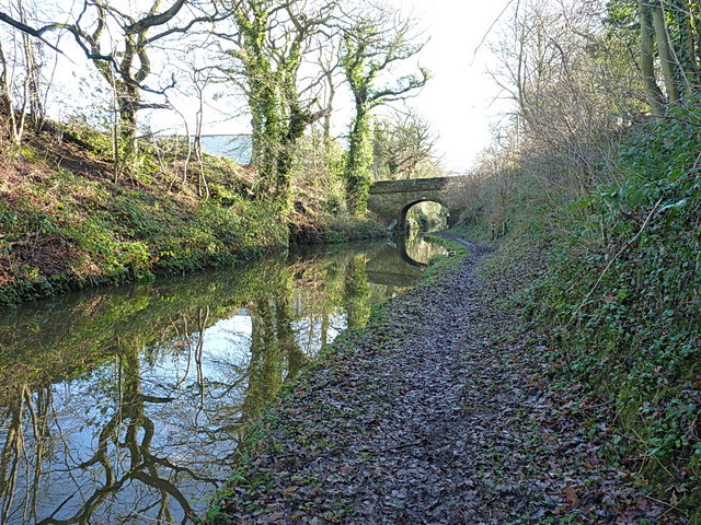
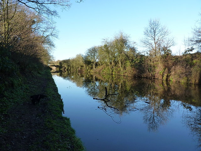
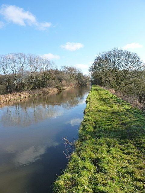
Stone Plantation is a picturesque woodland located in the county of Staffordshire, England. Situated near the town of Stone, the plantation covers an area of approximately 100 hectares and is known for its dense woodland and diverse range of plant and animal species.

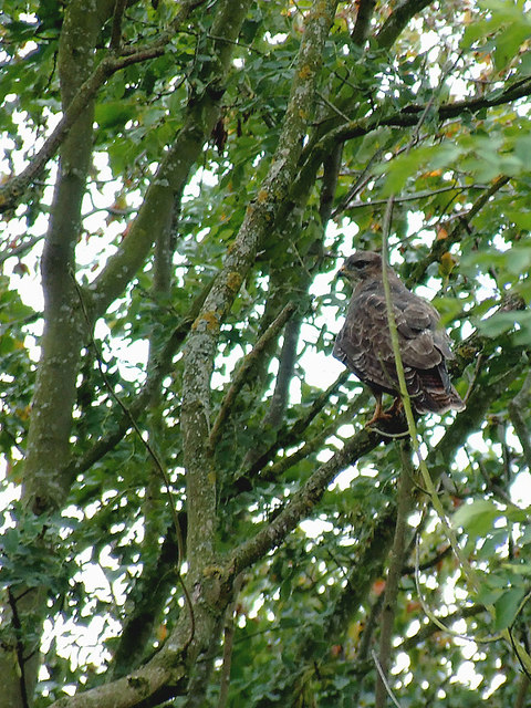
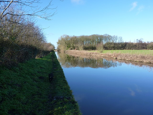
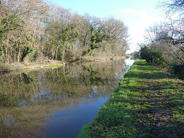
The plantation is primarily composed of a mixture of deciduous and coniferous trees, creating a rich and vibrant landscape throughout the year. Towering oak, beech, and birch trees dominate the woodland, providing a habitat for a variety of wildlife including deer, foxes, and numerous bird species.

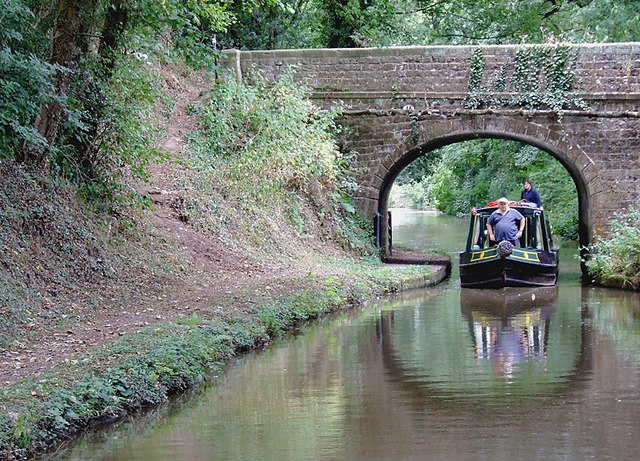
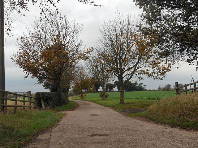
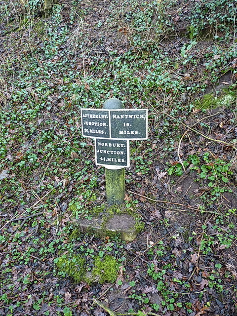
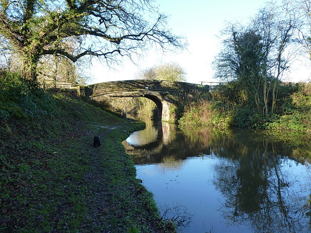
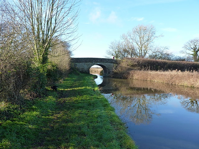
Walking through the plantation, visitors can enjoy a network of well-maintained footpaths that wind their way through the trees, allowing for peaceful and scenic walks. These paths provide an opportunity to explore the plantation's natural beauty and observe its inhabitants in their natural habitat.

Stone Plantation also holds historical significance, with remnants of an ancient stone circle still visible within its boundaries. This archaeological feature adds an air of mystery and intrigue to the woodland, attracting history enthusiasts and nature lovers alike.

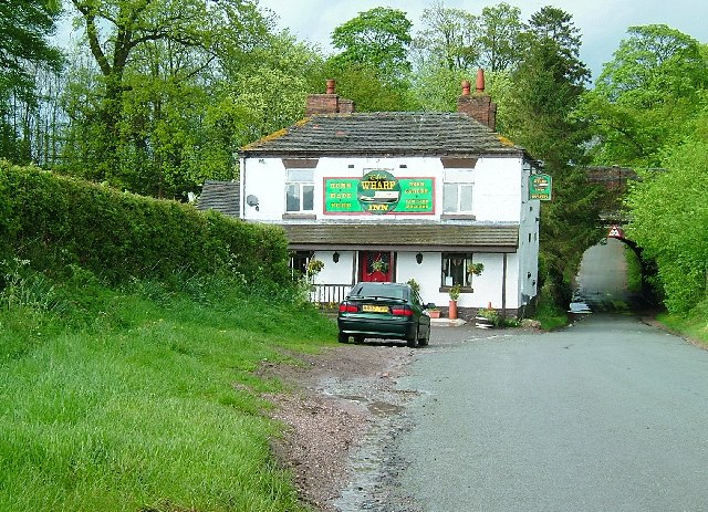
The plantation is easily accessible, with a car park and visitor facilities available on-site. It is a popular destination for outdoor enthusiasts, offering opportunities for activities such as hiking, birdwatching, and photography.

Overall, Stone Plantation in Staffordshire is a haven of natural beauty and tranquility, offering visitors a chance to immerse themselves in the wonders of the woodland and experience the rich biodiversity that thrives within its boundaries.

If you have any feedback on the listing, please let us know in the comments section below.

Stone Plantation Images

Images are sourced within 2km of 52.833798/-2.380055 or Grid Reference SJ7426. Thanks to Geograph Open Source API. All images are credited.

Driveway and path to Ellerton Grange
Shropshire Union Canal near Shebdon, Staffordshire Shebdon Bridge (No 44) is ahead, which carries the lane from Tunstall.
Shropshire Union Canal near Shebdon, Staffordshire
Shebdon Bridge (No 44) is ahead, which carries the lane from Tunstall.
Shebdon Bridge south-east of Knighton, Staffordshire Shebdon Bridge (No 44) carries the lane from Tunstall. Private long-term moorings on the right are by Shebdon Farm. Past the bridge, the Shropshire Union Canal continues towards another embankment. About five hundred metres ahead on the left is The Wharf Inn* at the base of the embankment. The sign on the bridge advertises it. The current Google satellite hybrid image incorrectly labels Batchacre Park Cottage (no road access) as The Wharf Inn.

*update: closed 2013.
Shebdon Bridge south-east of Knighton, Staffordshire
Shebdon Bridge (No 44) carries the lane from Tunstall. Private long-term moorings on the right are by Shebdon Farm. Past the bridge, the Shropshire Union Canal continues towards another embankment. About five hundred metres ahead on the left is The Wharf Inn* at the base of the embankment. The sign on the bridge advertises it. The current Google satellite hybrid image incorrectly labels Batchacre Park Cottage (no road access) as The Wharf Inn. *update: closed 2013.
Moorings by the pub at Shebdon, Staffordshire Here the Shropshire Union Canal has been built on another tree covered embankment. The Wharf Inn is at the base of the embankment here, down a stepped path through the trees. The current Google satellite hybrid image incorrectly labels Batchacre Park Cottage (no road access) as The Wharf Inn.

<a href="https://www.geograph.org.uk/photo/1835683">SJ7526 : The Wharf Inn Pub, Shebdon</a>

Update: The Wharf Inn closed permanently in 2013.
Moorings by the pub at Shebdon, Staffordshire
Here the Shropshire Union Canal has been built on another tree covered embankment. The Wharf Inn is at the base of the embankment here, down a stepped path through the trees. The current Google satellite hybrid image incorrectly labels Batchacre Park Cottage (no road access) as The Wharf Inn. SJ7526 : The Wharf Inn Pub, Shebdon Update: The Wharf Inn closed permanently in 2013.
Buzzard near Shebdon Wharf, Staffordshire This bird of prey was keeping an eye on the canal and the fields behind the trees.
Buzzard near Shebdon Wharf, Staffordshire
This bird of prey was keeping an eye on the canal and the fields behind the trees.
Shropshire Union canal at Knighton, Staffordshire Knighton Bridge (No 46) carries a bridleway and farm track.
Shropshire Union canal at Knighton, Staffordshire
Knighton Bridge (No 46) carries a bridleway and farm track.
Private driveway
Private driveway
Biking the dog, near Cheswardine, Shropshire Well "walking the dog" would seem to be a wild inaccuracy, and I do try to make my descriptions reliable. This is at Black Flat Bridge, No 47 across the Shropshire Union Canal, on a dull morning in October.
Biking the dog, near Cheswardine, Shropshire
Well "walking the dog" would seem to be a wild inaccuracy, and I do try to make my descriptions reliable. This is at Black Flat Bridge, No 47 across the Shropshire Union Canal, on a dull morning in October.
Premier Foods Knighton Wharf Adbaston I don't know how old the information is but the Knighton factory reportedly produces around 29,000 tonnes of powder per annum. Main brands include Cadbury's Drinking Chocolate, Highlights, Marvel, Angel Delight, Birds Custard Powder, Hartley's powder Jelly and others. In 1660 Knighton was exempted from the payment of all civil and military taxes. Cadburys’ built a milk processing factory at Knighton in 1911, attracted by the rates exemption. Cadbury operated the wharf up to the 1960s and the exemption from rates for Knighton continued as late as the 1970s although this also meant that not all local public services were supplied to the village.
Premier Foods Knighton Wharf Adbaston
I don't know how old the information is but the Knighton factory reportedly produces around 29,000 tonnes of powder per annum. Main brands include Cadbury's Drinking Chocolate, Highlights, Marvel, Angel Delight, Birds Custard Powder, Hartley's powder Jelly and others. In 1660 Knighton was exempted from the payment of all civil and military taxes. Cadburys’ built a milk processing factory at Knighton in 1911, attracted by the rates exemption. Cadbury operated the wharf up to the 1960s and the exemption from rates for Knighton continued as late as the 1970s although this also meant that not all local public services were supplied to the village.
Bridge 46 and the Shroppy Just west of Knighton, the minor bridge 46 carries a farm track, and gives pedestrian access to the towpath, which is currently closed off at the adjacent road bridge 45.
Bridge 46 and the Shroppy
Just west of Knighton, the minor bridge 46 carries a farm track, and gives pedestrian access to the towpath, which is currently closed off at the adjacent road bridge 45.
Knighton road bridge (45) on the Shroppy Access from the road bridge to the (rather muddy) towpath is closed off at the moment, so a quick stroll along a field edge to the adjacent bridge 46 is required.
Knighton road bridge (45) on the Shroppy
Access from the road bridge to the (rather muddy) towpath is closed off at the moment, so a quick stroll along a field edge to the adjacent bridge 46 is required.
Canal milepost at Knighton A cast iron milepost, one of several along this length of the cut; the next one to the northwest is <a href="https://www.geograph.org.uk/photo/3819016">SJ7327 : Canal milepost at Park Heath</a>
Canal milepost at Knighton
A cast iron milepost, one of several along this length of the cut; the next one to the northwest is SJ7327 : Canal milepost at Park Heath
Shroppy canal at Knighton A section of the canal coming out of Knighton cutting, and heading towards the Black Flat bridge in the distance.
Shroppy canal at Knighton
A section of the canal coming out of Knighton cutting, and heading towards the Black Flat bridge in the distance.
Black Flat bridge (no 47) on the Shroppy
The Knighton Wood straight Between Knighton cutting and the woods ahead, the canal here cuts a dead straight course across the countryside of Staffordshire. The border with Shropshire is just on the far side of the woods.
The Knighton Wood straight
Between Knighton cutting and the woods ahead, the canal here cuts a dead straight course across the countryside of Staffordshire. The border with Shropshire is just on the far side of the woods.
In Knighton Wood An area that used to provide superb fishing - small roach, perch and gudgeon aplenty in the 1980s, with the chance of a decent bream or carp once in a while. It'd be interesting to have a warm afternoon back here with half a pint of pinkies and some bloodworm.
In Knighton Wood
An area that used to provide superb fishing - small roach, perch and gudgeon aplenty in the 1980s, with the chance of a decent bream or carp once in a while. It'd be interesting to have a warm afternoon back here with half a pint of pinkies and some bloodworm.
Just west of Knighton Wood A straight section of the Shroppy, where it crosses the county border between Shrops (in the foreground) and Staffs (about 150 yards away)
Just west of Knighton Wood
A straight section of the Shroppy, where it crosses the county border between Shrops (in the foreground) and Staffs (about 150 yards away)
Park Heath bridge (48) The road between Puleston and Soudley crosses the Shroppy at Park Heath.
Park Heath bridge (48)
The road between Puleston and Soudley crosses the Shroppy at Park Heath.
Show me another place!

Stone Plantation is located at Grid Ref: SJ7426 (Lat: 52.833798, Lng: -2.380055)

Administrative County: Staffordshire

District: Stafford

Police Authority: Staffordshire

What 3 Words

///notices.motivator.crust. Near Chetwynd, Shropshire

Nearby Locations

Stone Plantation

Related Wikis

Knighton, Stafford

Knighton is a hamlet part of the parish of Adbaston in the county of Staffordshire, England. Knighton is situated close to the Staffordshire/Shropshire...

Shebdon

Shebdon is a hamlet in the county of Staffordshire, England. It is part of the parish of High Offley, a small village approximately 1.5 miles to the ENE...

Adbaston

Adbaston is a village and a civil parish in the English county of Staffordshire. == Location == The village is 13 miles (20.9 km) north east of the town...

Tunstall, Stafford

Tunstall is a hamlet near Eccleshall in the borough of Stafford in Staffordshire, England. In 1870–72 it had a population of 72. Tunstall was recorded...

Ellerton, Shropshire

Ellerton is a small hamlet in Shropshire, England. It lies in a rather isolated rural area several miles north of the town of Newport, close to the village...

RAF Chetwynd

Royal Air Force Chetwynd or more simply RAF Chetwynd is a former Royal Air Force satellite station located in Chetwynd, Shropshire, England. The following...

Soudley, Shropshire

Soudley is a small village in Shropshire in the civil parish of Cheswardine. The village had a pub called The Wheatsheaf until it was destroyed by fire...

Sambrook, Shropshire

Sambrook is a small village in the ceremonial county of Shropshire, where it is part of the civil parish of Chetwynd, north of the town of Newport. To...

Related Videos

UK Camper Vans built for under £2500 Meet up #vanlife #UKvanlife #camping #campervan #rvlife

Vlog of our first ever Vanlife meetup with like minded folk, February 2023 at The Haberdashers Arms in Knighton, Telford.

Nearby Amenities

Located within 500m of 52.833798,-2.380055
Power: pole
Lat/Long: 52.8315881/-2.3752522
Power: pole
Lat/Long: 52.8318166/-2.3760881
Power: pole
Lat/Long: 52.834237/-2.3868379
Power: pole
Lat/Long: 52.8336825/-2.3850657
Power: pole
Lat/Long: 52.8334168/-2.3835422
Power: pole
Lat/Long: 52.8331014/-2.3815775
Power: pole
Lat/Long: 52.8329389/-2.3806043
Power: pole
Lat/Long: 52.8327433/-2.3794115
Power: pole
Lat/Long: 52.8324653/-2.3784294
Power: pole
Lat/Long: 52.832141/-2.3772252
The data included in this document is from www.openstreetmap.org. The data is made available under ODbL.

Have you been to Stone Plantation?

Leave your review of Stone Plantation below (or comments, questions and feedback).