Hicks's Park Wood

Wood, Forest in Somerset Mendip

England

Hicks's Park Wood

Cattle by Strap Lane And by the GWR, from which this was taken, hence the blurred bush in the foreground, with hedgerow oaks on the left, and a barn at White Oak Farm on the right, by the tree-lined Strap Lane.
Cattle by Strap Lane Credit: Derek Harper

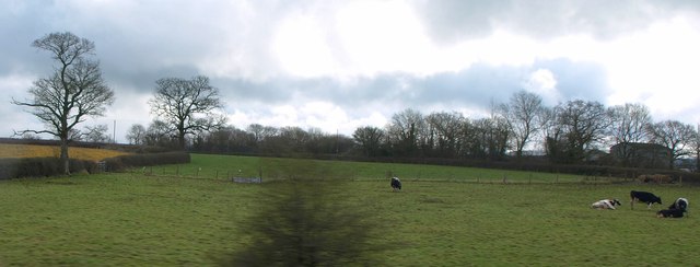
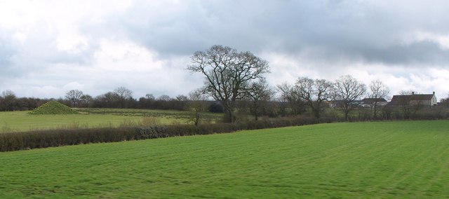
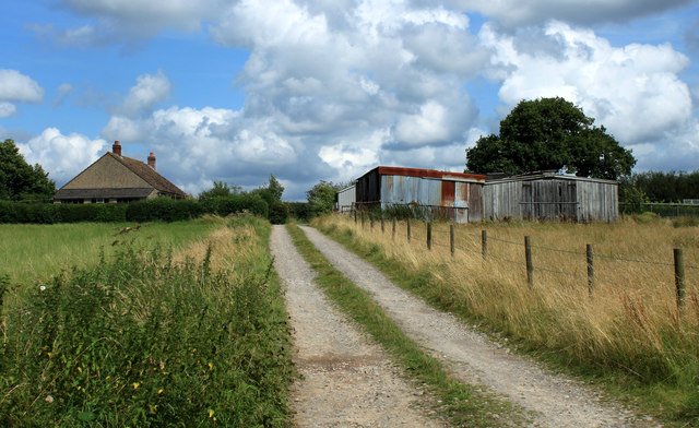
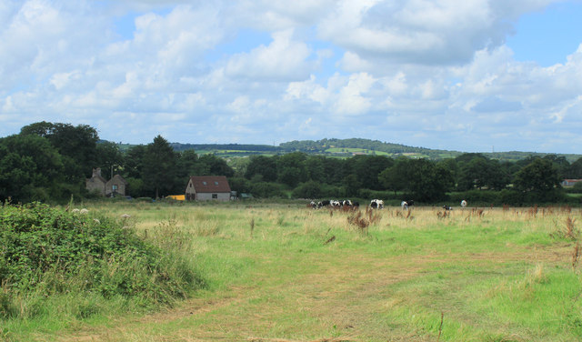
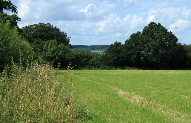
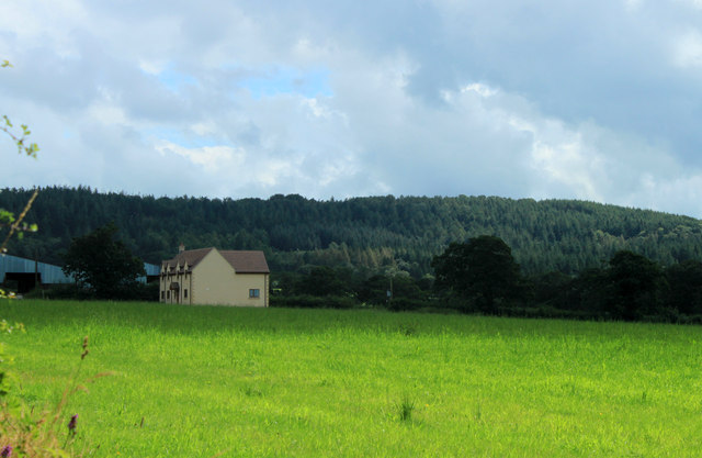
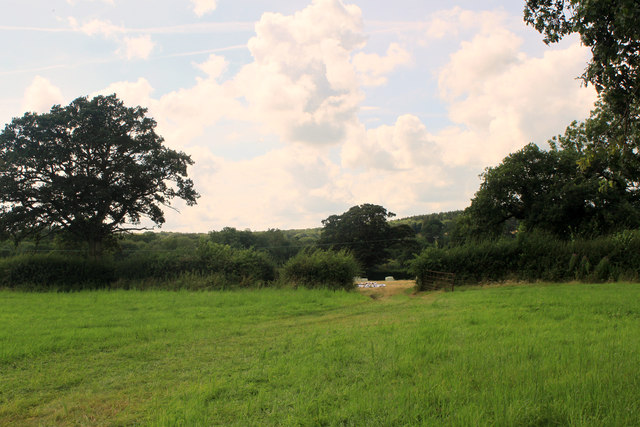
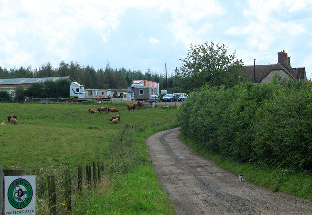
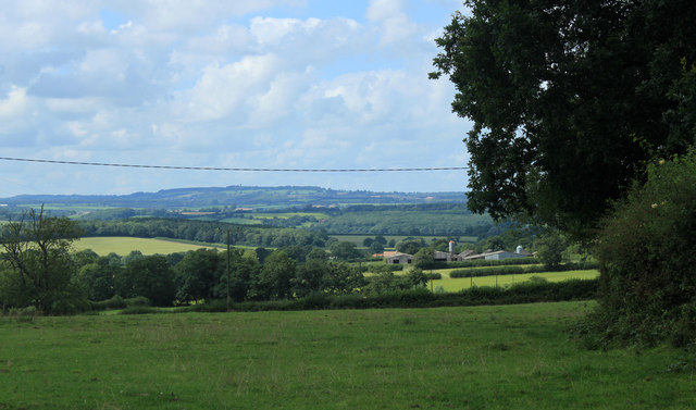
Hicks's Park Wood is a picturesque woodland located in Somerset, England. Covering an area of approximately 20 acres, the wood is known for its diverse range of flora and fauna, making it a popular destination for nature enthusiasts and hikers alike.

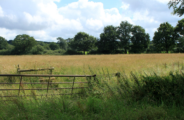
The wood is predominantly made up of broadleaf trees, such as oak, beech, and ash, which provide a dense canopy, casting dappled light on the forest floor. This creates a tranquil and ethereal atmosphere, making it a perfect spot for those seeking solace in nature. The woodland is home to a variety of wildlife, including deer, badgers, squirrels, and a wide range of bird species.

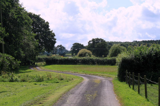
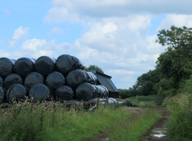
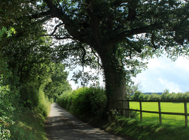
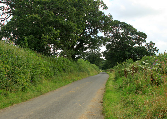
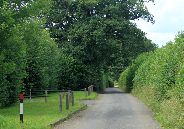
A network of well-maintained footpaths and trails wind their way through the wood, allowing visitors to explore its beauty at their own pace. These paths lead to various points of interest, including a small pond, which serves as a watering hole for many of the woodland creatures.

Hicks's Park Wood also boasts a rich history, with evidence of human presence dating back centuries. Archaeological finds have revealed the remains of ancient settlements and ritual sites within the wood, adding an extra layer of intrigue to its natural beauty.

The wood is open to the public year-round, offering a peaceful retreat for nature lovers and an opportunity to reconnect with the great outdoors. With its stunning scenery, diverse wildlife, and historical significance, Hicks's Park Wood is a true gem in the heart of Somerset.

If you have any feedback on the listing, please let us know in the comments section below.

Hicks's Park Wood Images

Images are sourced within 2km of 51.143262/-2.367056 or Grid Reference ST7438. Thanks to Geograph Open Source API. All images are credited.

Cattle by Strap Lane And by the GWR, from which this was taken, hence the blurred bush in the foreground, with hedgerow oaks on the left, and a barn at White Oak Farm on the right, by the tree-lined Strap Lane.
Cattle by Strap Lane
And by the GWR, from which this was taken, hence the blurred bush in the foreground, with hedgerow oaks on the left, and a barn at White Oak Farm on the right, by the tree-lined Strap Lane.
Farmland near Upton Noble With hedgerow oak trees, and a curious pyramid in the next field, its northern face covered in daffodils. Down's Farm, to the right, is in <a href="https://www.geograph.org.uk/gridref/ST7339">ST7339</a>. View from a train on the Bruton-Westbury stretch of the main line.
Farmland near Upton Noble
With hedgerow oak trees, and a curious pyramid in the next field, its northern face covered in daffodils. Down's Farm, to the right, is in ST7339. View from a train on the Bruton-Westbury stretch of the main line.
2012 : Bungalow for sale, Dark Lane  Nearly a mile south of Witham Friary.
Outside the entrance to Henleaze Farm.
2012 : Bungalow for sale, Dark Lane
Nearly a mile south of Witham Friary. Outside the entrance to Henleaze Farm.
2012 : Entrance drive to Henleaze Farm A summertime version of <a href="https://www.geograph.org.uk/photo/670934">ST7439 : Drive to Henleaze Farm</a> four years later.
Birch Hill is in the background.
2012 : Entrance drive to Henleaze Farm
A summertime version of ST7439 : Drive to Henleaze Farm four years later. Birch Hill is in the background.
2012 : Moorpartk Farm revisited A view from Dark Lane five years after <a href="https://www.geograph.org.uk/photo/466513">ST7439 : Entrance to Moorpark Farm.</a>. Not much changed, barns are a little more rusty, weather improved (for one day only).
2012 : Moorpartk Farm revisited
A view from Dark Lane five years after ST7439 : Entrance to Moorpark Farm.. Not much changed, barns are a little more rusty, weather improved (for one day only).
2012 : West from Dark Lane About one mile south of Witham Friary.
A field of uncut mowing grass, still standing due to the wet weather. Should be OK for silage if not left too long.
2012 : West from Dark Lane
About one mile south of Witham Friary. A field of uncut mowing grass, still standing due to the wet weather. Should be OK for silage if not left too long.
2012 : Stack of baled straw off Dark Lane  Or it could be silage, haven't seen much wheat in this area, more mowing grass.
2012 : Stack of baled straw off Dark Lane
Or it could be silage, haven't seen much wheat in this area, more mowing grass.
2012 : Hired low loader entering Holt Farm
2012 : Holt Farm with herd Seen from Dark Lane, Birch Hill behind.
2012 : Holt Farm with herd
Seen from Dark Lane, Birch Hill behind.
2012 : South east on Dark Lane Near the entrance to Holt Farm.
Dark Lane runs south and east from Witham Friary to a spot near Upper Gibbons Farm where it becomes Holt Road.
2012 : South east on Dark Lane
Near the entrance to Holt Farm. Dark Lane runs south and east from Witham Friary to a spot near Upper Gibbons Farm where it becomes Holt Road.
2012 : South  west from Dark Lane Near the point where it turns into Holt Road.
A field of mowing grass not long after mowing.
A fine oak tree to the right and another at the end of the hedgerow.
2012 : South west from Dark Lane
Near the point where it turns into Holt Road. A field of mowing grass not long after mowing. A fine oak tree to the right and another at the end of the hedgerow.
2012 : Across the field to Gibbons Farm  Seen from Dark Lane, a field away from Upper Gibbons Farm.
Hick's Park Wood is on the hill behind.
2012 : Across the field to Gibbons Farm
Seen from Dark Lane, a field away from Upper Gibbons Farm. Hick's Park Wood is on the hill behind.
2012 : South west from Dark Lane  The Hermitage is partly seen through the trees and Hick's Park Wood.
Oak trees abound in this area at least two here.
Electricity pylons are notable for their absence, it can be done.
2012 : South west from Dark Lane
The Hermitage is partly seen through the trees and Hick's Park Wood. Oak trees abound in this area at least two here. Electricity pylons are notable for their absence, it can be done.
2012 : Dark Lane heading south east Somewhere along here it becomes Holt Road and passes Upper Gibbons Farm.
A couple of fine oak trees overhang the road. It's all right my beauties, Nelson won't be after you, he's long gone.
2012 : Dark Lane heading south east
Somewhere along here it becomes Holt Road and passes Upper Gibbons Farm. A couple of fine oak trees overhang the road. It's all right my beauties, Nelson won't be after you, he's long gone.
2012 : Dark Lane heading north west To Witham Friary.
The entrance on the right is a private road to The Hermitage.
2012 : Dark Lane heading north west
To Witham Friary. The entrance on the right is a private road to The Hermitage.
2012 : Pleasant dreams at Sweetnap Farm Sweetnap Farm - the sign.
Off Holt Road near Yarnfield Gate. There is a website <span class="nowrap"><a title="http://www.searchme4.co.uk/caravan-transport-and-towing/frome/somerset/l-f-nicholls-and-sons/9252801.html" rel="nofollow ugc noopener" href="http://www.searchme4.co.uk/caravan-transport-and-towing/frome/somerset/l-f-nicholls-and-sons/9252801.html">Link</a><img style="margin-left:2px;" alt="External link" title="External link - shift click to open in new window" src="https://s1.geograph.org.uk/img/external.png" width="10" height="10"/></span>

They also do models <span class="nowrap"><a title="http://www.sweetnapfarmmodels.co.uk/aboutus.asp" rel="nofollow ugc noopener" href="http://www.sweetnapfarmmodels.co.uk/aboutus.asp">Link</a><img style="margin-left:2px;" alt="External link" title="External link - shift click to open in new window" src="https://s1.geograph.org.uk/img/external.png" width="10" height="10"/></span> yes please, nice legs and big ... what? not that kind of model?  Ah well, can't win 'em all.
2012 : Pleasant dreams at Sweetnap Farm
Sweetnap Farm - the sign. Off Holt Road near Yarnfield Gate. There is a website LinkExternal link They also do models LinkExternal link yes please, nice legs and big ... what? not that kind of model? Ah well, can't win 'em all.
2012 : Sweetnap Farm from the entrance With a green sign to protect them. 

Might have gone in if had looked at their website first <span class="nowrap"><a title="http://www.sweetnapfarmmodels.co.uk/" rel="nofollow ugc noopener" href="http://www.sweetnapfarmmodels.co.uk/">Link</a><img style="margin-left:2px;" alt="External link" title="External link - shift click to open in new window" src="https://s1.geograph.org.uk/img/external.png" width="10" height="10"/></span> Their "baddies keep away" sign put me off.
2012 : Sweetnap Farm from the entrance
With a green sign to protect them. Might have gone in if had looked at their website first LinkExternal link Their "baddies keep away" sign put me off.
2012 : South west from Holt Road At the entrance to Sweetnap Farm.
Looking over tangled Mendip country, hills looking as if they were dumped at random. Better organised when you get past Shepton Mallet to the west.
2012 : South west from Holt Road
At the entrance to Sweetnap Farm. Looking over tangled Mendip country, hills looking as if they were dumped at random. Better organised when you get past Shepton Mallet to the west.
Show me another place!

Hicks's Park Wood is located at Grid Ref: ST7438 (Lat: 51.143262, Lng: -2.367056)

Administrative County: Somerset

District: Mendip

Police Authority: Avon and Somerset

What 3 Words

///quarrel.bracing.amplified. Near Kilmington, Wiltshire

Related Wikis

North Brewham Meadows

North Brewham Meadows (grid reference ST743379) is an 8.9 hectare (21.9 acre) biological Site of Special Scientific Interest at North Brewham in Somerset...

Witham Charterhouse

Witham Charterhouse, also Witham Priory, at Witham Friary, Somerset, was established in 1178/79, the earliest of the ten medieval Carthusian houses (charterhouses...

Witham (Somerset) railway station

This station in Somerset is closed. For the open station in East Anglia, see Witham railway station.Witham (Somerset) railway station was a station serving...

Church of St Mary, Witham Friary

The Church of St Mary in Witham Friary, Somerset, England, dates from around 1200 and it has been designated as a Grade I listed building.The church was...

Witham Friary

Witham Friary is a small English village and civil parish located between the towns of Frome and Bruton in the county of Somerset. It is in the Cranborne...

Brewham

Brewham is a civil parish in Somerset, England, consisting of the villages of North Brewham and South Brewham, on either side of the river in the Brue...

Upton Noble

Upton Noble is a village and civil parish on the River Frome. It is roughly 4.5 miles (7 km) north-east of Bruton, and 7 miles (11 km) from Frome town...

King Alfred's Tower

Alfred's Tower is a folly in Somerset, England, on the edge of the border with Wiltshire, on the Stourhead estate. The tower stands on Kingsettle Hill...

Have you been to Hicks's Park Wood?

Leave your review of Hicks's Park Wood below (or comments, questions and feedback).