Birks Wood

Wood, Forest in Yorkshire South Lakeland

England

Birks Wood

View into Coat Weggs forestry from NE
View into Coat Weggs forestry from NE Credit: Luke Shaw

Birks Wood is a picturesque woodland located in Yorkshire, England. Situated in the heart of the countryside, this enchanting forest spans over a considerable area and is a haven for nature enthusiasts and outdoor explorers alike.

The wood boasts an array of diverse flora and fauna, with towering oak and beech trees dominating the landscape. The forest floor is adorned with a carpet of lush green moss, creating a serene and peaceful ambiance. Visitors to Birks Wood can expect to be greeted by a symphony of birdsong, as the area is home to various avian species such as great tits, woodpeckers, and robins.

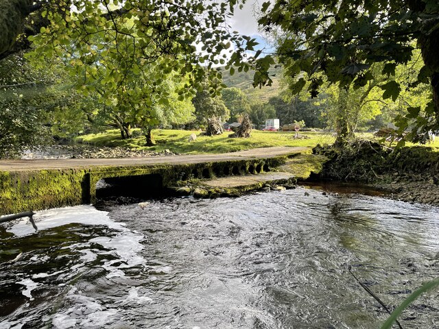
Traversing through the woodland, one can discover a network of well-maintained walking paths and trails, providing ample opportunities for leisurely strolls or more strenuous hikes. The wood is also intersected by a gentle stream, which adds to the tranquility of the environment, creating a serene atmosphere.

Birks Wood is a popular destination for wildlife enthusiasts, as it provides an ideal habitat for a variety of creatures. Squirrels can frequently be spotted scurrying between the branches, while rabbits and deer occasionally make appearances, adding a touch of magic to the woodland experience.

For those seeking a moment of solitude or a peaceful retreat from the hustle and bustle of daily life, Birks Wood offers a sanctuary of natural beauty. With its charming scenery, diverse wildlife, and ample walking opportunities, this Yorkshire forest is a true gem for nature lovers and a must-visit destination for anyone exploring the region.

If you have any feedback on the listing, please let us know in the comments section below.
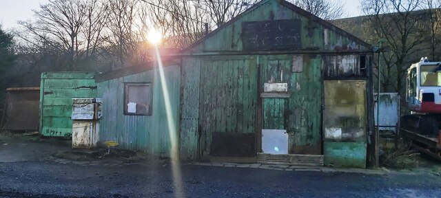
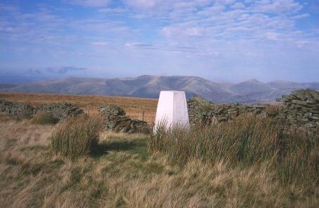
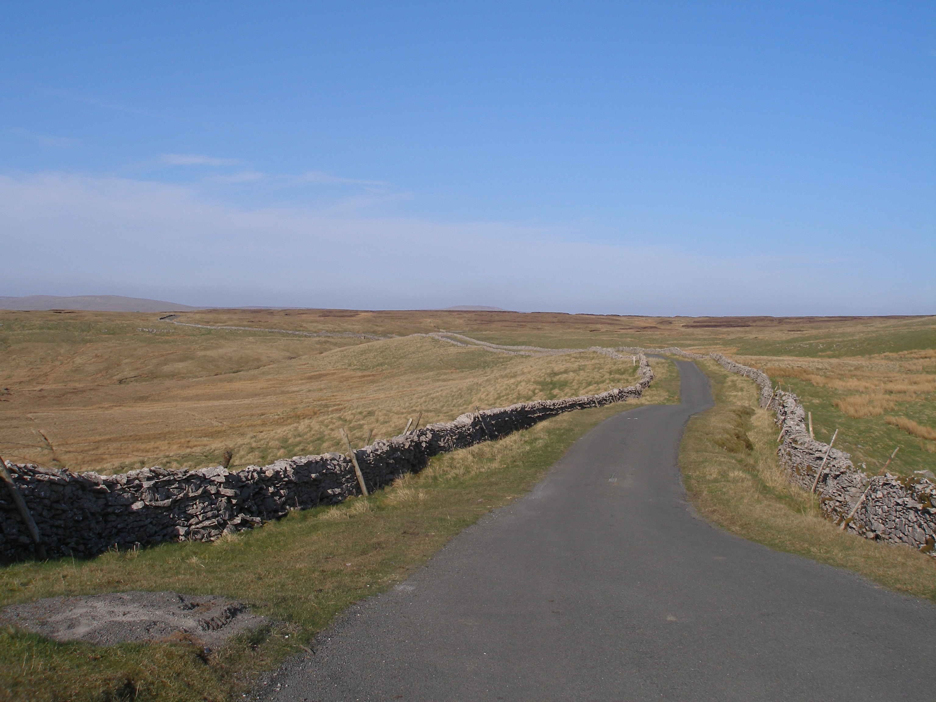
Birks Wood Images

Images are sourced within 2km of 54.303573/-2.3946889 or Grid Reference SD7489. Thanks to Geograph Open Source API. All images are credited.

View into Coat Weggs forestry from NE
Limekiln near spring on south side of East Baugh Fell
Looking south towards Garsdale along dry stone wall at Green Side
Junction of dry stone walls below Tarn Rigg Hill. View over Garsdale
Line of rocks below Tan Rigg Hill
Thistles in spring channel north of Coat Weggs forestry A limekiln beyond the spring source
Thistles in spring channel north of Coat Weggs forestry
A limekiln beyond the spring source
Moorland path on Green Side
Looking north along dry stone wall on south side of East Baugh Fell
Small cairn on Tarn Rigg Hill Maps show a spot height of 678m here
Small cairn on Tarn Rigg Hill
Maps show a spot height of 678m here
Swarthgill Service Station
Derelict building and Clough River at Banks
Little Winterscales Ford This irish bridge ford on the River Clough is found at Little Winterscales.
Little Winterscales Ford
This irish bridge ford on the River Clough is found at Little Winterscales.
Wall on the summit of Tarn Rigg Hill (Baugh Fell) Our last Dales 30 mountain.
Wall on the summit of Tarn Rigg Hill (Baugh Fell)
Our last Dales 30 mountain.
Thyme on outcrop on Little Little Snaizwold Fell
Stone wall with sheep's skull on top on Thorn Wold
Dry stone wall  on Hare Shaw
Dry stone wall on Hare Shaw
View over dry stone wall and footpath of Snaizwold Fell
Thistles on Little Snaizwold Fell
Show me another place!

Birks Wood is located at Grid Ref: SD7489 (Lat: 54.303573, Lng: -2.3946889)

Division: West Riding

Administrative County: Cumbria

District: South Lakeland

Police Authority: Cumbria

What 3 Words

///dictation.enable.caressing. Near Sedbergh, Cumbria

Related Wikis

Garsdale

Garsdale is a dale or valley in the south east of Cumbria, England, historically a part of the West Riding of Yorkshire. It is now within the South Lakeland...

Baugh Fell

Baugh Fell (, or locally ) is a large, flat-topped hill in the northern Pennines of England. It lies in the north-western corner of the Yorkshire Dales...

Rise Hill Tunnel

Rise Hill Tunnel is a 1,213-yard (1,109 m) long tunnel that takes the Settle–Carlisle line beneath Black Moss in Cumbria, England. It is the second longest...

Aye Gill Pike

Aye Gill Pike is a Marilyn in the Yorkshire Dales, the highest point of the ridge of Rise Hill between Dentdale and Garsdale in Cumbria, England.

Dent railway station

Dent is a railway station on the Settle and Carlisle Line, which runs between Carlisle and Leeds via Settle. The station, situated 58 miles 29 chains...

St John the Evangelist's Church, Cowgill

St John the Evangelist's Church is the Church of England parish church of the village of Cowgill, Cumbria, England. It is in the deanery of Kendal, the...

Cowgill, Cumbria

Cowgill is a village in Westmorland and Furness, Cumbria, England. It is within the historic boundaries of the West Riding of Yorkshire, and is located...

Coal Road

The Coal Road (also known as the Galloway Gate Road) is an unclassified highway which connects the railway stations at Garsdale and Dent in Cumbria, England...

Nearby Amenities

Located within 500m of 54.303573,-2.3946889
Post Office (E bound)
Naptan AtcoCode: 090079241027
Naptan Bearing: E
Naptan BusStopType: CUS
Naptan CommonName: Post Office (E bound)
Naptan Indicator: o/s
Naptan Landmark: the Post Office opposite the Garage
Naptan NaptanCode: cumdgwtm
Naptan Street: A684
Naptan Verified: no
Source: naptan_import
Lat/Long: 54.3014344/-2.3892893
Post Office (W bound)
Naptan AtcoCode: 090079243627
Naptan Bearing: W
Naptan BusStopType: CUS
Naptan CommonName: Post Office (W bound)
Naptan Indicator: opp
Naptan Landmark: Post Office
Naptan NaptanCode: cumdjadg
Naptan Street: No name
Naptan Verified: no
Source: naptan_import
Lat/Long: 54.3013538/-2.389181
Post Box
Post Box Type: lamp
Ref: LA10 48
Source: survey
Lat/Long: 54.3014363/-2.3892554
Telephone
Booth: K6
Check Date: 2021-04-02
Covered: booth
Source: survey
Lat/Long: 54.3011357/-2.3902668
Garsdale
Place: hamlet
Lat/Long: 54.3011782/-2.3928946
Generator Method: photovoltaic
Generator Orientation: south
Generator Output Electricity: yes
Generator Solar Modules: 10
Generator Source: solar
Generator Type: solar_photovoltaic_panel
Location: roof
Power: generator
Lat/Long: 54.3025275/-2.388891
Generator Method: photovoltaic
Generator Orientation: south
Generator Output Electricity: yes
Generator Solar Modules: 120
Generator Source: solar
Generator Type: solar_photovoltaic_panel
Location: roof
Power: generator
Lat/Long: 54.3013903/-2.4002471
Power: pole
Lat/Long: 54.3008215/-2.3924875
Power: pole
Lat/Long: 54.3012332/-2.3927061
Power: pole
Lat/Long: 54.3023792/-2.3891837
Power: pole
Lat/Long: 54.3002636/-2.3895666
Power: pole
Lat/Long: 54.3007472/-2.3891053
Power: pole
Lat/Long: 54.3010422/-2.3888169
Power: pole
Lat/Long: 54.3013967/-2.388491
Power: pole
Lat/Long: 54.3018733/-2.3888277
Power: pole
Lat/Long: 54.3019962/-2.3943409
Power: pole
Lat/Long: 54.3021527/-2.3940499
Power: pole
Lat/Long: 54.3016198/-2.3929261
Power: pole
Lat/Long: 54.3019876/-2.3931246
Power: pole
Lat/Long: 54.3016636/-2.4009553
Power: pole
Lat/Long: 54.30177/-2.3998556
Power: pole
Lat/Long: 54.3019766/-2.3979217
Power: pole
Lat/Long: 54.3021339/-2.3964022
Power: pole
Lat/Long: 54.3023037/-2.3947674
Power: pole
Lat/Long: 54.3024516/-2.3933794
Power: pole
Lat/Long: 54.3026433/-2.3915434
Power: pole
Lat/Long: 54.3027678/-2.3903686
Power: pole
Lat/Long: 54.3028523/-2.3895223
Power: pole
Lat/Long: 54.3030158/-2.3879412
Garsdale Street Chapel
Denomination: methodist
Historic: church
Religion: christian
Website: https://www.nationalchurchestrust.org/church/garsdale-street-chapel-garsdale
Wikidata: Q26663867
Lat/Long: 54.3014695/-2.3887096
Power: pole
Lat/Long: 54.3029236/-2.3926858
Power: pole
Lat/Long: 54.3032689/-2.3920534
The data included in this document is from www.openstreetmap.org. The data is made available under ODbL.

Have you been to Birks Wood?

Leave your review of Birks Wood below (or comments, questions and feedback).