Dairy Wood

Wood, Forest in Cheshire

England

Dairy Wood

Home Farm, Tatton Park A working farm, open to the public as part of the National Trust's Tatton Park.
Home Farm, Tatton Park Credit: Rich Daley

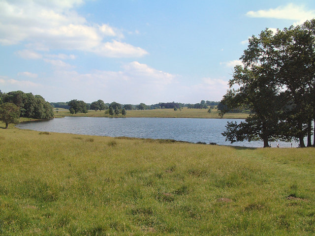
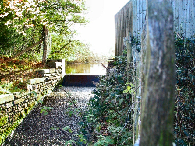
Dairy Wood is a picturesque woodland area located in the county of Cheshire, England. Situated near the village of Dairy, this wood is known for its natural beauty and tranquil atmosphere. Spanning over a considerable area, Dairy Wood is a popular destination for nature enthusiasts and families seeking a peaceful retreat from the bustling city life.

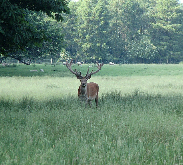
The woodland is primarily composed of broad-leaved trees, including oak, beech, and birch, which create a dense canopy that provides shade and shelter for a variety of flora and fauna. Bluebells carpet the forest floor during spring, adding a vibrant burst of color to the landscape. The diverse ecosystem is home to a range of wildlife, including squirrels, foxes, and a variety of bird species.

Dairy Wood offers several well-marked trails, allowing visitors to explore its scenic beauty at their own pace. The paths wind through the forest, providing opportunities for hikers and walkers to immerse themselves in nature. The wood is also equipped with picnic areas and benches, inviting visitors to relax and enjoy the peaceful surroundings.

The wood is easily accessible, with a car park located nearby. It is often recommended to wear appropriate footwear, as the trails can become muddy during wet weather. Additionally, visitors are encouraged to respect the natural environment and take any litter with them to preserve the beauty of Dairy Wood for future generations.

If you have any feedback on the listing, please let us know in the comments section below.
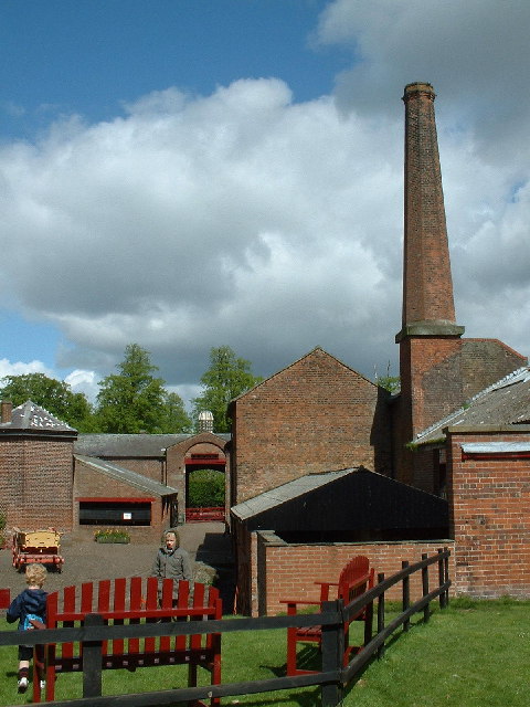
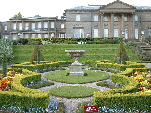
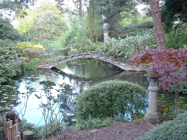
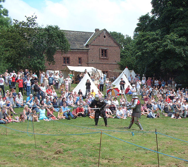
Dairy Wood Images

Images are sourced within 2km of 53.333941/-2.3917721 or Grid Reference SJ7481. Thanks to Geograph Open Source API. All images are credited.

Home Farm, Tatton Park A working farm, open to the public as part of the National Trust's Tatton Park.
Home Farm, Tatton Park
A working farm, open to the public as part of the National Trust's Tatton Park.
Tatton Hall, Tatton Park The historical seat of the Earls Egerton, now a National Trust property open to the public.
Tatton Hall, Tatton Park
The historical seat of the Earls Egerton, now a National Trust property open to the public.
Japanese Garden, Tatton Park A bridge in the Japanese-style garden at Tatton Park.
Japanese Garden, Tatton Park
A bridge in the Japanese-style garden at Tatton Park.
Tatton Old Hall Sword fighting demonstration at a Mediaeval Fair on a very hot day in June! The Mediaeval Hall is in the background.
Tatton Old Hall
Sword fighting demonstration at a Mediaeval Fair on a very hot day in June! The Mediaeval Hall is in the background.
Lake in Tatton Park The smaller of two lakes (Melchett Mere) in the area lies in the south west corner of the grid square. Picture taken looking south.
Lake in Tatton Park
The smaller of two lakes (Melchett Mere) in the area lies in the south west corner of the grid square. Picture taken looking south.
Deer Deer in Tatton Park
Deer
Deer in Tatton Park
Tatton Park Country Show This picture was taken from SJ737814 looking NE along the road running from the Lodge to the main Hall. The marquees for the country show line the route.
Tatton Park Country Show
This picture was taken from SJ737814 looking NE along the road running from the Lodge to the main Hall. The marquees for the country show line the route.
Parish church of St. Mary This view of the church was taken from SJ742836 looking east.
Parish church of St. Mary
This view of the church was taken from SJ742836 looking east.
Rostherne village This image was taken looking Northish through the village of Rostherne, stood at SJ743833.
Rostherne village
This image was taken looking Northish through the village of Rostherne, stood at SJ743833.
Fishing by Cicely Mill These meres were not in existence according to the 1940's OS map, and must have been artificially created in the interim. Bordering on Cicely Lane near Rostherne, they are a popular spot for anglers.
Fishing by Cicely Mill
These meres were not in existence according to the 1940's OS map, and must have been artificially created in the interim. Bordering on Cicely Lane near Rostherne, they are a popular spot for anglers.
Overflow At the north end of Little Mere, this runoff channel, or small weir, takes the overflow from the two meres under the A5034 and down the valley past Mere Farm to the fishing ponds at Cicely Mill.
Overflow
At the north end of Little Mere, this runoff channel, or small weir, takes the overflow from the two meres under the A5034 and down the valley past Mere Farm to the fishing ponds at Cicely Mill.
Meremoss Cottages below Mere Platt farm, opposite Meremoss Wood.
Meremoss
Cottages below Mere Platt farm, opposite Meremoss Wood.
Woods at Mere Halfway between Mere and Hoo Green on the A50 is a layby, from which this shot to the southwest shows a corner of the woods behind Mere Hall.
Woods at Mere
Halfway between Mere and Hoo Green on the A50 is a layby, from which this shot to the southwest shows a corner of the woods behind Mere Hall.
Mere Corner (Cross roads) Taken from the A50 looking NW.Where the A50 Crosses the always busy A556. The A556 is used as a short cut between the M6 & M56 motorways. The entrance to Mere Golf & Country Club is just out of sight to the right.
Mere Corner (Cross roads)
Taken from the A50 looking NW.Where the A50 Crosses the always busy A556. The A556 is used as a short cut between the M6 & M56 motorways. The entrance to Mere Golf & Country Club is just out of sight to the right.
Tatton Park Deer Enclosure Taken from the extreme NE corner of Tatton Park perimeter fence. (looking north over the fence into the Deer enclosure)
Tatton Park Deer Enclosure
Taken from the extreme NE corner of Tatton Park perimeter fence. (looking north over the fence into the Deer enclosure)
Knutsford Golf Course Showing the northern end of the golf course, taken from Tatton Park.
(The perimeter fence borders the golf club.)
Knutsford Golf Course
Showing the northern end of the golf course, taken from Tatton Park. (The perimeter fence borders the golf club.)
Tatton Mere Mill Pool Located in the NE corner of the square, this small mill pool is on the outlet stream from Tatton Mere. Thanks to Judy Popley (Geograph visitor and ex Tatton Estate employee) for additional information. The water flow was used to generate electricity for the estate at one time and indeed the water is still used for the toilets in the stable yard. Pump house is out of shot to the left.
The vehicle in the picture is that of the Park Rangers who appear to be maintaining the outlet.
Tatton Mere Mill Pool
Located in the NE corner of the square, this small mill pool is on the outlet stream from Tatton Mere. Thanks to Judy Popley (Geograph visitor and ex Tatton Estate employee) for additional information. The water flow was used to generate electricity for the estate at one time and indeed the water is still used for the toilets in the stable yard. Pump house is out of shot to the left. The vehicle in the picture is that of the Park Rangers who appear to be maintaining the outlet.
Memorial Stone An Easterly view from the Paratroop Regiment Memorial Stone. Just protruding from behind the stone, on the distant horizon (11.5 km), is Alderley Edge escarpment.
Memorial Stone
An Easterly view from the Paratroop Regiment Memorial Stone. Just protruding from behind the stone, on the distant horizon (11.5 km), is Alderley Edge escarpment.
Show me another place!

Dairy Wood is located at Grid Ref: SJ7481 (Lat: 53.333941, Lng: -2.3917721)

Unitary Authority: Cheshire East

Police Authority: Cheshire

What 3 Words

///interlude.took.lights. Near Mere, Cheshire

Related Wikis

Tatton Park

Tatton Park is a historic estate in Cheshire, England, north of the town of Knutsford. It contains a mansion, Tatton Hall; a medieval manor house, Tatton...

Tatton Park Flower Show

RHS Flower Show Tatton Park held at Tatton Park, near Knutsford, Cheshire, first began in 1999 by the Royal Horticultural Society. The show houses the...
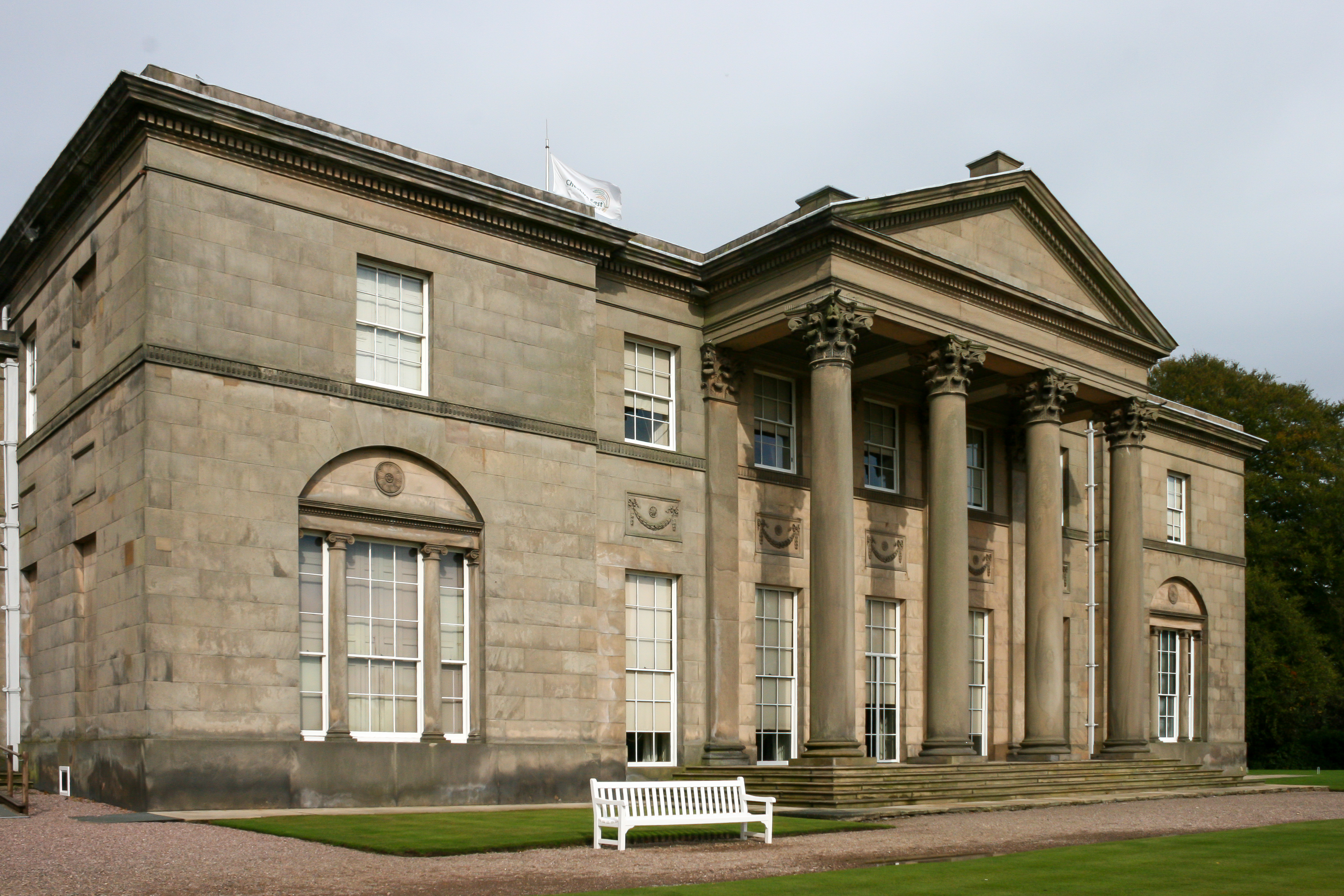
Tatton Hall

Tatton Hall is a country house in Tatton Park near Knutsford, Cheshire, England. It is designated as a Grade I listed building and is open to the public...
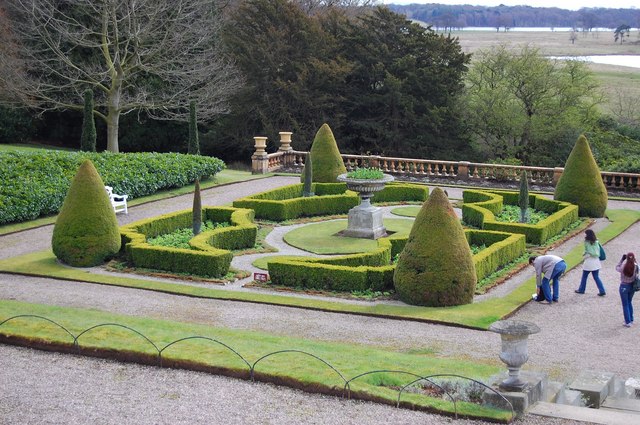
Tatton Park Gardens

Tatton Park Gardens consist of formal and informal gardens in Tatton Park to the south of Tatton Hall, Cheshire, England (grid reference SJ744814). Included...

Mere New Hall

Mere New Hall stood to the east of the village of Mere and the junction of the A566 and A50 roads in Cheshire, England. It was largely destroyed by fire...

Mere, Cheshire

Mere is a civil parish and linear village along the old course of the A556 road in the unitary authority of Cheshire East and the ceremonial county of...

Bucklow Hill

Bucklow Hill is a village in Cheshire, England whose name originates from a slight rise in the road. It is part of the civil parish of Mere and is located...

Mere Old Hall

Mere Old Hall is a 17th-century country house which stands to the west of the village of Mere and the junction of the A566 and A50 roads in Cheshire, England...

Nearby Amenities

Located within 500m of 53.333941,-2.3917721
Bus Stop
Tatton Dale, Ashley Road / Tatton Dale Farm
Bus: yes
Naptan AtcoCode: 0600MA0229
Naptan Bearing: NE
Naptan CommonName: Tatton Dale Farm
Naptan Indicator: opp
Naptan Landmark: Farm Cottages
Naptan LocalityName: Tatton Dale
Naptan NaptanCode: chemjwt
Naptan ShortCommonName: Tatton Dale Farm
Naptan Street: Ashley Road
Naptan Verified: no
Network: Cheshire East Council
Operator: Ansa Transport
Public Transport: platform
Source: naptan_import
Lat/Long: 53.3366653/-2.3886938
Bus Stop
Tatton Park, Mansion House
Bus: yes
Naptan AtcoCode: 0600MA6161
Naptan Bearing: NW
Naptan CommonName: Mansion House
Naptan Indicator: nr
Naptan Landmark: Mansion House
Naptan LocalityName: Tatton Park
Naptan NaptanCode: cheptmj
Naptan ShortCommonName: Mansion House
Naptan Street: Grounds
Naptan Verified: no
Network: Cheshire East Council
Operator: Ansa Transport
Public Transport: platform
Source: naptan_import
Lat/Long: 53.3308001/-2.387274
Toilets
Toilets Disposal: flush
Lat/Long: 53.3305188/-2.3871968
Leisure: playground
Lat/Long: 53.3301969/-2.3895875
Bicycle Parking
Tatton Park
Bicycle Parking: stands
Capacity: 8
Covered: no
Cyclestreets Id: 83855
Url: https://www.cyclestreets.net/location/83855/
Lat/Long: 53.3305223/-2.3870715
Post Box
Collection Times: Mo-Fr 09:00; Sa 07:00
Operator: Royal Mail
Operator Wikidata: Q638098
Post Box Type: wall
Ref: WA16 65
Royal Cypher: VR
Lat/Long: 53.3365276/-2.3885688
Bench
Lat/Long: 53.3299359/-2.390297
The data included in this document is from www.openstreetmap.org. The data is made available under ODbL.

Have you been to Dairy Wood?

Leave your review of Dairy Wood below (or comments, questions and feedback).