Bourne Hill Plantation

Wood, Forest in Dorset

England

Bourne Hill Plantation

Bridleway east of Muston Copse Part of the copse can be seen on the left of the photo.
Bridleway east of Muston Copse Credit: Maurice D Budden

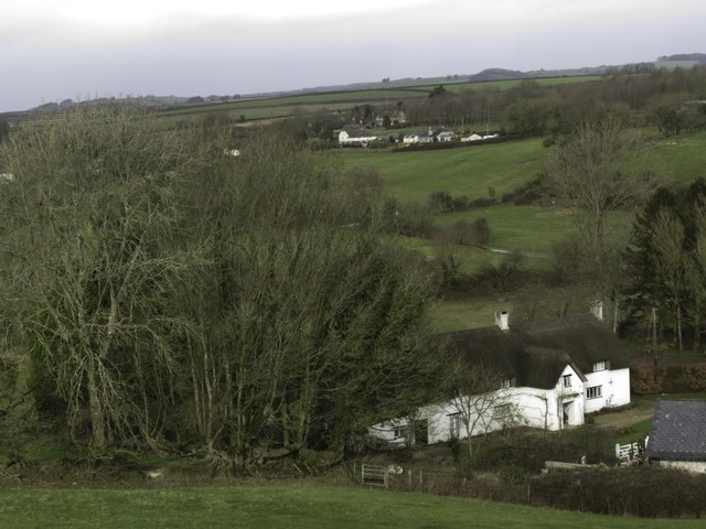
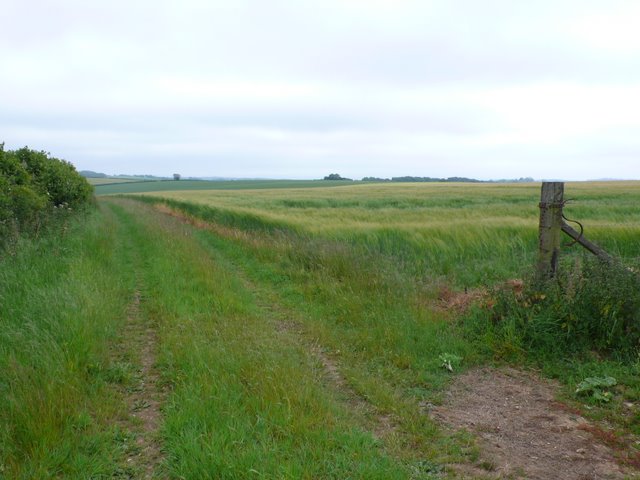
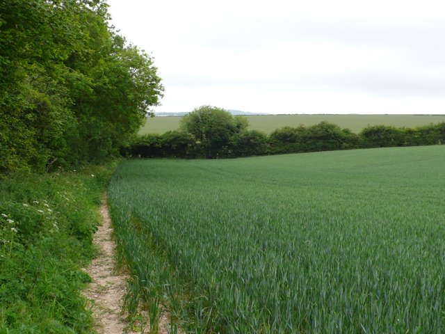
Bourne Hill Plantation is a picturesque woodland area located in the county of Dorset, England. Situated near the village of Puddletown, this enchanting forest covers approximately 100 hectares of land and is a popular destination for nature enthusiasts and hikers alike.

The plantation is characterized by a diverse mix of tree species, including native oak, beech, and ash trees, which create a lush and vibrant canopy. These trees provide habitat for a variety of wildlife, such as deer, squirrels, and a plethora of bird species.

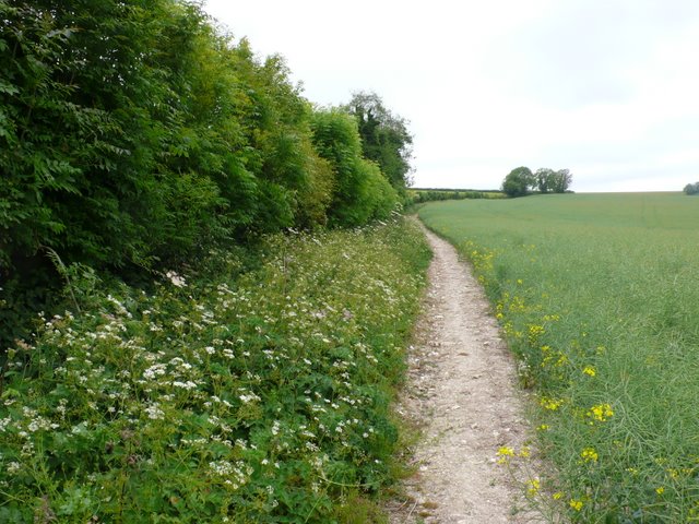
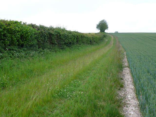
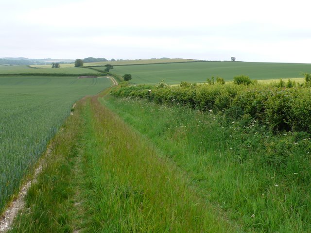
The woodland is crisscrossed by a network of well-marked trails, allowing visitors to explore and immerse themselves in the natural beauty of the area. The paths lead through ancient woodlands, meandering streams, and open glades, providing stunning views and opportunities for peaceful contemplation.

Bourne Hill Plantation also holds historical significance, as it was once part of a larger estate that dates back to the 18th century. Remnants of this past can still be found within the woodland, including old stone walls and the foundations of former buildings.

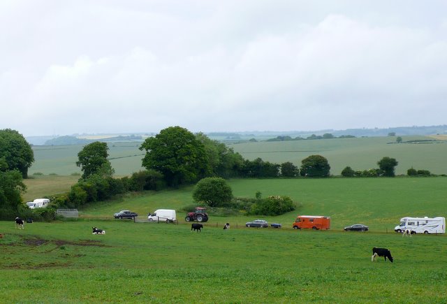
Visitors to Bourne Hill Plantation can enjoy a range of activities, including hiking, birdwatching, and picnicking. The tranquil atmosphere and scenic surroundings make it an ideal spot for individuals and families seeking a tranquil escape from the hustle and bustle of daily life.

In conclusion, Bourne Hill Plantation is a captivating woodland area in Dorset, offering a rich and diverse natural environment, as well as a glimpse into the region's history.

If you have any feedback on the listing, please let us know in the comments section below.

Bourne Hill Plantation Images

Images are sourced within 2km of 50.774878/-2.3769412 or Grid Reference SY7397. Thanks to Geograph Open Source API. All images are credited.

Bridleway east of Muston Copse Part of the copse can be seen on the left of the photo.
Bridleway east of Muston Copse
Part of the copse can be seen on the left of the photo.
Bridleway in Dole's Hill Plantation With a row of hazel coppice stools on the bank to the right.
Bridleway in Dole's Hill Plantation
With a row of hazel coppice stools on the bank to the right.
The Church of St Mary the Virgin, Piddlehinton Burial place of Ann Wizner, the Battle of Waterloo heroine. See <a title="https://www.geograph.org.uk/photo/1199641" href="https://www.geograph.org.uk/photo/1199641">Link</a>.
The Church of St Mary the Virgin, Piddlehinton
Burial place of Ann Wizner, the Battle of Waterloo heroine. See Link.
Little Puddle Farm
Little Puddle Farm
Old Direction Sign - Signpost by the B3143, Church Hill, Piddlehinton Annulus and bar finial - 3 arms; Dorset halo with NGR by the B3143, in parish of Piddlehinton (West Dorset District), Piddlehinton village crossroads, by Church Cottage, on wide grass verge.

Surveyed

Milestone Society National ID: DO_SY7197
Old Direction Sign - Signpost by the B3143, Church Hill, Piddlehinton
Annulus and bar finial - 3 arms; Dorset halo with NGR by the B3143, in parish of Piddlehinton (West Dorset District), Piddlehinton village crossroads, by Church Cottage, on wide grass verge. Surveyed Milestone Society National ID: DO_SY7197
Old Direction Sign - Signpost by the B3143, Higher Waterston Annulus and bar finial - 4 arms; Dorset halo with NGR by the B3143, in parish of Puddletown (West Dorset District), T-junction at Higher Waterston, in hedge.

Surveyed

Milestone Society National ID: DO_SY7295
Old Direction Sign - Signpost by the B3143, Higher Waterston
Annulus and bar finial - 4 arms; Dorset halo with NGR by the B3143, in parish of Puddletown (West Dorset District), T-junction at Higher Waterston, in hedge. Surveyed Milestone Society National ID: DO_SY7295
Cheselbourne, West Down Footpath Gate
Ford by Dole's Hill Plantation
Trees, on Hog Leaze
Trees, on Hog Leaze
Puddletown Down This bridleway runs between a hedgerow and a field of ripening rape up onto Puddletown down just south west of Chebbard Farm.
Puddletown Down
This bridleway runs between a hedgerow and a field of ripening rape up onto Puddletown down just south west of Chebbard Farm.
Bridle Path This bridle way just clips the north east corner of the grid square as it crosses Puddletown Down.The soil is very chalky and full of flints.
Bridle Path
This bridle way just clips the north east corner of the grid square as it crosses Puddletown Down.The soil is very chalky and full of flints.
Puddletown Down View southeast across the down in the very north east corner of the square.
Puddletown Down
View southeast across the down in the very north east corner of the square.
Puddletown Down View south from close to the bridle path that runs from Dewlish to Doles Hill Plantation
Puddletown Down
View south from close to the bridle path that runs from Dewlish to Doles Hill Plantation
Cheselbourne West Down View north west along the bridle path from Puddletown Down to Doles Hill Plantation as it approaches the bridle way from Doles hill to Dewlish which is marked by the line of trees going off to the right.
Cheselbourne West Down
View north west along the bridle path from Puddletown Down to Doles Hill Plantation as it approaches the bridle way from Doles hill to Dewlish which is marked by the line of trees going off to the right.
Badger sett This extremely large sett which is 40-50m long is in between two fields. it appears to be on a trackway no longer used. The badgers had excavated huge quantities of chalk and flint. The topsoil here on top of the downs is very thin and flinty and the chalk is not far below the surface.
Badger sett
This extremely large sett which is 40-50m long is in between two fields. it appears to be on a trackway no longer used. The badgers had excavated huge quantities of chalk and flint. The topsoil here on top of the downs is very thin and flinty and the chalk is not far below the surface.
Track across Cheselbourne Down A Dorset County Council notice date August 2009 had been placed on a nearby bridle path gate with a map  stating that the  track  was a "Claimed by-way open to all traffic" (claimed BOAT). At this point it did not have much appearance of a footpath let alone something open to all traffic.
Track across Cheselbourne Down
A Dorset County Council notice date August 2009 had been placed on a nearby bridle path gate with a map stating that the track was a "Claimed by-way open to all traffic" (claimed BOAT). At this point it did not have much appearance of a footpath let alone something open to all traffic.
MotoCross meet near Piddlehinton This track on a hillside just off the B3143 was hosting a meet that lasted all bank holiday weekend. There were a number of camper vans and tents.
MotoCross meet near Piddlehinton
This track on a hillside just off the B3143 was hosting a meet that lasted all bank holiday weekend. There were a number of camper vans and tents.
Stuck in the Mud This line of vehicles was moving out from the site where a motocross meet had been held over the bank holiday weekend. The white van was stuck in the mud and the tractor came to pull it out.
Stuck in the Mud
This line of vehicles was moving out from the site where a motocross meet had been held over the bank holiday weekend. The white van was stuck in the mud and the tractor came to pull it out.
Show me another place!

Bourne Hill Plantation is located at Grid Ref: SY7397 (Lat: 50.774878, Lng: -2.3769412)

Unitary Authority: Dorset

Police Authority: Dorset

What 3 Words

///pickup.grit.tribal. Near Puddletown, Dorset

Related Wikis

Piddlehinton

Piddlehinton is a village and civil parish in west Dorset, England, situated in the Piddle valley 5 miles (8.0 km) north of Dorchester. In the 2011 census...

Waterston Manor

Waterston Manor, Puddletown, Dorset is a manor house with 17th century origins, that was extensively rebuilt after a fire in 1863 and remodelled in 1911...

Doles Ash

Doles Ash is a farm in Dorset, England, a few kilometers east of Piddletrenthide and south of Plush. The farm features in Thomas Hardy's Tess of the D...

Dewlish House

Dewlish House is a country house near Dewlish in Dorset. It is a Grade I Listed building. == History == Dewlish House, built in 1702, became the home of...

Cheselbourne

Cheselbourne (sometimes spelled Chesilborne or Cheselborne) is a village and civil parish in Dorset, England, situated in the Dorset Downs, 7 miles (11...

Puddletown Hundred

Puddletown Hundred was a hundred in the county of Dorset, England, containing the following parishes: Athelhampton Burleston Milborne St Andrew (part...

Piddletrenthide (liberty)

Piddletrenthide Liberty was a liberty in the county of Dorset, England, containing the following parishes: Gorewood (from 1858) Minterne Magna (part)...

Puddletown

Puddletown is a village and civil parish in Dorset, England. It is situated by the River Piddle, from which it derives its name, about 4.5 miles (7 km...

Nearby Amenities

Located within 500m of 50.774878,-2.3769412
The data included in this document is from www.openstreetmap.org. The data is made available under ODbL.

Have you been to Bourne Hill Plantation?

Leave your review of Bourne Hill Plantation below (or comments, questions and feedback).