Alder Wood

Wood, Forest in Lancashire

England

Alder Wood

Newly Renovated Tow Path of the Bridgewater Canal
Newly Renovated Tow Path of the Bridgewater Canal Credit: Anthony Parkes

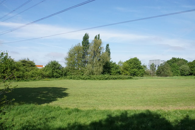
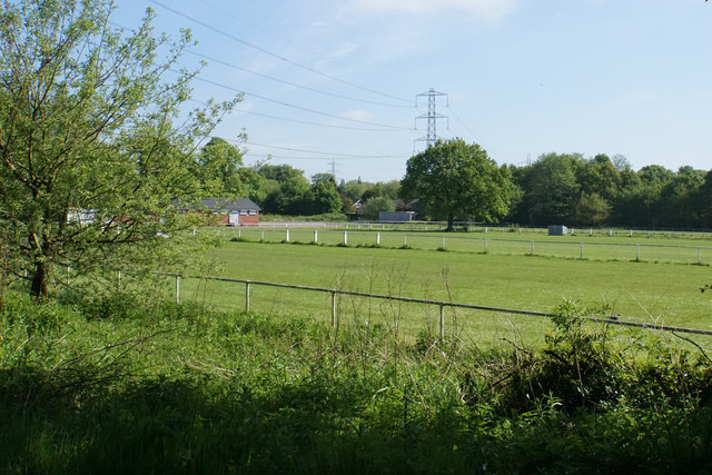
Alder Wood is a small village located in the county of Lancashire, England. Situated within the Forest of Bowland, it is surrounded by picturesque landscapes and a rich natural environment. The village is known for its abundant supply of alder trees, which can be found throughout the area.

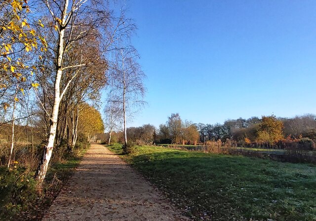
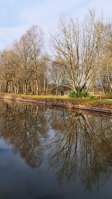
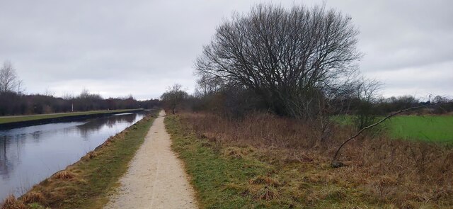
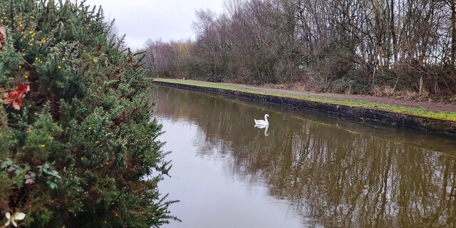
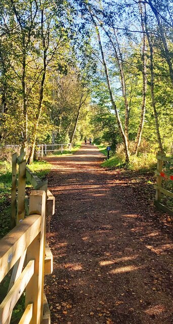
The woodlands in Alder Wood are a prominent feature of the village, attracting nature enthusiasts and outdoor adventurers. The alder trees, with their distinct cone-like fruits, create a unique and calming atmosphere in the village. The woodlands are home to a variety of flora and fauna, including wildflowers, birds, and small mammals.

The village itself is quaint and tranquil, offering a peaceful retreat for residents and visitors alike. It boasts a close-knit community, with a small population of friendly locals who take pride in their surroundings. The village is characterized by traditional stone cottages and well-maintained gardens.

For those seeking outdoor activities, Alder Wood provides ample opportunities for hiking, cycling, and nature walks. The surrounding forest offers numerous trails and paths that showcase the natural beauty of the area. Additionally, the nearby River Wyre provides a serene setting for fishing and boating.

Although Alder Wood is predominantly rural, it is within easy reach of larger towns and cities. The nearby market town of Garstang offers a range of amenities, including shops, restaurants, and schools. The city of Preston is also within a reasonable distance, providing further access to urban facilities and transportation links.

In conclusion, Alder Wood is a charming village nestled within the enchanting Forest of Bowland. It is a haven for nature lovers, offering a peaceful and idyllic setting with its alder woodlands and surrounding natural beauty.

If you have any feedback on the listing, please let us know in the comments section below.

Alder Wood Images

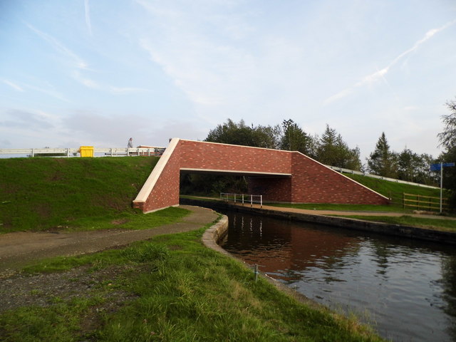
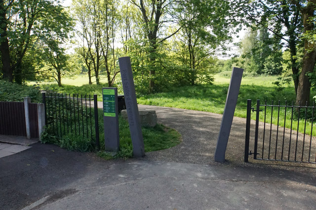
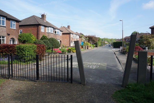
Images are sourced within 2km of 53.501066/-2.4051616 or Grid Reference SD7300. Thanks to Geograph Open Source API. All images are credited.

Newly Renovated Tow Path of the Bridgewater Canal
Reflections in The Bridgewater Canal
Bridgewater Canal near Boothstown
Swan on the Bridgewater Canal - Boothstown
Early Autumn by The Bridgewater Canal
The New Vicars Hall Bridge Completed in Summer 2017. For how the old bridge looked see <a href="https://www.geograph.org.uk/photo/2791738">SJ7199 : Vicars Hall Bridge</a>
The New Vicars Hall Bridge
Completed in Summer 2017. For how the old bridge looked see SJ7199 : Vicars Hall Bridge
Port Salford Greenway A cycle route to Peel Green, here at the end of Edenfield Lane.
Port Salford Greenway
A cycle route to Peel Green, here at the end of Edenfield Lane.
Edenfield Lane A residential road not far from the centre of Worsley. This is on the route of the Port Salford Greenway.
Edenfield Lane
A residential road not far from the centre of Worsley. This is on the route of the Port Salford Greenway.
New Alder Park Green space on the edge of Worsley. Behind the barrier is the M60 motorway but it is quite well screened.
New Alder Park
Green space on the edge of Worsley. Behind the barrier is the M60 motorway but it is quite well screened.
New Alder Park Part of the park used by Monton Amateur Football Club.
New Alder Park
Part of the park used by Monton Amateur Football Club.
Path by the Bridgewater Canal Not running very close to the canal.
Path by the Bridgewater Canal
Not running very close to the canal.
Soft ground conditions by the Bridgewater Canal Some drainage work has been undertaken below this low-lying land.
Soft ground conditions by the Bridgewater Canal
Some drainage work has been undertaken below this low-lying land.
The Bridgewater Canal near Boothstown The canal is renowned for the muddy colour of the water.
The Bridgewater Canal near Boothstown
The canal is renowned for the muddy colour of the water.
Path by the Bridgewater Canal Passing through plenty of spring foliage.
Path by the Bridgewater Canal
Passing through plenty of spring foliage.
The Bridgewater Canal Heading towards Boothstown. Boothstown Bridge is just visible ahead.
The Bridgewater Canal
Heading towards Boothstown. Boothstown Bridge is just visible ahead.
Boat on the Bridgewater Canal Vicars Hall Bridge is just appearing round the bend.
Boat on the Bridgewater Canal
Vicars Hall Bridge is just appearing round the bend.
Brambles and bullrushes Boggy ground next to the Vicars Hall Lane.
Brambles and bullrushes
Boggy ground next to the Vicars Hall Lane.
The Bridgewater Canal Looking west from Vicars Hall Bridge. You can see Astley Green Colliery Museum.
The Bridgewater Canal
Looking west from Vicars Hall Bridge. You can see Astley Green Colliery Museum.
Show me another place!

Alder Wood is located at Grid Ref: SD7300 (Lat: 53.501066, Lng: -2.4051616)

Unitary Authority: Salford

Police Authority: Greater Manchester

What 3 Words

///bench.decay.churn. Near Walkden, Manchester

Related Wikis

RHS Garden Bridgewater

RHS Garden Bridgewater is the Royal Horticultural Society's fifth public display garden. It is located in the village of Worsley in Salford, Greater Manchester...
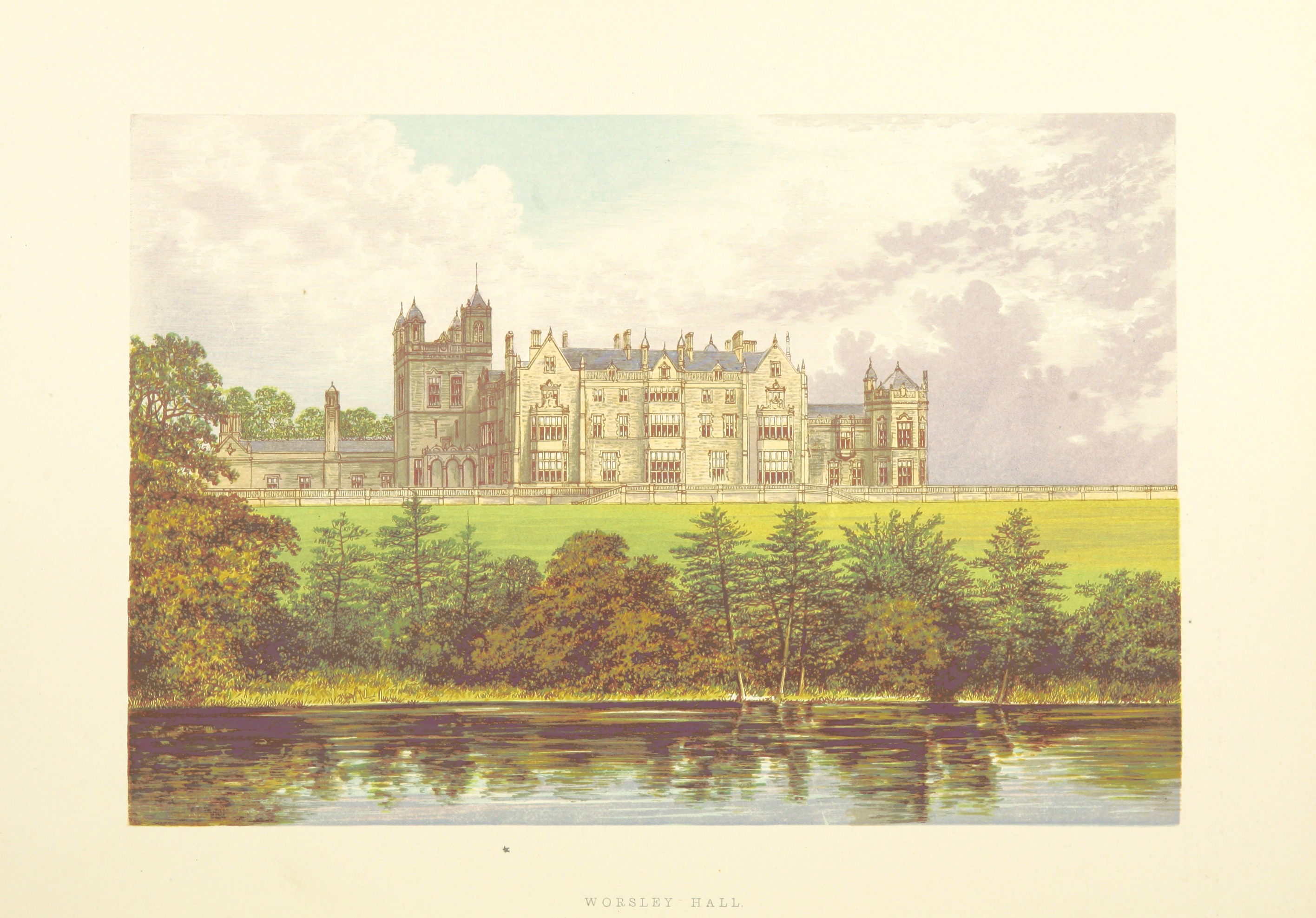
Worsley New Hall

Worsley New Hall is a former mansion and gardens by the Bridgewater Canal in Worsley, Greater Manchester, England, 8 miles (13 km) west of Manchester....

Boothstown Mines Rescue Station

Boothstown Mines Rescue Station which served the collieries of the Lancashire and Cheshire Coal Owners on the Lancashire Coalfield opened in November 1933...

Worsley (UK Parliament constituency)

Worsley was a parliamentary constituency represented in the House of Commons of the Parliament of the United Kingdom. It elected one Member of Parliament...
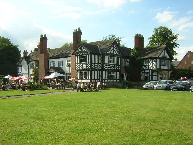
Worsley Old Hall

Worsley Old Hall is a public house and restaurant in Worsley, Greater Manchester, England. It is recorded in the National Heritage List for England as...

Mosley Common Colliery

Mosley Common Colliery was a coal mine originally owned by the Bridgewater Trustees operating on the Manchester Coalfield after 1866 in Mosley Common,...

St Mary the Virgin's Church, Ellenbrook

St Mary the Virgin's Church or Ellenbrook Chapel is an active Anglican church in Ellenbrook, Worsley, Greater Manchester, England. The church is part of...

Ellenbrook, Greater Manchester

Ellenbrook is a suburb of Worsley, in the City of Salford in Greater Manchester, England. Ellenbrook is 6.8 miles (10.9 km) west of Manchester, 5 miles...

Nearby Amenities

Located within 500m of 53.501066,-2.4051616
Turning Circle
Lat/Long: 53.5004966/-2.4091001
Bus Stop
Leigh Road/Elenbrook Road
Bus: yes
Naptan AtcoCode: 1800NF27911
Naptan Bearing: W
Naptan CommonName: Leigh Road/Elenbrook Road
Naptan Indicator: O/s House 207
Naptan Landmark: HOUSE 207
Naptan NaptanCode: mangjwpg
Naptan PlusbusZoneRef: MNCRPIC
Naptan ShortCommonName: Elenbrook Road
Naptan Street: LEIGH ROAD
Naptan Verified: no
Network: TfGM
Public Transport: platform
Source: naptan_import
Lat/Long: 53.502413/-2.4121145
Bus Stop
Leigh Road/Ellenbrook Road
Bus: yes
Naptan AtcoCode: 1800NF27921
Naptan Bearing: E
Naptan CommonName: Leigh Road/Ellenbrook Road
Naptan Indicator: O/s House 218
Naptan Landmark: HOUSE 218
Naptan NaptanCode: mangjwpj
Naptan PlusbusZoneRef: MNCRPIC
Naptan ShortCommonName: Ellenbrook Road
Naptan Street: LEIGH ROAD
Naptan Verified: no
Network: TfGM
Public Transport: platform
Source: naptan_import
Lat/Long: 53.5025403/-2.4116785
Bus Stop
Leigh Road/Worsley Boundary
Bus: yes
Naptan AtcoCode: 1800NF27951
Naptan Bearing: W
Naptan CommonName: Leigh Road/Worsley Boundary
Naptan Indicator: Nr Alderwood
Naptan Landmark: House 233
Naptan NaptanCode: mangjwpw
Naptan PlusbusZoneRef: MNCRPIC
Naptan ShortCommonName: Worsley Boundary
Naptan Street: LEIGH ROAD
Naptan Verified: no
Network: TfGM
Public Transport: platform
Source: naptan_import
Lat/Long: 53.5026527/-2.4077446
Bus Stop
Leigh Road/Worsley Boundary
Bus: yes
Naptan AtcoCode: 1800NF27961
Naptan Bearing: E
Naptan CommonName: Leigh Road/Worsley Boundary
Naptan Indicator: Opp Love Bros
Naptan Landmark: HOUSE 252
Naptan NaptanCode: mangjwta
Naptan PlusbusZoneRef: MNCRPIC
Naptan ShortCommonName: Worsley Boundary
Naptan Street: LEIGH ROAD
Naptan Verified: no
Network: TfGM
Public Transport: platform
Source: naptan_import
Lat/Long: 53.5028811/-2.4046541
Bus Stop
Leigh Road/Garden Centre
Bus: yes
Naptan AtcoCode: 1800NF27981
Naptan Bearing: E
Naptan CommonName: Leigh Road/Garden Centre
Naptan Indicator: Opp Garden Cntr
Naptan Landmark: House 260
Naptan NaptanCode: mangjwtg
Naptan PlusbusZoneRef: MNCRPIC
Naptan ShortCommonName: Garden Centre
Naptan Street: LEIGH ROAD
Naptan Verified: no
Network: TfGM
Public Transport: platform
Source: naptan_import
Lat/Long: 53.5029331/-2.4019126
Bus Stop
Leigh Road/The Lodge
Bus: yes
Naptan AtcoCode: 1800NF27991
Naptan Bearing: E
Naptan CommonName: Leigh Road/The Lodge
Naptan Indicator: O/s House 300
Naptan Landmark: HOUSE 300
Naptan NaptanCode: mangjwtj
Naptan PlusbusZoneRef: MNCRPIC
Naptan ShortCommonName: The Lodge
Naptan Street: LEIGH ROAD
Naptan Verified: no
Network: TfGM
Public Transport: platform
Source: naptan_import
Lat/Long: 53.5030439/-2.3983706
Bus Stop
Leigh Road/Occupation Road
Bus: yes
Naptan AtcoCode: 1800NF27971
Naptan Bearing: W
Naptan CommonName: Leigh Road/opp. Public Footpath
Naptan Indicator: opp House 290
Naptan Landmark: opp House 290
Naptan NaptanCode: MANGJWTD
Naptan PlusbusZoneRef: MNCRPIC
Naptan ShortCommonName: Public Footpath
Naptan Street: LEIGH ROAD
Naptan Verified: no
Network: TfGM
Public Transport: platform
Source: naptan_import
Lat/Long: 53.502848/-2.4001032
Post Box
Lat/Long: 53.5026127/-2.4108304
Railway: terminal_site
Lat/Long: 53.499781/-2.4121465
Crossing
Crossing: marked
Crossing Markings: yes
Source: survey
Lat/Long: 53.5004167/-2.4019421
Traffic Signals
Traffic Signals: signal
Lat/Long: 53.5026609/-2.4024716
Traffic Signals
Traffic Signals: signal
Traffic Signals Direction: forward
Lat/Long: 53.5028074/-2.4020191
Traffic Calming: hump
Lat/Long: 53.5028955/-2.4017511
Traffic Calming: hump
Lat/Long: 53.5028984/-2.4021648
Traffic Calming: hump
Lat/Long: 53.5028914/-2.4027845
Generator Method: photovoltaic
Generator Output Electricity: yes
Generator Source: solar
Generator Type: solar_photovoltaic_panel
Location: roof
Power: generator
Source: imagery
Lat/Long: 53.5030799/-2.4118455
Generator Method: photovoltaic
Generator Output Electricity: yes
Generator Source: solar
Generator Type: solar_photovoltaic_panel
Location: roof
Power: generator
Source: imagery
Lat/Long: 53.503316/-2.4101906
Generator Method: photovoltaic
Generator Output Electricity: yes
Generator Source: solar
Generator Type: solar_photovoltaic_panel
Location: roof
Power: generator
Source: imagery
Lat/Long: 53.503383/-2.4098338
Generator Method: photovoltaic
Generator Output Electricity: yes
Generator Source: solar
Generator Type: solar_photovoltaic_panel
Location: roof
Power: generator
Source: imagery
Lat/Long: 53.5030687/-2.4098151
Generator Method: photovoltaic
Generator Output Electricity: yes
Generator Source: solar
Generator Type: solar_photovoltaic_panel
Location: roof
Power: generator
Source: imagery
Lat/Long: 53.5023684/-2.4091928
Generator Method: photovoltaic
Generator Output Electricity: yes
Generator Source: solar
Generator Type: solar_photovoltaic_panel
Location: roof
Power: generator
Source: imagery
Lat/Long: 53.5011176/-2.4083935
Crossing
Crossing: marked
Crossing Markings: yes
Source: survey
Lat/Long: 53.5028046/-2.4025132
Crossing
Crossing: marked
Crossing Markings: yes
Source: survey
Lat/Long: 53.5026994/-2.4023778
Crossing
Crossing: marked
Crossing Markings: yes
Source: survey
Lat/Long: 53.50265/-2.4022129
Barrier: bollard
Lat/Long: 53.5012361/-2.4122337
Lord Ellesmere's Memorial
Historic: monument
Lat/Long: 53.5036177/-2.4001804
Parking
Lat/Long: 53.5016069/-2.4093714
Crossing
Crossing: uncontrolled
Crossing Markings: yes
Lat/Long: 53.5013749/-2.4019218
Crossing
Crossing: marked
Crossing Markings: yes
Lat/Long: 53.4991713/-2.402718
Crossing
Crossing: marked
Lat/Long: 53.4984089/-2.4024934
Crossing
Crossing: marked
Lat/Long: 53.4983999/-2.4022306
Crossing
Crossing: marked
Lat/Long: 53.4983911/-2.4019716
Crossing
Crossing: marked
Lat/Long: 53.4983822/-2.4017075
Crossing
Crossing: marked
Lat/Long: 53.4983732/-2.4014435
Crossing
Crossing: marked
Lat/Long: 53.4983643/-2.4011795
Crossing
Crossing: marked
Lat/Long: 53.4983556/-2.4009224
Crossing
Crossing: marked
Lat/Long: 53.4983105/-2.3995949
Crossing
Crossing: marked
Tactile Paving: no
Lat/Long: 53.49832/-2.3998748
Crossing
Crossing: marked
Lat/Long: 53.498329/-2.4001382
Crossing
Crossing: marked
Lat/Long: 53.498338/-2.4004033
Crossing
Crossing: marked
Lat/Long: 53.4983466/-2.4006578
Crossing
Crossing: marked
Lat/Long: 53.4983005/-2.3992979
Traffic Signals
Traffic Signals: signal
Traffic Signals Direction: backward
Lat/Long: 53.5028049/-2.4025663
Traffic Signals
Traffic Signals: signal
Lat/Long: 53.5026642/-2.4023618
Addr City: Boothstown, Worsley
Addr Housenumber: 213
Addr Street: Leigh Road
Source: survey
Lat/Long: 53.5023473/-2.4116824
Addr City: Boothstown, Worsley
Addr Housenumber: 207
Addr Street: Leigh Road
Source: survey
Lat/Long: 53.5023266/-2.412089
Crossing
Crossing: traffic_signals
Crossing Markings: yes
Crossing Ref: toucan
Lat/Long: 53.502956/-2.3990667
Addr City: Boothstown, Worsley
Addr Housenumber: 37
Addr Street: Falconwood Chase
Source: survey
Lat/Long: 53.5006411/-2.4083808
Addr City: Boothstown, Worsley
Addr Housenumber: 27
Addr Street: Falconwood Chase
Source: survey
Lat/Long: 53.5009274/-2.4083789
Addr City: Boothstown, Worsley
Addr Housenumber: 28
Addr Street: Falconwood Chase
Lat/Long: 53.5005728/-2.408804
Waste Basket
Lat/Long: 53.5013101/-2.4113072
Playground: swing
Lat/Long: 53.5011838/-2.4114206
Playground: climbingframe
Lat/Long: 53.5012301/-2.4111305
Playground: swing
Lat/Long: 53.5010175/-2.4113402
Playground: climbingframe
Lat/Long: 53.5010834/-2.4110803
Bench
Lat/Long: 53.5012897/-2.4114246
Bench
Lat/Long: 53.5013282/-2.411207
Bench
Lat/Long: 53.5012278/-2.4110606
Waste Basket
Operator: Salford Council
Source: survey
Lat/Long: 53.5012017/-2.4122806
Bicycle Repair Station
Fee: no
Lat/Long: 53.4992407/-2.4029856
The data included in this document is from www.openstreetmap.org. The data is made available under ODbL.

Have you been to Alder Wood?

Leave your review of Alder Wood below (or comments, questions and feedback).