Blake Rigg Wood

Wood, Forest in Yorkshire South Lakeland

England

Blake Rigg Wood

Track to Woman's Land The 18th century farmhouse is listed but not clearly visible in this view from the public road.  The listing does not explain the name, I guess that  at some time in the past a daughter rather than a son inherited the farm.
Track to Woman's Land Credit: Stephen Craven

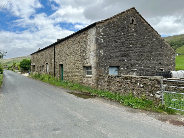
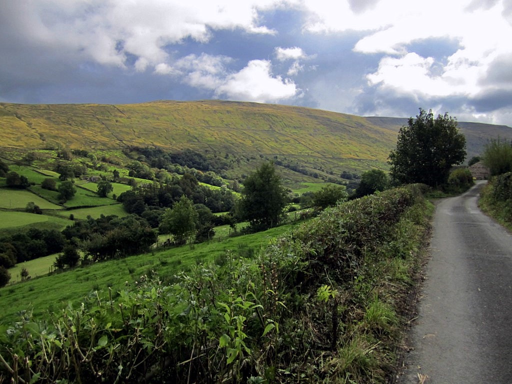
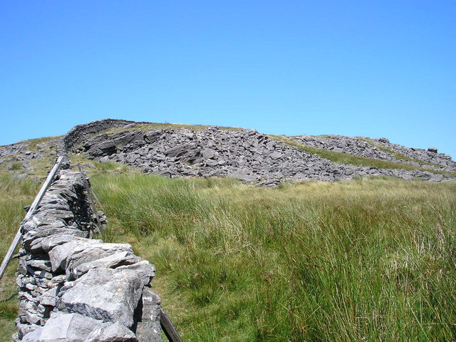
Blake Rigg Wood, located in Yorkshire, is a picturesque forest that captivates nature enthusiasts with its stunning beauty and diverse ecosystem. Spanning over a considerable area, the wood is a prominent natural attraction in the region, offering visitors an opportunity to immerse themselves in the tranquility of the countryside.

The wood boasts a rich variety of tree species, including oak, birch, beech, and ash. These towering trees create a dense canopy, providing shade and shelter for an array of wildlife. Numerous walking trails wind through the forest, allowing visitors to explore its enchanting ambiance while listening to the melodious songs of birds and the rustling of leaves underfoot.

Blake Rigg Wood is also home to a wide range of wildlife, making it a haven for animal lovers and nature photographers. Common sights in the forest include deer, rabbits, squirrels, and a plethora of bird species, such as woodpeckers and owls. The wood's diverse ecosystem supports a variety of plant life as well, with vibrant wildflowers and ferns adorning the forest floor.

The wood offers a peaceful retreat for those looking to escape the hustle and bustle of everyday life. It is a popular spot for activities such as picnicking, nature walks, and photography. With its serene atmosphere and natural beauty, Blake Rigg Wood is a true gem of Yorkshire, attracting visitors from near and far to experience the wonders of this enchanting forest.

If you have any feedback on the listing, please let us know in the comments section below.

Blake Rigg Wood Images

Images are sourced within 2km of 54.257825/-2.4219589 or Grid Reference SD7284. Thanks to Geograph Open Source API. All images are credited.

Track to Woman's Land The 18th century farmhouse is listed but not clearly visible in this view from the public road.  The listing does not explain the name, I guess that  at some time in the past a daughter rather than a son inherited the farm.
Track to Woman's Land
The 18th century farmhouse is listed but not clearly visible in this view from the public road. The listing does not explain the name, I guess that at some time in the past a daughter rather than a son inherited the farm.
Sign for Woman's Land See <a href="https://www.geograph.org.uk/photo/6961498">SD7286 : Track to Woman's Land</a> for context.
Sign for Woman's Land
Bankland, Dentdale Viewed from the road past Woman's Land across the dale.
Bankland, Dentdale
Viewed from the road past Woman's Land across the dale.
Whernside View, Dentdale The name refers to the unpainted building to the right; its view of Whernside is in the opposite direction. The whitewashed house to the left is Low Ground, grade II listed (list entry 1383905).
Whernside View, Dentdale
The name refers to the unpainted building to the right; its view of Whernside is in the opposite direction. The whitewashed house to the left is Low Ground, grade II listed (list entry 1383905).
Sign at the bottom of Deepdale Lane
Limekiln in Dentdale See also <a href="https://www.geograph.org.uk/photo/5957533">SD7286 : Disused Lime Kiln </a>. Listed grade II (list entry 1383901) as "A good example of its type, relatively well preserved... Conspicuous feature of the landscape at this point in Dentdale".
Limekiln in Dentdale
See also SD7286 : Disused Lime Kiln . Listed grade II (list entry 1383901) as "A good example of its type, relatively well preserved... Conspicuous feature of the landscape at this point in Dentdale".
Milestone in Dentdale The milestone is of a design distinctive to this area, a circular column just marked  "S 7" (S standing for Sedbergh).  Listed grade II (list entry 1383914). See <a href="https://www.geograph.org.uk/photo/6980982">SD6987 : Milestone by Holme Cottage</a> for a similar one on the road the other side of the dale.
Milestone in Dentdale
The milestone is of a design distinctive to this area, a circular column just marked "S 7" (S standing for Sedbergh). Listed grade II (list entry 1383914). See SD6987 : Milestone by Holme Cottage for a similar one on the road the other side of the dale.
Gibs Hall, Barn The barn adjoins Gibs Hall Cottage at the far end.  The houses on the other side of the road use the more modern spelling of the place name ‘Gibbs’, which is also used by the Ordnance Survey.
There is an Ordnance Survey cut benchmark low down on the barn wall near the corner, facing the road (photograph <a href="https://www.geograph.org.uk/photo/7185964">SD7386 : Benchmark, Gibbs Hall Barn</a>).
Gibs Hall, Barn
The barn adjoins Gibs Hall Cottage at the far end. The houses on the other side of the road use the more modern spelling of the place name ‘Gibbs’, which is also used by the Ordnance Survey. There is an Ordnance Survey cut benchmark low down on the barn wall near the corner, facing the road (photograph SD7386 : Benchmark, Gibbs Hall Barn).
Benchmark, Gibbs Hall Barn Detail of an Ordnance Survey cut benchmark on the wall of a barn on the south side of the road at Gibbs Hall. The benchmark marks a height of 190.6097m above Ordnance Datum Newlyn last verified in 1953 (location photograph <a href="https://www.geograph.org.uk/photo/7185944">SD7386 : Gibs Hall, Barn</a>).
Benchmark, Gibbs Hall Barn
Detail of an Ordnance Survey cut benchmark on the wall of a barn on the south side of the road at Gibbs Hall. The benchmark marks a height of 190.6097m above Ordnance Datum Newlyn last verified in 1953 (location photograph SD7386 : Gibs Hall, Barn).
Footpath gate near Tommy Bridge The gate is on the route of the Dales Way long distance path.
Footpath gate near Tommy Bridge
The gate is on the route of the Dales Way long distance path.
Ford near Tommy Bridge Adjacent to the Dales Way, this concreted ford across the River Dee carries a farm track.  It is not a public right of way.
Ford near Tommy Bridge
Adjacent to the Dales Way, this concreted ford across the River Dee carries a farm track. It is not a public right of way.
Path beside Deepdale Beck The Dales Way, The Dales High Way and A Pennine Journey are three long distance paths that follow this public footpath along a field edge beside Deepdale Beck (hidden in the trees) near Bridge End.
Path beside Deepdale Beck
The Dales Way, The Dales High Way and A Pennine Journey are three long distance paths that follow this public footpath along a field edge beside Deepdale Beck (hidden in the trees) near Bridge End.
Whernside Tarns
Whernside Tarns
Ford at High Nun House This ford is found on the track beside High Nun House.
Ford at High Nun House
This ford is found on the track beside High Nun House.
Unusual method of attaching single strand of barbed wire to top of dry-stone wall
Abandoned cable drum
Gate posts, Occupation Lane
Nun House Outrake
Nun House Outrake
Show me another place!

Blake Rigg Wood is located at Grid Ref: SD7284 (Lat: 54.257825, Lng: -2.4219589)

Division: West Riding

Administrative County: Cumbria

District: South Lakeland

Police Authority: Cumbria

What 3 Words

///straw.suspends.wiping. Near Sedbergh, Cumbria

Related Wikis

Deepdale, Cumbria

Deepdale is a side valley of Dentdale in the Yorkshire Dales National Park in Cumbria, England. It lies north west of the summit of Whernside. The dale...

Great Coum

Great Coum is a hill in the Yorkshire Dales, but is located in the South Lakeland district of Cumbria. The highest point is in Dent parish, but the boundary...
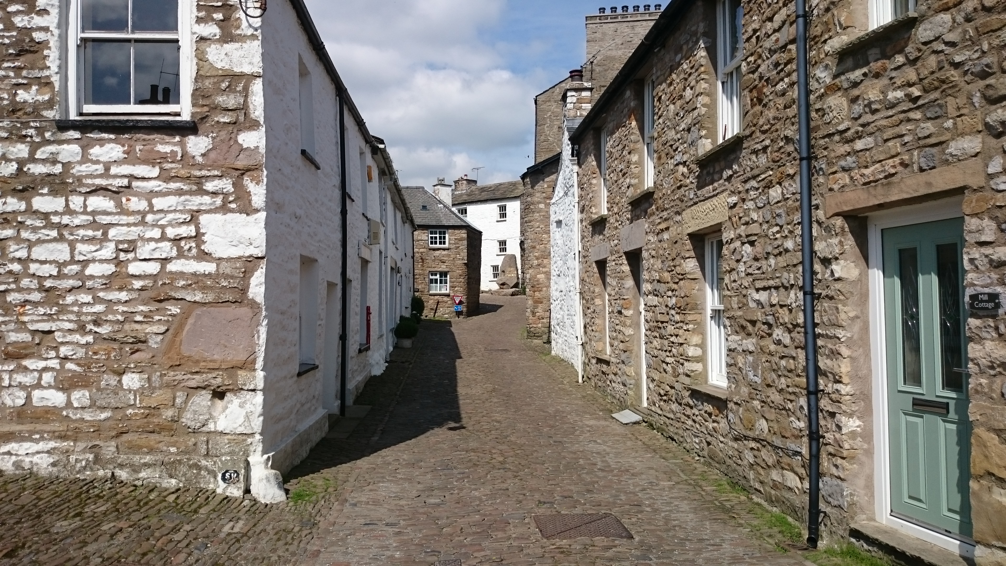
Dent, Cumbria

Dent is a village and civil parish in Cumbria, England, within the historic boundaries of the West Riding of Yorkshire. It lies in Dentdale, a narrow valley...
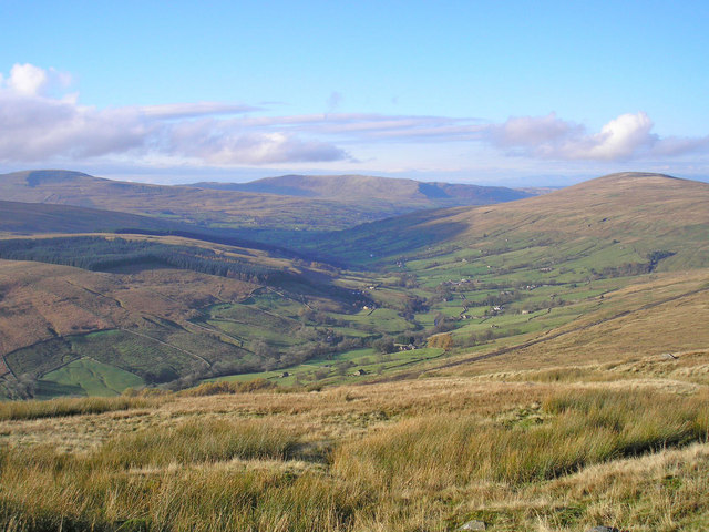
Dentdale

Dentdale is a dale or valley in the north-west of the Yorkshire Dales National Park in Cumbria, England. It is the valley of the River Dee, but takes...

St Andrew's Church, Dent

St Andrew's Church is in the village of Dent, Cumbria, England. It is an active Anglican parish church in the Western Dales Mission Community in the deanery...

Whernside

Whernside is a mountain in the Yorkshire Dales in Northern England. It is the highest of the Yorkshire Three Peaks, the other two being Ingleborough and...

Green Hill (Lancashire)

Green Hill is a mountain or fell in north west England. Its summit is 628 metres (2,060 ft) above sea level. It is located above Cowan Bridge, Lancashire...

St John the Evangelist's Church, Cowgill

St John the Evangelist's Church is the Church of England parish church of the village of Cowgill, Cumbria, England. It is in the deanery of Kendal, the...

Nearby Amenities

Located within 500m of 54.257825,-2.4219589
Barrier: cattle_grid
Bicycle: yes
Foot: yes
Lat/Long: 54.258302/-2.420036
Barrier: kissing_gate
Source: survey;gps
Lat/Long: 54.2544685/-2.4217592
Barrier: stile
Source: survey;gps
Stile: ladder
Lat/Long: 54.2552654/-2.420359
Barrier: stile
Source: survey;gps
Lat/Long: 54.255382/-2.4229383
Barrier: entrance
Source: survey;gps
Lat/Long: 54.2569134/-2.4230707
Barrier: entrance
Source: survey;gps
Lat/Long: 54.2590113/-2.4239619
Barrier: stile
Material: wood
Source: survey;gps
Stile: stepover
Lat/Long: 54.2597542/-2.4245309
Barrier: stile
Material: wood
Source: survey;gps
Stile: stepover
Lat/Long: 54.2595691/-2.4284597
Barrier: kissing_gate
Source: survey;gps
Lat/Long: 54.2559405/-2.4206681
Barrier: stile
Material: stone
Source: survey;gps
Stile: squeezer
Lat/Long: 54.2560902/-2.4206569
Barrier: stile
Material: wood
Source: survey;gps
Stile: stepover
Lat/Long: 54.2573375/-2.4212894
Barrier: stile
Material: stone
Source: survey;gps
Stile: stepover
Lat/Long: 54.2581435/-2.4217912
Barrier: stile
Material: stone
Source: survey;gps
Stile: stepover
Lat/Long: 54.2601716/-2.4207796
Barrier: stile
Material: stone
Source: survey;gps
Stile: stepover
Lat/Long: 54.2553856/-2.4185112
Barrier: stile
Material: stone
Source: survey;gps
Stile: stepover
Lat/Long: 54.2560609/-2.4172367
Generator Method: photovoltaic
Generator Orientation: south_west
Generator Output Electricity: yes
Generator Solar Modules: 4
Generator Source: solar
Generator Type: solar_photovoltaic_panel
Location: roof
Power: generator
Lat/Long: 54.2559029/-2.4175324
Power: pole
Lat/Long: 54.2533693/-2.4210779
Power: pole
Lat/Long: 54.254455/-2.4209606
Power: pole
Lat/Long: 54.2554409/-2.4208383
Power: pole
Lat/Long: 54.2558995/-2.4212207
Power: pole
Lat/Long: 54.2567231/-2.4219243
Power: pole
Lat/Long: 54.2546947/-2.427265
Power: pole
Lat/Long: 54.2554304/-2.4273122
Power: pole
Lat/Long: 54.2561229/-2.4273301
Power: pole
Lat/Long: 54.2571236/-2.4277023
Power: pole
Lat/Long: 54.2580707/-2.4280464
Power: pole
Lat/Long: 54.2591072/-2.4284364
Power: pole
Lat/Long: 54.256184/-2.4265296
Power: pole
Lat/Long: 54.2557283/-2.4261421
Ford: yes
Lat/Long: 54.2588276/-2.4235217
Power: pole
Lat/Long: 54.2592467/-2.4218334
Power: pole
Lat/Long: 54.2597966/-2.4202548
Power: pole
Lat/Long: 54.2604109/-2.4197733
Power: pole
Lat/Long: 54.2612616/-2.4196128
Power: pole
Lat/Long: 54.2620018/-2.4201063
Power: pole
Lat/Long: 54.2610531/-2.4205111
Power: pole
Lat/Long: 54.2581572/-2.4216478
Power: pole
Lat/Long: 54.2575868/-2.4215755
The data included in this document is from www.openstreetmap.org. The data is made available under ODbL.

Have you been to Blake Rigg Wood?

Leave your review of Blake Rigg Wood below (or comments, questions and feedback).