Ash Plantation
Wood, Forest in Somerset
England
Ash Plantation

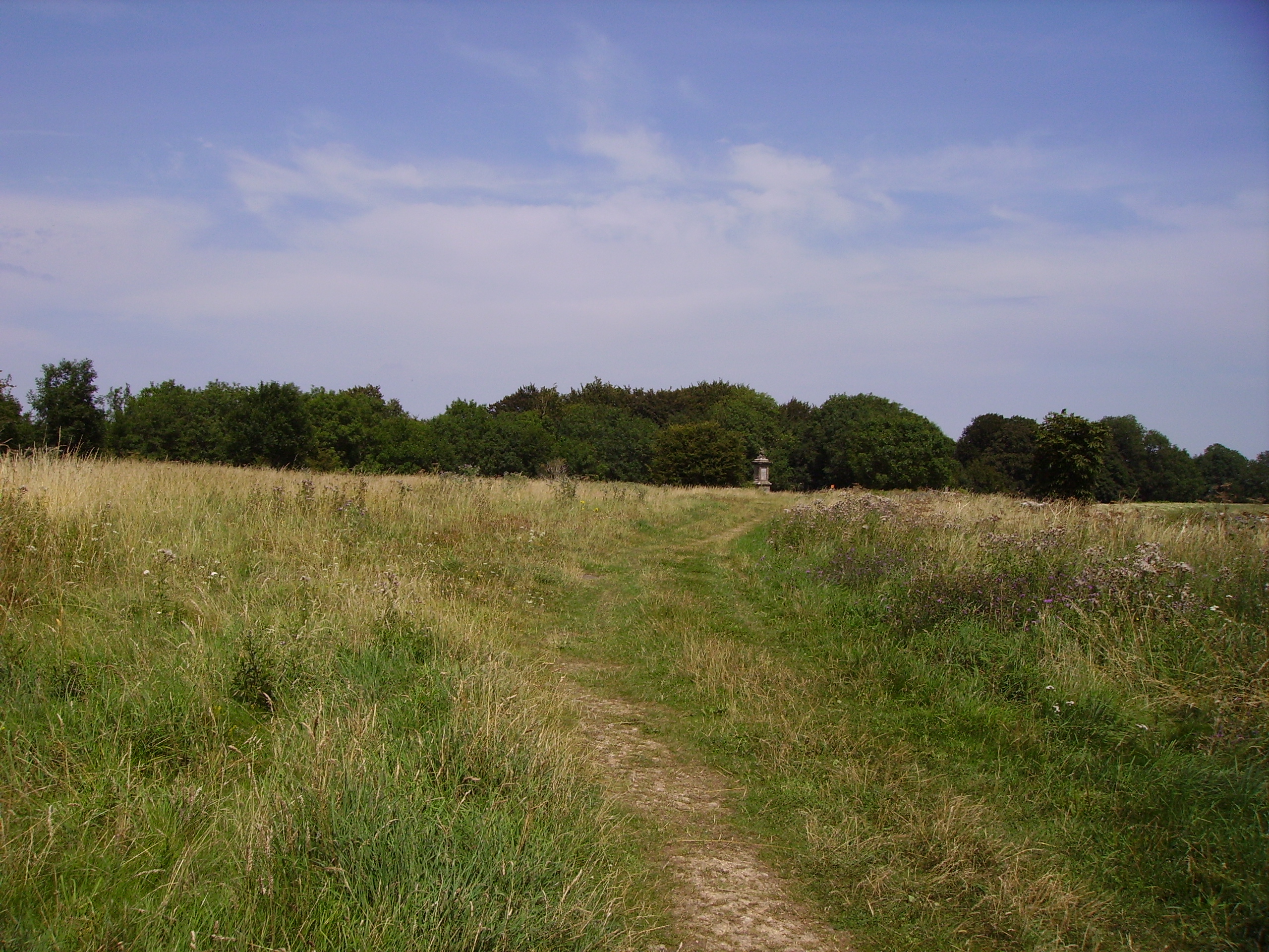
Ash Plantation is a picturesque woodland located in Somerset, England. Spanning over several acres, it is part of a network of woodlands in the region and is known for its rich biodiversity and scenic beauty. The plantation is primarily composed of ash trees, from which it derives its name.
The woodland is easily accessible and offers a tranquil retreat for nature lovers and outdoor enthusiasts alike. It is a popular destination for hikers, birdwatchers, and wildlife photographers, as it provides a habitat for a wide variety of species. Visitors can expect to encounter diverse birdlife, including woodpeckers, owls, and various songbirds, as well as small mammals like squirrels and rabbits.
The dense foliage of the ash trees creates a cool and shaded environment, making it an ideal spot for leisurely walks and picnics during the summer months. The plantation also boasts a network of well-maintained trails, allowing visitors to explore its various nooks and crannies.
Ash Plantation is managed by local conservation organizations, ensuring the preservation of its natural beauty and ecological importance. Conservation efforts focus on maintaining the health of the ash trees and protecting the woodland's delicate ecosystem.
Overall, Ash Plantation in Somerset offers a serene and enchanting experience for nature enthusiasts, providing an opportunity to immerse oneself in the wonders of a diverse woodland ecosystem.
If you have any feedback on the listing, please let us know in the comments section below.
Ash Plantation Images
Images are sourced within 2km of 51.413063/-2.4026736 or Grid Reference ST7268. Thanks to Geograph Open Source API. All images are credited.


Ash Plantation is located at Grid Ref: ST7268 (Lat: 51.413063, Lng: -2.4026736)
Unitary Authority: Bath and North East Somerset
Police Authority: Avon and Somerset
What 3 Words
///bets.clean.fallen. Near Saltford, Somerset
Nearby Locations
Related Wikis

Bath Racecourse
Bath Racecourse is a thoroughbred horse racing venue on Lansdown Hill, about 3+1⁄4 miles (5.2 km) northeast of Bath, Somerset, England. It is owned and...

Congrove Field and The Tumps
Congrove Field and The Tumps is a (grid reference ST713698) is a 14.2 hectares (35 acres) biological Site of Special Scientific Interest (SSSI) on Lansdown...

Beckford's Tower
Beckford's Tower, originally known as Lansdown Tower, is an architectural folly built in neo-classical style on Lansdown Hill, just outside Bath, Somerset...

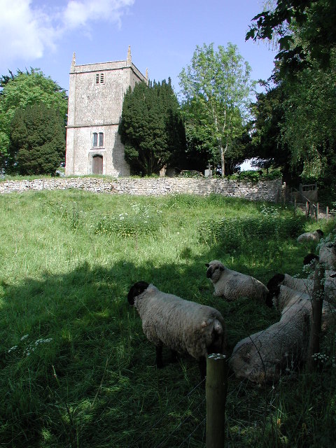
Church of St Martin, North Stoke
The Church of St Martin in North Stoke, Somerset, England dates from the 12th century and is a Grade II* listed building. == History == There is evidence...

Weston, Bath
Weston is a suburb and electoral ward of Bath in Bath and North East Somerset, South West England, located in the northwest of the city. Originally a separate...
Battle of Lansdowne
The First English Civil War battle of Lansdowne, or Lansdown, was fought on 5 July 1643, at Lansdowne Hill, near Bath, Somerset, England. Although the...
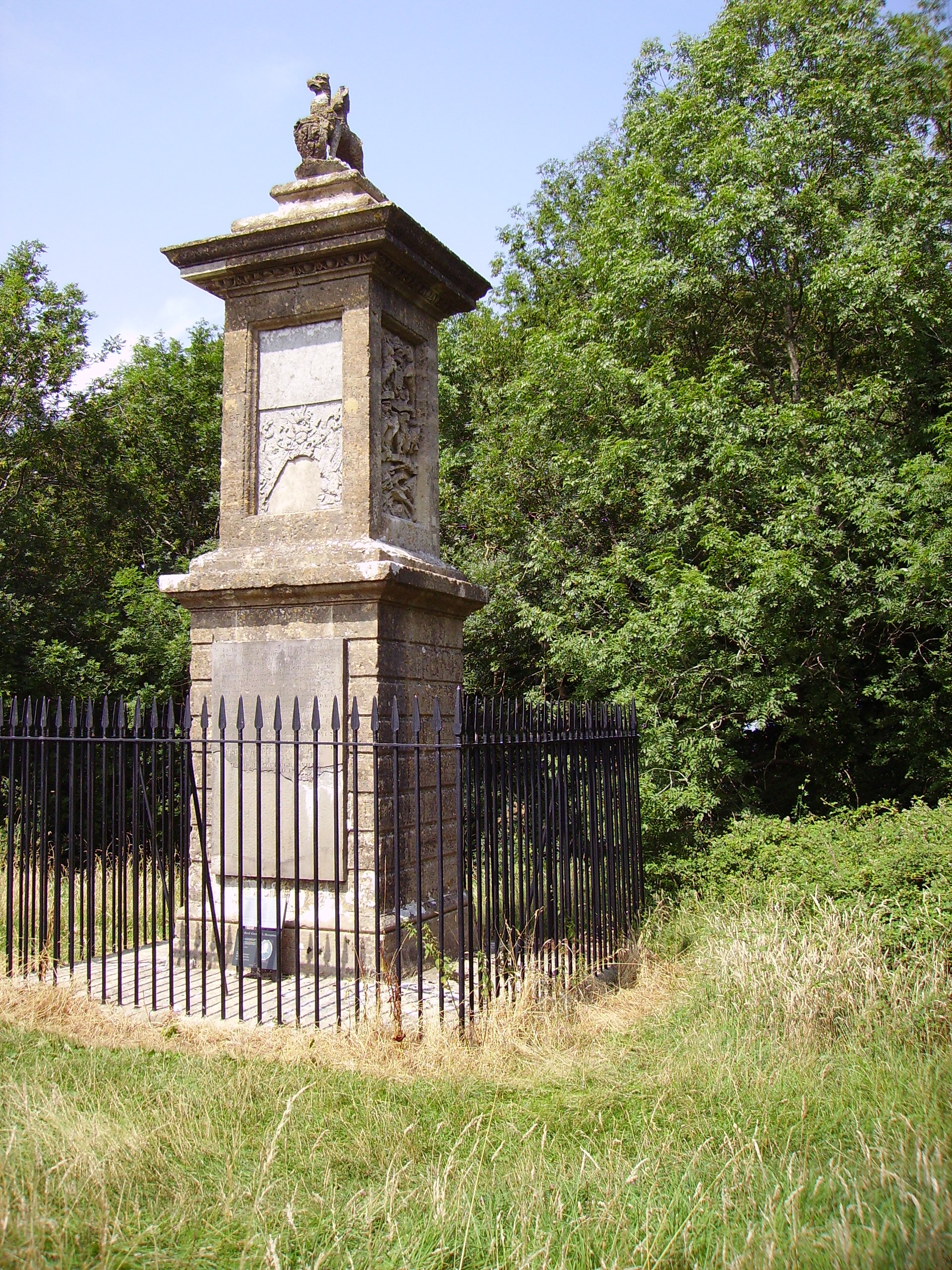
Sir Bevil Grenville's Monument
Sir Bevil Grenville's Monument is a monument erected in 1720 on Lansdown Hill, then called Lansdowne Hill, in Charlcombe parish about 4 miles (6.4 km)...
North Stoke, Somerset
North Stoke is a village within the civil parish of Kelston in the Bath and North East Somerset (BANES) unitary authority within the historic county of...
Related Videos

Bath Marina. Even boats struggled in the floods! #floods #flooding #bath #somerset #travel #holidays
We see the boats in Bath Marina are having trouble. The residents can't get off their boats due to the river Avon breaking its banks.

A night in the Somerset Countryside, England (Travel Vlog)
My first travel vlog.. Join me in the Somerset Countryside in England! Follow what I am up to: . My Blog- ...

Bath Botanical Gardens. "Walking The Streets of Bath, UK". (GoPro 9)
4k Video with ZHIYUN Crane-M2 and GoPro 9 at Bath Botanical Gardens. 16-06-2021.

River Avon Bath UK
Walking along the side of River Avon.
Nearby Amenities
Located within 500m of 51.413063,-2.4026736Have you been to Ash Plantation?
Leave your review of Ash Plantation below (or comments, questions and feedback).