Àird an t-Sionnaich

Settlement in Argyllshire

Scotland

Àird an t-Sionnaich

Autumn woodland above Ardentinny On a forestry logging road bound for Knap, further north on Loch Long-side.

This photograph was taken during the Coronavirus (COVID-19) pandemic of 2020/21.
Autumn woodland above Ardentinny Credit: James T M Towill

Àird an t-Sionnaich is a small rural settlement located in Argyllshire, Scotland. Situated in the western part of the country, it is surrounded by beautiful natural landscapes and offers a peaceful and picturesque setting for residents and visitors alike.

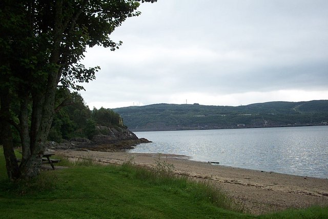
The area is known for its stunning views of the nearby Loch Sween, a sea loch that stretches along the Argyll coastline. The loch provides opportunities for water activities such as boating and fishing, attracting outdoor enthusiasts to the region.

Àird an t-Sionnaich is home to a close-knit community, with a population of approximately 200 residents. The settlement consists of a cluster of traditional Scottish cottages, adding to its charm and character. The residents are friendly and welcoming, creating a warm and inviting atmosphere for those who visit.

Although small, Àird an t-Sionnaich has a few local amenities to cater to the needs of its residents. There is a small convenience store where basic groceries can be purchased, and a cozy pub where locals often gather for drinks and socializing.

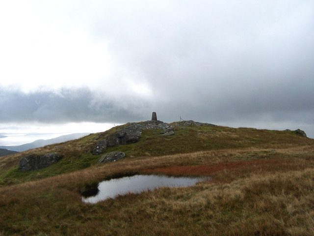
For those seeking outdoor adventures, the surrounding area offers numerous walking trails and nature reserves to explore. The nearby Knapdale Forest provides opportunities for hiking and wildlife spotting, with sightings of red deer and golden eagles being common.

Overall, Àird an t-Sionnaich is a tranquil and beautiful place, perfect for those looking to escape the hustle and bustle of city life and immerse themselves in the natural wonders of the Scottish countryside.

If you have any feedback on the listing, please let us know in the comments section below.

Àird an t-Sionnaich Images

Images are sourced within 2km of 56.042912/-4.90941 or Grid Reference NS1887. Thanks to Geograph Open Source API. All images are credited.

Autumn woodland above Ardentinny On a forestry logging road bound for Knap, further north on Loch Long-side.

This photograph was taken during the Coronavirus (COVID-19) pandemic of 2020/21.
Autumn woodland above Ardentinny
On a forestry logging road bound for Knap, further north on Loch Long-side. This photograph was taken during the Coronavirus (COVID-19) pandemic of 2020/21.
A track behind Finart Bay A pleasant walk from Ardentinny village to reach the carpark at Finart Bay.
A track behind Finart Bay
A pleasant walk from Ardentinny village to reach the carpark at Finart Bay.
The beach at Ardentinny On a dreich west coast day.
The beach at Ardentinny
On a dreich west coast day.
Strone & Ardentinny Church Church of Scotland church on the sea front at Ardentinny.
Strone & Ardentinny Church
Church of Scotland church on the sea front at Ardentinny.
Road from Ardentinny hugs the shore
The road to Ardentinny
A triple trunked cupressus makes way for the motorist The need to clear sight lines on the bends means some trees have to go
A triple trunked cupressus makes way for the motorist
The need to clear sight lines on the bends means some trees have to go
Rocky shoreline at Loch Long
Fingal's Well A historic well on the outskirts of the village of Ardentinny.
Fingal's Well
A historic well on the outskirts of the village of Ardentinny.
Roadside Waterfall A waterfall opposite the entrance to Glenfinart Caravan Park.
Roadside Waterfall
A waterfall opposite the entrance to Glenfinart Caravan Park.
Glenfinart House Remains Within the grounds of Glenfinart Caravan Site is the entrance portico and tower of the former Glenfinart House, which was destroyed by fire in 1968.

See <span class="nowrap"><a title="http://www.secretscotland.org.uk/index.php/Secrets/GlenfinartHouse?from=Secrets.HMSArmadillo" rel="nofollow ugc noopener" href="http://www.secretscotland.org.uk/index.php/Secrets/GlenfinartHouse?from=Secrets.HMSArmadillo">Link</a><img style="margin-left:2px;" alt="External link" title="External link - shift click to open in new window" src="https://s1.geograph.org.uk/img/external.png" width="10" height="10"/></span> for further information.
Glenfinart House Remains
Within the grounds of Glenfinart Caravan Site is the entrance portico and tower of the former Glenfinart House, which was destroyed by fire in 1968. See LinkExternal link for further information.
White Bay A small bay on Loch Long, north of Shepherd's Point.  This photograph is looking over the bay and loch to the massive RNAD Coulport complex.
White Bay
A small bay on Loch Long, north of Shepherd's Point. This photograph is looking over the bay and loch to the massive RNAD Coulport complex.
Shepherd's Point Navigation Beacon A prominent beacon is perched above the shore at Shepherd's Point.  Substantial tankers head past this point up Loch Long to the Finnart Ocean Terminal.
Shepherd's Point Navigation Beacon
A prominent beacon is perched above the shore at Shepherd's Point. Substantial tankers head past this point up Loch Long to the Finnart Ocean Terminal.
The Beach At Finart Bay, Ardentinny A tourist magnet in fine conditions.  A small area of 'beach' backed by a picnic and BBQ area with parking and toilets.
The Beach At Finart Bay, Ardentinny
A tourist magnet in fine conditions. A small area of 'beach' backed by a picnic and BBQ area with parking and toilets.
Weir In The Glen Finart Burn One of several weirs, this one adjacent to the Glenfinart Caravan Park and just downstream from a renovated bridge.
Weir In The Glen Finart Burn
One of several weirs, this one adjacent to the Glenfinart Caravan Park and just downstream from a renovated bridge.
Ardentinny Outdoor Education Centre Commissioned by the former Renfrew County Council (Since 1996, Renfrewshire Council) in the early 1970s, it is now run by an independent organisation and caters for a wide range of groups and studies.  

I went to the centre as a school pupil in 1993 and 1996 and have many fond memories of the centre and the activities.

For further information, refer to <span class="nowrap"><a title="http://actualrealitycentres.com/ardentinny" rel="nofollow ugc noopener" href="http://actualrealitycentres.com/ardentinny">Link</a><img style="margin-left:2px;" alt="External link" title="External link - shift click to open in new window" src="https://s1.geograph.org.uk/img/external.png" width="10" height="10"/></span>
Ardentinny Outdoor Education Centre
Commissioned by the former Renfrew County Council (Since 1996, Renfrewshire Council) in the early 1970s, it is now run by an independent organisation and caters for a wide range of groups and studies. I went to the centre as a school pupil in 1993 and 1996 and have many fond memories of the centre and the activities. For further information, refer to LinkExternal link
Radar Beacon Near Ardentinny Probably for MOD purposes, this beacon is next to the road to Ardentinny, south of the village.  It looks as if there has been work carried out at the site recently.
Radar Beacon Near Ardentinny
Probably for MOD purposes, this beacon is next to the road to Ardentinny, south of the village. It looks as if there has been work carried out at the site recently.
Reinforced Section Of Road A reinforced section of road to Ardentinny.  No doubt that the fetch coming up Loch Long could erode the banking beside the road given a chance.
Reinforced Section Of Road
A reinforced section of road to Ardentinny. No doubt that the fetch coming up Loch Long could erode the banking beside the road given a chance.
Show me another place!

Àird an t-Sionnaich is located at Grid Ref: NS1887 (Lat: 56.042912, Lng: -4.90941)

Unitary Authority: Argyll and Bute

Police Authority: Argyll and West Dunbartonshire

Also known as: Ardentinny, Àird an Teine

What 3 Words

///drips.able.according. Near Garelochhead, Argyll & Bute

Related Wikis

Ardentinny

Ardentinny (Scottish Gaelic: Àird an t-Sionnaich or Àird an Teine) is a small village on the western shore of Loch Long, 14 miles (23 km) north of Dunoon...

Loch Long

Loch Long is a body of water in the council area of Argyll and Bute, Scotland. The Sea Loch extends from the Firth of Clyde at its southwestern end. It...

RNAD Coulport

Royal Naval Armaments Depot Coulport, shortened to RNAD Coulport, on Loch Long in Argyll, Scotland, is the storage and loading facility for the nuclear...

Glen Finart

Glen Finart (Scottish Gaelic: Gleann Fhionnaird) is a glacially formed glen on the Cowal peninsula, Argyll and Bute, Scotland. The glen is within the...

Coulport (village)

Coulport (Scottish Gaelic: An Cùl Phort - literally the Back Port or Ferry) is a village on the east side of Loch Long, Argyll and Bute, Scotland. It is...

Ardpeaton

Ardpeaton is a settlement in Argyll and Bute, Scotland, on the shore of Loch Long, with a population under 1000. == References ==

Beinn Ruadh

Beinn Ruadh (664 m) is a mountain of Argyll and Bute in Scotland. Part of the Grampian Mountains, it lies between Loch Eck and Loch Long in Argyll Forest...

Rosneath Peninsula

The Rosneath Peninsula is a peninsula in Argyll and Bute, western Scotland. Formerly in the historic county of Dunbartonshire, it is formed on its eastern...

Nearby Amenities

Located within 500m of 56.042912,-4.90941
Created By: almien_coastlines
Lat/Long: 56.038608/-4.907063
Created By: almien_coastlines
Lat/Long: 56.03912/-4.907088
Ardentinny
Alt Name Gd: Àird an t-Sionnaich
Name Gd: Àird an Teine
Name Sco: Aranteenie
Place: village
Population: 177
Wikidata: Q639037
Wikipedia: en:Ardentinny
Lat/Long: 56.0450943/-4.9089202
Bus Stop
Lat/Long: 56.0467255/-4.9110732
Toilets
Lat/Long: 56.0465178/-4.9113777
Post Box
Lat/Long: 56.046097/-4.9100052
Information: board
Tourism: information
Lat/Long: 56.0468318/-4.9110915
Defibrillator
Emergency: defibrillator
Lat/Long: 56.0457553/-4.9093896
Ardentinny War Memorial
Historic: memorial
Memorial: war_memorial
Wikidata: Q114169200
Lat/Long: 56.0452458/-4.9089969
Power: pole
Lat/Long: 56.0461782/-4.9122685
Power: pole
Lat/Long: 56.0467977/-4.9126138
Power: pole
Lat/Long: 56.0448309/-4.9114631
The data included in this document is from www.openstreetmap.org. The data is made available under ODbL.

Have you been to Àird an t-Sionnaich?

Leave your review of Àird an t-Sionnaich below (or comments, questions and feedback).