Furnace Coppice

Wood, Forest in Shropshire

England

Furnace Coppice

Garage at the A4117/B4202 junction The white lorry is waiting to turn out of the B4202.
Garage at the A4117/B4202 junction Credit: Peter Whatley

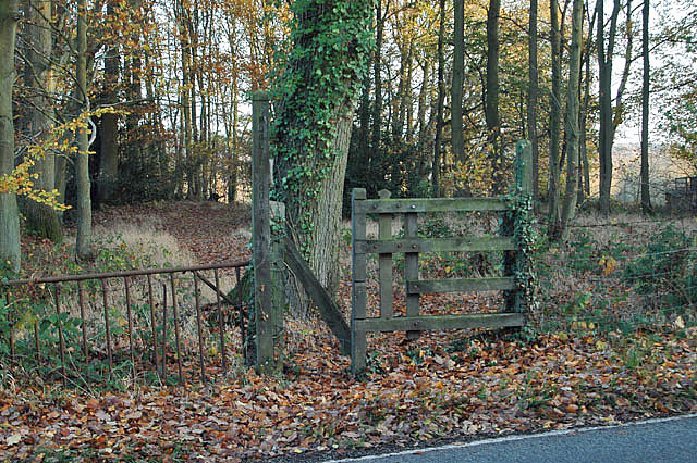
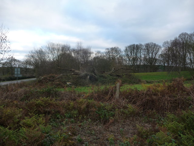
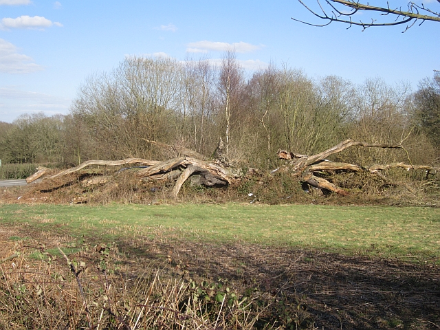
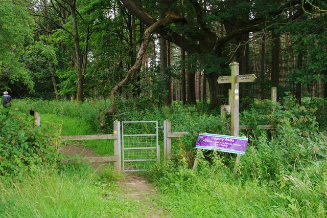
Furnace Coppice is a scenic woodland located in the county of Shropshire, England. This ancient forest covers an area of approximately 100 acres and is known for its diverse range of tree species, wildlife, and historical significance.

The woodland is predominantly composed of broadleaf trees, including oak, beech, birch, and ash, which create a captivating tapestry of colors throughout the year. The dense canopy provides a haven for numerous bird species, such as woodpeckers, owls, and various songbirds. Small mammals, like squirrels and hedgehogs, also thrive in this natural habitat.

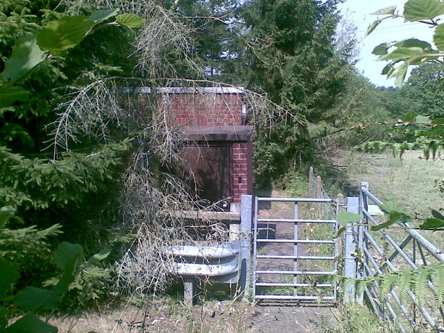
Furnace Coppice has a rich history that dates back centuries. The name itself is derived from the iron smelting furnaces that once operated in the area during the Industrial Revolution. The remnants of these furnaces can still be seen today, adding an intriguing element to the woodland's allure.

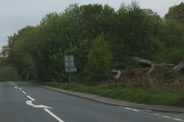
Visitors to Furnace Coppice can enjoy a variety of activities, including walking, birdwatching, and photography. The woodland features well-maintained paths that meander through its enchanting terrain, providing a peaceful and tranquil setting for exploration and relaxation.

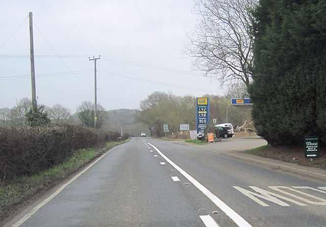
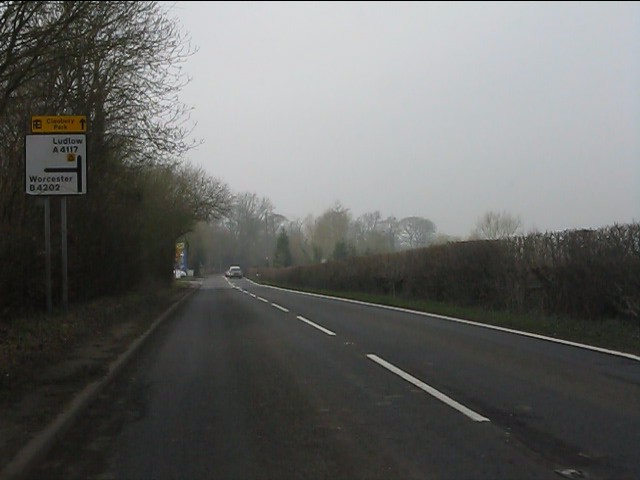
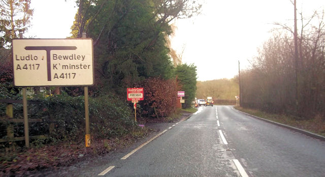
The forest is easily accessible, located near the village of Pontesbury, and there is ample parking available for visitors. The site is managed by local authorities who ensure the preservation of its natural beauty and historical significance.

Furnace Coppice is a true gem of Shropshire, offering a slice of nature's splendor and a glimpse into the region's industrial past. Whether you are a nature enthusiast, history buff, or simply seeking a peaceful retreat, this woodland is a must-visit destination.

If you have any feedback on the listing, please let us know in the comments section below.

Furnace Coppice Images

Images are sourced within 2km of 52.384172/-2.420183 or Grid Reference SO7176. Thanks to Geograph Open Source API. All images are credited.

Garage at the A4117/B4202 junction The white lorry is waiting to turn out of the B4202.
Garage at the A4117/B4202 junction
The white lorry is waiting to turn out of the B4202.
Footpath into the woods
Garage at B4202 and A4117 junction near Weston Farm
A4117 approaching the B4202 junction
Pumping station
Pumping station
The decaying Mawley Oak near Cleobury Mortimer This old oak tree was a notable landmark here for centuries until its collapse in 2001. It was of massive girth and possibly 300 years old - its massive girth due to a favourable position rather than ancient age. But its location may have sped up its demise. Rather than slowly laying down growth rings its accelerated growth and wide growth rings weakened it. It now lies here decaying slowly and no doubt supporting a veritable city of invertebrates, bugs, beetles, larvae etc etc.
The decaying Mawley Oak near Cleobury Mortimer
This old oak tree was a notable landmark here for centuries until its collapse in 2001. It was of massive girth and possibly 300 years old - its massive girth due to a favourable position rather than ancient age. But its location may have sped up its demise. Rather than slowly laying down growth rings its accelerated growth and wide growth rings weakened it. It now lies here decaying slowly and no doubt supporting a veritable city of invertebrates, bugs, beetles, larvae etc etc.
The Mawley Oak garage and filling station At the junction of the A4117 and B4202 roads near Cleobury Mortimer. Named for the old oak tree that stood nearby until 2001.
The Mawley Oak garage and filling station
At the junction of the A4117 and B4202 roads near Cleobury Mortimer. Named for the old oak tree that stood nearby until 2001.
B4202 junction with A4117
Mawley Oak An old oak has been left to rot. This was once a famous landmark, but collapsed in 2001.
Mawley Oak
An old oak has been left to rot. This was once a famous landmark, but collapsed in 2001.
Woodland and the Mawley Oak The tree trunk on the right is the remains of the Mawley Oak which fell in 2001 <span class="nowrap"><a title="http://wbrc.org.uk/worcRecd/Issue12/mawley.htm" rel="nofollow ugc noopener" href="http://wbrc.org.uk/worcRecd/Issue12/mawley.htm">Link</a><img style="margin-left:2px;" alt="External link" title="External link - shift click to open in new window" src="https://s1.geograph.org.uk/img/external.png" width="10" height="10"/></span>
Woodland and the Mawley Oak
The tree trunk on the right is the remains of the Mawley Oak which fell in 2001 LinkExternal link
Split Tree This is the remains of the Mawley Oak. See <span class="nowrap"><a title="http://wbrc.org.uk/worcRecd/Issue12/mawley.htm" rel="nofollow ugc noopener" href="http://wbrc.org.uk/worcRecd/Issue12/mawley.htm">Link</a><img style="margin-left:2px;" alt="External link" title="External link - shift click to open in new window" src="https://s1.geograph.org.uk/img/external.png" width="10" height="10"/></span>
Split Tree
This is the remains of the Mawley Oak. See LinkExternal link
Old Milestone by the A4117, opposite Lodge Coppice Stone post (plate lost) by the A4117, in parish of CLEOBURY MORTIMER (SOUTH SHROPSHIRE District), Lodge Coppice; E of B4201, by the road, on North side of road. Bewdley Dog Lane plate erected by the Dog Lane District of Bewdley Turnpike Trust in the 19th century. 

Inscription once read:-   : (TO / BEWDLEY / 6 MILES / CLEOBURY / 2 MILES) :

Listed - Shropshire HER Number (PRN): 21181 <span class="nowrap"><a title="https://www.heritagegateway.org.uk/Gateway/Results_Single.aspx?uid=MSA23812&resourceID=1015" rel="nofollow ugc noopener" href="https://www.heritagegateway.org.uk/Gateway/Results_Single.aspx?uid=MSA23812&resourceID=1015">Link</a><img style="margin-left:2px;" alt="External link" title="External link - shift click to open in new window" src="https://s1.geograph.org.uk/img/external.png" width="10" height="10"/></span>

Milestone Society National ID: SA_CMBD02.
Old Milestone by the A4117, opposite Lodge Coppice
Stone post (plate lost) by the A4117, in parish of CLEOBURY MORTIMER (SOUTH SHROPSHIRE District), Lodge Coppice; E of B4201, by the road, on North side of road. Bewdley Dog Lane plate erected by the Dog Lane District of Bewdley Turnpike Trust in the 19th century. Inscription once read:- : (TO / BEWDLEY / 6 MILES / CLEOBURY / 2 MILES) : Listed - Shropshire HER Number (PRN): 21181 LinkExternal link Milestone Society National ID: SA_CMBD02.
The A4117 at B4202 Junction for Worcester
Golfers at Hole 6 Deer Park Course, Cleobury Mortimer Golf Course, Shrops Golfers at Cleobury Mortimer Golf Club on a Sunday morning in July.
Golfers at Hole 6 Deer Park Course, Cleobury Mortimer Golf Course, Shrops
Golfers at Cleobury Mortimer Golf Club on a Sunday morning in July.
Public footpath in Cleobury Mortimer Golf Course, Shrops This is part of one of the public footpaths which cross the golf course. A small part is hard-surfaced before becoming a grass track.
Public footpath in Cleobury Mortimer Golf Course, Shrops
This is part of one of the public footpaths which cross the golf course. A small part is hard-surfaced before becoming a grass track.
Public footpath passing through gate, Cleobury Mortimer Golf Club, Shrops A public footpath passes through this gate and enters the Wyre Forest. For a closer view of the fingerpost see:- <a href="https://www.geograph.org.uk/photo/6556049">SO6976 : Fingerpost at an entrance to the Wyre Forest, Cleobury Mortimer Golf Club, Shrops</a>.
Public footpath passing through gate, Cleobury Mortimer Golf Club, Shrops
A public footpath passes through this gate and enters the Wyre Forest. For a closer view of the fingerpost see:- SO6976 : Fingerpost at an entrance to the Wyre Forest, Cleobury Mortimer Golf Club, Shrops.
Fingerpost at an entrance to the Wyre Forest, Cleobury Mortimer Golf Club, Shrops The fingerpost is where a public path passes from the golf course to the Wyre Forest.  The fingers point to the Club House and the Wyre Forest. Below is a notice suggesting that after a country walk you can call at the Golf Club's Club House for light refreshments.

<a href="https://www.geograph.org.uk/photo/6556039">SO6976 : Public footpath passing through gate, Cleobury Mortimer Golf Club, Shrops</a>.
<a href="https://www.geograph.org.uk/photo/6556066">SO6976 : Footpath markers on fingerpost at edge of Wyre Forest, Cleobury Mortimer Golf Club, Shrops</a>.
Fingerpost at an entrance to the Wyre Forest, Cleobury Mortimer Golf Club, Shrops
The fingerpost is where a public path passes from the golf course to the Wyre Forest. The fingers point to the Club House and the Wyre Forest. Below is a notice suggesting that after a country walk you can call at the Golf Club's Club House for light refreshments. SO6976 : Public footpath passing through gate, Cleobury Mortimer Golf Club, Shrops. SO6976 : Footpath markers on fingerpost at edge of Wyre Forest, Cleobury Mortimer Golf Club, Shrops.
Footpath markers on fingerpost at edge of Wyre Forest, Cleobury Mortimer Golf Club, Shrops The top marker indicates a Cleobury Country Walk and has been placed there by Cleobury Mortimer Footpath Association. The one below indicates a public footpath and has been placed there by Shropshire Council.

<a href="https://www.geograph.org.uk/photo/6556049">SO6976 : Fingerpost at an entrance to the Wyre Forest, Cleobury Mortimer Golf Club, Shrops</a>.
Footpath markers on fingerpost at edge of Wyre Forest, Cleobury Mortimer Golf Club, Shrops
The top marker indicates a Cleobury Country Walk and has been placed there by Cleobury Mortimer Footpath Association. The one below indicates a public footpath and has been placed there by Shropshire Council. SO6976 : Fingerpost at an entrance to the Wyre Forest, Cleobury Mortimer Golf Club, Shrops.
Show me another place!

Furnace Coppice is located at Grid Ref: SO7176 (Lat: 52.384172, Lng: -2.420183)

Unitary Authority: Shropshire

Police Authority: West Mercia

What 3 Words

///eyebrows.scaffold.lamenting. Near Cleobury Mortimer, Shropshire

Related Wikis

Wyre Forest railway station

Wyre Forest railway station was a station to the north of Far Forest, Worcestershire, England. The station which served the Wyre Forest was opened in 1869...

Cleobury Mortimer railway station

Cleobury Mortimer railway station was a station in Cleobury Mortimer, Shropshire, England. The station was opened in 1864 and closed in 1962. Station buildings...

Far Forest

Far Forest is a small village in north Worcestershire, England, approximately 3.5 miles (5.6 km) west of Bewdley, and next to the border with Shropshire...
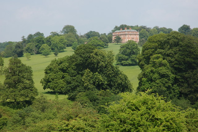
Mawley Hall

Mawley Hall is a privately owned 18th-century country mansion near Cleobury Mortimer, Shropshire, England. It is a Grade I listed building. The Blount...

Nearby Amenities

Located within 500m of 52.384172,-2.420183
The data included in this document is from www.openstreetmap.org. The data is made available under ODbL.

Have you been to Furnace Coppice?

Leave your review of Furnace Coppice below (or comments, questions and feedback).