Ash Plantation

Wood, Forest in Somerset Mendip

England

Ash Plantation

Old Milepost by the B3139, Kilmersdon Hill Cast iron post by the B3139, in parish of KILMERSDON (MENDIP District), Kilmersdon Hill, near Kilmersdon Village, on grass verge in front of hedge, on South side of road. Radstock iron casting, erected by the Radstock turnpike trust in the 19th century. 

Inscription reads:-
: WELLS / 11 : : LONDON / 111 : : KILMERSDON : : TROWBRIDGE / 12 / DEVIZES / 22 :

Grade II listed.
List Entry Number: 1177856 <span class="nowrap"><a title="https://historicengland.org.uk/listing/the-list/list-entry/1177856" rel="nofollow ugc noopener" href="https://historicengland.org.uk/listing/the-list/list-entry/1177856">Link</a><img style="margin-left:2px;" alt="External link" title="External link - shift click to open in new window" src="https://s1.geograph.org.uk/img/external.png" width="10" height="10"/></span>

Milestone Society National ID: SO_LBWL111
Old Milepost by the B3139, Kilmersdon Hill Credit: Gail Fawcett

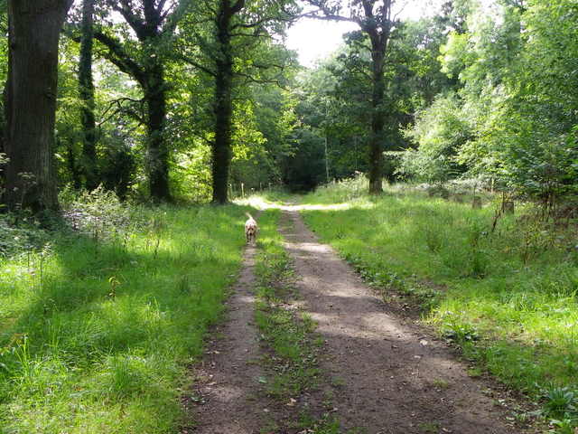
Ash Plantation is a sprawling woodland located in Somerset, England. Covering an area of approximately 500 acres, it is a prominent feature of the local landscape. The plantation is predominantly composed of ash trees, hence its name, which provide a dense canopy and create a unique ecosystem.

The woodland is characterized by its diverse flora and fauna. The dense foliage of the ash trees provides a habitat for a variety of bird species, including woodpeckers, owls, and songbirds. The forest floor is carpeted with a rich assortment of wildflowers, ferns, and mosses, creating a vibrant and colorful environment.

Ash Plantation offers numerous recreational opportunities for visitors. It boasts a network of well-maintained walking trails that wind through the woodland, providing an immersive experience in nature. These trails are suitable for all levels of hikers and offer breathtaking views of the surrounding countryside.

The woodland is also a popular destination for nature enthusiasts and photographers, who are drawn to its tranquil beauty and abundant wildlife. It is not uncommon to spot deer, squirrels, and rabbits roaming freely within the plantation.

In addition to its recreational value, Ash Plantation serves an important ecological purpose. The ash trees play a crucial role in carbon capture and storage, making it an essential part of the region's efforts to combat climate change.

Overall, Ash Plantation is a cherished natural asset in Somerset, offering a haven for wildlife, a retreat for outdoor enthusiasts, and a valuable contributor to the local ecosystem.

If you have any feedback on the listing, please let us know in the comments section below.

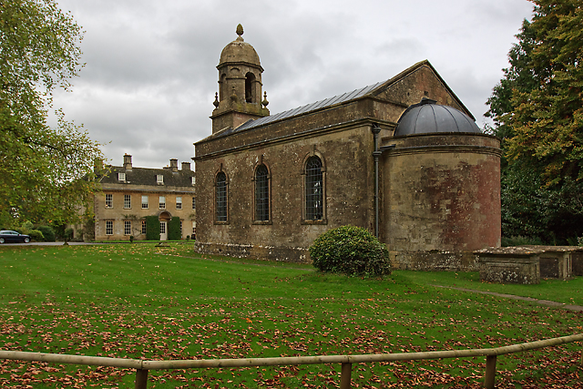
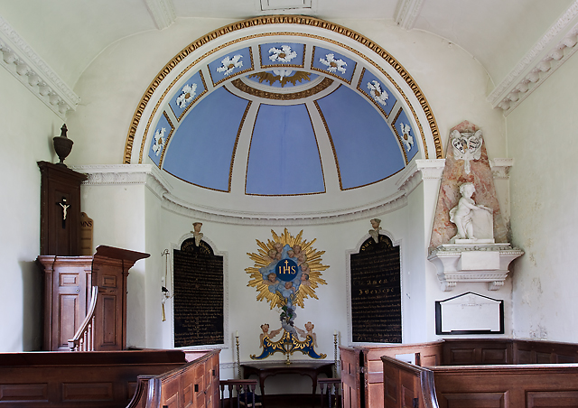
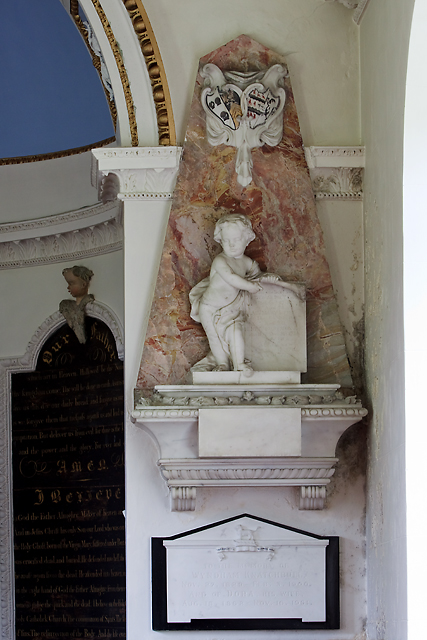
Ash Plantation Images

Images are sourced within 2km of 51.264238/-2.415947 or Grid Reference ST7151. Thanks to Geograph Open Source API. All images are credited.

Old Milepost by the B3139, Kilmersdon Hill Cast iron post by the B3139, in parish of KILMERSDON (MENDIP District), Kilmersdon Hill, near Kilmersdon Village, on grass verge in front of hedge, on South side of road. Radstock iron casting, erected by the Radstock turnpike trust in the 19th century. 

Inscription reads:-
: WELLS / 11 : : LONDON / 111 : : KILMERSDON : : TROWBRIDGE / 12 / DEVIZES / 22 :

Grade II listed.
List Entry Number: 1177856 <span class="nowrap"><a title="https://historicengland.org.uk/listing/the-list/list-entry/1177856" rel="nofollow ugc noopener" href="https://historicengland.org.uk/listing/the-list/list-entry/1177856">Link</a><img style="margin-left:2px;" alt="External link" title="External link - shift click to open in new window" src="https://s1.geograph.org.uk/img/external.png" width="10" height="10"/></span>

Milestone Society National ID: SO_LBWL111
Old Milepost by the B3139, Kilmersdon Hill
Cast iron post by the B3139, in parish of KILMERSDON (MENDIP District), Kilmersdon Hill, near Kilmersdon Village, on grass verge in front of hedge, on South side of road. Radstock iron casting, erected by the Radstock turnpike trust in the 19th century. Inscription reads:- : WELLS / 11 : : LONDON / 111 : : KILMERSDON : : TROWBRIDGE / 12 / DEVIZES / 22 : Grade II listed. List Entry Number: 1177856 LinkExternal link Milestone Society National ID: SO_LBWL111
Direction Sign – Signpost by the B3139 in Kilmersdon Located on the northeast side of the junction of the B3139 and Church Street in the village centre, Kilmersdon parish. 1 arm and pyramid finial. See <a title="https://www.geograph.org.uk/photo/6035483" href="https://www.geograph.org.uk/photo/6035483">Link</a> to see it before it was refurbished and the finial replaced.

Milestone Society National ID: SO_ST6952
Direction Sign – Signpost by the B3139 in Kilmersdon
Located on the northeast side of the junction of the B3139 and Church Street in the village centre, Kilmersdon parish. 1 arm and pyramid finial. See Link to see it before it was refurbished and the finial replaced. Milestone Society National ID: SO_ST6952
Direction Sign – Signpost on the B3139 in Kilmersdon parish Located on the west side of the junction of the B3139 and Knobsbury Hill in Kilmersdon parish. 4 arms and pyramid finial.

Milestone Society National ID: SO_ST7052B
Direction Sign – Signpost on the B3139 in Kilmersdon parish
Located on the west side of the junction of the B3139 and Knobsbury Hill in Kilmersdon parish. 4 arms and pyramid finial. Milestone Society National ID: SO_ST7052B
Direction Sign – Signpost on the B3139, Frome Road, A366 and A362 crossroads in Hemington parish Located on the west side of the crossroads of the B3139, Frome Road, A366 and A362 in Hemington parish. 6 arms and lost finial.

Milestone Society National ID: SO_ST7153
Direction Sign – Signpost on the B3139, Frome Road, A366 and A362 crossroads in Hemington parish
Located on the west side of the crossroads of the B3139, Frome Road, A366 and A362 in Hemington parish. 6 arms and lost finial. Milestone Society National ID: SO_ST7153
Old Milestone by A362, Buckland Down, North of Lodge to Ammerdown Park The Milestone is located on grass verge on the West of the road.  Parish of Hemington (Mendip  District). Metal plate attached to stone post, Radstock iron plate design, erected by the Radstock turnpike trust in the 18th century. Re-erected after being uprooted in 2001; repainted by a member of the public. An earlier photograph can be found here: <a title="https://www.geograph.org.uk/photo/6060915" href="https://www.geograph.org.uk/photo/6060915">Link</a> 

Inscription reads:-   
FROME / 5 / RADSTOCK / 3 

Grade II listed. List Entry Number: 1175774 <span class="nowrap"><a title="https://historicengland.org.uk/listing/the-list/list-entry/1175774" rel="nofollow ugc noopener" href="https://historicengland.org.uk/listing/the-list/list-entry/1175774">Link</a><img style="margin-left:2px;" alt="External link" title="External link - shift click to open in new window" src="https://s1.geograph.org.uk/img/external.png" width="10" height="10"/></span> 

Milestone Society National ID: SO_FRRS05
Old Milestone by A362, Buckland Down, North of Lodge to Ammerdown Park
The Milestone is located on grass verge on the West of the road.  Parish of Hemington (Mendip District). Metal plate attached to stone post, Radstock iron plate design, erected by the Radstock turnpike trust in the 18th century. Re-erected after being uprooted in 2001; repainted by a member of the public. An earlier photograph can be found here: Link  Inscription reads:- FROME / 5 / RADSTOCK / 3 Grade II listed. List Entry Number: 1175774 LinkExternal link Milestone Society National ID: SO_FRRS05
Track, Napp Wood The woodland, part of the Ammerdown Estate is open for the public.
Track, Napp Wood
The woodland, part of the Ammerdown Estate is open for the public.
Church of St. Peter and St. Paul The origin of the church is in the Norman period, but the main fabric dates from the 15th and 16th centuries with major restoration taking place in the 19th century.  The four stage tower has an embattled top with pinnacles.
Church of St. Peter and St. Paul
The origin of the church is in the Norman period, but the main fabric dates from the 15th and 16th centuries with major restoration taking place in the 19th century. The four stage tower has an embattled top with pinnacles.
Lychgate, Church of St Peter and St Paul The design of the lychgate symbolizes the Trinity and it was designed in 1900 by Sir Edwin Lutyens (29 March 1869 – 1 January 1944) for the Hylton family.

Many churches have a lych gate built over the main entrance to the enclosed area round the church. The name, also spelt lich or lytch, is from the Anglo Saxon 'lich' meaning corpse. The gate marks the division between consecrated and unconsecrated ground, where the bearers sheltered with the coffin, waiting for the clergyman to lead the procession before the burial. The original lych gates had seats, a lych cross and a lych stone - a slab on which the coffin rested.
Lychgate, Church of St Peter and St Paul
The design of the lychgate symbolizes the Trinity and it was designed in 1900 by Sir Edwin Lutyens (29 March 1869 – 1 January 1944) for the Hylton family. Many churches have a lych gate built over the main entrance to the enclosed area round the church. The name, also spelt lich or lytch, is from the Anglo Saxon 'lich' meaning corpse. The gate marks the division between consecrated and unconsecrated ground, where the bearers sheltered with the coffin, waiting for the clergyman to lead the procession before the burial. The original lych gates had seats, a lych cross and a lych stone - a slab on which the coffin rested.
Door, Church of St Peter and St Paul This is the west door to the church which is to be found under the tower.  For a wider view of the church <a href="https://www.geograph.org.uk/photo/2690088">ST6952 : Church of St. Peter and St. Paul</a>
Door, Church of St Peter and St Paul
This is the west door to the church which is to be found under the tower. For a wider view of the church ST6952 : Church of St. Peter and St. Paul
Detail, Church of St Peter and St Paul The boot scraper is set beside the west door.  For a wider view <a href="https://www.geograph.org.uk/photo/2690158">ST6952 : Door, Church of St Peter and St Paul</a>

These metal objects are prized by antique dealers, revered by history buffs, but are an object of puzzlement to many a 21st century pedestrian.
Detail, Church of St Peter and St Paul
The boot scraper is set beside the west door. For a wider view ST6952 : Door, Church of St Peter and St Paul These metal objects are prized by antique dealers, revered by history buffs, but are an object of puzzlement to many a 21st century pedestrian.
Bench Mark, Church of St Peter and St Paul The Ordnance Survey bench mark is to be found on the south west face of the church.  For a wider view <a href="https://www.geograph.org.uk/photo/2690088">ST6952 : Church of St. Peter and St. Paul</a> and for further information on the cut mark and others in the area <span class="nowrap"><a title="http://www.bench-marks.org.uk/bm31103" rel="nofollow ugc noopener" href="http://www.bench-marks.org.uk/bm31103">Link</a><img style="margin-left:2px;" alt="External link" title="External link - shift click to open in new window" src="https://s1.geograph.org.uk/img/external.png" width="10" height="10"/></span>
Bench Mark, Church of St Peter and St Paul
The Ordnance Survey bench mark is to be found on the south west face of the church. For a wider view ST6952 : Church of St. Peter and St. Paul and for further information on the cut mark and others in the area LinkExternal link
Gargoyle, Church of St Peter and St Paul The gargoyle is to be found on the church tower.
Gargoyle, Church of St Peter and St Paul
The gargoyle is to be found on the church tower.
St Margaret's parish church and Babington House St Margaret's Church was constructed in c1750 by an unknown architect (possibly to the design of John Strahan or William Halfpenny). The adjacent Babington House was built c1705 for Henry Mompesson and underwent updating later in the mid-C18, and again more radically in 1790 when the house and its park was in the hands of the Knatchbull family. Successive members of this family remained in possession until 1952 when the house and immediate grounds were sold. The house was bought in 1998 and converted into a hotel, private members club, and wedding venue. Many celebrity weddings have taken place here, with the redundant St Margaret's Church being brought into use (but not exclusively) for their wedding services. As well as serving Babington House, the church still hosts the occasional baptism and funeral service, as well as burials in existing graves within the cemetery.
St Margaret's parish church and Babington House
St Margaret's Church was constructed in c1750 by an unknown architect (possibly to the design of John Strahan or William Halfpenny). The adjacent Babington House was built c1705 for Henry Mompesson and underwent updating later in the mid-C18, and again more radically in 1790 when the house and its park was in the hands of the Knatchbull family. Successive members of this family remained in possession until 1952 when the house and immediate grounds were sold. The house was bought in 1998 and converted into a hotel, private members club, and wedding venue. Many celebrity weddings have taken place here, with the redundant St Margaret's Church being brought into use (but not exclusively) for their wedding services. As well as serving Babington House, the church still hosts the occasional baptism and funeral service, as well as burials in existing graves within the cemetery.
St Margaret's parish church, Babington St Margaret's Church was built in c1750 by Mrs Elizabeth Long when she inherited Babington House on the death of her uncle Henry Mompesson. At the same time the remains of the old declining medieval village of Babington was cleared away in order to create a park. Baroque in style, the church's design is similar to that of Redland Chapel, Bristol, perhaps indicating Mrs Long's family connections with that city.

The church stands adjacent to Babington House but separate from it within its own churchyard and cemetery, with the grounds of the house bordering it on three sides. It is owned and operated by the St. Margaret's, Babington, Charitable Trust and has been since 1993, following its legal redundancy by the Church of England. Members of the Trust include representatives of the Knatchbull and Jennings families who previously owned Babington House. The church is used mainly for weddings, and Wedding Blessings for clients of Babington House, although it is by no means for their exclusive use. The Church is also used for numerous other religious purposes, including baptisms and funerals, and although the churchyard is legally a Closed Churchyard, burials still take place in existing graves in the attached cemetery.
St Margaret's parish church, Babington
St Margaret's Church was built in c1750 by Mrs Elizabeth Long when she inherited Babington House on the death of her uncle Henry Mompesson. At the same time the remains of the old declining medieval village of Babington was cleared away in order to create a park. Baroque in style, the church's design is similar to that of Redland Chapel, Bristol, perhaps indicating Mrs Long's family connections with that city. The church stands adjacent to Babington House but separate from it within its own churchyard and cemetery, with the grounds of the house bordering it on three sides. It is owned and operated by the St. Margaret's, Babington, Charitable Trust and has been since 1993, following its legal redundancy by the Church of England. Members of the Trust include representatives of the Knatchbull and Jennings families who previously owned Babington House. The church is used mainly for weddings, and Wedding Blessings for clients of Babington House, although it is by no means for their exclusive use. The Church is also used for numerous other religious purposes, including baptisms and funerals, and although the churchyard is legally a Closed Churchyard, burials still take place in existing graves in the attached cemetery.
St Margaret's church, Babington - the nave The furnishings are all original, box pews, altar rails, and pulpit.
St Margaret's church, Babington - the nave
The furnishings are all original, box pews, altar rails, and pulpit.
St Margaret's church, Babington - the chancel The chancel is contained within a domed shallow apse containing a stuccoed 'rays of glory' cartouche in place of a reredos.
St Margaret's church, Babington - the chancel
The chancel is contained within a domed shallow apse containing a stuccoed 'rays of glory' cartouche in place of a reredos.
St Margaret's church, Babington - Pacey-Mompesson monument The memorial commemorates members of the Pacey and Mompesson families who were related by marriage. Thomas Pacey (†1687) was the C17 owner of the manor of Babington, and was married to wife Mary. The estate eventually passed to Elizabeth, the wife of Henry Mompesson of Corston, Wiltshire, Sheriff of Somerset in 1698, who built Babington House in c1705. Both are also commemorated; Henry died in 1715, his wife Elizabeth in 1726.
St Margaret's church, Babington - Pacey-Mompesson monument
The memorial commemorates members of the Pacey and Mompesson families who were related by marriage. Thomas Pacey (†1687) was the C17 owner of the manor of Babington, and was married to wife Mary. The estate eventually passed to Elizabeth, the wife of Henry Mompesson of Corston, Wiltshire, Sheriff of Somerset in 1698, who built Babington House in c1705. Both are also commemorated; Henry died in 1715, his wife Elizabeth in 1726.
St Margaret's church, Babington - Royal Arms The Royal Arms of George II is plastered in relief at the west end.
St Margaret's church, Babington - Royal Arms
The Royal Arms of George II is plastered in relief at the west end.
Show me another place!

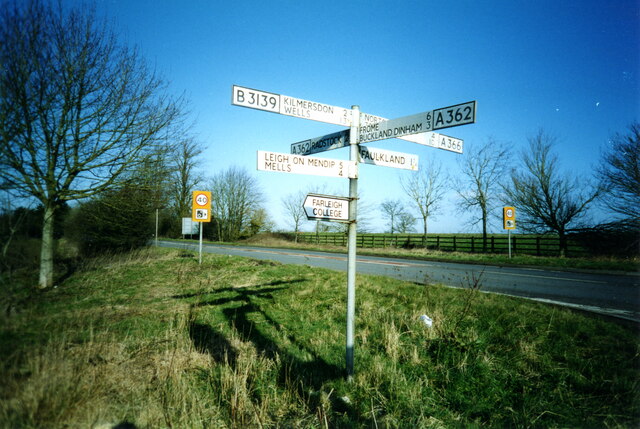
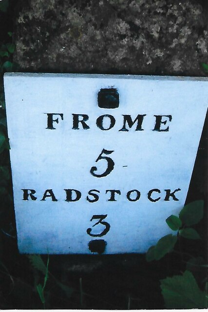
Ash Plantation is located at Grid Ref: ST7151 (Lat: 51.264238, Lng: -2.415947)

Administrative County: Somerset

District: Mendip

Police Authority: Avon and Somerset

What 3 Words

///spellings.promoted.tame. Near Radstock, Somerset

Related Wikis

Mells Road railway station

Mells Road railway station served the village of Mells, Somerset, England from 1875 to 1959 linking Radstock to Frome, Somerset on the Heart of Wessex...

Babington, Somerset

Babington is a small village between Radstock and Frome, Somerset, England, which has now largely disappeared. == History == In 1233 or 1234 much of the...

Kingsdown Camp

Kingsdown Camp is an Iron Age hillfort at Buckland Dinham 4.5 kilometres (3 mi) South East of Radstock, Somerset, England. It is a Scheduled Monument.It...

Ammerdown House, Kilmersdon

Ammerdown House in Kilmersdon, Somerset, England, was built in 1788. It has been designated as Grade I listed building.It was built as a country house...

Babington House

Babington House is a Grade II* listed manor house, located in the village of Babington, between Radstock and Frome, in the county of Somerset, England...

Kilmersdon

Kilmersdon is a village and civil parish on the north eastern slopes of the Mendip Hills in Somerset between the towns of Radstock and Frome. It is located...

Newbury Manor School

Newbury Manor School, formerly Farleigh College, is a mainly residential special school for pupils with Asperger syndrome, situated at Newbury, near Mells...

St Mary's Church, Hemington

St. Mary's Hemington is an Anglican church in Hemington, Somerset, England. The Norman church underwent major renovation in the 14th, 15th, 17th and 19th...

Nearby Amenities

Located within 500m of 51.264238,-2.415947
Railway: crossing
Lat/Long: 51.264259/-2.4192212
Bench
Lat/Long: 51.2642754/-2.419339
Bench
Lat/Long: 51.2641789/-2.4191164
The data included in this document is from www.openstreetmap.org. The data is made available under ODbL.

Have you been to Ash Plantation?

Leave your review of Ash Plantation below (or comments, questions and feedback).