Dannys Wood

Wood, Forest in Gloucestershire Forest of Dean

England

Dannys Wood

Newent Community School, 1 Main block photographed during the summer holidays, 2021.
Newent Community School, 1 Credit: Jonathan Billinger

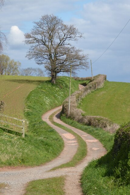
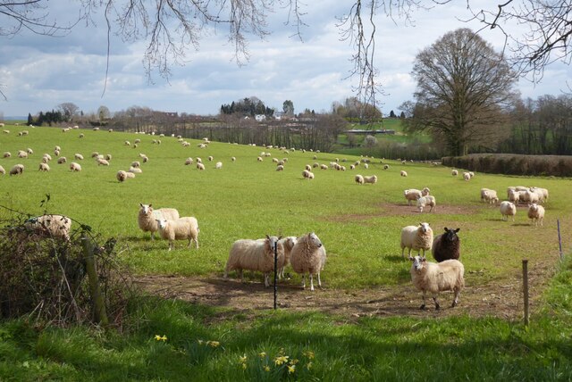
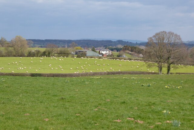
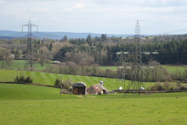
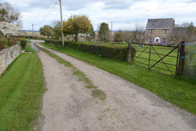
Dannys Wood is a picturesque forest located in the county of Gloucestershire, England. Situated near the village of Wood, this woodland area covers an approximate area of 100 acres. It is a popular destination for nature lovers, hikers, and birdwatchers due to its serene and tranquil environment.

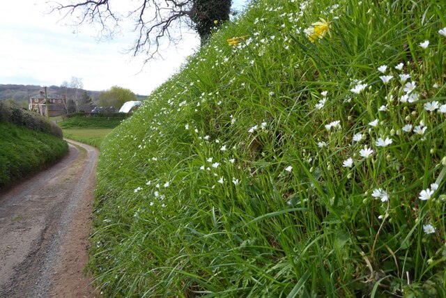
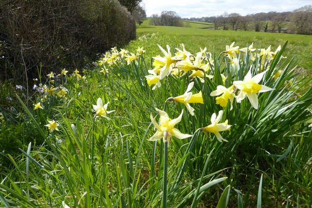
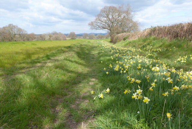
The wood is predominantly composed of native broadleaf trees, including oak, beech, and birch, which create a dense canopy and provide shelter for a variety of wildlife. The forest floor is adorned with a diverse range of flora, such as bluebells, primroses, and ferns, adding to the natural beauty of the area.

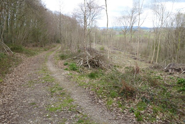
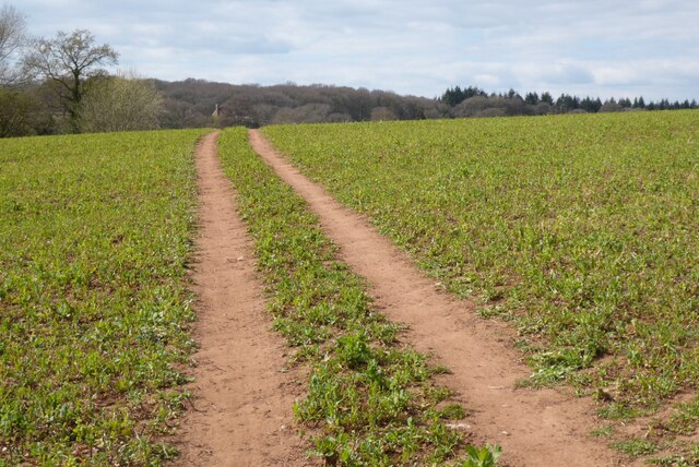
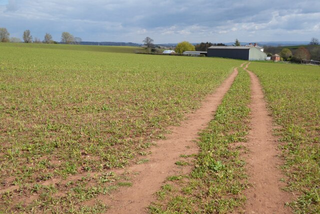
Trails and footpaths crisscross the wood, offering visitors the opportunity to explore its hidden corners and discover its enchanting features. The pathways are well-maintained, making it accessible for people of all ages and abilities.

Bird enthusiasts will be delighted by the presence of numerous species that inhabit the wood, including woodpeckers, song thrushes, and tawny owls. The forest also supports a rich population of small mammals, such as badgers, foxes, and squirrels.

Dannys Wood holds great historical significance as well. It is believed to have been part of a larger medieval hunting ground, which adds an intriguing element to its allure. Additionally, the wood has been managed sustainably for many years, ensuring the preservation of its natural habitat and biodiversity.

Overall, Dannys Wood in Gloucestershire offers a peaceful retreat for anyone seeking to immerse themselves in nature, explore its trails, or simply enjoy the tranquil ambiance of a beautiful woodland setting.

If you have any feedback on the listing, please let us know in the comments section below.
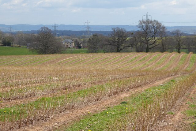
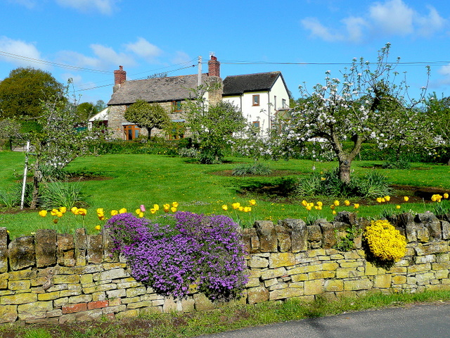
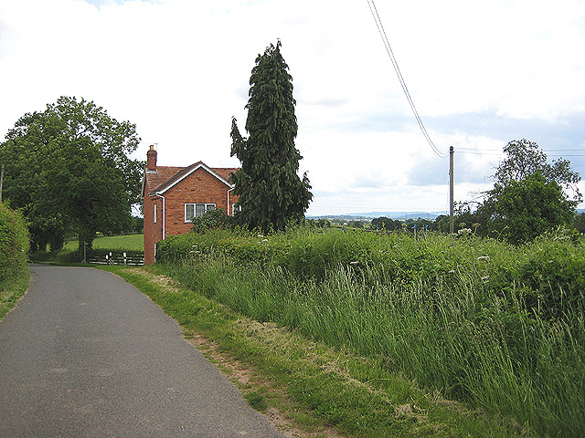
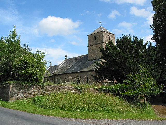
Dannys Wood Images

Images are sourced within 2km of 51.913029/-2.4261341 or Grid Reference SO7023. Thanks to Geograph Open Source API. All images are credited.

Newent Community School, 1 Main block photographed during the summer holidays, 2021.
Newent Community School, 1
Main block photographed during the summer holidays, 2021.
Newent Community School, 2 Main block photographed during the summer holidays, 2021.
Newent Community School, 2
Main block photographed during the summer holidays, 2021.
The start of the 2022 Snowdrops Galanthus nivalis emerging in late January.
The start of the 2022 Snowdrops
Galanthus nivalis emerging in late January.
A fine display of Snowdrops This spot always has a great show of Galanthus nivalis, see <a href="https://www.geograph.org.uk/photo/6758671">SO7222 : Snowdrops by Cugley Cottage, 2</a> from 2021.
A fine display of Snowdrops
This spot always has a great show of Galanthus nivalis, see SO7222 : Snowdrops by Cugley Cottage, 2 from 2021.
A fine display of wild daffodils This spot near Ploddy House was the scene of an equally fine carpet of snowdrops six weeks earlier. See <a href="https://www.geograph.org.uk/photo/7097861">SO7222 : A fine display of Snowdrops</a>.
A fine display of wild daffodils
This spot near Ploddy House was the scene of an equally fine carpet of snowdrops six weeks earlier. See SO7222 : A fine display of Snowdrops.
Farm drive to Knappers Farm The winding farm drive leading to Knappers Farm near Newent.  A public footpath follows this drive.
Farm drive to Knappers Farm
The winding farm drive leading to Knappers Farm near Newent. A public footpath follows this drive.
Spring blooms on the roadside The farm drive to Knappers Farm has become sunken, no doubt from centuries of use.  Spring bloom as colour to the grass bank.  The farmhouse can be seen in the background.
Spring blooms on the roadside
The farm drive to Knappers Farm has become sunken, no doubt from centuries of use. Spring bloom as colour to the grass bank. The farmhouse can be seen in the background.
Wild daffodils Wild daffodils beside a field hedgerow near Knappers Farm.
Wild daffodils
Wild daffodils beside a field hedgerow near Knappers Farm.
Daffodils and a footpath This footpath near Knappers Farm is the route of the Geopark Way.  Wild daffodils are a feature of this corner of Gloucestershire.
Daffodils and a footpath
This footpath near Knappers Farm is the route of the Geopark Way. Wild daffodils are a feature of this corner of Gloucestershire.
Sheep near Knappers Farm Sheep in a field beside the Geopark Way to the south-west of Knappers Farm.
Sheep near Knappers Farm
Sheep in a field beside the Geopark Way to the south-west of Knappers Farm.
Farmland around Knappers Farm View to the north-east from the Geopark Way where it enters Acorn Wood.  Sheep graze a field in the middle distance with Knappers Farm beyond.  The spire of Newent Church can be seen to the left of centre.
Farmland around Knappers Farm
View to the north-east from the Geopark Way where it enters Acorn Wood. Sheep graze a field in the middle distance with Knappers Farm beyond. The spire of Newent Church can be seen to the left of centre.
Bradfords Cottage An early 17th century timber-framed thatched cottage just outside Newent.  The cottage is Grade II listed, see: <span class="nowrap"><a title="https://historicengland.org.uk/listing/the-list/list-entry/1172282?section=official-list-entry" rel="nofollow ugc noopener" href="https://historicengland.org.uk/listing/the-list/list-entry/1172282?section=official-list-entry">Link</a><img style="margin-left:2px;" alt="External link" title="External link - shift click to open in new window" src="https://s1.geograph.org.uk/img/external.png" width="10" height="10"/></span>
Bradfords Cottage
An early 17th century timber-framed thatched cottage just outside Newent. The cottage is Grade II listed, see: LinkExternal link
Footpath through Acorn Word The Geopark Way follows this footpath through Acorn Wood to the south of Newent.  Here the wood is partially felled.
Footpath through Acorn Word
The Geopark Way follows this footpath through Acorn Wood to the south of Newent. Here the wood is partially felled.
Farm buildings Farm buildings and electricity pylons near Clifford Mesne.
Farm buildings
Farm buildings and electricity pylons near Clifford Mesne.
Footpath crossing an arable field The Geopark Way follows this footpath across this field near Knappers Farm.
Footpath crossing an arable field
The Geopark Way follows this footpath across this field near Knappers Farm.
Footpath approaching Knappers Farm The Geopark Way follows this footpath approaching Knappers Farm.
Footpath approaching Knappers Farm
The Geopark Way follows this footpath approaching Knappers Farm.
Footpath and track Footpath and track near Clifford's Mesne.
Footpath and track
Footpath and track near Clifford's Mesne.
Farmland near Clifford's Mesne I am not sure what the bushes are in this field, possibly currents.
Farmland near Clifford's Mesne
I am not sure what the bushes are in this field, possibly currents.
Show me another place!

Dannys Wood is located at Grid Ref: SO7023 (Lat: 51.913029, Lng: -2.4261341)

Administrative County: Gloucestershire

District: Forest of Dean

Police Authority: Gloucestershire

What 3 Words

///spaceship.convert.brew. Near Newent, Gloucestershire

Related Wikis

Boulsdon

Boulsdon is a village in Gloucestershire, England. It is the location of the International Centre for Birds of Prey.A low mound in the village may have...

Anthony's Cross

Anthony's Cross is a hamlet in Gloucestershire, England. == External links == Media related to Anthony's Cross at Wikimedia Commons

Cliffords Mesne

Cliffords Mesne is an English village in Gloucestershire, two miles (3.2 km) south-west of the town of Newent. It became the home of the autobiographical...

Aston Ingham

Aston Ingham is a village in south-eastern Herefordshire, England, near Newent and about 7 miles (11 km) east of Ross-on-Wye. The population of the village...

Newent Community School

Newent Community School is a secondary school in Newent, Gloucestershire, England. It is an Academy of 1,340 students, serving the town and the rural...

Gorsley and Kilcot

Gorsley and Kilcot is a civil parish forming part of the district of the Forest of Dean in the English county of Gloucestershire. The single parish of...

Newent

Newent (; originally called "Noent") is a market town and civil parish in the Forest of Dean in Gloucestershire, England. The town is 11 miles (18 km)...

Newent railway station

Newent railway station served the town of Newent in Gloucestershire, England. It opened on 27 July 1885 when the Newent Railway and the Ross and Ledbury...

Nearby Amenities

Located within 500m of 51.913029,-2.4261341
Bus Stop
Falconry Centre
Naptan AtcoCode: 1600GL3433
Naptan Bearing: NE
Naptan CommonName: Falconry Centre
Naptan Indicator: Opp
Naptan NaptanCode: gloamjwa
Naptan Street: Newent Rd
Naptan Verified: no
Source: naptan_import
Lat/Long: 51.9139862/-2.4287315
Bus Stop
Falconry Centre
Naptan AtcoCode: 1600GL3434
Naptan Bearing: SW
Naptan CommonName: Falconry Centre
Naptan NaptanCode: gloamjwd
Naptan Street: Newent Rd
Naptan Verified: no
Source: naptan_import
Lat/Long: 51.9139323/-2.4287165
Bus Stop
Woodbar Cottage
Naptan AtcoCode: 1600GLF043
Naptan Bearing: N
Naptan CommonName: Woodbar Cottage
Naptan NaptanCode: gloamjmw
Naptan Street: Newent Rd
Naptan Verified: no
Source: naptan_import
Lat/Long: 51.9118809/-2.4315755
Bus Stop
Woodbar Cottage
Naptan AtcoCode: 1600GLF044
Naptan Bearing: S
Naptan CommonName: Woodbar Cottage
Naptan Indicator: Opp
Naptan NaptanCode: gloamjpa
Naptan Street: Newent Rd
Naptan Verified: no
Source: naptan_import
Lat/Long: 51.9117462/-2.431516
Power: tower
Source: Bing
Lat/Long: 51.9087086/-2.4246963
Post Box
Collection Times: Mo-Fr 17:00; Sa 09:00
Post Box Type: lamp
Ref: GL18 230
Royal Cypher: EIIR
Royal Cypher Wikidata: Q33102113
Lat/Long: 51.917186/-2.4235956
Barrier: cattle_grid
Lat/Long: 51.9093493/-2.4227369
Power: pole
Lat/Long: 51.9107589/-2.4320877
Power: pole
Lat/Long: 51.9109971/-2.4314339
Power: pole
Lat/Long: 51.9113926/-2.4308699
Green Farm Newent
Power: pole
Transformer: distribution
Voltage Primary: 11000
Lat/Long: 51.9101913/-2.4211409
Boulsdon House
Power: pole
Transformer: distribution
Voltage Primary: 11000
Lat/Long: 51.9125045/-2.4283594
Location Transition: yes
Power: pole
Lat/Long: 51.9137913/-2.4253935
Power: pole
Lat/Long: 51.9143832/-2.425295
Power: pole
Lat/Long: 51.914889/-2.4252286
Power: pole
Lat/Long: 51.9153982/-2.4251407
Boulsdon
Power: pole
Transformer: distribution
Voltage Primary: 11000
Lat/Long: 51.9157411/-2.4252279
Power: pole
Lat/Long: 51.9161567/-2.4253218
Power: pole
Lat/Long: 51.9167465/-2.4254747
The data included in this document is from www.openstreetmap.org. The data is made available under ODbL.

Have you been to Dannys Wood?

Leave your review of Dannys Wood below (or comments, questions and feedback).