Bents Wood

Wood, Forest in Yorkshire South Lakeland

England

Bents Wood

Walking path beside coniferous plantation The walkers are descending on a track over moorland into Garsdale following an ascent to Aye Gill Pike.
Walking path beside coniferous plantation Credit: Trevor Littlewood

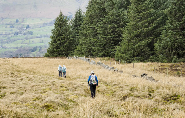
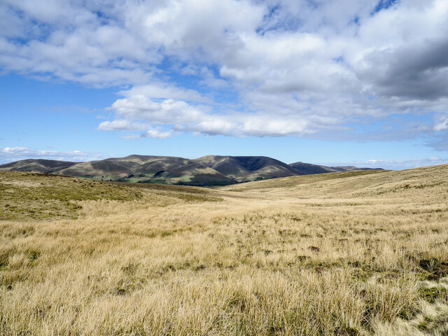
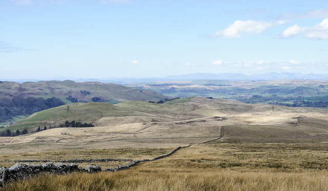
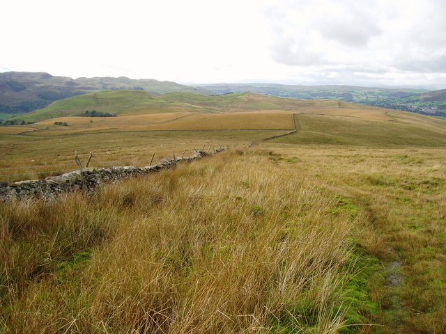
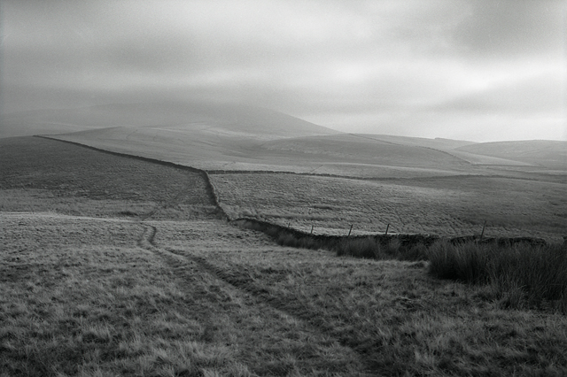
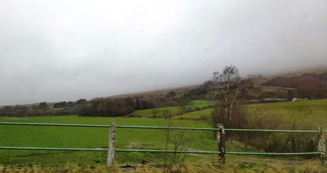
Bents Wood is a picturesque forest located in Yorkshire, England. Situated in the heart of the region, it covers an expansive area of land, offering visitors a serene and tranquil environment to explore and enjoy.

The wood is characterized by its dense and diverse vegetation, consisting of a variety of tree species such as oak, beech, and birch. The towering trees provide ample shade and create a captivating canopy, allowing rays of sunlight to filter through and create a beautiful dappled effect on the forest floor.

Bents Wood is renowned for its rich biodiversity, serving as a habitat for numerous plant and animal species. The forest is home to a diverse array of wildlife, including deer, squirrels, badgers, and a wide range of bird species. Birdwatchers are particularly drawn to the area, as it offers excellent opportunities for spotting rare and migratory bird species.

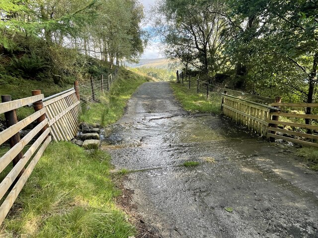
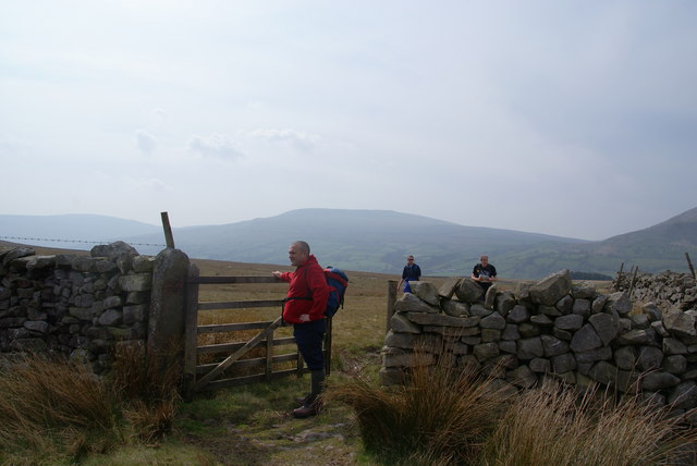
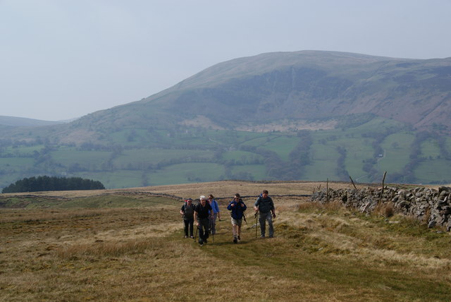
The wood is also a popular destination for outdoor enthusiasts and nature lovers. It boasts a network of well-maintained walking trails, allowing visitors to explore the forest at their own pace. These trails wind through the wood, offering breathtaking views of the surrounding landscape and providing an opportunity to immerse oneself in the peaceful ambiance of the natural surroundings.

Bents Wood is not only a haven for wildlife and nature enthusiasts but also a place of historical significance. The forest has witnessed human activity for centuries and contains remnants of ancient settlements, including burial mounds and archaeological sites. These historical elements add an intriguing layer to the overall experience of exploring the wood.

Overall, Bents Wood in Yorkshire is a captivating destination that offers a delightful blend of natural beauty, biodiversity, and historical significance. Whether one seeks peaceful solitude, a chance to connect with nature, or a glimpse into the region's past, this enchanting forest has something to offer for everyone.

If you have any feedback on the listing, please let us know in the comments section below.
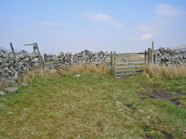
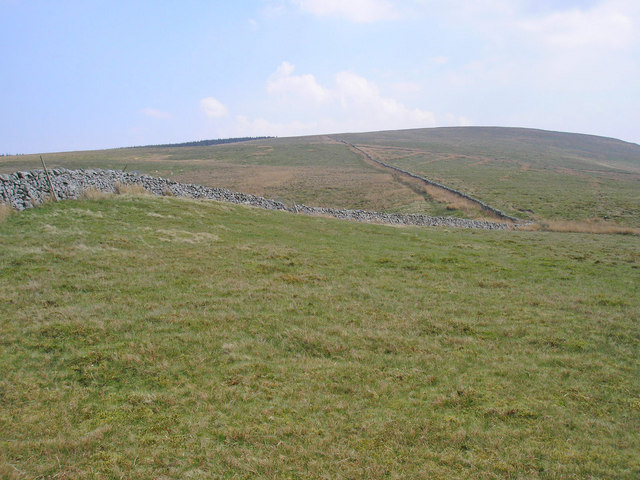
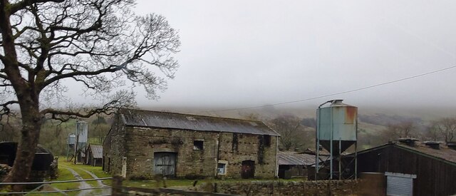
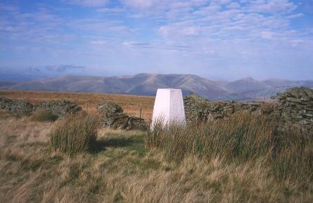
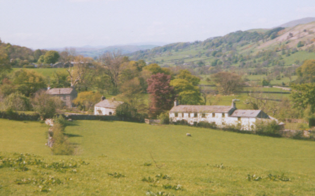
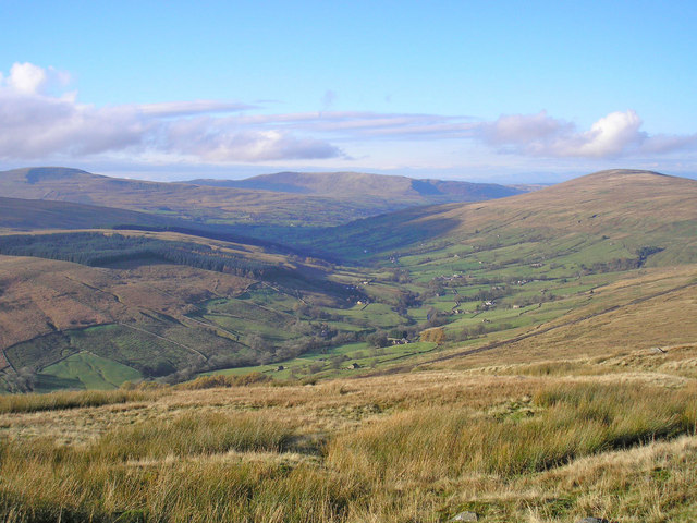
Bents Wood Images

Images are sourced within 2km of 54.314688/-2.4588175 or Grid Reference SD7091. Thanks to Geograph Open Source API. All images are credited.

Walking path beside coniferous plantation The walkers are descending on a track over moorland into Garsdale following an ascent to Aye Gill Pike.
Walking path beside coniferous plantation
The walkers are descending on a track over moorland into Garsdale following an ascent to Aye Gill Pike.
Valley of Holebeck Gill The shallow, upper valley of Holebeck Gill heading north to where it will meet the Clough River which drains Garsdale.
The Howgill Fells are in the distance beyond both the Clough River and the River Rawthey.
Valley of Holebeck Gill
The shallow, upper valley of Holebeck Gill heading north to where it will meet the Clough River which drains Garsdale. The Howgill Fells are in the distance beyond both the Clough River and the River Rawthey.
Gillfeet Gill Ford This ford is found on the road crossing Gillfeet Gill.
Gillfeet Gill Ford
This ford is found on the road crossing Gillfeet Gill.
Old milestone This West Riding CC milestone on the A684 is on a narrow verge at Bellow End on the south side of the road.   Although now leaning slightly backwards it is set to almost its full height with 20cm of backing stone set into the ground.   Going down Garsdale the previous milestone, Hawes 11/Sedbergh 5 is the only one lost from this route which was ceded to Cumbria in 1974.
It is Grade II listed 1384040.
Old milestone
This West Riding CC milestone on the A684 is on a narrow verge at Bellow End on the south side of the road. Although now leaning slightly backwards it is set to almost its full height with 20cm of backing stone set into the ground. Going down Garsdale the previous milestone, Hawes 11/Sedbergh 5 is the only one lost from this route which was ceded to Cumbria in 1974. It is Grade II listed 1384040.
Old milestone Of the 8 remaining West Riding CC milestones from Ribblehead viaduct to Sedbergh, on the A684, this is the only one with a foundry name.   WILLIAM TOWLER/GLOBE FOUNDRY/LEEDS.
Old milestone
Of the 8 remaining West Riding CC milestones from Ribblehead viaduct to Sedbergh, on the A684, this is the only one with a foundry name. WILLIAM TOWLER/GLOBE FOUNDRY/LEEDS.
Old milestone The Hawes 13 milestone on the A684 has its back to a drystone wall near Nether House on the south side of the road.   615 of these milestones were set up for the West Riding County Council in 1893/94 not long after the formation of County Councils.   Gill and Frank Stead, stonemasons, of Mirfield won the contract which stated that the work had to be done in 12 months or they would incur a penalty.   Considering the size of the West Riding that was a tremendous feat but they succeeded.   The WRCC didn't always have stones erected on old tollroads.   They wanted to promote new trade routes.   It is Grade II listed 1384039.
Old milestone
The Hawes 13 milestone on the A684 has its back to a drystone wall near Nether House on the south side of the road. 615 of these milestones were set up for the West Riding County Council in 1893/94 not long after the formation of County Councils. Gill and Frank Stead, stonemasons, of Mirfield won the contract which stated that the work had to be done in 12 months or they would incur a penalty. Considering the size of the West Riding that was a tremendous feat but they succeeded. The WRCC didn't always have stones erected on old tollroads. They wanted to promote new trade routes. It is Grade II listed 1384039.
Moorland of north-west ridge of Aye Gill Pike Aye Gill Pike is the high point of a long ridge oriented almost north-west to south east between two valleys, Garsdale and Dentdale. The broad western end of the ridge is seen here, descending towards Sedbergh.
Moorland of north-west ridge of Aye Gill Pike
Aye Gill Pike is the high point of a long ridge oriented almost north-west to south east between two valleys, Garsdale and Dentdale. The broad western end of the ridge is seen here, descending towards Sedbergh.
Western slope of Aye Gill Pike A faint track runs beside the wall running to the summit of Aye Gill Pike. This path has been well walked before the introduction of open access, but now a number of stiles have been built over the cross walls.
Western slope of Aye Gill Pike
A faint track runs beside the wall running to the summit of Aye Gill Pike. This path has been well walked before the introduction of open access, but now a number of stiles have been built over the cross walls.
Bridleway junction A gate at the junction of two bridleways between Dentdale and Garsdale.
Bridleway junction
A gate at the junction of two bridleways between Dentdale and Garsdale.
The slopes of Aye Gill Pike The track up the fell can be seen to the left of the wall.
The slopes of Aye Gill Pike
The track up the fell can be seen to the left of the wall.
A gateway through the wall This is where you reach the top of the ridge, and suddenly get views of the Howgills.
A gateway through the wall
This is where you reach the top of the ridge, and suddenly get views of the Howgills.
Climbing to the top of the ridge on Long Moor Dominating the background is Calf Top with Combe Scar on its side.
Climbing to the top of the ridge on Long Moor
Dominating the background is Calf Top with Combe Scar on its side.
Stone walls on slopes of Aye Gill Pike
Old Milestone by the A684 near Bellow End Metal plate attached to stone post by the A684, in parish of Garsdale (South Lakeland District), 20m West of Bellow Hill Turn, Thwaite Head Gill, on narrow verge, on South side of road. Sedburgh V iron casting, erected by the County Council in the 19th century. 

Inscription reads:-
: SEDBERGH / 4 MILES : : SEDBERGH & HAWES / ROAD / GARSDALE : : HAWES / 12 MILES : 

Grade II listed.
List Entry Number: 1384040 <span class="nowrap"><a title="https://historicengland.org.uk/listing/the-list/list-entry/1384040" rel="nofollow ugc noopener" href="https://historicengland.org.uk/listing/the-list/list-entry/1384040">Link</a><img style="margin-left:2px;" alt="External link" title="External link - shift click to open in new window" src="https://s1.geograph.org.uk/img/external.png" width="10" height="10"/></span>

Milestone Society National ID: YW_HWSB12
Old Milestone by the A684 near Bellow End
Metal plate attached to stone post by the A684, in parish of Garsdale (South Lakeland District), 20m West of Bellow Hill Turn, Thwaite Head Gill, on narrow verge, on South side of road. Sedburgh V iron casting, erected by the County Council in the 19th century. Inscription reads:- : SEDBERGH / 4 MILES : : SEDBERGH & HAWES / ROAD / GARSDALE : : HAWES / 12 MILES : Grade II listed. List Entry Number: 1384040 LinkExternal link Milestone Society National ID: YW_HWSB12
Old Milestone by the A684, Garsdale Milestone by the A684, in parish of Garsdale (Eden District), Ex. Yorkshire West Riding, near Nether House, back to drystone wall.

Inscription reads:-
: SEDBERGH / 3 MILES : : SEDBERGH & HAWES / ROAD / GARSDALE : : HAWES / 13 MILES :

Grade II listed.
List Entry Number: 1384039 <span class="nowrap"><a title="https://historicengland.org.uk/listing/the-list/list-entry/1384039" rel="nofollow ugc noopener" href="https://historicengland.org.uk/listing/the-list/list-entry/1384039">Link</a><img style="margin-left:2px;" alt="External link" title="External link - shift click to open in new window" src="https://s1.geograph.org.uk/img/external.png" width="10" height="10"/></span>

Milestone Society National ID: YW_HWSB13
Old Milestone by the A684, Garsdale
Milestone by the A684, in parish of Garsdale (Eden District), Ex. Yorkshire West Riding, near Nether House, back to drystone wall. Inscription reads:- : SEDBERGH / 3 MILES : : SEDBERGH & HAWES / ROAD / GARSDALE : : HAWES / 13 MILES : Grade II listed. List Entry Number: 1384039 LinkExternal link Milestone Society National ID: YW_HWSB13
Fields near Bellow End
Farm Buildings at Kiln Haw
Grazing, Bellow Hill
Show me another place!

Bents Wood is located at Grid Ref: SD7091 (Lat: 54.314688, Lng: -2.4588175)

Division: West Riding

Administrative County: Cumbria

District: South Lakeland

Police Authority: Cumbria

What 3 Words

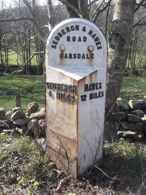
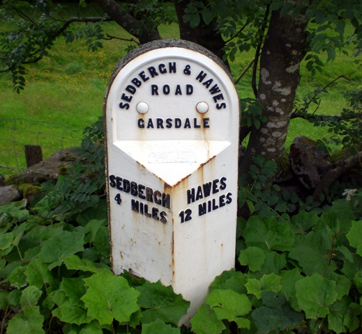
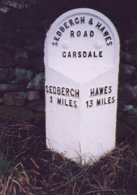
///managed.tradition.novel. Near Sedbergh, Cumbria

Nearby Locations

Bents Wood

Related Wikis

Clough River

The Clough River is a river in Cumbria, England. A tributary of the River Rawthey, it flows for 21.8 kilometres (13.5 mi) primarily through the Garsdale...

Aye Gill Pike

Aye Gill Pike is a Marilyn in the Yorkshire Dales, the highest point of the ridge of Rise Hill between Dentdale and Garsdale in Cumbria, England.

Baugh Fell

Baugh Fell (, or locally ) is a large, flat-topped hill in the northern Pennines of England. It lies in the north-western corner of the Yorkshire Dales...

Gawthrop

Gawthrop is a hamlet in the South Lakeland district, in the county of Cumbria, England. Historically part of the West Riding of Yorkshire, it lies within...

Settlebeck School

Settlebeck School is a small coeducational secondary school with academy status. It is located in Sedbergh in the English county of Cumbria, drawing pupils...

St Andrew's Church, Dent

St Andrew's Church is in the village of Dent, Cumbria, England. It is an active Anglican parish church in the Western Dales Mission Community in the deanery...

Dentdale

Dentdale is a dale or valley in the north-west of the Yorkshire Dales National Park in Cumbria, England. It is the valley of the River Dee, but takes...

Millthrop

Millthrop is a hamlet in the South Lakeland district of Cumbria, Northern England and the Yorkshire Dales. Millthrop lies on the south bank of the River...

Nearby Amenities

Located within 500m of 54.314688,-2.4588175
Barrier: cattle_grid
Source: survey
Lat/Long: 54.3164531/-2.4650553
Generator Method: photovoltaic
Generator Orientation: south
Generator Output Electricity: yes
Generator Solar Modules: 16
Generator Source: solar
Generator Type: solar_photovoltaic_panel
Location: roof
Power: generator
Lat/Long: 54.3156578/-2.4525674
Power: pole
Lat/Long: 54.3166124/-2.4581561
Power: pole
Lat/Long: 54.3173564/-2.4620204
Power: pole
Lat/Long: 54.3172989/-2.4604252
Power: pole
Lat/Long: 54.3169672/-2.4593134
Power: pole
Lat/Long: 54.3161853/-2.4567854
Power: pole
Lat/Long: 54.3157809/-2.4554376
Power: pole
Lat/Long: 54.315004/-2.4528573
Power: pole
Lat/Long: 54.3146199/-2.4516436
Power: pole
Lat/Long: 54.3124638/-2.4559901
Power: pole
Lat/Long: 54.3126203/-2.4567208
Power: pole
Lat/Long: 54.3127433/-2.4573843
Power: pole
Lat/Long: 54.3128831/-2.4581581
Power: pole
Lat/Long: 54.3131067/-2.4593918
Power: pole
Lat/Long: 54.3151161/-2.4559949
Power: pole
Lat/Long: 54.3143713/-2.4566944
Power: pole
Lat/Long: 54.3131514/-2.4578778
The data included in this document is from www.openstreetmap.org. The data is made available under ODbL.

Have you been to Bents Wood?

Leave your review of Bents Wood below (or comments, questions and feedback).