The Shrubbery

Wood, Forest in Somerset South Somerset

England

The Shrubbery

Stoney Stoke: Entrance to Knowlerock Farm
Stoney Stoke: Entrance to Knowlerock Farm Credit: Mr Eugene Birchall

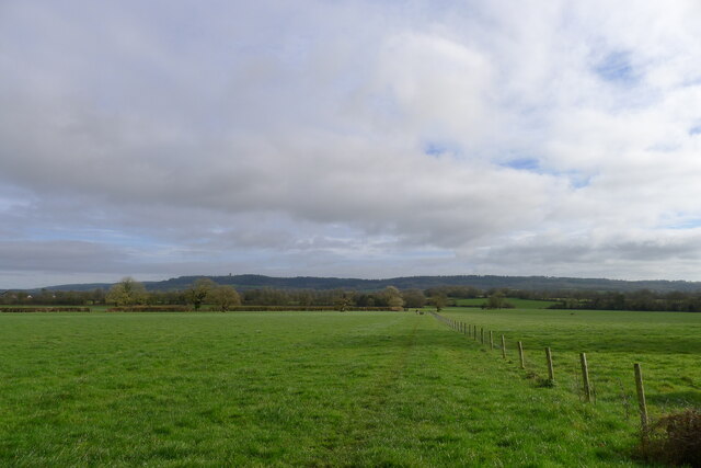
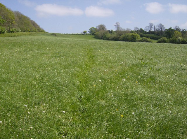
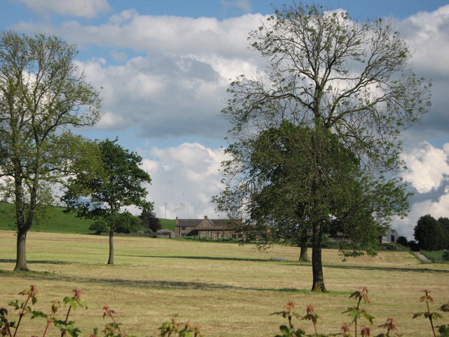
The Shrubbery is a picturesque woodland located in Somerset, England. Spread across a vast area, it is renowned for its lush greenery, diverse flora, and tranquil atmosphere. The woodland is densely populated with a variety of trees, including oak, beech, ash, and birch, creating a captivating landscape that changes with the seasons.

With its enchanting pathways, The Shrubbery offers a haven for nature enthusiasts, hikers, and photographers alike. The forest floor is adorned with a rich carpet of ferns, bluebells, and wildflowers, providing a vibrant burst of color during spring and summer months. A network of well-maintained trails meanders through the woodland, allowing visitors to explore its hidden treasures and discover its abundant wildlife.

The Shrubbery is home to a diverse range of animal species. Squirrels can be spotted darting between the trees, while birdsong fills the air as various avian species flit through the branches. It is not uncommon to stumble upon deer, rabbits, and other small mammals during a stroll through this natural sanctuary.

The woodland is well-preserved and managed by local authorities, ensuring its longevity and protecting its delicate ecosystem. This effort also allows for the organization of educational activities and guided tours, enabling visitors to learn more about the unique flora and fauna that call The Shrubbery home.

Overall, The Shrubbery is a serene and captivating woodland, offering a respite from the hustle and bustle of daily life. Whether one seeks relaxation, exploration, or simply a connection with nature, this enchanting forest promises an unforgettable experience.

If you have any feedback on the listing, please let us know in the comments section below.

The Shrubbery Images

Images are sourced within 2km of 51.096549/-2.4277206 or Grid Reference ST7033. Thanks to Geograph Open Source API. All images are credited.

Stoney Stoke: Entrance to Knowlerock Farm
Stoney Stoke: View towards Redlynch View north-west, through a hedge, across fields towards Redlynch
Stoney Stoke: View towards Redlynch
View north-west, through a hedge, across fields towards Redlynch
Hedge near Discove with Triangulation Pillar Viewed from the east.
Hedge near Discove with Triangulation Pillar
Viewed from the east.
Ordnance Survey Cut Mark This OS cut mark can be found on the NW face of St Peter's Church. It marks a point 148.048m above mean sea level.
Ordnance Survey Cut Mark
This OS cut mark can be found on the NW face of St Peter's Church. It marks a point 148.048m above mean sea level.
Gnarled Trees observed from the Old Coach Road A public footpath follows tightly against the hedgerow in a northerly direction. The coach road passes this scene east to west
Gnarled Trees observed from the Old Coach Road
A public footpath follows tightly against the hedgerow in a northerly direction. The coach road passes this scene east to west
Leland Trail outside Brewhamfields Farm The Leland Trail and Macmillan Way long distance footpaths on a section of the old coach road between Stourhead and Redlynch.
It is a sloppy mess at this point, resembling the consistency of thick custard.
Leland Trail outside Brewhamfields Farm
The Leland Trail and Macmillan Way long distance footpaths on a section of the old coach road between Stourhead and Redlynch. It is a sloppy mess at this point, resembling the consistency of thick custard.
Redlynch Farm Farmhouse at Redlynch Cross, passed by on the Leland Trail/MacMillan Way long distance footpaths
Redlynch Farm
Farmhouse at Redlynch Cross, passed by on the Leland Trail/MacMillan Way long distance footpaths
Leland Trail in Moor Wood Adopting the old coach road that once stretched between Redlynch and the Stourhead Estate.
Leland Trail in Moor Wood
Adopting the old coach road that once stretched between Redlynch and the Stourhead Estate.
Water trough near Brewhamfields Farm
The Leland Trail following the old coach road to the east Heading towards the Stourhead Estate woods on the escarpment in the distance. King Alfred's Tower is visible on the left horizon
The Leland Trail following the old coach road to the east
Heading towards the Stourhead Estate woods on the escarpment in the distance. King Alfred's Tower is visible on the left horizon
Old oak near Moor Wood Dead wood at the top, but new buds emerging lower down
Old oak near Moor Wood
Dead wood at the top, but new buds emerging lower down
View east from Moor Wood Cottage Looking east along the line of the Leland Trail, which follows the old coach road towards the Stourhead Estate escarpment in the distance. King Alfred's Tower is visible on the left horizon.
View east from Moor Wood Cottage
Looking east along the line of the Leland Trail, which follows the old coach road towards the Stourhead Estate escarpment in the distance. King Alfred's Tower is visible on the left horizon.
Redlynch Farm House Grade II listed, early 19th century <span class="nowrap"><a title="https://historicengland.org.uk/listing/the-list/list-entry/1307899?section=official-list-entry" rel="nofollow ugc noopener" href="https://historicengland.org.uk/listing/the-list/list-entry/1307899?section=official-list-entry">Link</a><img style="margin-left:2px;" alt="External link" title="External link - shift click to open in new window" src="https://s1.geograph.org.uk/img/external.png" width="10" height="10"/></span>
Redlynch Farm House
Grade II listed, early 19th century LinkExternal link
REDLYNCH, Somerset St Peter's Church - an unusual late C18 design.
REDLYNCH, Somerset
St Peter's Church - an unusual late C18 design.
Chapel at Redlynch
Chapel at Redlynch
Ascending Discove Hill Looking East.  Dropping Lane to the left (north).  The footpath (part of the Macmillan Way) is ill-defined through this pasture.
Ascending Discove Hill
Looking East. Dropping Lane to the left (north). The footpath (part of the Macmillan Way) is ill-defined through this pasture.
Knowle Park Farm
Knowle Park Farm
St. Peter's church, Redlynch That "Christmas" tree is growing nicely (compare other pictures in this square).
St. Peter's church, Redlynch
That "Christmas" tree is growing nicely (compare other pictures in this square).
Show me another place!

The Shrubbery is located at Grid Ref: ST7033 (Lat: 51.096549, Lng: -2.4277206)

Administrative County: Somerset

District: South Somerset

Police Authority: Avon and Somerset

What 3 Words

///watching.dock.spellings. Near Redlynch, Somerset

Nearby Locations

Redlynch The Shrubbery

Related Wikis

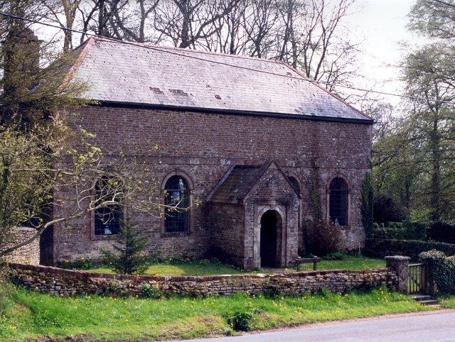
Church of St Peter, Redlynch

The Anglican Church of St Peter in Redlynch, Somerset, England was built in about 1750. It is a Grade II* listed building. == History == The church was...

Redlynch, Somerset

Redlynch is a village and former manor in the civil parish of Bruton, in the South Somerset district of Somerset, England. The 18th-century church and...

Cogley Wood

Cogley Wood (grid reference ST703345) is a 60.7 hectare biological Site of Special Scientific Interest east of Bruton in Somerset, notified in 1987. The...

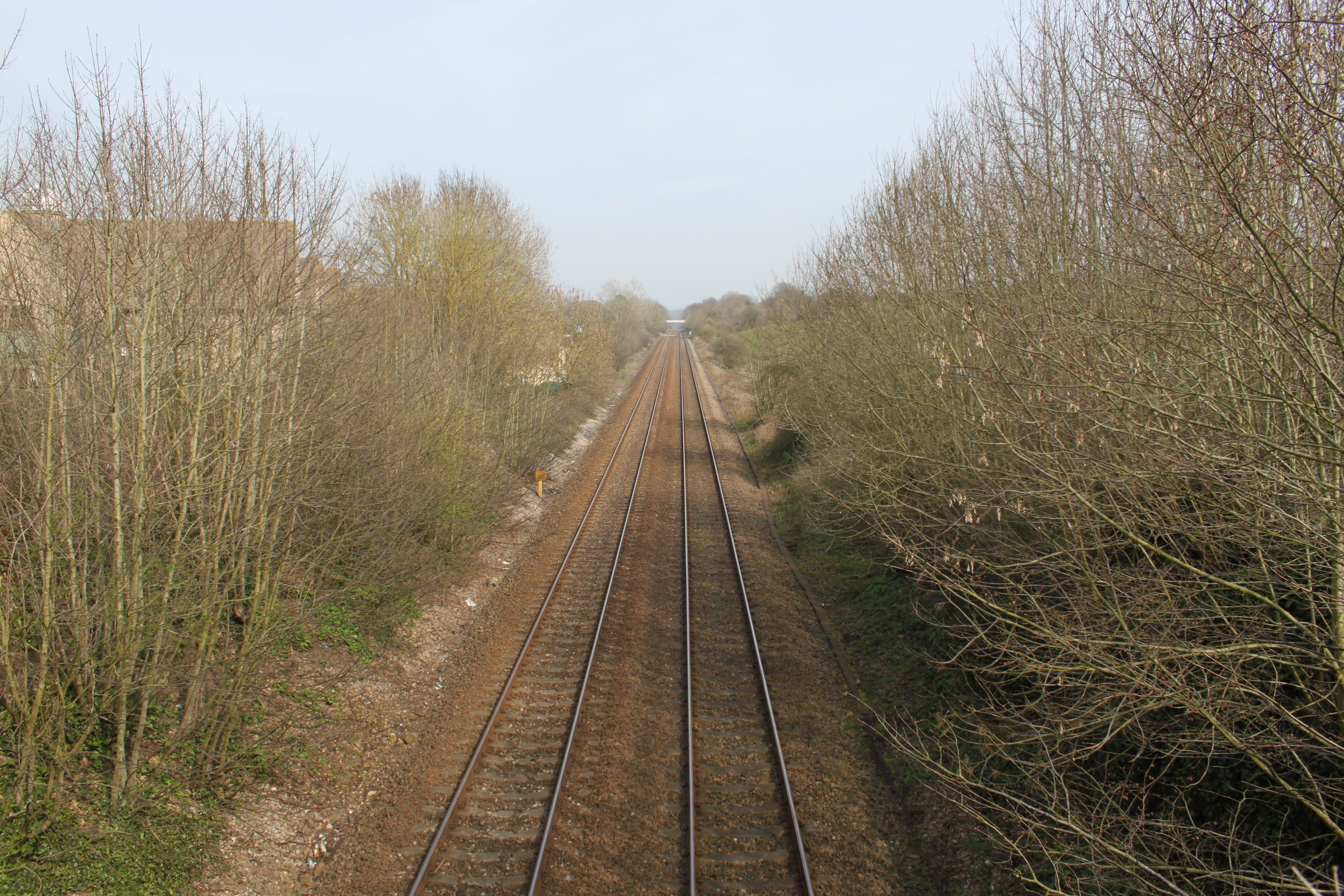
Bruton railway cutting

Bruton Railway Cutting is a 1.7 hectare geological Site of Special Scientific Interest at Bruton in Somerset, notified in 1971. The geology exposed in...

Shepton Montague Railway Cutting

Shepton Montague Railway Cutting (grid reference ST686316) is a 1.61 hectare geological Site of Special Scientific Interest at Shepton Montague in Somerset...

Bruton railway station

Bruton railway station serves a largely rural area in the county of Somerset in England. The station is situated in the market town of Bruton. The station...
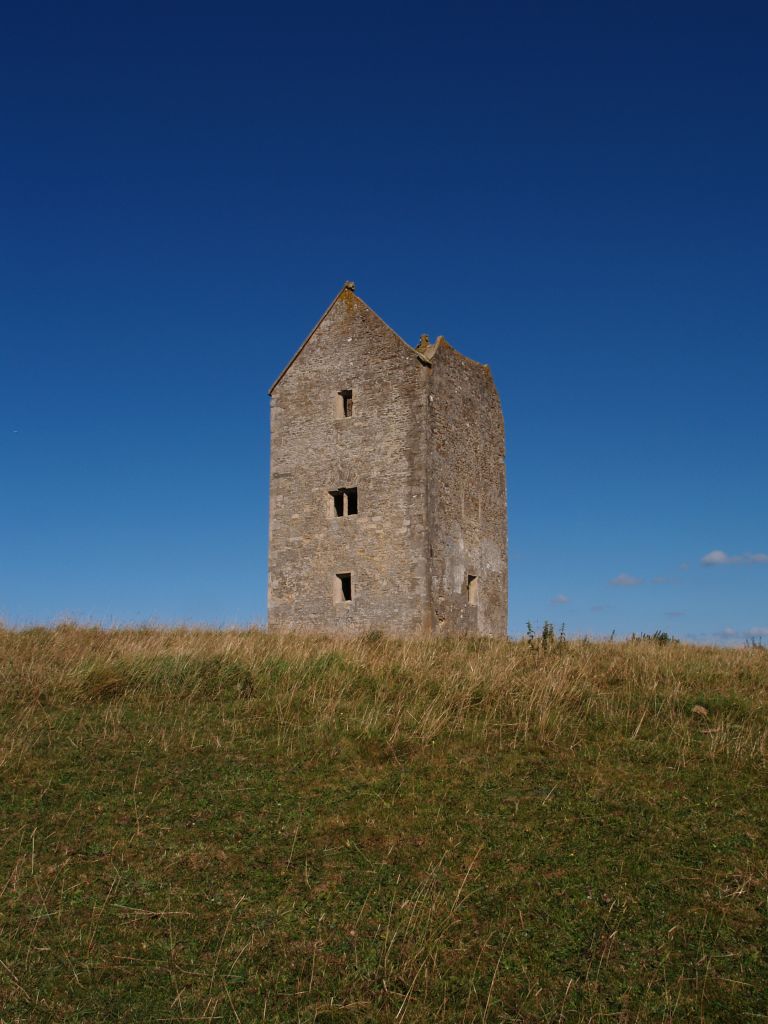
Bruton Dovecote

The Bruton Dovecote is a limestone tower that was built between the 15th and 17th century in Bruton in the English county of Somerset. The structure was...
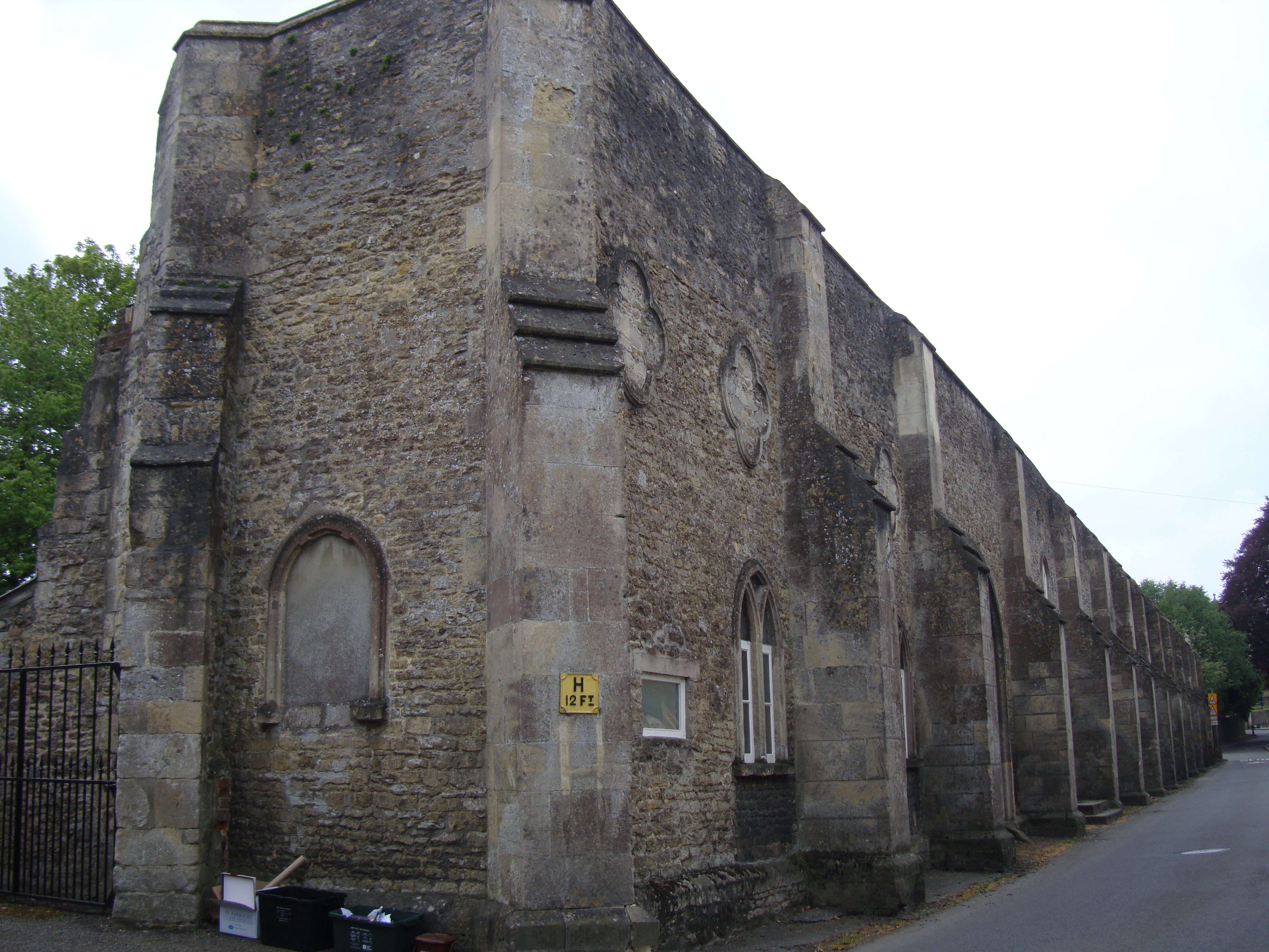
Bruton Abbey

Bruton Abbey in Bruton, Somerset was founded as a house of Augustinian canons in about 1127, and became an abbey in 1511, shortly before its dissolution...

Nearby Amenities

Located within 500m of 51.096549,-2.4277206
Redlynch
Is In: Somerset, England, UK
Place: hamlet
Source: OS_OpenData_Streetview
Wikidata: Q7306079
Wikipedia: en:Redlynch, Somerset
Lat/Long: 51.0977733/-2.4344987
Post Box
Operator: Royal Mail
Operator Wikidata: Q638098
Post Box Type: wall
Ref: BA10 82
Royal Cypher: VR
Royal Cypher Wikidata: Q33102356
Lat/Long: 51.0990401/-2.4272302
Redlynch Cross
Place: hamlet
Lat/Long: 51.0994151/-2.4261237
The data included in this document is from www.openstreetmap.org. The data is made available under ODbL.

Have you been to The Shrubbery?

Leave your review of The Shrubbery below (or comments, questions and feedback).