Brickkiln Coppice

Wood, Forest in Dorset

England

Brickkiln Coppice

Oaks, Beaulieu Wood By the lane to Duntish Cross.
Oaks, Beaulieu Wood Credit: Derek Harper

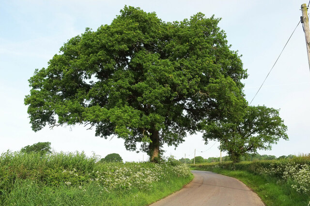
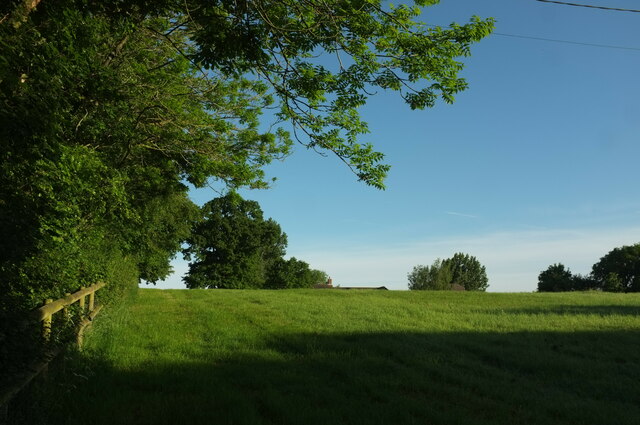
Brickkiln Coppice is an enchanting woodland located in the picturesque county of Dorset, England. Spread across an area of approximately 100 acres, this dense forest offers a serene and tranquil escape from the hustle and bustle of everyday life.

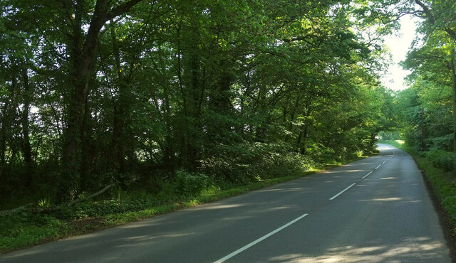
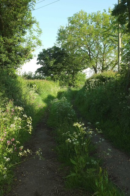
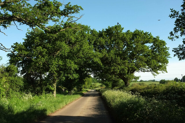
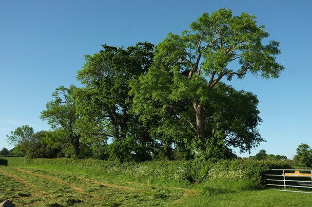
The woodland is primarily comprised of a mixture of broadleaf trees, such as oak, beech, and ash, which create a rich and diverse ecosystem. These majestic trees provide a dense canopy, allowing only dappled sunlight to filter through, creating an ethereal atmosphere. The forest floor is adorned with a carpet of wildflowers, including bluebells, primroses, and wood anemones, adding bursts of color to the green landscape.

Brickkiln Coppice is home to a variety of wildlife, making it a haven for nature enthusiasts. Birdwatchers can spot rare species such as the lesser spotted woodpecker, tawny owl, and various warblers. The forest is also teeming with small mammals, including foxes, badgers, and squirrels, which can often be spotted scurrying amongst the undergrowth.

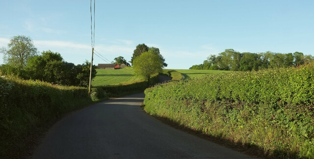
The woodland is intersected by a network of well-maintained walking trails, allowing visitors to explore its beauty at their own pace. These paths lead to hidden clearings and secluded ponds, providing opportunities for peaceful contemplation and a chance to connect with nature.

Brickkiln Coppice is a popular destination for outdoor activities such as hiking, birdwatching, and photography. It offers a tranquil and idyllic setting for those seeking a peaceful retreat amidst the natural beauty of Dorset.

If you have any feedback on the listing, please let us know in the comments section below.

Brickkiln Coppice Images

Images are sourced within 2km of 50.867459/-2.4257616 or Grid Reference ST7007. Thanks to Geograph Open Source API. All images are credited.

Oaks, Beaulieu Wood By the lane to Duntish Cross.
Oaks, Beaulieu Wood
By the lane to Duntish Cross.
Field, West Pulham The nightmare that is footpath N49 20 is drawing to a close. Currently my nomination for Dorset's worst right of way (of those I've completed), and there's tough competition. Visible in the centre is the roof of Chaselands.
Field, West Pulham
The nightmare that is footpath N49 20 is drawing to a close. Currently my nomination for Dorset's worst right of way (of those I've completed), and there's tough competition. Visible in the centre is the roof of Chaselands.
B3143 south of Pulham The B road crosses a slight dip on its way towards Duntish. The farm is Towns End Farm. The wood on the right is Brickkiln Coppice.
B3143 south of Pulham
The B road crosses a slight dip on its way towards Duntish. The farm is Towns End Farm. The wood on the right is Brickkiln Coppice.
B3143 northeast of Pulham The B road runs between two narrow belts of trees towards King's Stag.
B3143 northeast of Pulham
The B road runs between two narrow belts of trees towards King's Stag.
Footpath, Furze Hill Footpath N49 14 runs along this track between hedges from the B3143 before turning left to cross fields.
Footpath, Furze Hill
Footpath N49 14 runs along this track between hedges from the B3143 before turning left to cross fields.
Lane to Holwell Roadside trees on a straight lane passing Oakwood View.
Lane to Holwell
Roadside trees on a straight lane passing Oakwood View.
Grass triangle near Pulham Part of a staggered crossroads on the B3143, bearing left here. The turning on the right is Cannings Court Lane, a no through road.
Grass triangle near Pulham
Part of a staggered crossroads on the B3143, bearing left here. The turning on the right is Cannings Court Lane, a no through road.
Trees near Hartmoor Farm Along the lane from Holwell to Pulham.
Trees near Hartmoor Farm
Along the lane from Holwell to Pulham.
Junction near Brockhampton Green The lane from Brockhampton meets the road between Duntish (left) and Westfields, which takes precedence as the white line shows.
Junction near Brockhampton Green
The lane from Brockhampton meets the road between Duntish (left) and Westfields, which takes precedence as the white line shows.
Bridleway, Brockhampton Green Bridleway S10 15 leaves the road shown in <a href="https://www.geograph.org.uk/photo/7520093">ST7106 : Junction near Brockhampton Green</a> and very soon the bridleway takes a sharp left turn where a footpath continues north-eastwards. But there's bad news here for anyone planning to follow the footpath; the white notice attached to the post reads "NO BRIDGE ON PATH AHEAD"; that will be over the River Lydden. 13 months later as I write, I doubt if the situation has improved.
Bridleway, Brockhampton Green
Bridleway S10 15 leaves the road shown in ST7106 : Junction near Brockhampton Green and very soon the bridleway takes a sharp left turn where a footpath continues north-eastwards. But there's bad news here for anyone planning to follow the footpath; the white notice attached to the post reads "NO BRIDGE ON PATH AHEAD"; that will be over the River Lydden. 13 months later as I write, I doubt if the situation has improved.
Fields. Beaulieu Wood Farmland south of the road from Brockhampton Green.
Fields. Beaulieu Wood
Farmland south of the road from Brockhampton Green.
Harvested field, Beaulieu Wood On the other side of the road from <a href="https://www.geograph.org.uk/photo/7520425">ST7106 : Fields. Beaulieu Wood</a>.
Harvested field, Beaulieu Wood
On the other side of the road from ST7106 : Fields. Beaulieu Wood.
Farm, Beaulieu Wood Lawcrest seen from the road from Brockhampton Green.
Farm, Beaulieu Wood
Lawcrest seen from the road from Brockhampton Green.
Driveway to Lawcrest A concrete farm entrance track, and a Holstein cow regarding me coolly.
Driveway to Lawcrest
A concrete farm entrance track, and a Holstein cow regarding me coolly.
Road, Beaulieu Wood Passing roadside oaks.
Road, Beaulieu Wood
Passing roadside oaks.
Road, Beaulieu Wood At the bend, the road crosses the line of footpath S10 12.
Road, Beaulieu Wood
At the bend, the road crosses the line of footpath S10 12.
Road, Beaulieu Wood From the junction with the footpath, shown in <a href="https://www.geograph.org.uk/photo/7520981">ST7006 : Road, Beaulieu Wood</a>, looking along the road to New House Farm.
Road, Beaulieu Wood
From the junction with the footpath, shown in ST7006 : Road, Beaulieu Wood, looking along the road to New House Farm.
Footpath, Beaulieu Wood Looking left along footpath S10 12, from the junction shown in <a href="https://www.geograph.org.uk/photo/7520981">ST7006 : Road, Beaulieu Wood</a>. The track leads to a house among the trees, but the footpath divides, one arm going towards Woolford's Water and the other to Brockhampton.
Footpath, Beaulieu Wood
Looking left along footpath S10 12, from the junction shown in ST7006 : Road, Beaulieu Wood. The track leads to a house among the trees, but the footpath divides, one arm going towards Woolford's Water and the other to Brockhampton.
Show me another place!

Brickkiln Coppice is located at Grid Ref: ST7007 (Lat: 50.867459, Lng: -2.4257616)

Unitary Authority: Dorset

Police Authority: Dorset

What 3 Words

///buck.opened.driftwood. Near Sturminster Newton, Dorset

Nearby Locations

Brickkiln Coppice

Related Wikis

Dungeon Hill

Dungeon Hill is an Iron Age hillfort, about 1+1⁄4 miles (2 kilometres) north of the village of Buckland Newton in Dorset, England. It is a scheduled monument...

Pulham

Pulham is a village and civil parish in the county of Dorset in south-west England. It is situated in the Blackmore Vale, 7 miles (11 kilometres) southeast...

Glanvilles Wootton

Glanvilles Wootton, or Wootton Glanville, is a village and civil parish in the county of Dorset in southern England. It is situated in the Blackmore Vale...

Buckland Newton Hundred

Buckland Newton Hundred was a hundred in the county of Dorset, England, containing the following parishes: Buckland Newton Glanvilles Wootton Mappowder...

Buckland Newton

Buckland Newton is a village and civil parish in Dorset, England. It is situated beneath the scarp slope of the Dorset Downs, 7+1⁄2 miles (12.1 km) south...

Bookham Knoll

Bookham Knoll is a rounded hill, 211 metres (692 ft) high, about 1 kilometre southeast of the village of Buckland Newton in the county of Dorset in southern...

Holwell, Dorset

Holwell is a village and civil parish in the county of Dorset in southern England, situated approximately 5 miles (8.0 km) south-east of Sherborne. It...

Woolford's Water

Woolford's Water is a village in Dorset, England.

Related Videos

St Mary's Church, Glanvilles Wootton, Dorset, England

Filmed November, 2021. Music: Vaughan Williams - The Lark Ascending Benedictines Of Mary, Queen of Apostles - Christus Rex.

Nearby Amenities

Located within 500m of 50.867459,-2.4257616
Material: wood
Power: pole
Source: bing
Lat/Long: 50.8636132/-2.4271814
Material: wood
Power: pole
Source: bing
Lat/Long: 50.8643461/-2.4262167
Material: wood
Power: pole
Source: bing
Lat/Long: 50.865038/-2.4252527
Material: wood
Power: pole
Source: bing
Lat/Long: 50.8657679/-2.4242677
Material: wood
Power: pole
Source: bing
Lat/Long: 50.8664862/-2.4232925
Material: wood
Power: pole
Source: bing
Lat/Long: 50.8671967/-2.4223188
Material: wood
Power: pole
Source: bing
Lat/Long: 50.8679692/-2.4214989
Material: wood
Power: pole
Source: bing
Lat/Long: 50.868648/-2.4207885
Material: wood
Power: pole
Source: bing
Lat/Long: 50.8694134/-2.4199988
Material: wood
Power: pole
Source: bing
Lat/Long: 50.8713816/-2.42527
Material: wood
Power: pole
Source: bing
Lat/Long: 50.8714679/-2.4249902
Material: wood
Power: pole
Source: bing
Lat/Long: 50.8715875/-2.4246045
The data included in this document is from www.openstreetmap.org. The data is made available under ODbL.

Have you been to Brickkiln Coppice?

Leave your review of Brickkiln Coppice below (or comments, questions and feedback).