Countersett

Settlement in Yorkshire Richmondshire

England

Countersett

Countersett, Holly House barn The barn is on the east side of the road. The benchmark is cut into a left hand cornerstone and remains as crisp as the day it was cut.
Countersett, Holly House barn Credit: Mel Towler

Countersett is a small village located in the Richmondshire district of North Yorkshire, England. Situated in the picturesque Yorkshire Dales National Park, it is surrounded by rolling hills, lush green valleys, and enchanting countryside. The village is nestled just south of Hawes and west of Bainbridge, making it a popular destination for those seeking tranquility and natural beauty.

With a population of around 100 residents, Countersett retains its quaint, rural charm. The architecture predominantly consists of traditional stone-built houses, giving the village a timeless appeal. The local community is close-knit and welcoming, creating a warm and friendly atmosphere for both residents and visitors alike.

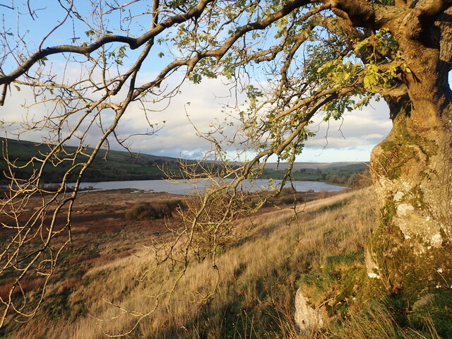
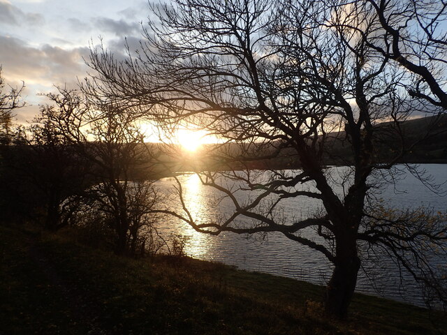
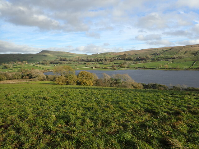
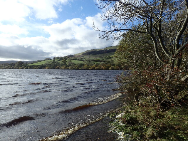
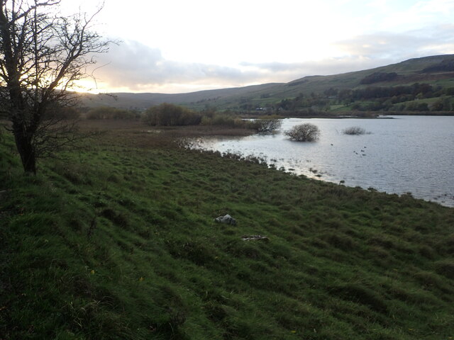
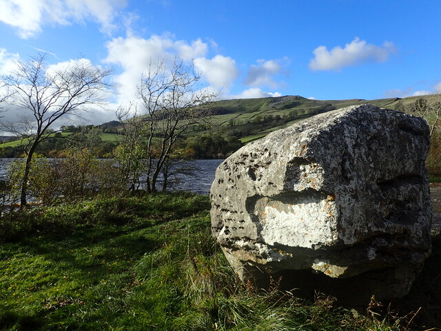
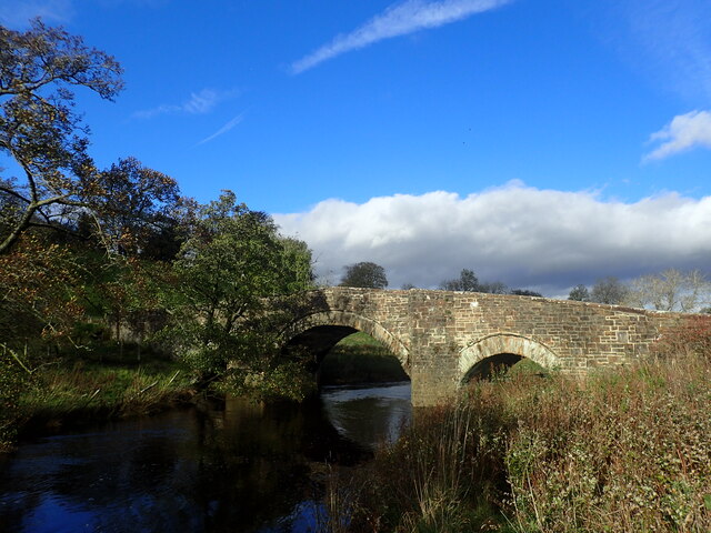
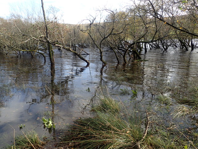
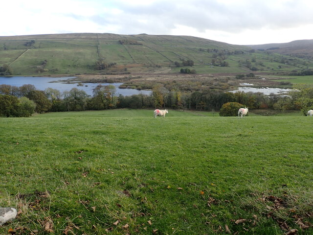
Nature enthusiasts flock to Countersett as it is an excellent base for exploring the stunning landscapes of the Dales. The village is surrounded by numerous walking trails and footpaths, providing opportunities for hikers to immerse themselves in the breathtaking scenery. One of the notable attractions near Countersett is Semerwater, a large natural lake that offers opportunities for fishing, canoeing, and picnicking by its shores.

Although small, Countersett benefits from its proximity to larger towns such as Hawes and Leyburn, which provide essential amenities such as shops, cafes, and pubs. Additionally, the village is within easy reach of notable tourist attractions like Aysgarth Falls and Bolton Castle, further enriching the experience for visitors to the area.

In summary, Countersett is a charming and idyllic village in the heart of the Yorkshire Dales, offering a peaceful retreat for those seeking a break from the hustle and bustle of city life. Its natural beauty, friendly community, and convenient location make it a hidden gem in the Yorkshire countryside.

If you have any feedback on the listing, please let us know in the comments section below.
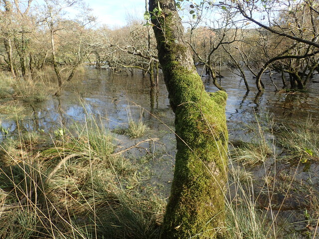
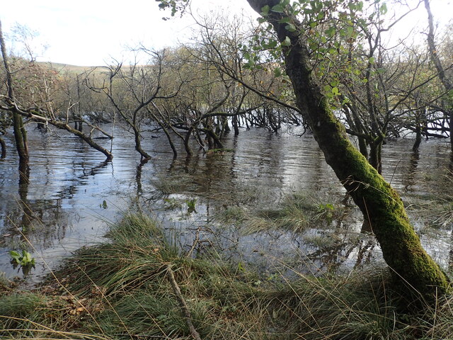
Countersett Images

Images are sourced within 2km of 54.287126/-2.12255 or Grid Reference SD9287. Thanks to Geograph Open Source API. All images are credited.

Countersett, Holly House barn The barn is on the east side of the road. The benchmark is cut into a left hand cornerstone and remains as crisp as the day it was cut.
Countersett, Holly House barn
The barn is on the east side of the road. The benchmark is cut into a left hand cornerstone and remains as crisp as the day it was cut.
Countersett, Holly House barn The barn is on the east side of the road. There is a benchmark cut into a left hand cornerstone and remains as crisp as the day it was cut.
Countersett, Holly House barn
The barn is on the east side of the road. There is a benchmark cut into a left hand cornerstone and remains as crisp as the day it was cut.
Semer Water Semer Water viewed from Carpley Green Road.
Semer Water
Semer Water viewed from Carpley Green Road.
Path down to Semer Water There are only two lakes in the Yorkshire Dales, Malham Tarn and Semer Water. Semer Water was formed during the last Ice Age by a moraine which effectively dammed the valley. The lake today is a shadow of its former self but is still three miles in circumference and 45 feet deep. This is the footpath back down to Semer Water in evening sunlight.
Path down to Semer Water
There are only two lakes in the Yorkshire Dales, Malham Tarn and Semer Water. Semer Water was formed during the last Ice Age by a moraine which effectively dammed the valley. The lake today is a shadow of its former self but is still three miles in circumference and 45 feet deep. This is the footpath back down to Semer Water in evening sunlight.
Semer Water at sunset There are only two lakes in the Yorkshire Dales, Malham Tarn and Semer Water. Semer Water was formed during the last Ice Age by a moraine which effectively dammed the valley. The lake today is a shadow of its former self but is still three miles in circumference and 45 feet deep. Legend has it that there is a drowned village under the water.
Semer Water at sunset
There are only two lakes in the Yorkshire Dales, Malham Tarn and Semer Water. Semer Water was formed during the last Ice Age by a moraine which effectively dammed the valley. The lake today is a shadow of its former self but is still three miles in circumference and 45 feet deep. Legend has it that there is a drowned village under the water.
Crag Side Road Crag Side Road leads from Countersett up on to the moors above Wensleydale. The Roman Cam High Road is just a short distance ahead.
Crag Side Road
Crag Side Road leads from Countersett up on to the moors above Wensleydale. The Roman Cam High Road is just a short distance ahead.
View from a footpath above Semer Water There are only two lakes in the Yorkshire Dales, Malham Tarn and Semer Water. Semer Water was formed during the last Ice Age by a moraine which effectively dammed the valley. The lake today is a shadow of its former self but is still three miles in circumference and 45 feet deep. Legend has it that there is a drowned village under the water. The hill in the distance is Addlebrough.
View from a footpath above Semer Water
There are only two lakes in the Yorkshire Dales, Malham Tarn and Semer Water. Semer Water was formed during the last Ice Age by a moraine which effectively dammed the valley. The lake today is a shadow of its former self but is still three miles in circumference and 45 feet deep. Legend has it that there is a drowned village under the water. The hill in the distance is Addlebrough.
Semer Water There are only two lakes in the Yorkshire Dales, Malham Tarn and Semer Water. Semer Water was formed during the last Ice Age by a moraine which effectively dammed the valley. The lake today is a shadow of its former self but is still three miles in circumference and 45 feet deep. Legend has it that there is a drowned village under the water. The River Bain, which flows out of Semer Water, at two and half miles is the shortest river in England.
Semer Water
There are only two lakes in the Yorkshire Dales, Malham Tarn and Semer Water. Semer Water was formed during the last Ice Age by a moraine which effectively dammed the valley. The lake today is a shadow of its former self but is still three miles in circumference and 45 feet deep. Legend has it that there is a drowned village under the water. The River Bain, which flows out of Semer Water, at two and half miles is the shortest river in England.
The head of Semer Water at sunset There are only two lakes in the Yorkshire Dales, Malham Tarn and Semer Water. Semer Water was formed during the last Ice Age by a moraine which effectively dammed the valley. The lake today is a shadow of its former self but is still three miles in circumference and 45 feet deep. This is the view from the footpath looking back to the head of Semer Water at sunset.
The head of Semer Water at sunset
There are only two lakes in the Yorkshire Dales, Malham Tarn and Semer Water. Semer Water was formed during the last Ice Age by a moraine which effectively dammed the valley. The lake today is a shadow of its former self but is still three miles in circumference and 45 feet deep. This is the view from the footpath looking back to the head of Semer Water at sunset.
Footpath from Crag Side Road Crag Side Road leads from Countersett up on to the moors above Wensleydale. The Roman Cam High Road is just a short distance to the left see also <a title="https://www.geograph.org.uk/photo/7327706" href="https://www.geograph.org.uk/photo/7327706">Link</a>
Footpath from Crag Side Road
Crag Side Road leads from Countersett up on to the moors above Wensleydale. The Roman Cam High Road is just a short distance to the left see also Link
Erratic at Semer Water Semer Water was formed during the last Ice Age by a moraine which effectively dammed the valley and leaving erratic boulders like this one behind. The lake today is a shadow of its former self but is still three miles in circumference and 45 feet deep.
Erratic at Semer Water
Semer Water was formed during the last Ice Age by a moraine which effectively dammed the valley and leaving erratic boulders like this one behind. The lake today is a shadow of its former self but is still three miles in circumference and 45 feet deep.
Semer Water Bridge The River Bain flows from Semer Water under the bridge here. As a tributary of the River Ure, it is one of the shortest, named rivers in England.
Semer Water Bridge
The River Bain flows from Semer Water under the bridge here. As a tributary of the River Ure, it is one of the shortest, named rivers in England.
Part of Semer water There are only two lakes in the Yorkshire Dales, Malham Tarn and Semer Water. This is Semer Water in Wensleydale. It was clearly fuller than normal making this look like a mangrove swamp. Legend has it that there is a drowned village under the water.
Part of Semer water
There are only two lakes in the Yorkshire Dales, Malham Tarn and Semer Water. This is Semer Water in Wensleydale. It was clearly fuller than normal making this look like a mangrove swamp. Legend has it that there is a drowned village under the water.
Semer Water There are only two lakes in the Yorkshire Dales, Malham Tarn and Semer Water. This is Semer Water in Wensleydale. It was clearly fuller than normal making this look like a mangrove swamp. Legend has it that there is a drowned village under the water.
Semer Water
There are only two lakes in the Yorkshire Dales, Malham Tarn and Semer Water. This is Semer Water in Wensleydale. It was clearly fuller than normal making this look like a mangrove swamp. Legend has it that there is a drowned village under the water.
Semer Water seen from Marsett Lane There are only two lakes in the Yorkshire Dales, Malham Tarn and Semer Water. Semer Water was formed during the last Ice Age by a moraine which effectively dammed the valley. The lake today is a shadow of its former self but is still three miles in circumference and 45 feet deep. Legend has it that there is a drowned village under the water.
Semer Water seen from Marsett Lane
There are only two lakes in the Yorkshire Dales, Malham Tarn and Semer Water. Semer Water was formed during the last Ice Age by a moraine which effectively dammed the valley. The lake today is a shadow of its former self but is still three miles in circumference and 45 feet deep. Legend has it that there is a drowned village under the water.
Old stone barn near Semer Water The barns in the Yorkshire Dales are in varying stages of dilapidation. This one seems in reasonably good condition and it appears to have a decent roof. This view is from the footpath which leads from Busk Lane towards Semer Water.
Old stone barn near Semer Water
The barns in the Yorkshire Dales are in varying stages of dilapidation. This one seems in reasonably good condition and it appears to have a decent roof. This view is from the footpath which leads from Busk Lane towards Semer Water.
Stalling Busk Old Church Stalling Busk Old Church (on the right here) above Semer Water in a side valley of Wensleydale was rebuilt in 1822 on the site of an older church which had been founded in 1609 to serve the scattered communities of the dale. It was abandoned when the new church was built in 1909.
Stalling Busk Old Church
Stalling Busk Old Church (on the right here) above Semer Water in a side valley of Wensleydale was rebuilt in 1822 on the site of an older church which had been founded in 1609 to serve the scattered communities of the dale. It was abandoned when the new church was built in 1909.
Show me another place!

Countersett is located at Grid Ref: SD9287 (Lat: 54.287126, Lng: -2.12255)

Division: North Riding

Administrative County: North Yorkshire

District: Richmondshire

Police Authority: North Yorkshire

What 3 Words

///elbowed.unhelpful.exhales. Near Leyburn, North Yorkshire

Nearby Locations

Countersett

Related Wikis

Countersett

Countersett is the largest of the three settlements in Raydale, around Semerwater in the Richmondshire district of North Yorkshire, England. It is in the...

Semerwater

Semerwater () is the second largest natural lake in North Yorkshire, England, after Malham Tarn. It is half a mile (800 m) long, covers 100 acres (0.40...

St Matthew's Church, Stalling Busk

St Matthew's Church, Stalling Busk is a Grade II listed parish church in the Church of England in Stalling Busk, North Yorkshire. == History == The church...

Stalling Busk

Stalling Busk is one of three settlements around Semer Water in the Richmondshire district of North Yorkshire in the small dale of Raydale just off...

Addlebrough

Addlebrough is a fell in Wensleydale, North Yorkshire, England. It is 481 m (1,578 ft) high. Bronze Age inhabitants built homes and enclosures on the fell...

Marsett

Marsett is one of three settlements in around Semer Water in Raydale, a small side dale off Wensleydale in North Yorkshire, England. Marsett is only a...

River Bain Hydro

The River Bain Hydro is a hydroelectric generator on the River Bain in the village of Bainbridge, North Yorkshire, England. Its screw turbine powers most...

Virosidum

Virosidum was a Roman fort and settlement situated near to the modern town of Bainbridge, North Yorkshire, England. The site is a Scheduled monument....

Nearby Amenities

Located within 500m of 54.287126,-2.12255
Countersett
Is In Country Code: GB
Is In County: North Yorkshire
Is In Municipality: Richmondshire
Place: hamlet
Source: NPE
Wikidata: Q5177027
Wikipedia: en:Countersett
Lat/Long: 54.286642/-2.1255159
Addr City: Hawes
Addr Housename: East Hill Top
Addr Postcode: DL8 3DD
Addr Suburb: Countersett
Building: yes
Source: http://colinday.co.uk/maps/WensleydaleMaps/Countersett.pdf
Lat/Long: 54.2862772/-2.1248131
Addr City: Hawes
Addr Housename: Hill Top
Addr Postcode: DL8 3DD
Addr Suburb: Countersett
Building: yes
Source: http://colinday.co.uk/maps/WensleydaleMaps/Countersett.pdf
Lat/Long: 54.2862005/-2.1250129
Addr City: Hawes
Addr Housename: Candle Cottage
Addr Postcode: DL8 3DD
Addr Suburb: Countersett
Building: yes
Source: http://colinday.co.uk/maps/WensleydaleMaps/Countersett.pdf
Lat/Long: 54.2861003/-2.1251886
Addr City: Hawes
Addr Housename: Countersett Hall
Addr Postcode: DL8 3DD
Addr Suburb: Countersett
Building: yes
Historic: house
Source: http://colinday.co.uk/maps/WensleydaleMaps/Countersett.pdf
Wikidata: Q17537065
Lat/Long: 54.2867406/-2.125768
Addr Housename: The White House
Is In Country Code: GB
Is In County: North Yorkshire
Is In Hamlet: Countersett
Is In Municipality: Richmondshire
Source: http://colinday.co.uk/maps/WensleydaleMaps/Countersett.pdf
Lat/Long: 54.2868236/-2.1262159
Addr Housename: The Boar West
Is In Country Code: GB
Is In County: North Yorkshire
Is In Hamlet: Countersett
Is In Municipality: Richmondshire
Source: http://colinday.co.uk/maps/WensleydaleMaps/Countersett.pdf
Lat/Long: 54.2864385/-2.1263178
Addr City: Hawes
Addr Housename: The Boar East
Addr Postcode: DL8 3DD
Addr Suburb: Countersett
Building: yes
Source: http://colinday.co.uk/maps/WensleydaleMaps/Countersett.pdf
Lat/Long: 54.2864823/-2.126173
Addr City: Hawes
Addr Housename: Beebole Cottage
Addr Postcode: DL8 3DD
Addr Suburb: Countersett
Building: yes
Source: http://colinday.co.uk/maps/WensleydaleMaps/Countersett.pdf
Lat/Long: 54.2865825/-2.1256956
Addr City: Hawes
Addr Housename: The Schoolhouse
Addr Postcode: DL8 3DD
Addr Suburb: Countersett
Building: yes
Source: http://colinday.co.uk/maps/WensleydaleMaps/Countersett.pdf
Lat/Long: 54.2868048/-2.1251457
Addr City: Hawes
Addr Housename: Li'le Foss
Addr Postcode: DL8 3DD
Addr Suburb: Countersett
Building: yes
Source: http://colinday.co.uk/maps/WensleydaleMaps/Countersett.pdf
Lat/Long: 54.2874154/-2.1250116
Addr City: Hawes
Addr Housename: Meeting House
Addr Postcode: DL8 3DD
Addr Suburb: Countersett
Building: yes
Source: http://colinday.co.uk/maps/WensleydaleMaps/Countersett.pdf
Lat/Long: 54.2869912/-2.1255266
Addr City: Hawes
Addr Housename: Chapel Farmhouse
Addr Postcode: DL8 3DD
Addr Suburb: Countersett
Building: yes
Source: http://colinday.co.uk/maps/WensleydaleMaps/Countersett.pdf
Lat/Long: 54.2871321/-2.1253066
Barrier: stile
Lat/Long: 54.2851687/-2.1230065
Post Box
Post Box Type: wall
Source: survey
Lat/Long: 54.2864769/-2.1254859
Telephone
Booth: KX100
Covered: booth
Source: survey
Lat/Long: 54.2867133/-2.1251263
Barrier: stile
Lat/Long: 54.2874564/-2.1164298
Power: pole
Lat/Long: 54.2913123/-2.1210439
Power: pole
Lat/Long: 54.290621/-2.1216737
Power: pole
Lat/Long: 54.2898609/-2.1223612
Power: pole
Lat/Long: 54.289111/-2.1230689
Power: pole
Lat/Long: 54.288758/-2.1240325
Power: pole
Lat/Long: 54.2882805/-2.1254477
Power: pole
Lat/Long: 54.2878352/-2.1267375
Power: pole
Lat/Long: 54.2875716/-2.127533
Power: pole
Lat/Long: 54.2872361/-2.1284463
Power: pole
Lat/Long: 54.286826/-2.1295254
Power: pole
Lat/Long: 54.289502/-2.121473
Power: pole
Lat/Long: 54.2892531/-2.1207979
Power: pole
Lat/Long: 54.2888312/-2.1197666
Power: pole
Lat/Long: 54.2884812/-2.1188909
Power: pole
Lat/Long: 54.2878557/-2.11732
Power: pole
Lat/Long: 54.2872361/-2.1157768
The data included in this document is from www.openstreetmap.org. The data is made available under ODbL.

Have you been to Countersett?

Leave your review of Countersett below (or comments, questions and feedback).