Whistling Copse

Wood, Forest in Somerset

England

Whistling Copse

Old Boundary Markers beside the A4 on Newton Bridge On Newton Bridge over Corston Brook, on the southwest side of the A4 Bristol Road.

On the left, on the boundary of Newton St Loe and Corston parishes, is Turnpike Parish Boundary Marker SO_BABR03pb. On its left face is NEWT.N / P.H and on its right face is CORST.N / P.H with BRISTOL TURNPIKE TRUST vertically between them and 1823 horizontally above. See also <a title="https://www.geograph.org.uk/photo/6038123" href="https://www.geograph.org.uk/photo/6038123">Link</a>.

On the right, entirely in Corston parish, is bridge marker SO_CORST01br.
Old Boundary Markers beside the A4 on Newton Bridge Credit: Roadside Relics

Whistling Copse is a picturesque woodland located in Somerset, England. This enchanting forest covers an area of approximately 100 acres and is a popular destination for nature lovers and outdoor enthusiasts.

The copse is characterized by its dense canopy of towering trees, predominantly consisting of oak, beech, and ash. These majestic trees create a serene and peaceful atmosphere, providing a haven for a diverse range of wildlife. Birdsong fills the air, with species such as robins, blackbirds, and great tits making their homes within the copse.

As visitors explore Whistling Copse, they will discover a network of well-maintained footpaths that wind their way through the forest. These paths offer a chance to immerse oneself in the natural beauty of the area, with sunlight filtering through the leaves and casting dappled shadows on the forest floor.

One of the copse's standout features is a small stream that meanders through the woodland. This babbling brook provides a refreshing soundtrack and adds to the tranquility of the surroundings. Visitors can enjoy picnicking by the stream or simply take a moment to sit and listen to the soothing sound of running water.

Whistling Copse is also home to a variety of plant species, including bluebells, wild garlic, and ferns, which carpet the forest floor during the spring and summer months. This burst of color and fragrance adds to the charm of the copse, creating a magical setting for those who visit.

Overall, Whistling Copse is a hidden gem in Somerset, offering a sanctuary of natural beauty and tranquility. It is a place where visitors can escape the hustle and bustle of everyday life and immerse themselves in the wonders of the natural world.

If you have any feedback on the listing, please let us know in the comments section below.

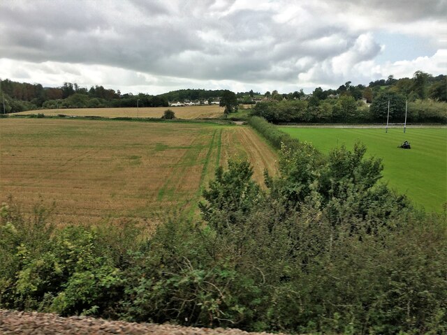
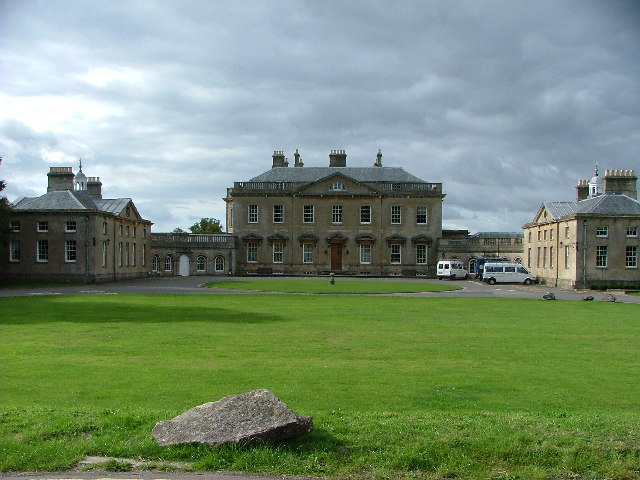
Whistling Copse Images

Images are sourced within 2km of 51.373209/-2.4312289 or Grid Reference ST7063. Thanks to Geograph Open Source API. All images are credited.

Old Boundary Markers beside the A4 on Newton Bridge On Newton Bridge over Corston Brook, on the southwest side of the A4 Bristol Road.

On the left, on the boundary of Newton St Loe and Corston parishes, is Turnpike Parish Boundary Marker SO_BABR03pb. On its left face is NEWT.N / P.H and on its right face is CORST.N / P.H with BRISTOL TURNPIKE TRUST vertically between them and 1823 horizontally above. See also <a title="https://www.geograph.org.uk/photo/6038123" href="https://www.geograph.org.uk/photo/6038123">Link</a>.

On the right, entirely in Corston parish, is bridge marker SO_CORST01br.
Old Boundary Markers beside the A4 on Newton Bridge
On Newton Bridge over Corston Brook, on the southwest side of the A4 Bristol Road. On the left, on the boundary of Newton St Loe and Corston parishes, is Turnpike Parish Boundary Marker SO_BABR03pb. On its left face is NEWT.N / P.H and on its right face is CORST.N / P.H with BRISTOL TURNPIKE TRUST vertically between them and 1823 horizontally above. See also Link. On the right, entirely in Corston parish, is bridge marker SO_CORST01br.
Ordnance Survey Cut Mark This OS cut mark can be found on cottage No5 at Wilmington. It marks a point 117.875m above mean sea level.
Ordnance Survey Cut Mark
This OS cut mark can be found on cottage No5 at Wilmington. It marks a point 117.875m above mean sea level.
Ordnance Survey Cut Mark This OS cut mark can be found on a gatepost SW side of the cross roads. It marks a point 142.034m above mean sea level.
Ordnance Survey Cut Mark
This OS cut mark can be found on a gatepost SW side of the cross roads. It marks a point 142.034m above mean sea level.
Ordnance Survey Cut Mark This OS cut mark can be found on a gatepost NE side of the road. It marks a point 89.891m above mean sea level.
Ordnance Survey Cut Mark
This OS cut mark can be found on a gatepost NE side of the road. It marks a point 89.891m above mean sea level.
From a Swindon-Bristol train, fields and playing field near Corston
Old Boundary Marker beside the A39 Wells Road, Corston Turnpike Parish Boundary Marker on the grass verge on the south side of the A39 Wells Road east of Corston village. Corston parish. Grade II Listed details <span class="nowrap"><a title="https://historicengland.org.uk/listing/the-list/list-entry/1320799" rel="nofollow ugc noopener" href="https://historicengland.org.uk/listing/the-list/list-entry/1320799">Link</a><img style="margin-left:2px;" alt="External link" title="External link - shift click to open in new window" src="https://s1.geograph.org.uk/img/external.png" width="10" height="10"/></span>. For an older photo, see <a title="https://www.geograph.org.uk/photo/6048086" href="https://www.geograph.org.uk/photo/6048086">Link</a>. See also <a title="https://www.geograph.org.uk/photo/5883994" href="https://www.geograph.org.uk/photo/5883994">Link</a> and <a title="https://www.geograph.org.uk/photo/1719253" href="https://www.geograph.org.uk/photo/1719253">Link</a>.

Milestone Society National ID: SO_BAMK03pb
Old Boundary Marker beside the A39 Wells Road, Corston
Turnpike Parish Boundary Marker on the grass verge on the south side of the A39 Wells Road east of Corston village. Corston parish. Grade II Listed details LinkExternal link. For an older photo, see Link. See also Link and Link. Milestone Society National ID: SO_BAMK03pb
Cattle at Newton Park The Newton Park estate belongs to the Duchy of Cornwall and part of it is used by Bath Spa University
Cattle at Newton Park
The Newton Park estate belongs to the Duchy of Cornwall and part of it is used by Bath Spa University
The lake, Newton Park Part of the main house is visible in the distance
The lake, Newton Park
Part of the main house is visible in the distance
Keep of St Loe Castle with University buildings beyond The keep of St Loe Castle is in the grounds of Newton Park, part of which is now used by Bath Spa University <span class="nowrap"><a title="http://en.wikipedia.org/wiki/Newton_St_Loe_Castle" rel="nofollow ugc noopener" href="http://en.wikipedia.org/wiki/Newton_St_Loe_Castle">Link</a><img style="margin-left:2px;" alt="External link" title="External link - shift click to open in new window" src="https://s1.geograph.org.uk/img/external.png" width="10" height="10"/></span>
Keep of St Loe Castle with University buildings beyond
The keep of St Loe Castle is in the grounds of Newton Park, part of which is now used by Bath Spa University LinkExternal link
Ornamental gates, Newton Park
Newton Park House Part of Bath Spa University
Newton Park House
Part of Bath Spa University
Bench at Newton Park Campus Bench at Newton Park Campus just round the back of main house
Bench at Newton Park Campus
Bench at Newton Park Campus just round the back of main house
Newton Park Campus Newton Park Campus estate.
Newton Park Campus
Newton Park Campus estate.
Tree Near Newton Park
Newton Park Campus Taken from the bridge with the lake behind
Newton Park Campus
Taken from the bridge with the lake behind
Newton Park Taken early on a morning showing what was once the Newton Park estate.
Newton Park
Taken early on a morning showing what was once the Newton Park estate.
Balloon near Bath Looking north from the path near Seven Acre Wood towards Saltford.
Balloon near Bath
Looking north from the path near Seven Acre Wood towards Saltford.
Newton Park, Newton St Loe A fine house of c1761-65 built in the Palladian tradition of a central block flanked by wings connected by quadrant walls. The architect was Stiff Leadbetter. Pevsner wrote that it is "among the finest C18 country houses in Somerset, noble and reticent." Grade I listed.
Built for Joseph Langton, a Bristol merchant, it became a teacher training college in 1947 and now forms part of Bath Spa University.
Leadbetter was a builder-architect who at one time was Surveyor of St Paul's Cathedral. In his Biographical Dictionary of British Architects, Howard Colvin describes him as "a very competent architect who designed a number of handsome Georgian country houses".
Newton Park, Newton St Loe
A fine house of c1761-65 built in the Palladian tradition of a central block flanked by wings connected by quadrant walls. The architect was Stiff Leadbetter. Pevsner wrote that it is "among the finest C18 country houses in Somerset, noble and reticent." Grade I listed. Built for Joseph Langton, a Bristol merchant, it became a teacher training college in 1947 and now forms part of Bath Spa University. Leadbetter was a builder-architect who at one time was Surveyor of St Paul's Cathedral. In his Biographical Dictionary of British Architects, Howard Colvin describes him as "a very competent architect who designed a number of handsome Georgian country houses".
Show me another place!

Whistling Copse is located at Grid Ref: ST7063 (Lat: 51.373209, Lng: -2.4312289)

Unitary Authority: Bath and North East Somerset

Police Authority: Avon and Somerset

What 3 Words

///blotting.presuming.helpfully. Near Corston, Somerset

Related Wikis

Bath Spa University

Bath Spa University is a public university in Bath, England, with its main campus at Newton Park, about 3+1⁄2 miles (5.6 km) west of the centre of the...

Newton Park

Newton Park is an 18th-century Grade I listed country house in the parish of Newton St Loe, Somerset, England, situated 4 miles (6.4 km) west of Bath....

Newton St Loe Castle

Newton St Loe Castle was a fortified manor house in the village of Newton St Loe, Somerset, England. Parts of it survive: a 14th-century keep and 15th...

Alfred Jewel

The Alfred Jewel is a piece of Anglo-Saxon goldsmithing work made of enamel and quartz enclosed in gold. It was discovered in 1693, in North Petherton...

Newton St Loe

Newton St Loe is a small Somerset village and civil parish located close to the villages of Corston and Stanton Prior, between Bath and Bristol in England...

Church of the Holy Trinity, Newton St Loe

The Anglican Church of the Holy Trinity in Newton St Loe within the English county of Somerset is a Grade II* listed building.A church has stood on the...

Wilmington, Somerset

Wilmington is a hamlet in the civil parish of Priston within the unitary authority of Bath and North East Somerset, England. It is nestled in the hilly...

Corston, Somerset

Corston is a small village and civil parish close to the River Avon and situated on the A39 road in the Bath and North East Somerset unitary authority...

Nearby Amenities

Located within 500m of 51.373209,-2.4312289
Barrier: stile
Lat/Long: 51.3775643/-2.4314587
Barrier: cattle_grid
Lat/Long: 51.3776053/-2.4314787
Barrier: stile
Lat/Long: 51.3763131/-2.4349262
Barrier: stile
Lat/Long: 51.3755485/-2.4360412
Bus Stop
Newton Park Library
Bus: yes
Naptan AtcoCode: 0180BAC30436
Naptan Bearing: NE
Naptan CommonName: Newton Park Library
Naptan Indicator: NE-bound
Naptan NaptanCode: bthdgmw
Naptan PlusbusZoneRef: BATHSPA
Naptan Street: BATH SPA UNIVERSITY CAMPUS
Naptan Verified: no
Public Transport: platform
Shelter: yes
Toilets Wheelchair: yes
Wheelchair: yes
Lat/Long: 51.3757062/-2.4371799
Barrier: kissing_gate
Fixme: unsure of authorisation for this gate
Lat/Long: 51.3753874/-2.4372935
Barrier: cattle_grid
Lat/Long: 51.375967/-2.4362652
Crossing
Crossing: uncontrolled
Crossing Ref: zebra
Lat/Long: 51.3757441/-2.4368053
Crossing
Crossing: uncontrolled
Crossing Ref: zebra
Lat/Long: 51.375771/-2.4368398
Newton Park
Fixme: unsure how to tag this & it needs expanding to an area of it's boundary.
Place: locality
Wikidata: Q15262203
Wikipedia: en:Newton Park
Lat/Long: 51.3724758/-2.4383171
Barrier: bollard
Lat/Long: 51.3760383/-2.4366028
The data included in this document is from www.openstreetmap.org. The data is made available under ODbL.

Have you been to Whistling Copse?

Leave your review of Whistling Copse below (or comments, questions and feedback).