Bosom Wood

Wood, Forest in Yorkshire South Lakeland

England

Bosom Wood

View of moorland through field gate at High House
View of moorland through field gate at High House Credit: Roger Templeman

Bosom Wood is a picturesque forest located in Yorkshire, England. Covering an area of approximately 200 hectares, it is a popular destination for nature lovers, hikers, and wildlife enthusiasts. The forest is situated near the village of Bosom, which adds to its charm and accessibility.

The wood is characterized by its dense foliage, consisting mainly of oak, beech, and birch trees. These towering trees create a serene and peaceful environment, providing a haven for various species of birds, mammals, and insects. It is not uncommon to spot deer, squirrels, and a wide range of bird species while exploring the forest trails.

The wood is crisscrossed by a network of well-maintained footpaths and trails, allowing visitors to explore its beauty at their own pace. The paths wind through the forest, leading to hidden clearings, tranquil ponds, and breathtaking viewpoints. The diverse flora and fauna make it an ideal spot for photography and nature walks.

Bosom Wood is not only a natural sanctuary but also a place of historical significance. It is believed that the forest has been a part of the landscape for centuries, providing timber, shelter, and sustenance for the local communities. The remnants of old boundary walls and stone structures can still be found within the wood, serving as a reminder of its past.

With its serene atmosphere, rich biodiversity, and historical significance, Bosom Wood is a beloved destination for both locals and tourists alike. Whether one seeks a peaceful retreat or an adventurous hike, this enchanting forest offers a memorable experience for all who visit.

If you have any feedback on the listing, please let us know in the comments section below.
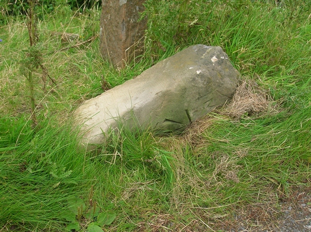
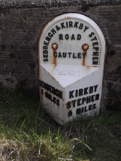
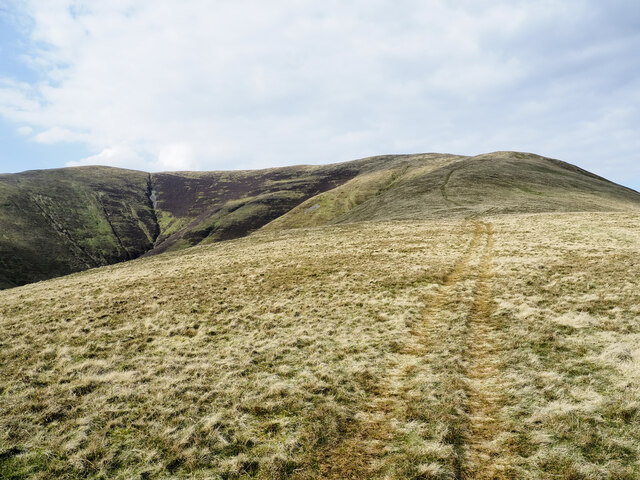
Bosom Wood Images

Images are sourced within 2km of 54.356683/-2.4641633 or Grid Reference SD6995. Thanks to Geograph Open Source API. All images are credited.

View of moorland through field gate at High House
Moorland on north side of barn at High House
A683 near Narthwaite
Old Milestone by the A683, Cautley Road, Narthwaite Metal plate attached to stone post by the A683, in parish of Sedbergh (South Lakeland District), Cautley Road, ⅔ mile South of bridge over River Rawthey, in south end of retaining wall, on East side of road. WR iron casting, erected by the County Council in the 19th century. 

Inscription reads:-
: SEDBERGH / 5 MILES : : SEDBERGH & KIRKBY STEPHEN / ROAD / CAUTLEY : : KIRKBY STEPHEN / 9 MILES :
Maker:-
: WILLIAM TOWLER / GLOBE FOUNDRY / - LEEDS - :

Grade II listed. List Entry Number: 1384110
<span class="nowrap"><a title="https://historicengland.org.uk/listing/the-list/list-entry/1384110" rel="nofollow ugc noopener" href="https://historicengland.org.uk/listing/the-list/list-entry/1384110">Link</a><img style="margin-left:2px;" alt="External link" title="External link - shift click to open in new window" src="https://s1.geograph.org.uk/img/external.png" width="10" height="10"/></span>

Milestone Society National ID: YW_SBKS05.
Old Milestone by the A683, Cautley Road, Narthwaite
Metal plate attached to stone post by the A683, in parish of Sedbergh (South Lakeland District), Cautley Road, ⅔ mile South of bridge over River Rawthey, in south end of retaining wall, on East side of road. WR iron casting, erected by the County Council in the 19th century. Inscription reads:- : SEDBERGH / 5 MILES : : SEDBERGH & KIRKBY STEPHEN / ROAD / CAUTLEY : : KIRKBY STEPHEN / 9 MILES : Maker:- : WILLIAM TOWLER / GLOBE FOUNDRY / - LEEDS - : Grade II listed. List Entry Number: 1384110 LinkExternal link Milestone Society National ID: YW_SBKS05.
Stream near Handley's bridge
Old Milestone by the A683, east of Narthwaite Carved stone post by the A683, in parish of SEDBERGH (SOUTH LAKELAND District), ½ mile South of bridge over River Rawthey, Narthwaite, South end of post and metal bars fence near "Beware Debris in Road sign", on West side of road. Old Sedbergh stone, erected by the Sedbergh turnpike trust in the 19th century. Now re-erected.

Inscription reads:-
: 9 MILE :
Carved benchmark on base front.

Milestone Society National ID: YW_SBKS04a.
Old Milestone by the A683, east of Narthwaite
Carved stone post by the A683, in parish of SEDBERGH (SOUTH LAKELAND District), ½ mile South of bridge over River Rawthey, Narthwaite, South end of post and metal bars fence near "Beware Debris in Road sign", on West side of road. Old Sedbergh stone, erected by the Sedbergh turnpike trust in the 19th century. Now re-erected. Inscription reads:- : 9 MILE : Carved benchmark on base front. Milestone Society National ID: YW_SBKS04a.
A683 bend near Narthwaite
Old milestone In 2005 this stone at the south end of the post and metal bars fence at the side of the River Rawthay was upright but sunken.   In 2007 it had been knocked over.  By 2010 it had been reset but less deep than formerly.  4 Miles can just be made out.  These would be 'Customary' miles as it is over 4½ miles now from Sedbergh.  This stone is a favourite with Bench Mark recorders as the cut mark is so clear. It is also a unique shape for the area being different to the Sedbergh turnpike stones and the ones over the border in Westmorland (Cumbria)
Old milestone
In 2005 this stone at the south end of the post and metal bars fence at the side of the River Rawthay was upright but sunken. In 2007 it had been knocked over. By 2010 it had been reset but less deep than formerly. 4 Miles can just be made out. These would be 'Customary' miles as it is over 4½ miles now from Sedbergh. This stone is a favourite with Bench Mark recorders as the cut mark is so clear. It is also a unique shape for the area being different to the Sedbergh turnpike stones and the ones over the border in Westmorland (Cumbria)
Old milestone This is the most northerly on this road of the West Riding CC posts from 1893/94.
The wall at the south end of the bridge over the River Rawthay has been built round it.   The river was formerly the boundary between the West Riding and Westmorland.  This post has the foundry name on the bevel.   William Towler/Globe Foundry/Leeds.  The posts at 2, 3 and 4 miles from Sedbergh have no foundry name and the letters and numbers are a slightly different size.  Grade II listed 484542.
Old milestone
This is the most northerly on this road of the West Riding CC posts from 1893/94. The wall at the south end of the bridge over the River Rawthay has been built round it. The river was formerly the boundary between the West Riding and Westmorland. This post has the foundry name on the bevel. William Towler/Globe Foundry/Leeds. The posts at 2, 3 and 4 miles from Sedbergh have no foundry name and the letters and numbers are a slightly different size. Grade II listed 484542.
Low Haygarth Ford This bridleway ford is shown on the fingerpost as a deep ford and there is no other means of crossing the beck at this location.
Low Haygarth Ford
This bridleway ford is shown on the fingerpost as a deep ford and there is no other means of crossing the beck at this location.
Footbridge over the River Rawthey
Cautley Holme Beck
Cautley Holme Beck
The A368 to Sedbergh The 'Calf' looms ahead.
The A368 to Sedbergh
The 'Calf' looms ahead.
Cross Keys Inn
Cross Keys Inn
Looking towards the valley of Cautley Holme Beck & view towards Great Dummacks
Track leading up towards Cautley Spout, Howgill Fells
Ridge rising to Great Dummacks Great Dummacks is an elongated rib of ground at the top of the rising ridge and across the head of the valley to the left. As with most Howgill ridges there's a quad bike track following this one which acts perfectly as a path for those on foot.
Ridge rising to Great Dummacks
Great Dummacks is an elongated rib of ground at the top of the rising ridge and across the head of the valley to the left. As with most Howgill ridges there's a quad bike track following this one which acts perfectly as a path for those on foot.
Steps down to footbridge over River Rawthey
Show me another place!

Bosom Wood is located at Grid Ref: SD6995 (Lat: 54.356683, Lng: -2.4641633)

Division: West Riding

Administrative County: Cumbria

District: South Lakeland

Police Authority: Cumbria

What 3 Words

///detergent.workshop.ropes. Near Sedbergh, Cumbria

Related Wikis

Calders (Yorkshire Dales)

Calders is a summit of 2,211 feet (674 m) in the Howgill Fells, Cumbria, England. It lies about 2⁄3 mile (1 km) south east of the summit of The Calf and...

Yarlside

Yarlside is a hill in the Howgill Fells, Cumbria (historically Westmorland), England. This fell is not to be confused with the Yarlside area near Barrow...

The Calf

The Calf, at 676 m, is the highest top in the Howgill Fells, an area of high ground in the north-west of the Yorkshire Dales in the county of Cumbria...

Clough River

The Clough River is a river in Cumbria, England. A tributary of the River Rawthey, it flows for 21.8 kilometres (13.5 mi) primarily through the Garsdale...

Randygill Top

Randygill Top is a mountain located in the Howgill Fells, Cumbria (historically Westmorland), England. == References ==

Settlebeck School

Settlebeck School is a small coeducational secondary school with academy status. It is located in Sedbergh in the English county of Cumbria, drawing pupils...

Howgill Fells

The Howgill Fells are uplands in Northern England between the Lake District and the Yorkshire Dales, lying roughly within a triangle formed by the town...

The Bull Hotel, Sedbergh

The Bull Hotel, formerly The Black Bull Hotel, is a 17th-century coaching inn in Sedbergh, Cumbria. It is located in a narrow passage parallel with the...

Nearby Amenities

Located within 500m of 54.356683,-2.4641633
Foxhole Rigg Wood
Natural: wood
Source: OS OpenData StreetView
Lat/Long: 54.3541236/-2.4689149
Gill Wood
Natural: wood
Source: OS OpenData StreetView
Lat/Long: 54.3569746/-2.4659323
Intake Wood
Natural: woodland
Source: OS OpenData StreetView
Lat/Long: 54.3575248/-2.4636578
Baugh Fell
Place: locality
Source: OS OpenData StreetView
Lat/Long: 54.3603278/-2.4640454
West Baugh Fell
Place: locality
Source: OS OpenData StreetView
Lat/Long: 54.3593025/-2.4654938
Cautley
Place: locality
Source: OS_OpenData_StreetView
Lat/Long: 54.3550569/-2.4579099
Give Way
Direction: forward
Lat/Long: 54.3586096/-2.4689436
Power: pole
Lat/Long: 54.3538764/-2.4672702
Power: pole
Lat/Long: 54.3534801/-2.4684544
Power: pole
Lat/Long: 54.3599635/-2.4693449
Power: pole
Lat/Long: 54.3581005/-2.470797
Ford: yes
Lat/Long: 54.354177/-2.4696132
Wardses
Place: locality
Source Name: OS_OpenData_StreetView
Lat/Long: 54.3590383/-2.4694482
Power: pole
Lat/Long: 54.3563251/-2.4569004
Power: pole
Lat/Long: 54.3558212/-2.4581269
Power: pole
Lat/Long: 54.3553542/-2.4592409
Power: pole
Lat/Long: 54.3548544/-2.4604314
Power: pole
Lat/Long: 54.3545885/-2.462288
Power: pole
Lat/Long: 54.3543316/-2.4640774
Power: pole
Lat/Long: 54.3541138/-2.465589
The data included in this document is from www.openstreetmap.org. The data is made available under ODbL.

Have you been to Bosom Wood?

Leave your review of Bosom Wood below (or comments, questions and feedback).