Horseley Grove

Wood, Forest in Gloucestershire Forest of Dean

England

Horseley Grove

Farm drive to Knappers Farm The winding farm drive leading to Knappers Farm near Newent.  A public footpath follows this drive.
Farm drive to Knappers Farm Credit: Philip Halling

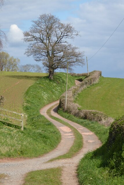
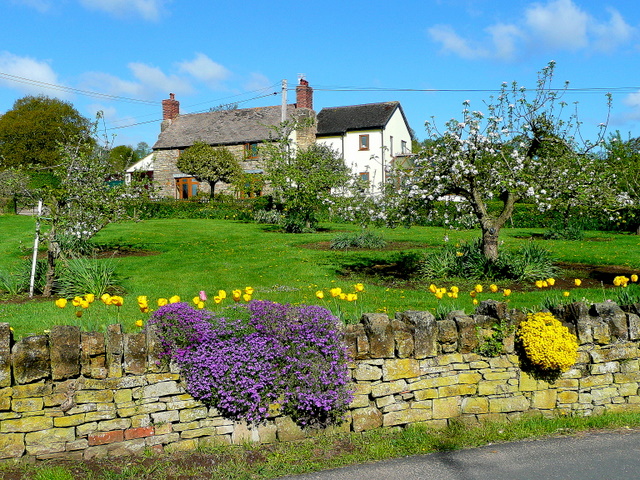
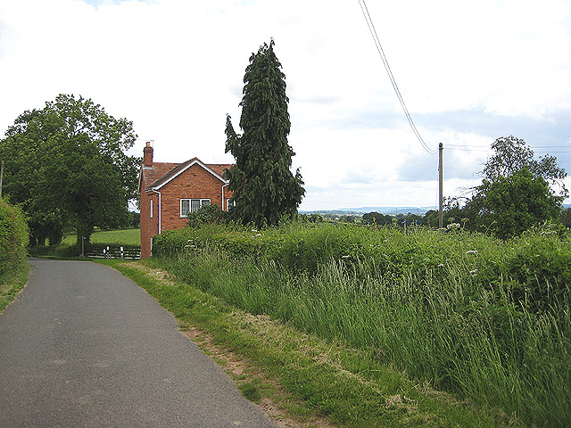
Horseley Grove is a charming village located in the county of Gloucestershire, England. Situated in the heart of the picturesque Wood Forest, it is surrounded by lush greenery and breathtaking natural beauty. The village is renowned for its tranquil atmosphere and idyllic rural setting, making it a popular destination for nature lovers and those seeking a peaceful retreat.

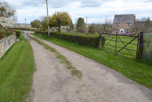
Horseley Grove is characterized by its quaint cottages and traditional architecture, which add to the village's old-world charm. The streets are lined with vibrant gardens and well-maintained pathways, creating a welcoming and inviting ambiance. Residents take great pride in their community and often participate in local initiatives to preserve the village's rich heritage.

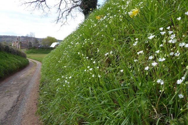
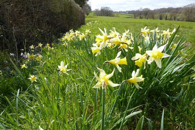
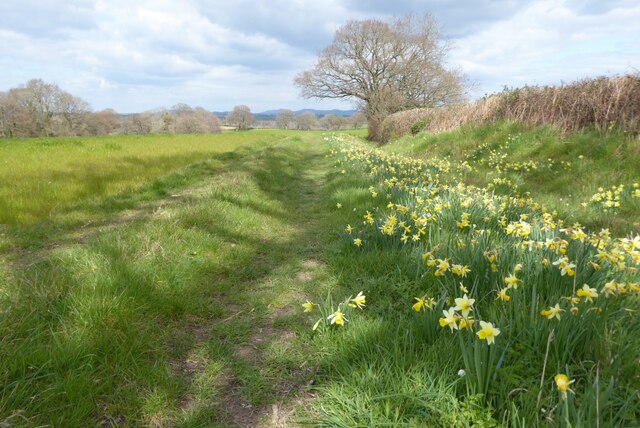
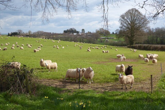
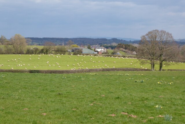
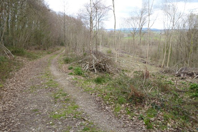
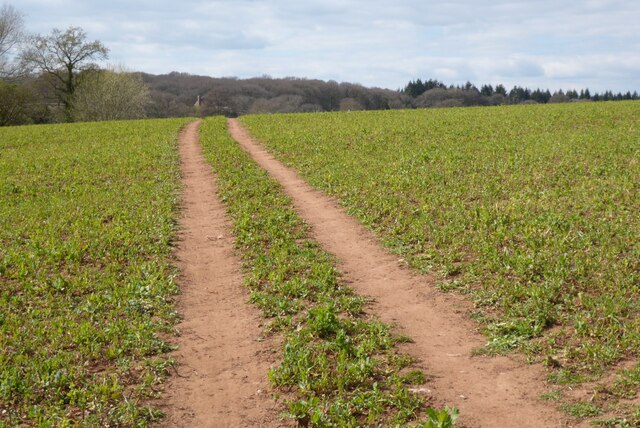
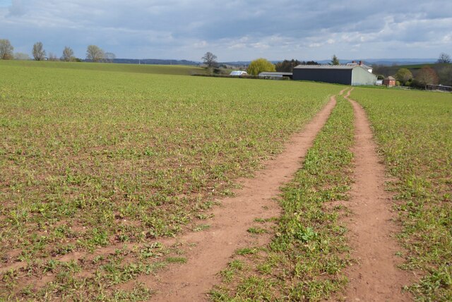
The Wood Forest, which envelops Horseley Grove, is a haven for wildlife enthusiasts and outdoor adventurers. It offers an extensive network of walking trails and cycling routes, allowing visitors to explore the area's diverse flora and fauna. The forest boasts an impressive variety of trees, including oak, beech, and birch, which create a stunning canopy overhead.

In addition to its natural beauty, Horseley Grove is also home to a close-knit community. The village hosts regular social events, such as fairs and festivals, which bring residents together and foster a sense of belonging. The local pub, The Horse and Hound, serves as a hub for socializing and is known for its warm hospitality and delicious traditional cuisine.

Overall, Horseley Grove, Gloucestershire, offers a unique blend of natural splendor and community spirit. Whether exploring the Wood Forest or engaging in village activities, visitors are sure to be enchanted by the village's timeless appeal.

If you have any feedback on the listing, please let us know in the comments section below.

Horseley Grove Images

Images are sourced within 2km of 51.911549/-2.4422277 or Grid Reference SO6923. Thanks to Geograph Open Source API. All images are credited.

Farm drive to Knappers Farm The winding farm drive leading to Knappers Farm near Newent.  A public footpath follows this drive.
Farm drive to Knappers Farm
The winding farm drive leading to Knappers Farm near Newent. A public footpath follows this drive.
Spring blooms on the roadside The farm drive to Knappers Farm has become sunken, no doubt from centuries of use.  Spring bloom as colour to the grass bank.  The farmhouse can be seen in the background.
Spring blooms on the roadside
The farm drive to Knappers Farm has become sunken, no doubt from centuries of use. Spring bloom as colour to the grass bank. The farmhouse can be seen in the background.
Wild daffodils Wild daffodils beside a field hedgerow near Knappers Farm.
Wild daffodils
Wild daffodils beside a field hedgerow near Knappers Farm.
Daffodils and a footpath This footpath near Knappers Farm is the route of the Geopark Way.  Wild daffodils are a feature of this corner of Gloucestershire.
Daffodils and a footpath
This footpath near Knappers Farm is the route of the Geopark Way. Wild daffodils are a feature of this corner of Gloucestershire.
Sheep near Knappers Farm Sheep in a field beside the Geopark Way to the south-west of Knappers Farm.
Sheep near Knappers Farm
Sheep in a field beside the Geopark Way to the south-west of Knappers Farm.
Farmland around Knappers Farm View to the north-east from the Geopark Way where it enters Acorn Wood.  Sheep graze a field in the middle distance with Knappers Farm beyond.  The spire of Newent Church can be seen to the left of centre.
Farmland around Knappers Farm
View to the north-east from the Geopark Way where it enters Acorn Wood. Sheep graze a field in the middle distance with Knappers Farm beyond. The spire of Newent Church can be seen to the left of centre.
Footpath through Acorn Word The Geopark Way follows this footpath through Acorn Wood to the south of Newent.  Here the wood is partially felled.
Footpath through Acorn Word
The Geopark Way follows this footpath through Acorn Wood to the south of Newent. Here the wood is partially felled.
Farm buildings Farm buildings and electricity pylons near Clifford Mesne.
Farm buildings
Farm buildings and electricity pylons near Clifford Mesne.
Footpath crossing an arable field The Geopark Way follows this footpath across this field near Knappers Farm.
Footpath crossing an arable field
The Geopark Way follows this footpath across this field near Knappers Farm.
Footpath approaching Knappers Farm The Geopark Way follows this footpath approaching Knappers Farm.
Footpath approaching Knappers Farm
The Geopark Way follows this footpath approaching Knappers Farm.
Footpath and track Footpath and track near Clifford's Mesne.
Footpath and track
Footpath and track near Clifford's Mesne.
Farmland near Clifford's Mesne I am not sure what the bushes are in this field, possibly currents.
Farmland near Clifford's Mesne
I am not sure what the bushes are in this field, possibly currents.
Former Newent Falconry centre Sadly this falconry centre is no longer open.
Former Newent Falconry centre
Sadly this falconry centre is no longer open.
A field of broad beans Broad beans beside a footpath in a field to the south of Newent.
A field of broad beans
Broad beans beside a footpath in a field to the south of Newent.
Gated Track in Newent Woods
St Peter's Church - Clifford's Mesne
The Green
The Green
Vanishing Point Power lines vanish into the dense fog
Vanishing Point
Power lines vanish into the dense fog
Show me another place!

Horseley Grove is located at Grid Ref: SO6923 (Lat: 51.911549, Lng: -2.4422277)

Administrative County: Gloucestershire

District: Forest of Dean

Police Authority: Gloucestershire

What 3 Words

///dart.schematic.urge. Near Newent, Gloucestershire

Nearby Locations

Horseley Grove Reslaw Wood

Related Wikis

Aston Ingham

Aston Ingham is a village in south-eastern Herefordshire, England, near Newent and about 7 miles (11 km) east of Ross-on-Wye. The population of the village...

Boulsdon

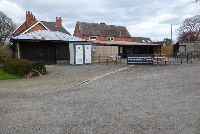
Boulsdon is a village in Gloucestershire, England. It is the location of the International Centre for Birds of Prey.A low mound in the village may have...

Cliffords Mesne

Cliffords Mesne is an English village in Gloucestershire, two miles (3.2 km) south-west of the town of Newent. It became the home of the autobiographical...

Gorsley and Kilcot

Gorsley and Kilcot is a civil parish forming part of the district of the Forest of Dean in the English county of Gloucestershire. The single parish of...

Anthony's Cross

Anthony's Cross is a hamlet in Gloucestershire, England. == External links == Media related to Anthony's Cross at Wikimedia Commons

Beavan's Hill

Beavan's Hill is a village in south east Herefordshire, England. The village is situated on the edge of Withymoor Wood, an area of ancient woodland, and...

May Hill

May Hill is a prominent English hill between Gloucester and Ross-on-Wye. Its summit, on the western edge of Gloucestershire and its northern slopes in...

Luxley

Luxley is a village in the southwest Midlands of England, on the border between Gloucestershire and Herefordshire near May Hill. Luxley is 12 km (7.5 mi...

Nearby Amenities

Located within 500m of 51.911549,-2.4422277
Barrier: kissing_gate
Lat/Long: 51.9106167/-2.4396386
Barrier: kissing_gate
Lat/Long: 51.9118816/-2.4409766
Barrier: stile
Lat/Long: 51.9120752/-2.4415783
Power: tower
Source: Bing
Lat/Long: 51.9103824/-2.441403
Power: tower
Source: Bing
Lat/Long: 51.9102267/-2.4375943
Power: tower
Source: Bing
Lat/Long: 51.9102966/-2.4443365
Power: tower
Source: Bing
Lat/Long: 51.9099059/-2.4379753
Power: tower
Source: Bing
Lat/Long: 51.907914/-2.4460429
Power: tower
Source: Bing
Lat/Long: 51.9109354/-2.4426812
Barrier: stile
Lat/Long: 51.9106777/-2.4374579
Barrier: stile
Lat/Long: 51.9112974/-2.4379302
Power: pole
Lat/Long: 51.9072277/-2.4412983
Power: pole
Lat/Long: 51.9073881/-2.4418706
Power: pole
Lat/Long: 51.9075026/-2.442585
Power: pole
Lat/Long: 51.9076913/-2.443828
Power: pole
Lat/Long: 51.907818/-2.4446516
Location Transition: yes
Power: pole
Lat/Long: 51.9079501/-2.4454992
Barrier: stile
Lat/Long: 51.9149371/-2.4411433
Barrier: kissing_gate
Lat/Long: 51.9149531/-2.4412635
The Beeches
Power: pole
Transformer: distribution
Voltage Primary: 11000
Lat/Long: 51.9082024/-2.439512
Power: pole
Lat/Long: 51.9078077/-2.4393739
Location Transition: yes
Power: pole
Lat/Long: 51.9084949/-2.4474507
Perrys Farm
Power: pole
Transformer: distribution
Voltage Primary: 11000
Lat/Long: 51.9084928/-2.4470557
Power: pole
Lat/Long: 51.9082045/-2.4462377
Hudgemore
Power: pole
Transformer: distribution
Voltage Primary: 11000
Lat/Long: 51.9113185/-2.4385625
Power: pole
Lat/Long: 51.9112044/-2.4377967
Power: pole
Lat/Long: 51.9110832/-2.4370055
Power: pole
Lat/Long: 51.9108631/-2.4360359
Power: tower
Source: Bing
Lat/Long: 51.9096809/-2.4427199
The data included in this document is from www.openstreetmap.org. The data is made available under ODbL.

Have you been to Horseley Grove?

Leave your review of Horseley Grove below (or comments, questions and feedback).