Spring Plantation

Wood, Forest in Cheshire

England

Spring Plantation

Hole House underground gas storage plant Minshull Vernon. View from footpath towards Hole House underground gas storage plant. This is a new feature not yet shown on the OS map - and quite a surprise to find such a modern industrial installation in the middle of a little-walked area of footpaths and farmland. Needless to say the concept of nderground gas storage - as here and at Byley and Lostock Gralam not far away -is proving controversial locally. A lot of protests, but apparently no suggestions as to cost-effective alternative ways of providing the protesters with their energy needs.
Hole House underground gas storage plant Credit: Mike Harris

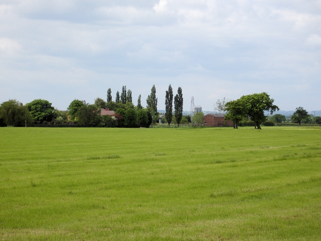
Spring Plantation, Cheshire, also known as Wood or Forest, is a picturesque and expansive area located in the county of Cheshire, England. Spanning over 100 acres, it is renowned for its lush greenery, diverse wildlife, and a rich history that dates back several centuries.

The plantation is characterized by its dense woodland, with a variety of tree species such as oak, beech, and birch dominating the landscape. These trees provide a stunning canopy, creating a tranquil and serene ambiance throughout the seasons. The woodland floor is adorned with a colorful array of wildflowers, adding to the natural beauty of the area.

Home to an abundance of wildlife, Spring Plantation is a haven for nature enthusiasts. Visitors may spot various species of birds, including woodpeckers, owls, and songbirds, as well as small mammals like squirrels, rabbits, and foxes. The plantation's diverse ecosystem also supports a range of insects, butterflies, and other invertebrates.

The history of Spring Plantation is deeply intertwined with the local community. It has been utilized for centuries as a source of timber, providing wood for various purposes such as construction and fuel. The area also served as a hunting ground for the local nobility, who would frequently organize hunting parties on its grounds.

Today, Spring Plantation is cherished not only for its natural beauty but also as a recreational area. It offers numerous walking trails, allowing visitors to explore the woodland and enjoy the tranquility of nature. Whether it is a leisurely stroll, a picnic, or simply birdwatching, Spring Plantation offers a peaceful retreat for all who visit.

If you have any feedback on the listing, please let us know in the comments section below.

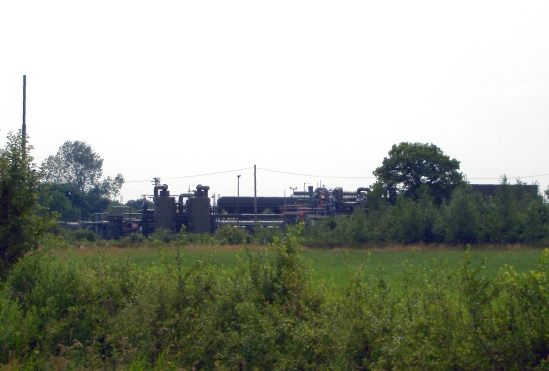
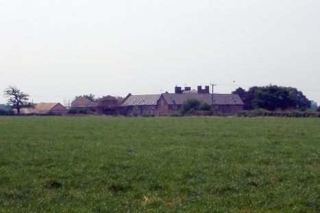
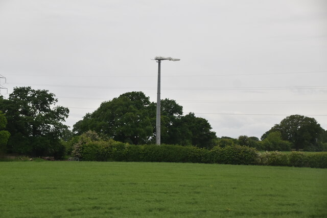
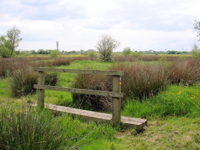
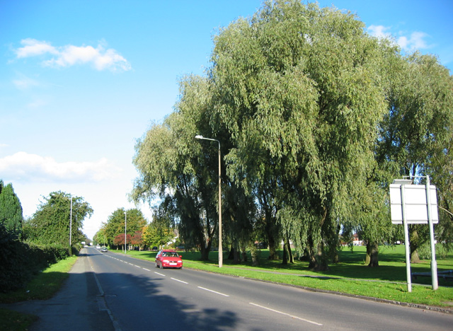
Spring Plantation Images

Images are sourced within 2km of 53.12511/-2.4575494 or Grid Reference SJ6958. Thanks to Geograph Open Source API. All images are credited.

Hole House underground gas storage plant Minshull Vernon. View from footpath towards Hole House underground gas storage plant. This is a new feature not yet shown on the OS map - and quite a surprise to find such a modern industrial installation in the middle of a little-walked area of footpaths and farmland. Needless to say the concept of nderground gas storage - as here and at Byley and Lostock Gralam not far away -is proving controversial locally. A lot of protests, but apparently no suggestions as to cost-effective alternative ways of providing the protesters with their energy needs.
Hole House underground gas storage plant
Minshull Vernon. View from footpath towards Hole House underground gas storage plant. This is a new feature not yet shown on the OS map - and quite a surprise to find such a modern industrial installation in the middle of a little-walked area of footpaths and farmland. Needless to say the concept of nderground gas storage - as here and at Byley and Lostock Gralam not far away -is proving controversial locally. A lot of protests, but apparently no suggestions as to cost-effective alternative ways of providing the protesters with their energy needs.
Dairy Farm, Minshull Vernon Minshull Vernon. View from Crewe & Nantwich Circular Walk towards Dairy Farm. This farm is unimaginatively, but very appropriately, named! In the middle of flat dairy farming countryside north of Crewe.
Dairy Farm, Minshull Vernon
Minshull Vernon. View from Crewe & Nantwich Circular Walk towards Dairy Farm. This farm is unimaginatively, but very appropriately, named! In the middle of flat dairy farming countryside north of Crewe.
Farmland north of Crewe
Pylon, Spring Farm
Pylon, Spring Farm
Wind Turbine
Wind Turbine
Wind Turbine
Wind Turbine
Warmingham Road at Coppenhall Moss, Crewe Crewe. View along Warmingham Road at Coppenhall Moss. The edge of the urban sprawl - after this it is countryside.
Warmingham Road at Coppenhall Moss, Crewe
Crewe. View along Warmingham Road at Coppenhall Moss. The edge of the urban sprawl - after this it is countryside.
Crewe & Nantwich Circular Walk at Coppenhall Moss Crewe. View along Crewe & Nantwich Circular Walk near Coppenhall Moss. The boundary of Crewe is at the forward hedge line - after this it is the flat farmland of Warmingham.
Crewe & Nantwich Circular Walk at Coppenhall Moss
Crewe. View along Crewe & Nantwich Circular Walk near Coppenhall Moss. The boundary of Crewe is at the forward hedge line - after this it is the flat farmland of Warmingham.
Warmingham farmland Warmingham. View along footpath. Between Ridding Farm and Stocia Farm.
Warmingham farmland
Warmingham. View along footpath. Between Ridding Farm and Stocia Farm.
Warmingham: field pond near Warmingham Road Warmingham: field pond beside footpath near Warmingham Road well south of the village centre.
Warmingham: field pond near Warmingham Road
Warmingham: field pond beside footpath near Warmingham Road well south of the village centre.
Warmingham: Stocia Farm Warmingham: Stocia Farm - a dairy farm south of the village.
Warmingham: Stocia Farm
Warmingham: Stocia Farm - a dairy farm south of the village.
North Street Methodist Church
The Cross Keys
The Cross Keys
Crewe - Crewe Town footpath 13 Crewe. View along footpath Crewe Town 13. The main line railway (Crewe - Winsford - Liverpool) is to the right behind the bushes. The houses on the left are on Wareham Drive.
Crewe - Crewe Town footpath 13
Crewe. View along footpath Crewe Town 13. The main line railway (Crewe - Winsford - Liverpool) is to the right behind the bushes. The houses on the left are on Wareham Drive.
Crewe - Coppenhall Moss Crewe. View from Crewe Town footpath 28 across Coppenhall Moss. The footbridge in the distance carries Crewe Town 29 over the main line railway.
Crewe - Coppenhall Moss
Crewe. View from Crewe Town footpath 28 across Coppenhall Moss. The footbridge in the distance carries Crewe Town 29 over the main line railway.
Warmingham - Moss Lane Warmingham. View along Moss Lane (Warmingham footpath 16) from west of Moss Lane Farm.
Warmingham - Moss Lane
Warmingham. View along Moss Lane (Warmingham footpath 16) from west of Moss Lane Farm.
Hall Lane Meets Warmingham Road
Hall Lane
Hall Lane
Show me another place!

Spring Plantation is located at Grid Ref: SJ6958 (Lat: 53.12511, Lng: -2.4575494)

Unitary Authority: Cheshire East

Police Authority: Cheshire

What 3 Words

///glorified.trains.sample. Near Crewe, Cheshire

Nearby Locations

Spring Plantation

Related Wikis

Leighton, Cheshire

Leighton is a scattered settlement and civil parish in the unitary authority of Cheshire East and the ceremonial county of Cheshire, England, which lies...

A530 road

The A530 road is a road linking the A525 east of Whitchurch, Shropshire, England with the A559 east of Northwich, in Cheshire. The road follows the route...

St Peter's Church, Minshull Vernon

St Peter's Church is in Middlewich Road, Minshull Vernon, Cheshire, England. It is an active Anglican parish church in the deanery of Nantwich, the archdeaconry...

Leighton Hospital

Leighton Hospital is a hospital located to the northwest of the town of Crewe in the county of Cheshire, England. It is managed by the Mid Cheshire Hospitals...

Nearby Amenities

Located within 500m of 53.12511,-2.4575494
Barrier: stile
Foot: yes
Lat/Long: 53.1213436/-2.46107
Power: tower
Lat/Long: 53.1266969/-2.459666
Power: tower
Lat/Long: 53.1248179/-2.4643383
Barrier: stile
Foot: yes
Lat/Long: 53.1226185/-2.4520566
Barrier: stile
Foot: yes
Lat/Long: 53.1226966/-2.4516719
Barrier: stile
Foot: yes
Lat/Long: 53.1272662/-2.4542695
Barrier: kissing_gate
Foot: yes
Lat/Long: 53.1269641/-2.4591474
Note: tripwire across public footpath
Lat/Long: 53.1272022/-2.4547045
Barrier: stile
Foot: yes
Lat/Long: 53.1268311/-2.4589117
Barrier: stile
Foot: yes
Lat/Long: 53.1268253/-2.4590116
Power: tower
Lat/Long: 53.1269614/-2.4552157
Power: tower
Lat/Long: 53.125133/-2.4648589
Power: tower
Lat/Long: 53.1275291/-2.462826
Barrier: stile
Foot: yes
Lat/Long: 53.1249252/-2.4534932
Waste Basket
Lat/Long: 53.1225015/-2.4577641
Waste Basket
Lat/Long: 53.1226518/-2.4540898
The data included in this document is from www.openstreetmap.org. The data is made available under ODbL.

Have you been to Spring Plantation?

Leave your review of Spring Plantation below (or comments, questions and feedback).