Burthwaite Wood

Wood, Forest in Westmorland Eden

England

Burthwaite Wood

Flakebridge Flakebridge comprises a scattering of houses along the southern edge of Flakebridge Wood, above the very flat valley of Murton Beck. This house sits opposite the junction track heading north alongside Swine Gill, deeper into the forest. Judging by the noise which assailed us for the best part of an hour as we approached this point, which had fortunately ceased by the time we got here, the main activity here is slaughtering anything that comes into shotgun range. Just to the west, after the shooting had desisted, the howls of very many dogs serenaded our passing from a building in which they were clearly imprisoned but keen to escape and either greet or devour passers by.
Flakebridge Credit: Andy Waddington

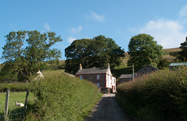
Burthwaite Wood is a picturesque woodland located in Westmorland, a historic county in the northwest of England. Nestled in the heart of the Lake District National Park, this enchanting forest covers several acres of land and offers visitors a tranquil and serene experience.

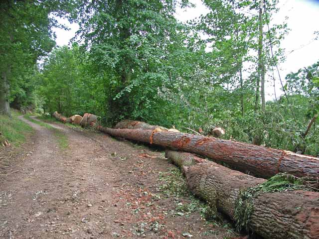
The wood is characterized by its diverse range of tree species, including oak, beech, ash, and birch. These majestic trees create a dense canopy that provides shade and shelter to a variety of wildlife. The forest floor is adorned with a rich carpet of bluebells and wildflowers during the spring season, adding a splash of vibrant colors to the landscape.

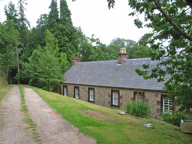
Visitors can explore Burthwaite Wood through a network of well-maintained walking trails that wind their way through the forest. These paths offer breathtaking views of the surrounding countryside and afford glimpses of wildlife such as deer, squirrels, and a myriad of bird species.

The wood also houses a small picnic area, where visitors can relax and enjoy a packed lunch amidst the peaceful ambiance of nature. Additionally, there are designated areas for camping and bonfires, allowing visitors to extend their stay and experience the beauty of the wood at night.

Burthwaite Wood is a popular destination for nature enthusiasts, hikers, and families seeking a day out in the great outdoors. Its combination of scenic beauty, diverse flora and fauna, and well-maintained trails make it a must-visit location for anyone exploring the Westmorland region.

If you have any feedback on the listing, please let us know in the comments section below.

Burthwaite Wood Images

Images are sourced within 2km of 54.604147/-2.4741585 or Grid Reference NY6923. Thanks to Geograph Open Source API. All images are credited.

Flakebridge Flakebridge comprises a scattering of houses along the southern edge of Flakebridge Wood, above the very flat valley of Murton Beck. This house sits opposite the junction track heading north alongside Swine Gill, deeper into the forest. Judging by the noise which assailed us for the best part of an hour as we approached this point, which had fortunately ceased by the time we got here, the main activity here is slaughtering anything that comes into shotgun range. Just to the west, after the shooting had desisted, the howls of very many dogs serenaded our passing from a building in which they were clearly imprisoned but keen to escape and either greet or devour passers by.
Flakebridge
Flakebridge comprises a scattering of houses along the southern edge of Flakebridge Wood, above the very flat valley of Murton Beck. This house sits opposite the junction track heading north alongside Swine Gill, deeper into the forest. Judging by the noise which assailed us for the best part of an hour as we approached this point, which had fortunately ceased by the time we got here, the main activity here is slaughtering anything that comes into shotgun range. Just to the west, after the shooting had desisted, the howls of very many dogs serenaded our passing from a building in which they were clearly imprisoned but keen to escape and either greet or devour passers by.
The Pennine Way near Bow Hall
Ordnance Survey Cut Mark This OS cut mark can be found on the gatepost south side of the track. It marks a point 853.5ft above mean sea level.
Ordnance Survey Cut Mark
This OS cut mark can be found on the gatepost south side of the track. It marks a point 853.5ft above mean sea level.
Milestone - Birkdale 6 Stone with the inscription 'Birkdale 6m'
Milestone - Birkdale 6
Stone with the inscription 'Birkdale 6m'
Ordnance Survey Cut Mark This OS cut mark can be found on the gatepost south side of the road. It marks a point 244.377m above mean sea level.
Ordnance Survey Cut Mark
This OS cut mark can be found on the gatepost south side of the road. It marks a point 244.377m above mean sea level.
Fields south of minor road near Greenhow A narrow minor road connects the villages of Dufton and Murton at the foot of the western side of the northern Pennines. The view here is over fields south of that road, east of the farm at Greenhow.
Fields south of minor road near Greenhow
A narrow minor road connects the villages of Dufton and Murton at the foot of the western side of the northern Pennines. The view here is over fields south of that road, east of the farm at Greenhow.
Hay field south-west of Town Head A narrow minor road connects the two villages, Dufton and Murton; the view here is from that road near to the farm at Town Head showing a field with three phases of hay making on show: unmown grass to the right, mown grass to the left and at the centre, an area of grass where the hay has been lifted.
Note: it's also possible that the product of this field will be 'haylage', similar to hay but with a higher moisture content; the name being a portmanteau word of hay and silage.
Hay field south-west of Town Head
A narrow minor road connects the two villages, Dufton and Murton; the view here is from that road near to the farm at Town Head showing a field with three phases of hay making on show: unmown grass to the right, mown grass to the left and at the centre, an area of grass where the hay has been lifted. Note: it's also possible that the product of this field will be 'haylage', similar to hay but with a higher moisture content; the name being a portmanteau word of hay and silage.
Keisley Keisley is a farm lying north of a minor road connecting the villages of Dufton and Murton.
Keisley
Keisley is a farm lying north of a minor road connecting the villages of Dufton and Murton.
High Cup Winery and Townhead farm
Bow hall farm. Farm near Dufton in the Eden valley.
Bow hall farm.
Farm near Dufton in the Eden valley.
Keisley
Keisley
Boardwalk across marshes near Billy's Beck
Harthwaite Sike
Harthwaite Sike
Bridleway at Bow Hall Part of the Pennine Way.
Bridleway at Bow Hall
Part of the Pennine Way.
Seat near Keisley
Seat near Keisley
Two hills along line of farm road The farther hill is named Keisley Bank, the one to the right is Harthwaite; the view is from just south of the Pennine Way.
Two hills along line of farm road
The farther hill is named Keisley Bank, the one to the right is Harthwaite; the view is from just south of the Pennine Way.
Felled trees at Flakebridge There is a sawmill nearby.
Felled trees at Flakebridge
There is a sawmill nearby.
Cottages at Flakebridge
Show me another place!

Burthwaite Wood is located at Grid Ref: NY6923 (Lat: 54.604147, Lng: -2.4741585)

Administrative County: Cumbria

District: Eden

Police Authority: Cumbria

What 3 Words

///funny.tripling.richer. Near Appleby-in-Westmorland, Cumbria

Nearby Locations

Burthwaite Wood

Related Wikis

Keisley

Keisley is a small hamlet in the English county of Cumbria. It is located in the Dufton civil parish and the Eden district. == Location and geography... ==

Flakebridge

Flakebridge is a woodland and small hamlet in the Eden District, Cumbria, England, 3 kilometres (1.9 mi) south-west from the village of Dufton and 1.95...

Dufton

Dufton is a village and civil parish in Cumbria, England. Historically part of Westmorland, it lies in the Eden Valley and below Great Dun Fell. It is...

Brampton, Eden

Brampton is a village in the Eden district, in the county of Cumbria, England. Before 1974 it was in the county of Westmorland; the nearest town is Appleby...

Nearby Amenities

Located within 500m of 54.604147,-2.4741585
Power: pole
Lat/Long: 54.6039468/-2.4665069
Power: pole
Lat/Long: 54.6039422/-2.4673394
The data included in this document is from www.openstreetmap.org. The data is made available under ODbL.

Have you been to Burthwaite Wood?

Leave your review of Burthwaite Wood below (or comments, questions and feedback).