Busk Coppice

Wood, Forest in Worcestershire Malvern Hills

England

Busk Coppice

Old Milepost by the B4204 at Yearston Court Cast iron post by the B4204, in parish of Upper Sapey (District), Yearston Court, by ivy hedge. Grazebrook iron T-post, erected by the County Council in the 20th century. 

Inscription reads:-
: {hand->} / STANFORD / ON TEME 2 / TENBURY 7½ / BROMYARD 7½ : : UPPER SAPEY : : {<-hand} / CLIFTON-ON / TEME 2 / MARTLEY 5½ / WORCESTER 13 :
Maker:-
: M&W GRAZEBOOK / IRON FOUNDERS / DUDLEY :

Herefordshire SMR.
SMR Number: 56556 <span class="nowrap"><a title="https://www.heritagegateway.org.uk/Gateway/Results_Single.aspx?uid=MHE28313&resourceID=101" rel="nofollow ugc noopener" href="https://www.heritagegateway.org.uk/Gateway/Results_Single.aspx?uid=MHE28313&resourceID=101">Link</a><img style="margin-left:2px;" alt="External link" title="External link - shift click to open in new window" src="https://s1.geograph.org.uk/img/external.png" width="10" height="10"/></span>

Milestone Society National ID: HF_TBWO07
Old Milepost by the B4204 at Yearston Court Credit: Roadside Relics

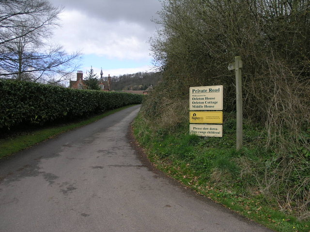
Busk Coppice is a serene and picturesque woodland located in Worcestershire, England. Situated near the village of Callow Hill, this enchanting forest spans an area of approximately 50 acres. It is a popular destination for nature enthusiasts, hikers, and families seeking a tranquil escape from the hustle and bustle of everyday life.

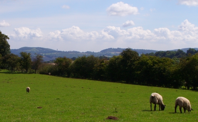
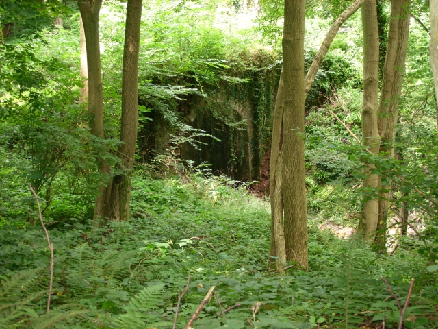
The woodland is predominantly composed of broadleaf trees, including oak, ash, and beech, which create a dense canopy overhead. This lush vegetation provides a habitat for a diverse range of wildlife, such as deer, foxes, badgers, and numerous bird species. The forest floor is adorned with a carpet of bluebells during spring, creating a breathtaking sight for visitors.

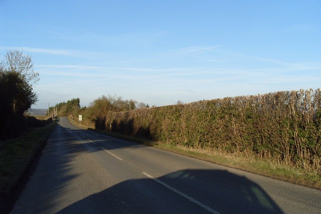
Visitors can explore the woodland through a network of well-maintained footpaths and trails, which wind through the trees and lead to secluded clearings and viewpoints. These paths are suitable for walkers of all ages and abilities, and there are designated areas where visitors can rest and enjoy a picnic amidst the natural beauty of the surroundings.

Busk Coppice is not only a haven for wildlife and outdoor enthusiasts but also serves as an important educational resource. Local schools often organize field trips to the woodland, allowing students to learn about the ecosystem and the importance of conservation.

Overall, Busk Coppice offers a serene and captivating experience for those seeking solace in nature. With its breathtaking scenery, abundant wildlife, and educational opportunities, this woodland is a true gem in the Worcestershire countryside.

If you have any feedback on the listing, please let us know in the comments section below.

Busk Coppice Images

Images are sourced within 2km of 52.284585/-2.4501122 or Grid Reference SO6965. Thanks to Geograph Open Source API. All images are credited.

Old Milepost by the B4204 at Yearston Court Cast iron post by the B4204, in parish of Upper Sapey (District), Yearston Court, by ivy hedge. Grazebrook iron T-post, erected by the County Council in the 20th century. 

Inscription reads:-
: {hand->} / STANFORD / ON TEME 2 / TENBURY 7½ / BROMYARD 7½ : : UPPER SAPEY : : {<-hand} / CLIFTON-ON / TEME 2 / MARTLEY 5½ / WORCESTER 13 :
Maker:-
: M&W GRAZEBOOK / IRON FOUNDERS / DUDLEY :

Herefordshire SMR.
SMR Number: 56556 <span class="nowrap"><a title="https://www.heritagegateway.org.uk/Gateway/Results_Single.aspx?uid=MHE28313&resourceID=101" rel="nofollow ugc noopener" href="https://www.heritagegateway.org.uk/Gateway/Results_Single.aspx?uid=MHE28313&resourceID=101">Link</a><img style="margin-left:2px;" alt="External link" title="External link - shift click to open in new window" src="https://s1.geograph.org.uk/img/external.png" width="10" height="10"/></span>

Milestone Society National ID: HF_TBWO07
Old Milepost by the B4204 at Yearston Court
Cast iron post by the B4204, in parish of Upper Sapey (District), Yearston Court, by ivy hedge. Grazebrook iron T-post, erected by the County Council in the 20th century. Inscription reads:- : {hand->} / STANFORD / ON TEME 2 / TENBURY 7½ / BROMYARD 7½ : : UPPER SAPEY : : {<-hand} / CLIFTON-ON / TEME 2 / MARTLEY 5½ / WORCESTER 13 : Maker:- : M&W GRAZEBOOK / IRON FOUNDERS / DUDLEY : Herefordshire SMR. SMR Number: 56556 LinkExternal link Milestone Society National ID: HF_TBWO07
Old Milestone, B4204, near Adamswood Farm The milestone is located 30m north of the junction with Pouk Lane, on the verge on the south west side of the road. Parish of Upper Sapey (Herefordshire District). Stone post (plate lost), Hundred House stone design, erected by the Hundred House (First District) turnpike trust in the 19th century. 

Inscription reads:-
TO
LONDON
127 MILES
TO
WORCESTER
15
TO
TENBURY
7 

Herefordshire SMR.
SMR Number: 56555 &lt;span class=&quot;nowrap&quot;&gt;&lt;a title=&quot;https://www.heritagegateway.org.uk/Gateway/Results_Single.aspx?uid=MHE28312&amp;amp;resourceID=101&quot; rel=&quot;nofollow ugc noopener&quot; href=&quot;https://www.heritagegateway.org.uk/Gateway/Results_Single.aspx?uid=MHE28312&amp;amp;resourceID=101&quot;&gt;Link&lt;/a&gt;&lt;img style=&quot;margin-left:2px;&quot; alt=&quot;External link&quot; title=&quot;External link - shift click to open in new window&quot; src=&quot;https://s1.geograph.org.uk/img/external.png&quot; width=&quot;10&quot; height=&quot;10&quot;/&gt;&lt;/span&gt;

Milestone Society National ID: HF_TBWO08
Old Milestone, B4204, near Adamswood Farm
The milestone is located 30m north of the junction with Pouk Lane, on the verge on the south west side of the road. Parish of Upper Sapey (Herefordshire District). Stone post (plate lost), Hundred House stone design, erected by the Hundred House (First District) turnpike trust in the 19th century. Inscription reads:- TO LONDON 127 MILES TO WORCESTER 15 TO TENBURY 7 Herefordshire SMR. SMR Number: 56555 LinkExternal link Milestone Society National ID: HF_TBWO08
Loxton, Stanford-on-Teme House and farm buildings viewed from the road to the east.
Loxton, Stanford-on-Teme
House and farm buildings viewed from the road to the east.
Private Road Public Footpath This private road to Orleton House is also a public footpath to Quarry Hill.
Private Road Public Footpath
This private road to Orleton House is also a public footpath to Quarry Hill.
Woodland path near Sapey Common Woodland path leading down to Temple Dingle
Woodland path near Sapey Common
Woodland path leading down to Temple Dingle
Larch trees in Park Plantation The larch tree is the only deciduous coniferous tree in Britain.
Larch trees in Park Plantation
The larch tree is the only deciduous coniferous tree in Britain.
Upper Sapey Viewed from the footpath east of Upper Sapey church which can be seen beyond the trees in the valley.
Upper Sapey
Viewed from the footpath east of Upper Sapey church which can be seen beyond the trees in the valley.
Sheep in a field next to Busk Coppice
Buildings opposite High House Approaching the junction of the B4204 and B4203.
Buildings opposite High House
Approaching the junction of the B4204 and B4203.
Upper Sapey church The church at Upper Sapey is dedicated to St Michael and All Angels.
Upper Sapey church
The church at Upper Sapey is dedicated to St Michael and All Angels.
Dudshill Court Dudshill Court viewed from the footpath to the south.
Dudshill Court
Dudshill Court viewed from the footpath to the south.
The red earth of Worcestershire
Entrance to Withey Bank
Kiln Cottages Looking west on the road from Sapey Common
Kiln Cottages
Looking west on the road from Sapey Common
Sheep Pasture, Church Farm, Hanley William Looking towards the Abbeley Clock Tower &lt;a href=&quot;https://www.geograph.org.uk/photo/392108&quot;&gt;SO7466 : Abberley Clock Tower&lt;/a&gt;
Sheep Pasture, Church Farm, Hanley William
Looking towards the Abbeley Clock Tower SO7466 : Abberley Clock Tower
Bridge in Hanley Dingle A very tall brick built bridge over the stream running into Hanley Dingle; close to the noisy waterfall. The bridge carries a farm track and public footpath.
Bridge in Hanley Dingle
A very tall brick built bridge over the stream running into Hanley Dingle; close to the noisy waterfall. The bridge carries a farm track and public footpath.
B4204 Near Sapey Common
Show me another place!

Busk Coppice is located at Grid Ref: SO6965 (Lat: 52.284585, Lng: -2.4501122)

Administrative County: Worcestershire

District: Malvern Hills

Police Authority: West Mercia

What 3 Words

///acclaimed.dignify.export. Near Collington, Herefordshire

Related Wikis

Stanford on Teme

Stanford on Teme is a village and former civil parish, now in the parish of Stanford with Orleton, in the Malvern Hills district, in the county of Worcestershire...

Sapey Common

Sapey Common is a small village in Herefordshire, England, near the border with Worcestershire, 10 km (6.2 mi) north east of Bromyard . Although the area...

Hanley William

Hanley William is a village and former civil parish, now in the parish of Hanley, in the Malvern Hills district, in the county of Worcestershire, England...

Upper Sapey

Upper Sapey is a small village and civil parish in Herefordshire, England. It is located 4 miles (6 km) northeast of Bromyard. The population of this civil...

Hanley, Worcestershire

Hanley is a civil parish in the district of Malvern Hills in the county of Worcestershire, England. Hanley William and Hanley Child are places within the...

Shelsleys

The Shelsleys are a group of small villages in the Malvern Hills District in the county of Worcestershire, England. Situated on either wide of the Teme...

Stockton on Teme

Stockton on Teme is a village and civil parish in the Malvern Hills District in the county of Worcestershire, England. It is close to the River Teme and...

Eardiston

Eardiston is a village in Worcestershire, England. The village of Eardiston lies in the valley of the river Teme between Great Witley and Tenbury Wells...

Nearby Amenities

Located within 500m of 52.284585,-2.4501122
Park Farm Stanford
Power: pole
Transformer: distribution
Voltage Primary: 11000
Lat/Long: 52.2808963/-2.4467808
Power: pole
Lat/Long: 52.2809791/-2.4487784
Power: pole
Lat/Long: 52.2805369/-2.4479181
Power: pole
Lat/Long: 52.281432/-2.4496501
Power: pole
Lat/Long: 52.2814944/-2.45044
Power: pole
Lat/Long: 52.2815301/-2.4510308
Power: pole
Lat/Long: 52.2807945/-2.45205
Fall Farm
Power: pole
Transformer: distribution
Voltage Primary: 11000
Lat/Long: 52.2870371/-2.4522351
Power: pole
Lat/Long: 52.2868738/-2.4530961
Power: pole
Lat/Long: 52.2867278/-2.4538873
Power: pole
Lat/Long: 52.2860945/-2.4547322
Power: pole
Lat/Long: 52.2855227/-2.4554712
Power: pole
Lat/Long: 52.2847934/-2.456426
Power: pole
Lat/Long: 52.28458/-2.4571583
The data included in this document is from www.openstreetmap.org. The data is made available under ODbL.

Have you been to Busk Coppice?

Leave your review of Busk Coppice below (or comments, questions and feedback).