Hillhouse Grove

Wood, Forest in Gloucestershire Forest of Dean

England

Hillhouse Grove

Farm drive to Knappers Farm The winding farm drive leading to Knappers Farm near Newent.  A public footpath follows this drive.
Farm drive to Knappers Farm Credit: Philip Halling

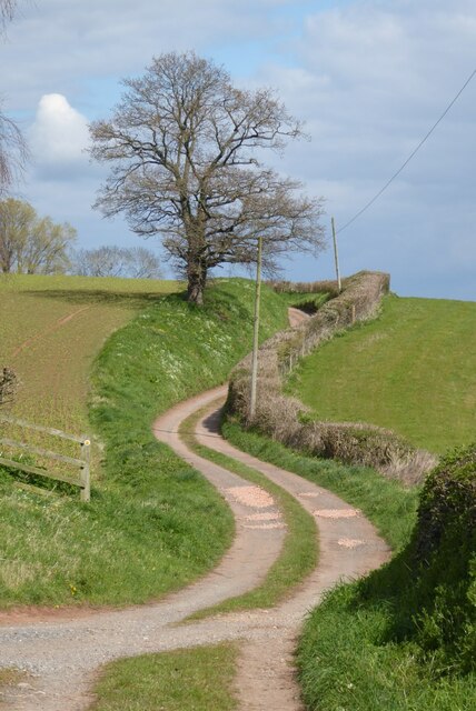
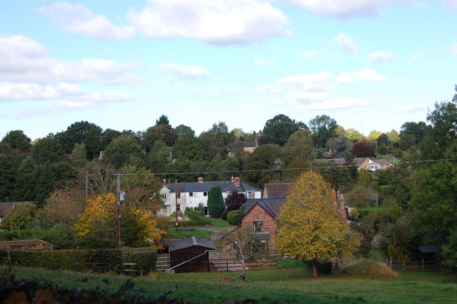
Hillhouse Grove is a charming woodland area located in Gloucestershire, England. Nestled within the stunning landscape of the Forest of Dean, this grove offers visitors a tranquil and picturesque setting to explore and unwind.

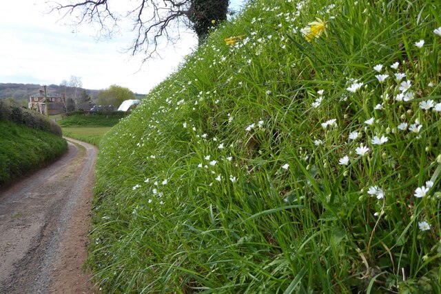
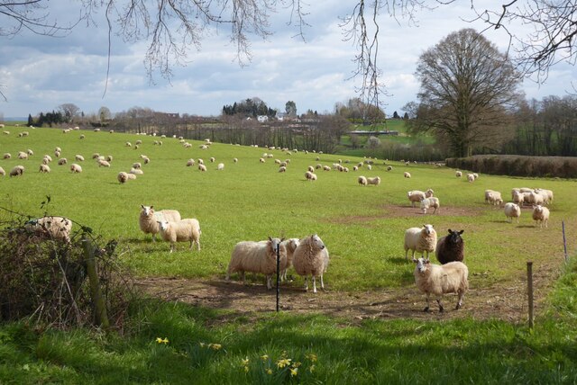
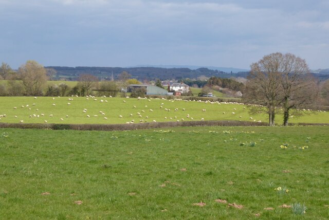
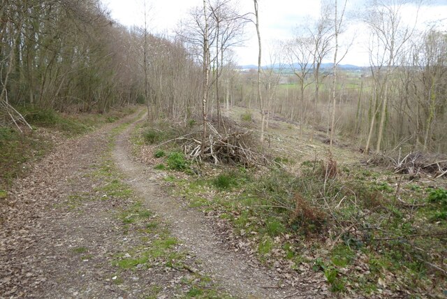
The grove is characterized by its dense canopy of towering trees, predominantly consisting of a mixture of oak, beech, and birch. These majestic trees provide ample shade and create a serene atmosphere throughout the year. The forest floor is covered in a thick layer of leaf litter, providing a soft carpet underfoot and creating a rich habitat for various woodland creatures.

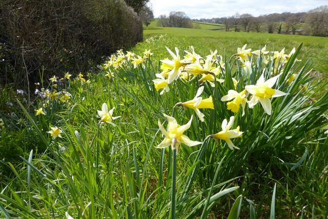
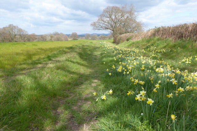
Hillhouse Grove is also home to a diverse range of flora and fauna. Wildflowers such as bluebells, primroses, and foxgloves bloom in abundance during the spring, adding vibrant splashes of color to the greenery. Bird enthusiasts will delight in the opportunity to spot species such as woodpeckers, thrushes, and owls, as they flit and call amidst the treetops.

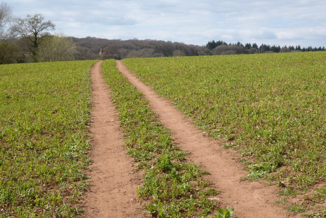
The grove is a popular destination for nature lovers and outdoor enthusiasts alike. It offers a network of well-maintained walking trails, allowing visitors to explore the area at their own pace. These paths wind through the woodland, revealing hidden glades, babbling brooks, and small clearings perfect for picnicking.

Hillhouse Grove is a true haven for those seeking respite from the hustle and bustle of everyday life. Its tranquil ambiance, natural beauty, and rich biodiversity make it a must-visit destination for anyone looking to immerse themselves in the splendor of Gloucestershire's woodlands.

If you have any feedback on the listing, please let us know in the comments section below.

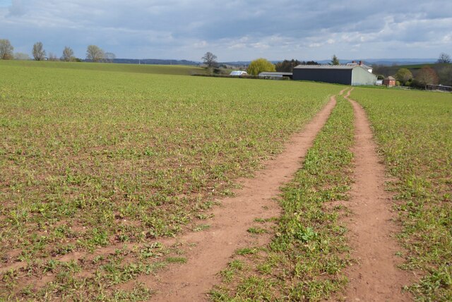
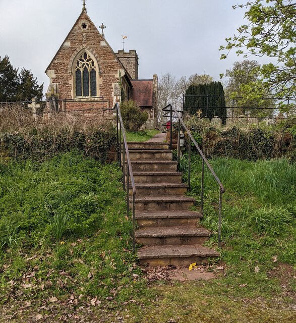
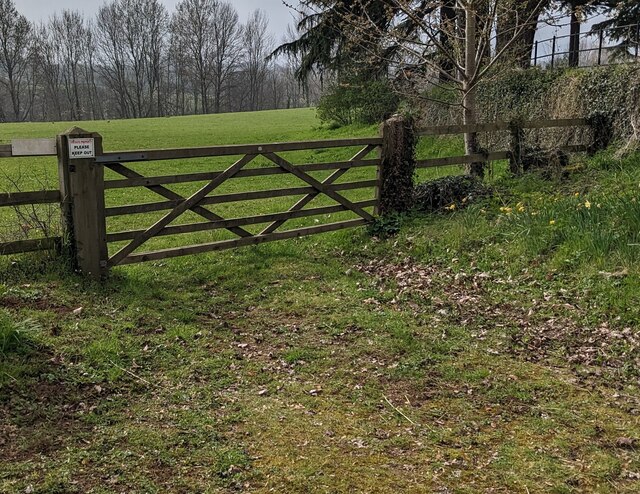
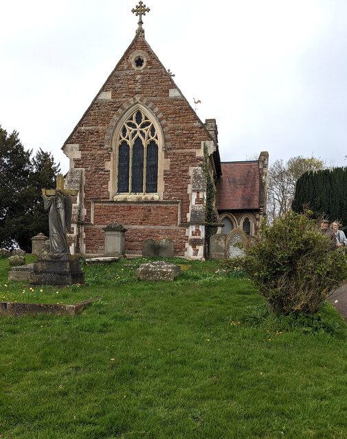
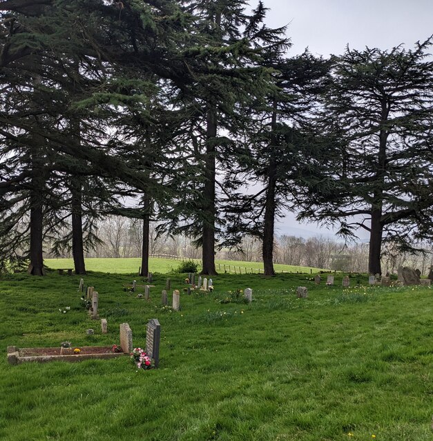
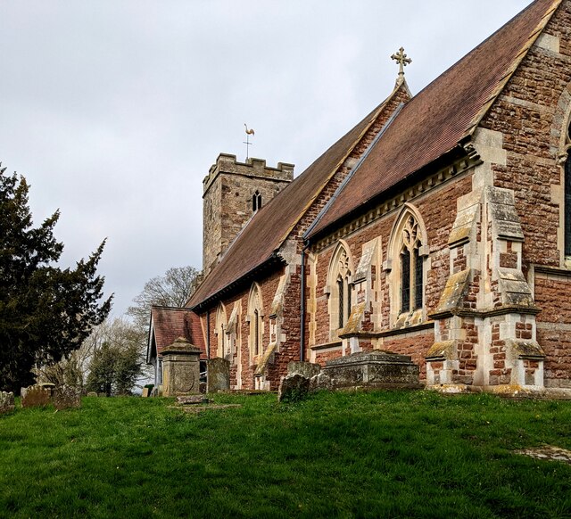
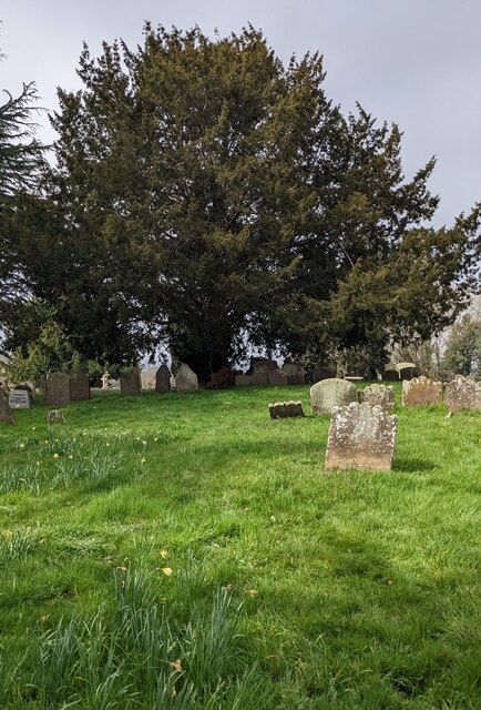
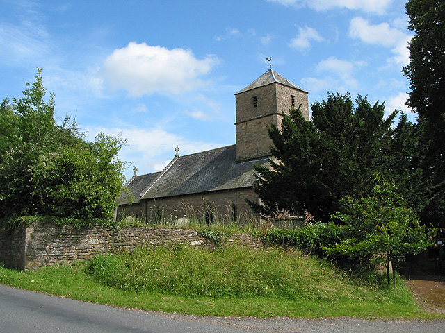
Hillhouse Grove Images

Images are sourced within 2km of 51.932054/-2.4477816 or Grid Reference SO6926. Thanks to Geograph Open Source API. All images are credited.

Farm drive to Knappers Farm The winding farm drive leading to Knappers Farm near Newent.  A public footpath follows this drive.
Farm drive to Knappers Farm
The winding farm drive leading to Knappers Farm near Newent. A public footpath follows this drive.
Spring blooms on the roadside The farm drive to Knappers Farm has become sunken, no doubt from centuries of use.  Spring bloom as colour to the grass bank.  The farmhouse can be seen in the background.
Spring blooms on the roadside
The farm drive to Knappers Farm has become sunken, no doubt from centuries of use. Spring bloom as colour to the grass bank. The farmhouse can be seen in the background.
Wild daffodils Wild daffodils beside a field hedgerow near Knappers Farm.
Wild daffodils
Wild daffodils beside a field hedgerow near Knappers Farm.
Daffodils and a footpath This footpath near Knappers Farm is the route of the Geopark Way.  Wild daffodils are a feature of this corner of Gloucestershire.
Daffodils and a footpath
This footpath near Knappers Farm is the route of the Geopark Way. Wild daffodils are a feature of this corner of Gloucestershire.
Sheep near Knappers Farm Sheep in a field beside the Geopark Way to the south-west of Knappers Farm.
Sheep near Knappers Farm
Sheep in a field beside the Geopark Way to the south-west of Knappers Farm.
Farmland around Knappers Farm View to the north-east from the Geopark Way where it enters Acorn Wood.  Sheep graze a field in the middle distance with Knappers Farm beyond.  The spire of Newent Church can be seen to the left of centre.
Farmland around Knappers Farm
View to the north-east from the Geopark Way where it enters Acorn Wood. Sheep graze a field in the middle distance with Knappers Farm beyond. The spire of Newent Church can be seen to the left of centre.
Footpath through Acorn Word The Geopark Way follows this footpath through Acorn Wood to the south of Newent.  Here the wood is partially felled.
Footpath through Acorn Word
The Geopark Way follows this footpath through Acorn Wood to the south of Newent. Here the wood is partially felled.
Footpath crossing an arable field The Geopark Way follows this footpath across this field near Knappers Farm.
Footpath crossing an arable field
The Geopark Way follows this footpath across this field near Knappers Farm.
Footpath approaching Knappers Farm The Geopark Way follows this footpath approaching Knappers Farm.
Footpath approaching Knappers Farm
The Geopark Way follows this footpath approaching Knappers Farm.
Path through Acorn Wood A footpath leading north through Acorn Wood.
Path through Acorn Wood
A footpath leading north through Acorn Wood.
Gate into field A track leading to a gate on a sheep field.
Gate into field
A track leading to a gate on a sheep field.
Daffodils along track Lots of daffodils alongside a dirt track leading towards Newent.
Daffodils along track
Lots of daffodils alongside a dirt track leading towards Newent.
Steps up to the churchyard, Oxenhall, Gloucestershire Ascending from a free car park to St Anne's churchyard 
in the Church of England Diocese of Gloucester.
Steps up to the churchyard, Oxenhall, Gloucestershire
Ascending from a free car park to St Anne's churchyard in the Church of England Diocese of Gloucester.
Field gate, Oxenhall, Gloucestershire A notice on the post on the left side of the gate shows
PRIVATE PROPERTY
PLEASE KEEP OUT
Field gate, Oxenhall, Gloucestershire
A notice on the post on the left side of the gate shows PRIVATE PROPERTY PLEASE KEEP OUT
East side of St Anne's Church, Oxenhall, Gloucestershire Grade II (Star) Listed church in the Church of England Diocese of Gloucester.
East side of St Anne's Church, Oxenhall, Gloucestershire
Grade II (Star) Listed church in the Church of England Diocese of Gloucester.
Evergreen trees in the churchyard, Oxenhall, Gloucestershire In St Anne's churchyard in the Church of England Diocese of Gloucester.
Evergreen trees in the churchyard, Oxenhall, Gloucestershire
In St Anne's churchyard in the Church of England Diocese of Gloucester.
South side of St Anne's Church, Oxenhall Grade II (Star) Listed church in the Church of England Diocese of Gloucester.
South side of St Anne's Church, Oxenhall
Grade II (Star) Listed church in the Church of England Diocese of Gloucester.
Yew, Oxenhall, Gloucestershire Evergreen tree in St Anne's churchyard.  The European Yew (Taxus baccata) 
is an evergreen tree often found in churchyards in the UK, Ireland, France
and northern parts of Spain.
Yew, Oxenhall, Gloucestershire
Evergreen tree in St Anne's churchyard. The European Yew (Taxus baccata) is an evergreen tree often found in churchyards in the UK, Ireland, France and northern parts of Spain.
Show me another place!

Hillhouse Grove is located at Grid Ref: SO6926 (Lat: 51.932054, Lng: -2.4477816)

Administrative County: Gloucestershire

District: Forest of Dean

Police Authority: Gloucestershire

What 3 Words

///surprised.reporter.making. Near Newent, Gloucestershire

Nearby Locations

Hillhouse Grove

Related Wikis

Gorsley and Kilcot

Gorsley and Kilcot is a civil parish forming part of the district of the Forest of Dean in the English county of Gloucestershire. The single parish of...

Gorsley

Gorsley is a small village in the Forest of Dean district of Gloucestershire, forming part of the civil parish of Gorsley and Kilcot in the South West...

Ledbury and Gloucester Railway

The Ledbury and Gloucester Railway, (also known as the Daffodil Line), was a railway line in Herefordshire and Gloucestershire, England, running between...

Gwen and Vera's Fields

Gwen and Vera's Fields (grid reference SO696277) is a 0.28-hectare (0.69-acre) nature reserve in Gloucestershire.The site, which consists of two separate...

Aston Ingham

Aston Ingham is a village in south-eastern Herefordshire, England, near Newent and about 7 miles (11 km) east of Ross-on-Wye. The population of the village...

Gorsley Common

Gorsley Common is a village in Herefordshire, west of Gorsley and Kilcot and east of Linton. == References == == External links == Media related to Gorsley...

Oxenhall

Oxenhall is a village and civil parish 10 miles (16 km) north west of Gloucester, in the Forest of Dean district, in the county of Gloucestershire, England...

Beavan's Hill

Beavan's Hill is a village in south east Herefordshire, England. The village is situated on the edge of Withymoor Wood, an area of ancient woodland, and...

Nearby Amenities

Located within 500m of 51.932054,-2.4477816
Kews Farm
Landuse: farm
Note Retag: CS #48756035
Source: OS_OpenData_StreetView
Lat/Long: 51.9293683/-2.4439224
Barrier: stile
Lat/Long: 51.931805/-2.4416602
Barrier: stile
Lat/Long: 51.9303162/-2.4415952
Kews Farm
Power: pole
Transformer: distribution
Voltage Primary: 11000
Lat/Long: 51.9296871/-2.4447135
Power: pole
Lat/Long: 51.9291727/-2.4427743
Power: pole
Lat/Long: 51.9295539/-2.443357
Power: pole
Lat/Long: 51.9299629/-2.4439591
Power: pole
Lat/Long: 51.9303329/-2.4429117
Power: pole
Lat/Long: 51.9306356/-2.4420561
Power: pole
Lat/Long: 51.9310019/-2.4410369
Brassfields
Power: pole
Transformer: distribution
Voltage Primary: 11000
Lat/Long: 51.9289804/-2.4528781
Power: pole
Lat/Long: 51.9287431/-2.4523102
Location Transition: yes
Power: pole
Lat/Long: 51.9277821/-2.4487073
Power: pole
Lat/Long: 51.9279426/-2.448488
Power: pole
Lat/Long: 51.9276775/-2.4461538
Power: pole
Lat/Long: 51.9280302/-2.4467433
Power: pole
Lat/Long: 51.9283618/-2.4478845
Power: pole
Lat/Long: 51.9287894/-2.4472576
Power: pole
Lat/Long: 51.9291739/-2.4461773
Power: pole
Lat/Long: 51.9294195/-2.445488
The data included in this document is from www.openstreetmap.org. The data is made available under ODbL.

Have you been to Hillhouse Grove?

Leave your review of Hillhouse Grove below (or comments, questions and feedback).