Lodge Wood

Wood, Forest in Cheshire

England

Lodge Wood

Smokers Brook, Tabley Taken from Linnards Lane bridge, looking NE.
Smokers Brook, Tabley Credit: Ian Warburton

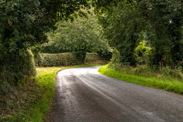
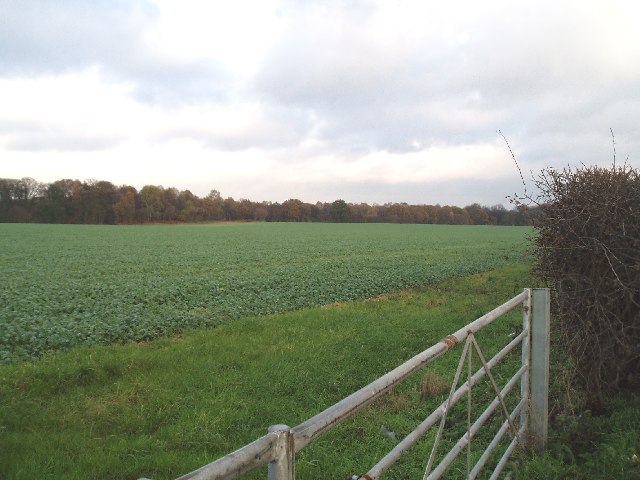
Lodge Wood is a picturesque forest located in the county of Cheshire, England. Covering an area of approximately 100 acres, it is a popular destination for nature lovers and outdoor enthusiasts alike. The wood is situated near the village of Norley, offering a tranquil and serene environment for visitors to explore.

The woodland is predominantly composed of native tree species, such as oak, beech, and birch, creating a diverse and vibrant ecosystem. The dense canopy formed by these trees provides ample shade, making it an ideal spot for picnics, walks, and other recreational activities.

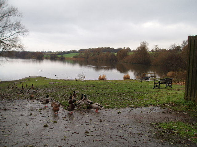
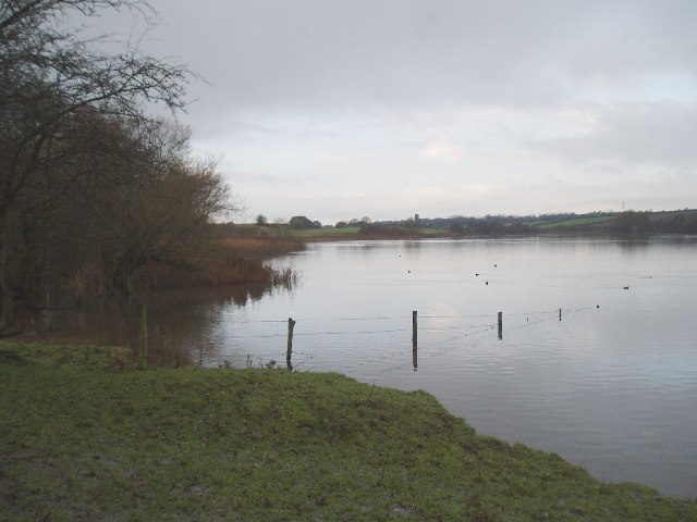
Lodge Wood is known for its rich biodiversity, housing a variety of flora and fauna. The forest floor is adorned with carpets of bluebells during the spring season, creating a breathtaking sight for visitors. Wildlife enthusiasts can spot numerous species of birds, including woodpeckers and owls, as well as small mammals like squirrels and rabbits.

Several well-maintained trails wind through Lodge Wood, allowing visitors to explore its beauty at their own pace. These trails are suitable for both leisurely strolls and more challenging hikes, catering to individuals of all fitness levels. Additionally, the wood features designated picnic areas, providing a perfect setting for families and friends to enjoy a day out in nature.

Lodge Wood is accessible year-round, with the changing seasons offering a different experience each time. Whether it's the vibrant colors of autumn or the fresh green foliage of summer, the wood never fails to captivate visitors with its natural beauty.

If you have any feedback on the listing, please let us know in the comments section below.
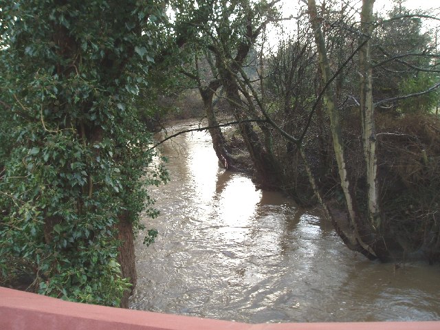
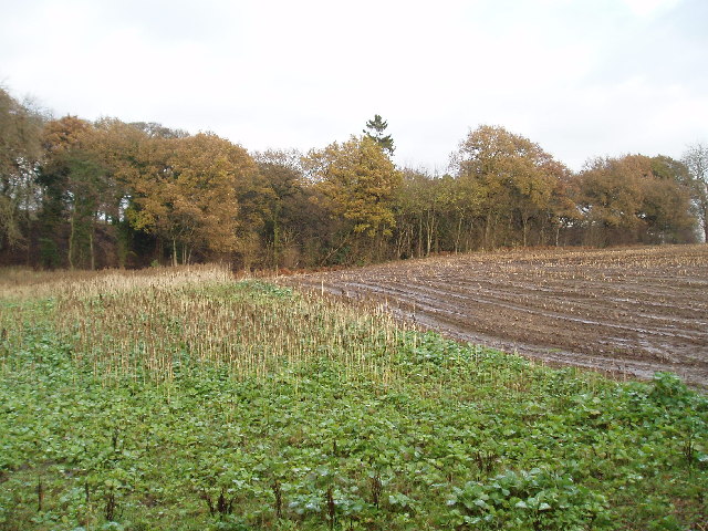
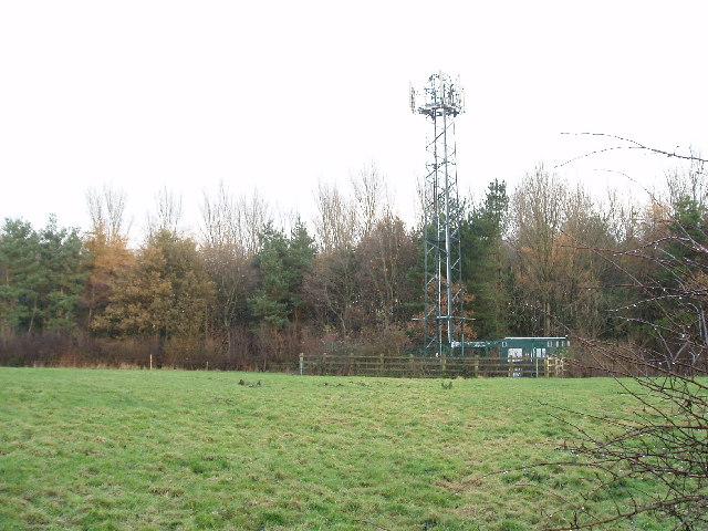
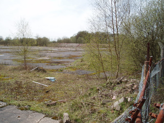
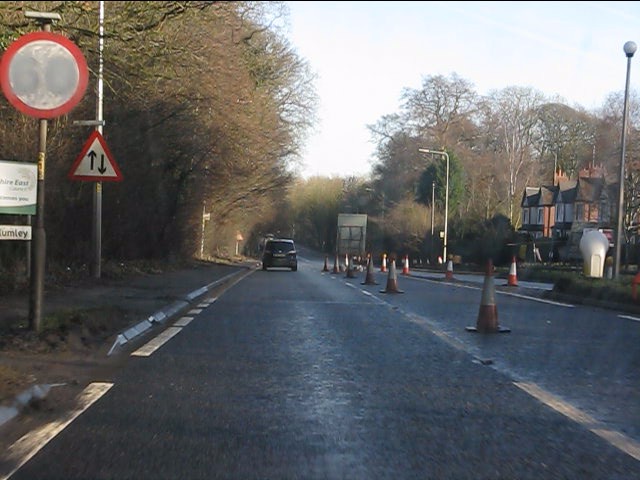
Lodge Wood Images

Images are sourced within 2km of 53.27425/-2.4725324 or Grid Reference SJ6875. Thanks to Geograph Open Source API. All images are credited.

Smokers Brook, Tabley Taken from Linnards Lane bridge, looking NE.
Smokers Brook, Tabley
Taken from Linnards Lane bridge, looking NE.
Smoker Wood, Tabley Taken from SJ70307597, much of the wood is actually in <a href="https://www.geograph.org.uk/gridref/SJ7076">SJ7076</a>.
Smoker Wood, Tabley
Taken from SJ70307597, much of the wood is actually in SJ7076.
Leonard's Wood from Linnards lane Not much else in this square, except fields!
Leonard's Wood from Linnards lane
Not much else in this square, except fields!
Site of Associated Octel chemical works The Chemical Works on this site used to produce the anti-knock additive (based on lead) which was added to petrol. It was distributed from this site by rail to the UK refineries, and to Liverpool for export overseas. But then along came unleaded petrol hence no more chemical works!
Site of Associated Octel chemical works
The Chemical Works on this site used to produce the anti-knock additive (based on lead) which was added to petrol. It was distributed from this site by rail to the UK refineries, and to Liverpool for export overseas. But then along came unleaded petrol hence no more chemical works!
A556 at Ascol Drive The 60mph sign has been painted out due to the 40mph restriction through the roadworks.  Ascol Drive is off to the right, beyond the bollard.
A556 at Ascol Drive
The 60mph sign has been painted out due to the 40mph restriction through the roadworks. Ascol Drive is off to the right, beyond the bollard.
Leonard's Wood Road near Leonard's Wood.
Leonard's Wood
Road near Leonard's Wood.
Salt Works The Trent and Mersey canal passes through a large chemical works as it skirts Northwich. 

Additional information provided by a visitor to Geograph:- 
At the time the picture was taken this was ICI's Lostock Works.  The main output was, and still is Soda Ash (Sodium Carbonate), the end product of the Ammonia Soda process. Salt, in the form of brine, is used in the process and is purified in the plant to the right of the picture.

Today (Jan 2010) the site is owned and run by Brunner Mond, a name used by one of the four companies that formed ICI in 1926.
Salt Works
The Trent and Mersey canal passes through a large chemical works as it skirts Northwich. Additional information provided by a visitor to Geograph:- At the time the picture was taken this was ICI's Lostock Works. The main output was, and still is Soda Ash (Sodium Carbonate), the end product of the Ammonia Soda process. Salt, in the form of brine, is used in the process and is purified in the plant to the right of the picture. Today (Jan 2010) the site is owned and run by Brunner Mond, a name used by one of the four companies that formed ICI in 1926.
Winnington Wood Taken from Manchester Road (A559), Lostock Gralam, looking NW.
Winnington Wood
Taken from Manchester Road (A559), Lostock Gralam, looking NW.
Church of St John the Evangelist, Lostock Gralam The church is situated on station road Lostock Gralam.(Opposite Arthur Street)
Church of St John the Evangelist, Lostock Gralam
The church is situated on station road Lostock Gralam.(Opposite Arthur Street)
Pipelines, with ICI works in background Taken at the side of Manchester Road (A559) Northwich, near Austin Street.
Pipelines, with ICI works in background
Taken at the side of Manchester Road (A559) Northwich, near Austin Street.
Trent & Mersey Canal from Wincham lane bridge Looking NW, I think the factory in the background is BP nutrition.
Trent & Mersey Canal from Wincham lane bridge
Looking NW, I think the factory in the background is BP nutrition.
The Black Greyhound, Higher Wincham Situated at the crossroads of Hall Lane, Marston Lane, Wincham Lane & Church Street.
The Black Greyhound, Higher Wincham
Situated at the crossroads of Hall Lane, Marston Lane, Wincham Lane & Church Street.
Pick Mere, looking west A popular place in the summer, (and to think there used to be a small fair ground here and you could hire jetskis!!).
Pick Mere, looking west
A popular place in the summer, (and to think there used to be a small fair ground here and you could hire jetskis!!).
Pick Mere , looking west This southern end of the mere is just in SJ6876!!
Pick Mere , looking west
This southern end of the mere is just in SJ6876!!
Four Lanes Garage, Higher Marston Situated at the crossroads of Dark Lane, Ollershaw Lane,& Marston Lane
Four Lanes Garage, Higher Marston
Situated at the crossroads of Dark Lane, Ollershaw Lane,& Marston Lane
ICI  Chemical Works Taken from Manchester Road, near junction with Denton Drive, looking east. 
(Just across the road from B&Q)
ICI Chemical Works
Taken from Manchester Road, near junction with Denton Drive, looking east. (Just across the road from B&Q)
B5391, Higher Wincham, Cheshire The stream that runs under the road forms the boundary between Vale Royal and Macclesfield districts.
B5391, Higher Wincham, Cheshire
The stream that runs under the road forms the boundary between Vale Royal and Macclesfield districts.
The Red Lion, Pickmere Situated on the corner of the B5391 and the minor road to Great Budworth.
The Red Lion, Pickmere
Situated on the corner of the B5391 and the minor road to Great Budworth.
Show me another place!

Lodge Wood is located at Grid Ref: SJ6875 (Lat: 53.27425, Lng: -2.4725324)

Unitary Authority: Cheshire West and Chester

Police Authority: Cheshire

What 3 Words

///loser.clip.film. Near Marston, Cheshire

Related Wikis

Victoria Stadium (Northwich)

The Victoria Stadium was a football stadium in Wincham, Northwich in the county of Cheshire, England, and was home to Northwich Victoria. == History... ==

Lostock Gralam railway station

Lostock Gralam railway station serves the village of Lostock Gralam in Cheshire, England. The station is on the Mid-Cheshire Line from Chester to Manchester...

Lostock Gralam

Lostock Gralam ( GRAY-ləm) is a village and civil parish in Cheshire, England, east of Northwich. The civil parish also includes the small hamlet of Lostock...

Wincham Park

Wincham Park is a football stadium in Wincham, a parish on the edge of Northwich, England. The home ground of Witton Albion, it first opened in 1989, after...
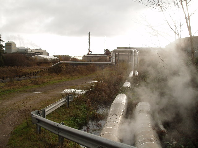
Lion Salt Works

The Lion Salt Works is the last remaining open pan salt works in Marston, near Northwich, Cheshire, England. It closed as a work in 1986 and is now preserved...

Marston, Cheshire

Marston is a village and civil parish in the unitary authority of Cheshire West and Chester, in the northwest of England. The settlement is on the River...

Pickmere

Pickmere is a village and civil parish near Knutsford in the Borough of Cheshire East. It has a population of 541 (2001 Census). Landmarks in and around...

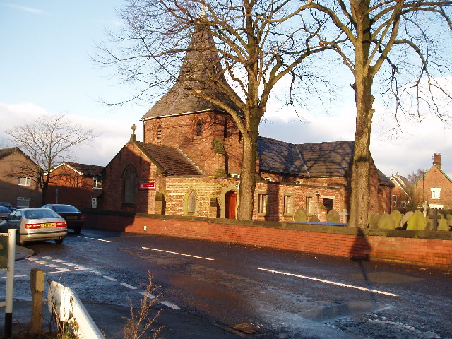
St Paul's Church, Marston

St Paul's Church was in the village of Marston, Cheshire, England. The church was built in 1874 and designed by the Chester architect John Douglas. It...

Nearby Amenities

Located within 500m of 53.27425,-2.4725324
Crossing
Crossing: unmarked
Crossing Markings: no
Lat/Long: 53.2723894/-2.4663324
Generator Method: photovoltaic
Generator Output Electricity: yes
Generator Source: solar
Generator Type: solar_photovoltaic_panel
Location: roof
Power: generator
Lat/Long: 53.2720467/-2.4667899
Generator Method: photovoltaic
Generator Output Electricity: yes
Generator Source: solar
Generator Type: solar_photovoltaic_panel
Location: roof
Power: generator
Lat/Long: 53.2720467/-2.4668542
Generator Method: photovoltaic
Generator Output Electricity: yes
Generator Source: solar
Generator Type: solar_photovoltaic_panel
Location: roof
Power: generator
Lat/Long: 53.2723001/-2.466004
Generator Method: photovoltaic
Generator Output Electricity: yes
Generator Source: solar
Generator Type: solar_photovoltaic_panel
Location: roof
Power: generator
Lat/Long: 53.2724958/-2.4657974
Generator Method: photovoltaic
Generator Output Electricity: yes
Generator Source: solar
Generator Type: solar_photovoltaic_panel
Location: roof
Power: generator
Lat/Long: 53.2726578/-2.4662561
Generator Method: photovoltaic
Generator Output Electricity: yes
Generator Source: solar
Generator Type: solar_photovoltaic_panel
Location: roof
Power: generator
Lat/Long: 53.2731134/-2.4656499
Generator Method: photovoltaic
Generator Output Electricity: yes
Generator Source: solar
Generator Type: solar_photovoltaic_panel
Location: roof
Power: generator
Lat/Long: 53.2731551/-2.4657358
Generator Method: photovoltaic
Generator Output Electricity: yes
Generator Source: solar
Generator Type: solar_photovoltaic_panel
Location: roof
Power: generator
Lat/Long: 53.2731936/-2.4658001
Generator Method: photovoltaic
Generator Output Electricity: yes
Generator Source: solar
Generator Type: solar_photovoltaic_panel
Location: roof
Power: generator
Lat/Long: 53.2732369/-2.465894
Generator Method: photovoltaic
Generator Output Electricity: yes
Generator Source: solar
Generator Type: solar_photovoltaic_panel
Location: roof
Power: generator
Lat/Long: 53.2732738/-2.4659584
Generator Method: photovoltaic
Generator Output Electricity: yes
Generator Source: solar
Generator Type: solar_photovoltaic_panel
Location: roof
Power: generator
Lat/Long: 53.2731823/-2.4667523
Generator Method: photovoltaic
Generator Output Electricity: yes
Generator Source: solar
Generator Type: solar_photovoltaic_panel
Location: roof
Power: generator
Lat/Long: 53.2735705/-2.4654783
Generator Method: photovoltaic
Generator Output Electricity: yes
Generator Source: solar
Generator Type: solar_photovoltaic_panel
Location: roof
Power: generator
Lat/Long: 53.2735128/-2.4653871
Generator Method: photovoltaic
Generator Output Electricity: yes
Generator Source: solar
Generator Type: solar_photovoltaic_panel
Location: roof
Power: generator
Lat/Long: 53.2734245/-2.46521
Generator Method: photovoltaic
Generator Output Electricity: yes
Generator Source: solar
Generator Type: solar_photovoltaic_panel
Location: roof
Power: generator
Lat/Long: 53.2738865/-2.4657116
Generator Method: photovoltaic
Generator Output Electricity: yes
Generator Source: solar
Generator Type: solar_photovoltaic_panel
Location: roof
Power: generator
Lat/Long: 53.2739715/-2.4655185
Generator Method: photovoltaic
Generator Output Electricity: yes
Generator Source: solar
Generator Type: solar_photovoltaic_panel
Location: roof
Power: generator
Lat/Long: 53.27401/-2.4654327
Generator Method: photovoltaic
Generator Output Electricity: yes
Generator Source: solar
Generator Type: solar_photovoltaic_panel
Location: roof
Power: generator
Lat/Long: 53.2741495/-2.4651779
The data included in this document is from www.openstreetmap.org. The data is made available under ODbL.

Have you been to Lodge Wood?

Leave your review of Lodge Wood below (or comments, questions and feedback).