Towsbank Wood

Wood, Forest in Northumberland

England

Towsbank Wood

Snope Burn View of the wooded valley of Snope Burn.
Snope Burn Credit: Peter McDermott

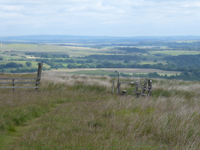
Towsbank Wood is a picturesque woodland located in the county of Northumberland, England. Covering an area of approximately 50 hectares, the wood is situated in the western part of the county, near the village of Hexham. It is known for its tranquil atmosphere and diverse range of flora and fauna.

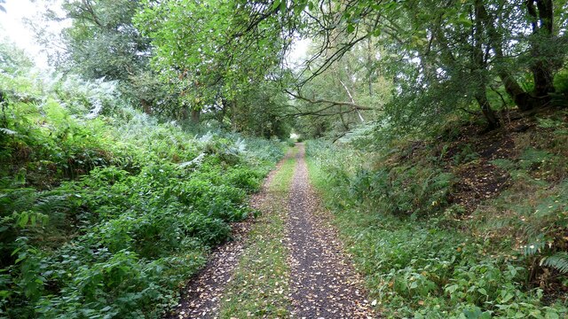
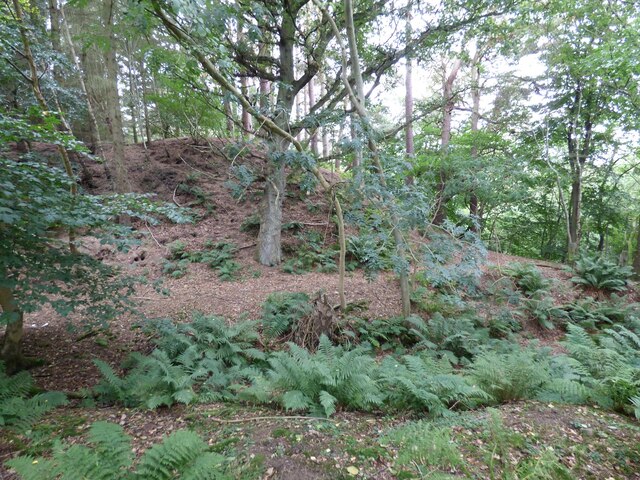
The woodland is predominantly composed of native deciduous trees, such as oak, birch, and beech, which create a dense canopy that provides shade and shelter for a variety of wildlife. Towsbank Wood is particularly famous for its bluebells, which carpet the forest floor in spring, creating a breathtaking sight.

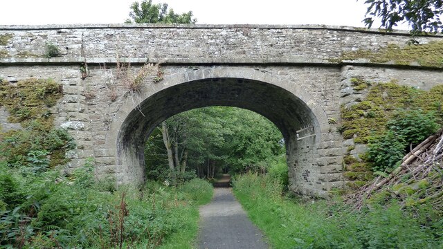
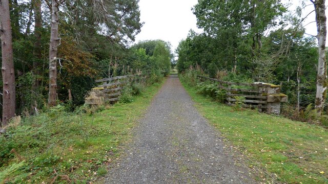
Walking through the wood, visitors can enjoy a network of well-maintained paths and trails, allowing them to explore the area at their own pace. The wood also features a small stream that meanders through the trees, adding to the natural beauty of the surroundings.

The diverse range of wildlife found in Towsbank Wood includes various bird species, such as woodpeckers, jays, and thrushes, which can be heard singing throughout the year. The wood is also home to mammals like badgers, foxes, and deer, as well as smaller creatures like squirrels and rabbits.

Due to its natural beauty and biodiversity, Towsbank Wood is a popular destination for nature lovers, photographers, and walkers. The wood offers a peaceful retreat from the hustle and bustle of everyday life, allowing visitors to immerse themselves in the beauty of Northumberland's countryside.

If you have any feedback on the listing, please let us know in the comments section below.

Towsbank Wood Images

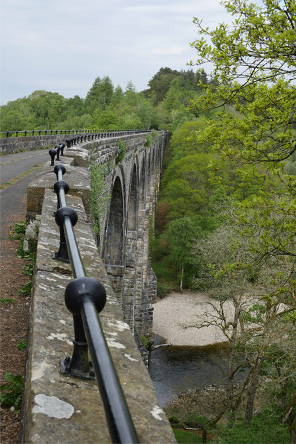
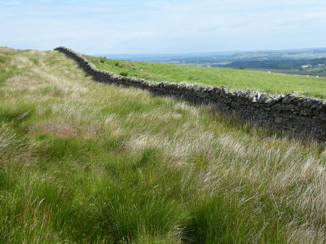
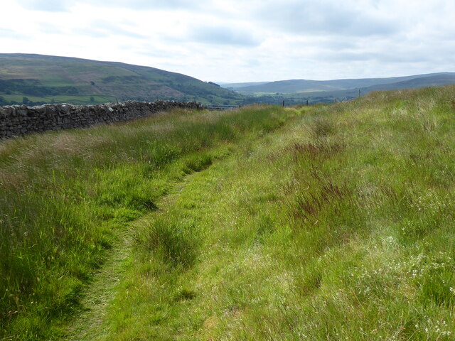
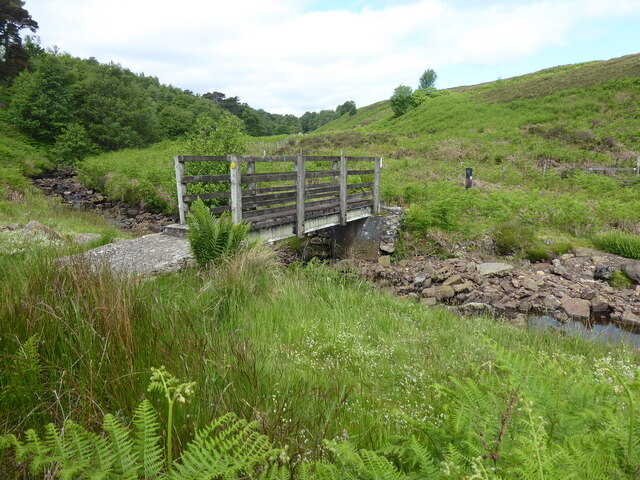
Images are sourced within 2km of 54.904362/-2.4946026 or Grid Reference NY6856. Thanks to Geograph Open Source API. All images are credited.

Snope Burn View of the wooded valley of Snope Burn.
Snope Burn
View of the wooded valley of Snope Burn.
Bridge over Haltwhistle to Alston branch line at Softley
Haltwhistle to Alston branch line crossing a stream near Whitwham View from south.
Haltwhistle to Alston branch line crossing a stream near Whitwham
View from south.
Haltwhistle to Alston branch line at Bowden's Banks
Lambley Viaduct Lambley Viaduct on the Alston Branch Railway crosses the River South Tyne between Alston and Haltwhistle in a series of tall and elegant arches and was the engineering centrepiece of the Newcastle & Carlisle Railway's branch line to Alston. The viaduct opened in November 1852, a few months after the rest of the line, and was closed in 1976 when the viaduct fell into decay with some of its stonework falling into the river. The structure was Grade II* listed in August 1985. A survey was carried out in 1994; it was restored over the following two years and much of the masonry replaced, repointed with lime mortar imported from France.

The 260m long viaduct is thought to have been designed by Sir George Barclay Bruce (1821-1908), an eminent Victorian engineer. The river is crossed by nine 17-metre (56 ft) wide arches, with three 20-foot arches to the north side and four on a curve at the southern end, supporting a deck 32 metres (105 ft) above the river but, as it carried a single track, only 3.5 metres (11 ft) wide.

The piers to the arches are built of massive rough-faced stones each weighing up to 500 kilograms (1,100 lb), with similar-sized stones in ashlar to the main arch voussoirs. The spandrels and piers to the 6-metre (20 ft) wide approach arches are built of coursed rubble masonry.

At one time, a pedestrian footbridge crossed the water, supported by the viaduct's piers.

Today Lambley Viaduct accommodates the South Tyne Trail although the west end has been fenced off to stop people straying into the former Lambley Railway Station which is now a private house. Access to that end of the viaduct is by a series of steps leading down from the north side.

The South Tynedale Railway Preservation Society have acquired both the Lambley Viaduct and Alston Arches and have an ambitious aim to reopen the entire line from Alston to Haltwhistle by 2022 <span class="nowrap"><a title="http://www.hexhamcourant.co.uk/news/haltwhistle-to-alston-line-could-re-open-by-2022-1.1172456" rel="nofollow ugc noopener" href="http://www.hexhamcourant.co.uk/news/haltwhistle-to-alston-line-could-re-open-by-2022-1.1172456">Link</a><img style="margin-left:2px;" alt="External link" title="External link - shift click to open in new window" src="https://s1.geograph.org.uk/img/external.png" width="10" height="10"/></span>

Wikipedia: <span class="nowrap"><a title="http://en.wikipedia.org/wiki/Lambley,_Northumberland#Lambley_viaduct" rel="nofollow ugc noopener" href="http://en.wikipedia.org/wiki/Lambley,_Northumberland#Lambley_viaduct">Link</a><img style="margin-left:2px;" alt="External link" title="External link - shift click to open in new window" src="https://s1.geograph.org.uk/img/external.png" width="10" height="10"/></span>
Bridges on the Tyne: <span class="nowrap"><a title="http://www.bridgesonthetyne.co.uk/lambrw.html" rel="nofollow ugc noopener" href="http://www.bridgesonthetyne.co.uk/lambrw.html">Link</a><img style="margin-left:2px;" alt="External link" title="External link - shift click to open in new window" src="https://s1.geograph.org.uk/img/external.png" width="10" height="10"/></span>
The Transport Trust: <span class="nowrap"><a title="http://www.transportheritage.com/find-heritage-locations.html?sobi2Task=sobi2Details&sobi2Id=172" rel="nofollow ugc noopener" href="http://www.transportheritage.com/find-heritage-locations.html?sobi2Task=sobi2Details&sobi2Id=172">Link</a><img style="margin-left:2px;" alt="External link" title="External link - shift click to open in new window" src="https://s1.geograph.org.uk/img/external.png" width="10" height="10"/></span>
Lambley Viaduct
Lambley Viaduct on the Alston Branch Railway crosses the River South Tyne between Alston and Haltwhistle in a series of tall and elegant arches and was the engineering centrepiece of the Newcastle & Carlisle Railway's branch line to Alston. The viaduct opened in November 1852, a few months after the rest of the line, and was closed in 1976 when the viaduct fell into decay with some of its stonework falling into the river. The structure was Grade II* listed in August 1985. A survey was carried out in 1994; it was restored over the following two years and much of the masonry replaced, repointed with lime mortar imported from France. The 260m long viaduct is thought to have been designed by Sir George Barclay Bruce (1821-1908), an eminent Victorian engineer. The river is crossed by nine 17-metre (56 ft) wide arches, with three 20-foot arches to the north side and four on a curve at the southern end, supporting a deck 32 metres (105 ft) above the river but, as it carried a single track, only 3.5 metres (11 ft) wide. The piers to the arches are built of massive rough-faced stones each weighing up to 500 kilograms (1,100 lb), with similar-sized stones in ashlar to the main arch voussoirs. The spandrels and piers to the 6-metre (20 ft) wide approach arches are built of coursed rubble masonry. At one time, a pedestrian footbridge crossed the water, supported by the viaduct's piers. Today Lambley Viaduct accommodates the South Tyne Trail although the west end has been fenced off to stop people straying into the former Lambley Railway Station which is now a private house. Access to that end of the viaduct is by a series of steps leading down from the north side. The South Tynedale Railway Preservation Society have acquired both the Lambley Viaduct and Alston Arches and have an ambitious aim to reopen the entire line from Alston to Haltwhistle by 2022 LinkExternal link Wikipedia: LinkExternal link Bridges on the Tyne: LinkExternal link The Transport Trust: LinkExternal link
Castle Hill Earthwork A natural mound, which has been enhanced for defensive purposes. The ditch in the foreground would have provided additional protection <span class="nowrap"><a title="https://www.heritagegateway.org.uk/Gateway/Results_Single.aspx?uid=N5951&resourceID=110" rel="nofollow ugc noopener" href="https://www.heritagegateway.org.uk/Gateway/Results_Single.aspx?uid=N5951&resourceID=110">Link</a><img style="margin-left:2px;" alt="External link" title="External link - shift click to open in new window" src="https://s1.geograph.org.uk/img/external.png" width="10" height="10"/></span>
Castle Hill Earthwork
A natural mound, which has been enhanced for defensive purposes. The ditch in the foreground would have provided additional protection LinkExternal link
The disused track bed of the Alston to Haltwhistle line This track is part of the River Tyne Trail and is a section of National Cycle Network route 68.
The disused track bed of the Alston to Haltwhistle line
This track is part of the River Tyne Trail and is a section of National Cycle Network route 68.
Lambley Viaduct over the River South Tyne A quiet mid-May Sunday afternoon at Lambley Viaduct.  This view is looking north-east along the upstream face of the viaduct.

This photograph was taken during the Coronavirus (COVID-19) pandemic of 2020/21/22.
Lambley Viaduct over the River South Tyne
A quiet mid-May Sunday afternoon at Lambley Viaduct. This view is looking north-east along the upstream face of the viaduct. This photograph was taken during the Coronavirus (COVID-19) pandemic of 2020/21/22.
Oak nibbler A Grey Squirrel feeding, as viewed from the Lambley Viaduct.

This photograph was taken during the Coronavirus (COVID-19) pandemic of 2020/21/22.
Oak nibbler
A Grey Squirrel feeding, as viewed from the Lambley Viaduct. This photograph was taken during the Coronavirus (COVID-19) pandemic of 2020/21/22.
The Pennine Way near Softley
The Pennine Way crossing Glendue Burn
The Pennine Way near Lambley Common
Lambley Viaduct from Bowden's Banks A view of this impressive structure on the former Alston Branch railway from Bowden's Banks.  Upon crossing the viaduct, the cyclist has to dismount and carry the bike down steps, under the viaduct and back up steps to rejoin the route of the former railway.  On this instance, I diverted via Lambley village but altogether this is an easier route.

This photograph was taken during the Coronavirus (COVID-19) pandemic of 2020/21/22.
Lambley Viaduct from Bowden's Banks
A view of this impressive structure on the former Alston Branch railway from Bowden's Banks. Upon crossing the viaduct, the cyclist has to dismount and carry the bike down steps, under the viaduct and back up steps to rejoin the route of the former railway. On this instance, I diverted via Lambley village but altogether this is an easier route. This photograph was taken during the Coronavirus (COVID-19) pandemic of 2020/21/22.
On Lambley Viaduct - walkway on viaduct Lambley viaduct crosses the River South Tyne as a series of elegant stone arches. More than 850 feet long, it once carried the Haltwhistle to Alston railway. The railway, which was opened in 1852 to haul coal and lead from the Alston mines, closed in 1976, and the viaduct was allowed to decay. In 1991 the British Rail Property Board agreed to repair the viaduct and hand it over to the North Pennine Heritage Trust which would maintain it in the future; however the Trust went into administration in 2011. The viaduct was probably designed by George Barclay Bruce, a Victorian engineer who was involved in the Alston line before leaving for India to pioneer railway construction there. It is a particularly elegant example of Victorian engineering: the river is crossed by nine 56 foot wide arches which support a deck at least 108 feet above the river. (source Wikipedia)
On Lambley Viaduct - walkway on viaduct
Lambley viaduct crosses the River South Tyne as a series of elegant stone arches. More than 850 feet long, it once carried the Haltwhistle to Alston railway. The railway, which was opened in 1852 to haul coal and lead from the Alston mines, closed in 1976, and the viaduct was allowed to decay. In 1991 the British Rail Property Board agreed to repair the viaduct and hand it over to the North Pennine Heritage Trust which would maintain it in the future; however the Trust went into administration in 2011. The viaduct was probably designed by George Barclay Bruce, a Victorian engineer who was involved in the Alston line before leaving for India to pioneer railway construction there. It is a particularly elegant example of Victorian engineering: the river is crossed by nine 56 foot wide arches which support a deck at least 108 feet above the river. (source Wikipedia)
Possible remains of a Roman culvert
Pennine Way towards Burnstones
Pennine Way heading towards Burnstones
Show me another place!

Towsbank Wood is located at Grid Ref: NY6856 (Lat: 54.904362, Lng: -2.4946026)

Unitary Authority: Northumberland

Police Authority: Northumbria

What 3 Words

///pesky.direction.froth. Near Greenhead, Northumberland

Nearby Locations

Brown's Pool Towsbank Wood

Related Wikis

Lambley railway station

Lambley was a railway station on the Alston Branch Line, which ran between Haltwhistle and Alston. The station, situated 4+3⁄4 miles (8 km) south-west...

Lambley, Northumberland

Lambley, formerly known as Harper Town, is a village and former civil parish, now in the parish of Coanwood, in Northumberland, England about four miles...

Coanwood railway station

Coanwood was a railway station on the Alston Branch Line, which ran between Haltwhistle and Alston. The station, situated 4 miles (6 km) south-west of...

Coanwood

Coanwood is a village in Northumberland, England, and is part of the Parish of Haltwhistle. It is about four miles (6 km) to the south-west of Haltwhistle...

Nearby Amenities

Located within 500m of 54.904362,-2.4946026
Power: pole
Lat/Long: 54.9052152/-2.4920646
Power: pole
Lat/Long: 54.9002949/-2.4947092
Power: pole
Lat/Long: 54.9062993/-2.4918902
Power: pole
Lat/Long: 54.9068729/-2.4918527
The data included in this document is from www.openstreetmap.org. The data is made available under ODbL.

Have you been to Towsbank Wood?

Leave your review of Towsbank Wood below (or comments, questions and feedback).