Old Covert

Wood, Forest in Cheshire

England

Old Covert

Crewe Works Open Day, 1975 British Rail Class 25 number 25264. The paper sign above the buffer beam reads: NO ADMITTANCE ON THIS LOCOMOTIVE.
Crewe Works Open Day, 1975 Credit: Richard Sutcliffe

Old Covert is a picturesque woodland area located in the county of Cheshire in England. Stretching over several acres, it is a haven for nature enthusiasts and those seeking tranquility away from the hustle and bustle of city life. The forest is situated near the village of Covert, giving it its name.

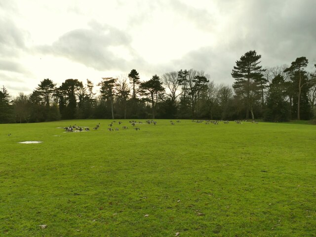
The woodland is known for its ancient trees, some of which are estimated to be over 300 years old. These majestic specimens include oak, beech, and ash trees, creating a dense and diverse canopy that provides a habitat for a wide variety of wildlife. The forest floor is covered in a thick layer of moss and ferns, adding to the enchanting atmosphere.

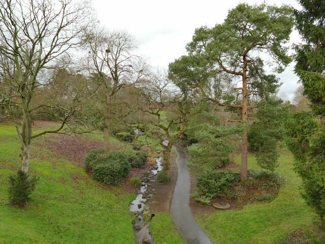
Old Covert offers a network of walking trails that wind through the forest, allowing visitors to explore its hidden corners and discover its natural beauty. These paths are well-maintained and suitable for all levels of fitness, making the woodland accessible to people of all ages.

The woodland is home to numerous species of birds, making it a popular spot for birdwatchers. Visitors may catch a glimpse of woodpeckers, owls, and various songbirds as they traverse the trails. Squirrels, rabbits, and other small mammals can also be spotted among the trees, adding to the wildlife experience.

Old Covert is not only a haven for nature lovers but also a place of historical significance. Local legends suggest that the forest has been inhabited since ancient times, and remnants of old structures, such as stone walls and ruins, can still be found within its depths.

Overall, Old Covert is a captivating woodland, combining natural beauty, diverse wildlife, and a touch of history. It offers a peaceful retreat for those seeking solace in the midst of nature.

If you have any feedback on the listing, please let us know in the comments section below.

Old Covert Images

Images are sourced within 2km of 53.08777/-2.4735322 or Grid Reference SJ6854. Thanks to Geograph Open Source API. All images are credited.

Crewe Works Open Day, 1975 British Rail Class 25 number 25264. The paper sign above the buffer beam reads: NO ADMITTANCE ON THIS LOCOMOTIVE.
Crewe Works Open Day, 1975
British Rail Class 25 number 25264. The paper sign above the buffer beam reads: NO ADMITTANCE ON THIS LOCOMOTIVE.
Crewe Works Open Day, 1975 Two unidentified British Rail Class 47s and an unidentified Class 40.
Crewe Works Open Day, 1975
Two unidentified British Rail Class 47s and an unidentified Class 40.
Crewe Works Open Day, 1975 LNWR 2-2-2 3020 Cornwall, dating from 1847 (rebuilt in 1858) alongside a new (in 1975) Class 43 HST at the Crewe Works Open Day.

Grid reference approximate.
Crewe Works Open Day, 1975
LNWR 2-2-2 3020 Cornwall, dating from 1847 (rebuilt in 1858) alongside a new (in 1975) Class 43 HST at the Crewe Works Open Day. Grid reference approximate.
Wrecked locomotive The damage to British Rail Class 40 No. 40 189 is obvious. The locomotive was involved in the Weaver Junction crash on 6 August 1975. It was hauling a freight train which was unable to stop due to a lack of brake power, over-ran a signal and collided with another freight train. Seen during the Crewe Works Open Day, 1975.

Location within Crewe Works where photographed is a guess.
Wrecked locomotive
The damage to British Rail Class 40 No. 40 189 is obvious. The locomotive was involved in the Weaver Junction crash on 6 August 1975. It was hauling a freight train which was unable to stop due to a lack of brake power, over-ran a signal and collided with another freight train. Seen during the Crewe Works Open Day, 1975. Location within Crewe Works where photographed is a guess.
Crewe Works Open Day, 1975 British Rail Class 47 No. 47 137.

Grid reference approximate.
Crewe Works Open Day, 1975
British Rail Class 47 No. 47 137. Grid reference approximate.
Crewe Works Open Day, 1975 British Rail Class 40 No. 40 014 and British Rail Class 27 No. 27 006. In the distance on the right is British Rail Class 76 No. 76044.

Grid reference approximate.
Crewe Works Open Day, 1975
British Rail Class 40 No. 40 014 and British Rail Class 27 No. 27 006. In the distance on the right is British Rail Class 76 No. 76044. Grid reference approximate.
Queen's Park - the car park A view into the car park, most of which is in the next grid square from the park itself.
Queen's Park - the car park
A view into the car park, most of which is in the next grid square from the park itself.
Queen's Park - park plan A board just inside the eastern gate, with a plan of the park and its facilities.
Queen's Park - park plan
A board just inside the eastern gate, with a plan of the park and its facilities.
Queen's Park - play area An extensive set of play equipment inside the eastern gate, with a shelter for parents to watch their children.
Queen's Park - play area
An extensive set of play equipment inside the eastern gate, with a shelter for parents to watch their children.
Queen's Park - lake outfall The park lake was formed from damming the Valley Brook; the outfall drops over a weir, and resumes its course as it flows under Queen's Park Drive.
Queen's Park - lake outfall
The park lake was formed from damming the Valley Brook; the outfall drops over a weir, and resumes its course as it flows under Queen's Park Drive.
Queen's Park - east end of the lake The lake is about 325m long, and occupies most of the southern side of the park. Compare this midwinter view with a summer one <a href="https://www.geograph.org.uk/photo/4579436">SJ6855 : Queen's Park: lake, east end</a>.
Queen's Park - east end of the lake
The lake is about 325m long, and occupies most of the southern side of the park. Compare this midwinter view with a summer one SJ6855 : Queen's Park: lake, east end.
Queen's Park - restoration plaque The plaque is outside the cafe / toilet block <a href="https://www.geograph.org.uk/photo/4579425">SJ6855 : Queen's Park:terrace cafe</a> and records the park's restoration completed in 2011.
Queen's Park - restoration plaque
The plaque is outside the cafe / toilet block SJ6855 : Queen's Park:terrace cafe and records the park's restoration completed in 2011.
Queen's Park - memorial plaque in the cafe The plaque is dated 8 August 1903 and marks the service of employees of the London and North-Western Railway in the South African War. It should be read in conjunction with the larger memorial outside <a href="https://www.geograph.org.uk/photo/4579418">SJ6855 : Queen's Park: war memorial</a>.
Queen's Park - memorial plaque in the cafe
The plaque is dated 8 August 1903 and marks the service of employees of the London and North-Western Railway in the South African War. It should be read in conjunction with the larger memorial outside SJ6855 : Queen's Park: war memorial.
Queen's Park - Royal Engineers roll of honour Unlike most war memorials of the 20th century, the one in Queen's Park commemorates those who served in the South African War (also known as the Boer war) of 1899-1902. See <a href="https://www.geograph.org.uk/photo/4579418">SJ6855 : Queen's Park: war memorial</a> for context. This plaque is the longest of several lists of names by regiment, comprising those who served with the 2nd Cheshire Royal Engineers (Railway Volunteers).
Queen's Park - Royal Engineers roll of honour
Unlike most war memorials of the 20th century, the one in Queen's Park commemorates those who served in the South African War (also known as the Boer war) of 1899-1902. See SJ6855 : Queen's Park: war memorial for context. This plaque is the longest of several lists of names by regiment, comprising those who served with the 2nd Cheshire Royal Engineers (Railway Volunteers).
Queen's Park - Canada geese A large flock of geese wintering in the park.
Queen's Park - Canada geese
A large flock of geese wintering in the park.
Queen's Park - Coronation Valley A small clough on the Valley Brook within the park, planted for the coronation of George VI in 1937.
Queen's Park - Coronation Valley
A small clough on the Valley Brook within the park, planted for the coronation of George VI in 1937.
Queen's Park - west gates There is a cycle rack at this, as well as the east entrance.
Queen's Park - west gates
There is a cycle rack at this, as well as the east entrance.
Queen's Park - east lodge Each of the pair of lodges at the main (north) gates of the park is grade II listed. The list entry for this one is 1138681. Architect John Brooke, date 1888. The white wording between the ground and first floor appears to read "The Jubilee of Her Majesty Queen Victoria and the 50th Anniversary of the opening of the Grand Junction Railway".
Queen's Park - east lodge
Each of the pair of lodges at the main (north) gates of the park is grade II listed. The list entry for this one is 1138681. Architect John Brooke, date 1888. The white wording between the ground and first floor appears to read "The Jubilee of Her Majesty Queen Victoria and the 50th Anniversary of the opening of the Grand Junction Railway".
Show me another place!

Old Covert is located at Grid Ref: SJ6854 (Lat: 53.08777, Lng: -2.4735322)

Unitary Authority: Cheshire East

Police Authority: Cheshire

What 3 Words

///buyers.sudden.sands. Near Crewe, Cheshire

Related Wikis

Wistaston

Wistaston is a civil parish and village in the unitary authority of Cheshire East and the ceremonial county of Cheshire, in North West England. It is approximately...

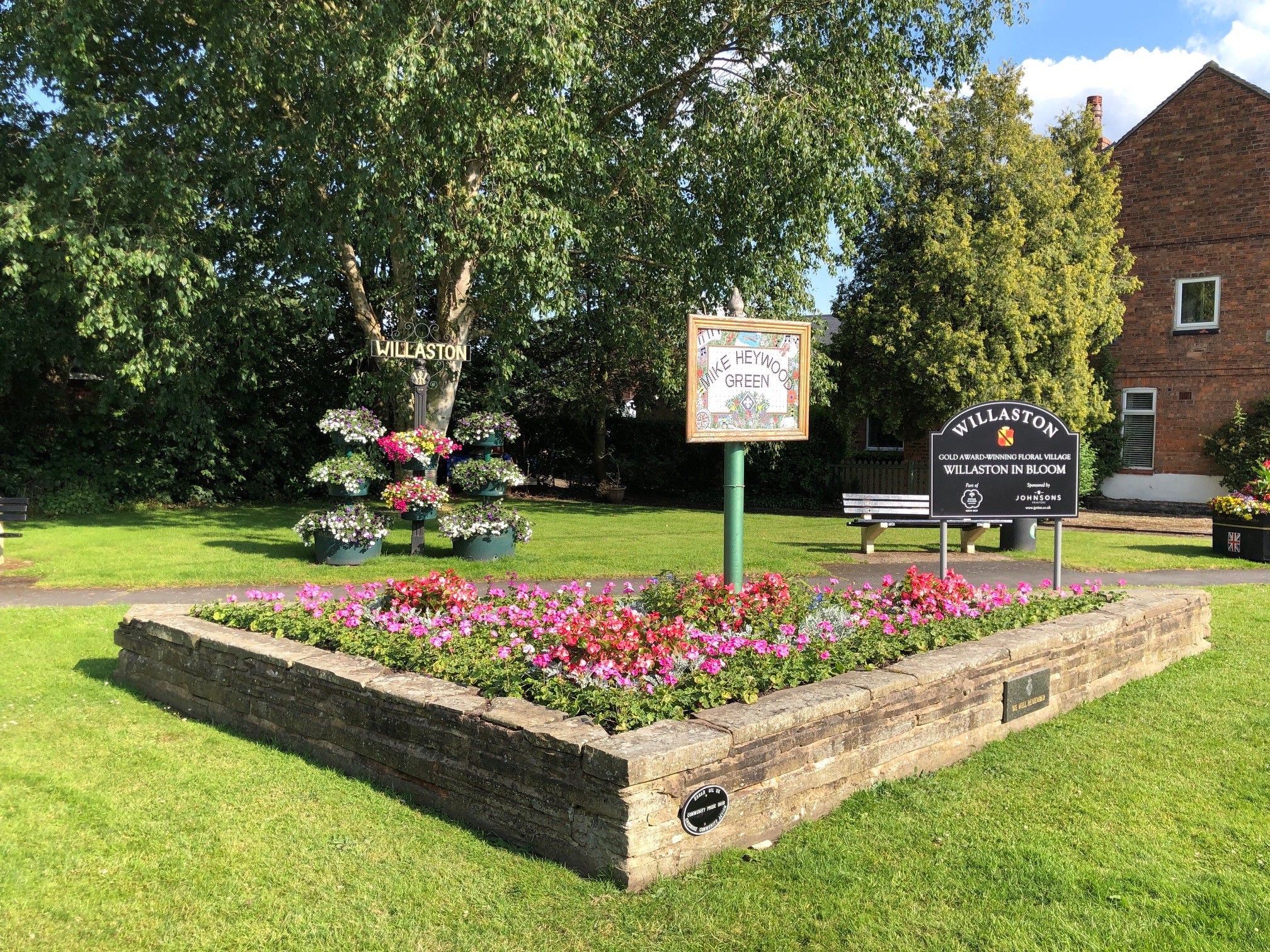
Willaston, Cheshire East

Willaston is a civil parish and village in the unitary authority of Cheshire East and the ceremonial county of Cheshire, in north-west England. It had...

Crewe and Nantwich (UK Parliament constituency)

Crewe and Nantwich is a constituency in the House of Commons of the UK Parliament. It is located in Cheshire. It was created in 1983, and has been represented...

St Thomas More Catholic School, Crewe

St Thomas More Catholic High School is a coeducational Roman Catholic secondary school for 11- to 16-year-olds, situated close to the centre of Crewe,...

Woolstanwood

Woolstanwood (also Woolstan Wood) is a village (at SJ680556) and civil parish in the unitary authority of Cheshire East and the ceremonial county of Cheshire...

Church of St Mary the Virgin, Wistaston

The Church of St Mary the Virgin is in the village of Wistaston, Cheshire, England. The church is recorded in the National Heritage List for England as...
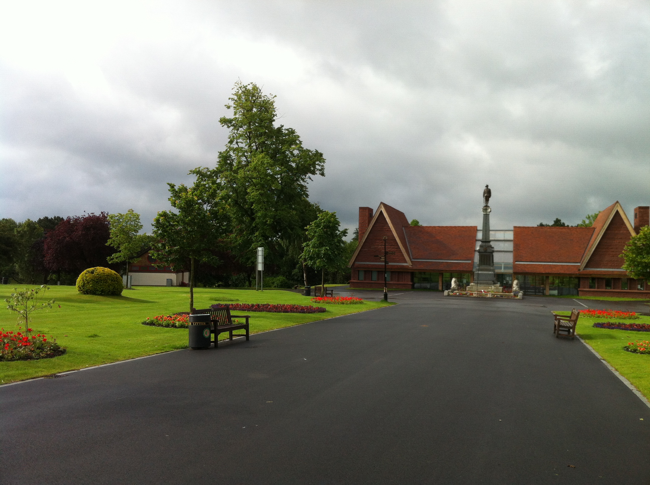
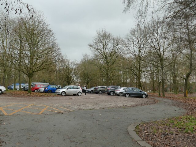
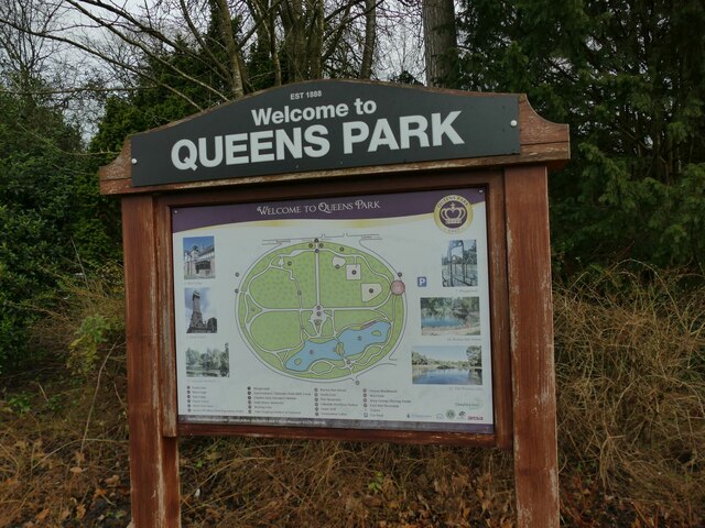
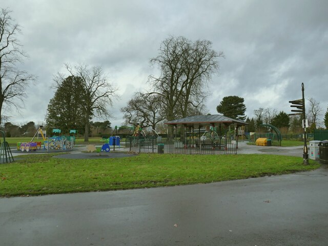
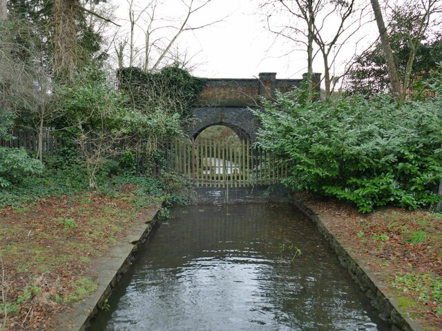
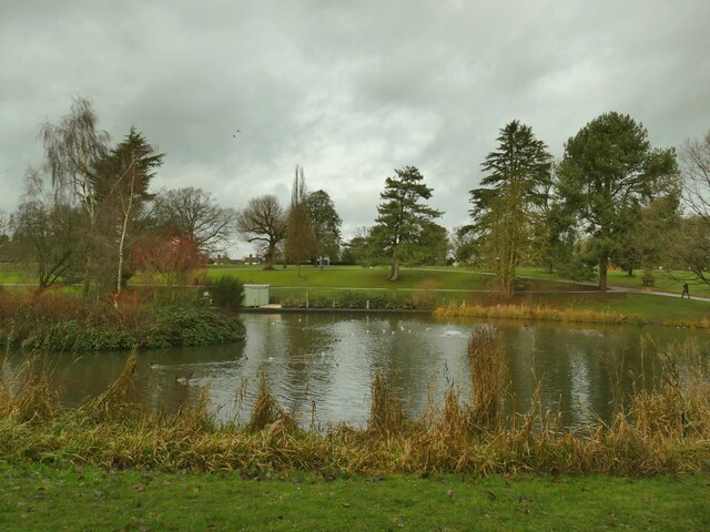
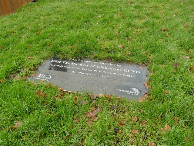
Queens Park, Crewe

Queens Park in Crewe, Cheshire, is a 44.5 acre (18ha) Grade II* listed public park opened in 1887, little changed from its original plan. == History... ==

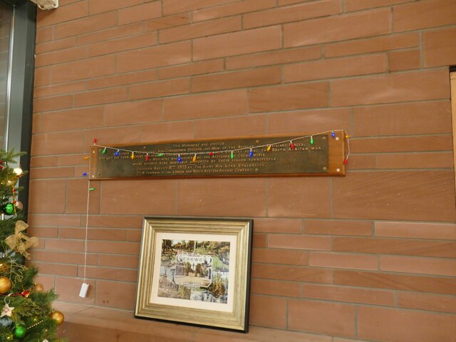
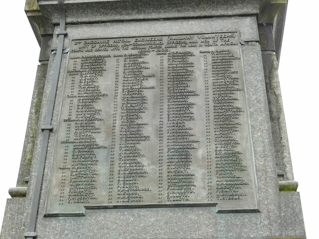
Boer War Memorial, Crewe

The Boer War Memorial, also known as the South African War Memorial, stands in a prominent position in Queens Park, Crewe, England. It was erected in memory...

Nearby Amenities

Located within 500m of 53.08777,-2.4735322
Source: Bing
Traffic Calming: cushion
Lat/Long: 53.0896426/-2.4678707
Mini Roundabout
Direction: clockwise
Lat/Long: 53.0870064/-2.4678636
Source: Bing
Traffic Calming: cushion
Lat/Long: 53.0876372/-2.4667152
Place Of Worship
Saint Marks Methodist Church
Addr Postcode: CW2 8PZ
Addr Street: Bramhall Road
Denomination: methodist
Name En: Saint Mark’s Methodist Church
Phone: +44 1270666059
Religion: christian
Website: https://www.cheshiresouth.org.uk/churches/coppenhall/st-marks-crewe.html
Lat/Long: 53.0910005/-2.4706281
Turning Circle
Source: Bing
Lat/Long: 53.0881957/-2.4672683
Bus Stop
Wistaston Green, Wistaston Green Road / Beech Drive
Bus: yes
Naptan AtcoCode: 0600CR062
Naptan Bearing: SE
Naptan CommonName: Beech Drive
Naptan Crossing: Beech Drive
Naptan Indicator: opp
Naptan Landmark: Alvaston Walk
Naptan LocalityName: Wistaston Green
Naptan NaptanCode: cheagat
Naptan PlusbusZoneRef: CREWE
Naptan ShortCommonName: Beech Drive
Naptan Street: Wistaston Green Road
Naptan Verified: no
Network: Cheshire East Council
Operator: Ansa Transport
Public Transport: platform
Source: naptan_import
Lat/Long: 53.0896596/-2.4712627
Bus Stop
Wistaston Green, Wistaston Green Road / Beech Drive
Bus: yes
Naptan AtcoCode: 0600CR063
Naptan Bearing: NW
Naptan CommonName: Beech Drive
Naptan Crossing: Beech Drive
Naptan Indicator: cnr
Naptan Landmark: Beech Drive
Naptan LocalityName: Wistaston Green
Naptan NaptanCode: cheagaw
Naptan PlusbusZoneRef: CREWE
Naptan ShortCommonName: Beech Drive
Naptan Street: Wistaston Green Road
Naptan Verified: no
Network: Cheshire East Council
Operator: Ansa Transport
Public Transport: platform
Source: naptan_import
Lat/Long: 53.089469/-2.471475
Bus Stop
Wistaston Green, Capesthorne Road / Ravenscroft Road
Bus: yes
Naptan AtcoCode: 0600CR064
Naptan Bearing: NE
Naptan CommonName: Ravenscroft Road
Naptan Crossing: Ravenscroft Road
Naptan Indicator: cnr
Naptan Landmark: Ravenscroft Road
Naptan LocalityName: Wistaston Green
Naptan NaptanCode: chejdpg
Naptan PlusbusZoneRef: CREWE
Naptan ShortCommonName: Ravenscroft Road
Naptan Street: Capesthorne Road
Naptan Verified: no
Network: Cheshire East Council
Operator: Ansa Transport
Public Transport: platform
Source: naptan_import
Lat/Long: 53.0915882/-2.4722992
Bus Stop
Wistaston Green, Capesthorne Road / Tatton Road
Bus: yes
Naptan AtcoCode: 0600CR17348
Naptan Bearing: SW
Naptan CommonName: Tatton Road
Naptan Crossing: Tatton Road
Naptan Indicator: cnr
Naptan Landmark: Tatton Road
Naptan LocalityName: Wistaston Green
Naptan NaptanCode: chetgja
Naptan PlusbusZoneRef: CREWE
Naptan ShortCommonName: Tatton Road
Naptan Street: Capesthorne Road
Naptan Verified: no
Network: Cheshire East Council
Operator: Ansa Transport
Public Transport: platform
Source: naptan_import
Lat/Long: 53.0907958/-2.4726339
Bus Stop
Wistaston Green, Wistaston Green Road / Wood End
Bus: yes
Naptan AtcoCode: 0600CR196
Naptan Bearing: NW
Naptan CommonName: Wood End
Naptan Crossing: Laurel Drive
Naptan Indicator: NW-bound
Naptan Landmark: Laurel Drive
Naptan LocalityName: Wistaston Green
Naptan NaptanCode: cheajda
Naptan PlusbusZoneRef: CREWE
Naptan ShortCommonName: Wood End
Naptan Street: Wistaston Green Road
Naptan Verified: no
Network: Cheshire East Council
Operator: Ansa Transport
Public Transport: platform
Source: naptan_import
Lat/Long: 53.0875676/-2.4683581
Bus Stop
Wistaston Green, Wistaston Green Road / Wood End
Bus: yes
Naptan AtcoCode: 0600CR197
Naptan Bearing: S
Naptan CommonName: Wood End
Naptan Crossing: Wood End
Naptan Indicator: S-bound
Naptan Landmark: Wood End
Naptan LocalityName: Wistaston Green
Naptan NaptanCode: cheajdg
Naptan PlusbusZoneRef: CREWE
Naptan ShortCommonName: Wood End
Naptan Street: Wistaston Green Road
Naptan Verified: no
Network: Cheshire East Council
Operator: Ansa Transport
Public Transport: platform
Source: naptan_import
Lat/Long: 53.0877034/-2.4681207
Bus Stop
Wistaston Green, Valley Road / Wistaston Green Road
Bus: yes
Naptan AtcoCode: 0600CR200
Naptan Bearing: NE
Naptan CommonName: Wistaston Green Road
Naptan Crossing: Wistaston Green Road
Naptan Indicator: NE-bound
Naptan Landmark: House number 13
Naptan LocalityName: Wistaston Green
Naptan NaptanCode: cheajdj
Naptan PlusbusZoneRef: CREWE
Naptan ShortCommonName: Wistaston Green Rd
Naptan Street: Valley Road
Naptan Verified: no
Network: Cheshire East Council
Operator: Ansa Transport
Public Transport: platform
Source: naptan_import
Lat/Long: 53.087473/-2.4672522
Bus Stop
Wistaston Green, Valley Road / Wistaston Green Road
Bus: yes
Naptan AtcoCode: 0600CR201
Naptan Bearing: SW
Naptan BusStopType: CUS
Naptan CommonName: Wistaston Green Road
Naptan Crossing: Wistaston Green Road
Naptan Indicator: SW-bound
Naptan Landmark: House number 13
Naptan LocalityName: Wistaston Green
Naptan NaptanCode: cheajdm
Naptan PlusbusZoneRef: CREWE
Naptan ShortCommonName: Wistaston Green Rd
Naptan Street: Valley Road
Naptan Verified: no
Network: Cheshire East Council
Operator: Ansa Transport
Public Transport: platform
Source: naptan_import
Lat/Long: 53.087357/-2.4670419
Barrier: stile
Lat/Long: 53.0860264/-2.4758825
Post Box
Lat/Long: 53.0895293/-2.4716776
Source: Bing
Traffic Calming: cushion
Lat/Long: 53.0871865/-2.4674966
Source: Bing
Traffic Calming: cushion
Lat/Long: 53.0890577/-2.4685782
Source: Bing
Traffic Calming: cushion
Lat/Long: 53.0901808/-2.4674253
Noexit: yes
Lat/Long: 53.0914157/-2.4702351
Source: Bing
Traffic Calming: hump
Lat/Long: 53.0863497/-2.4674115
Leisure: playground
Lat/Long: 53.0858726/-2.4756119
Bus Stop
Wistaston Green, Capesthorne Road / Ravenscroft Road
Bus: yes
Naptan AtcoCode: 0600CR065
Naptan Bearing: SW
Naptan BusStopType: CUS
Naptan CommonName: Ravenscroft Road
Naptan Crossing: Ravenscroft Road
Naptan Indicator: opp
Naptan Landmark: Ravenscroft Road
Naptan LocalityName: Wistaston Green
Naptan NaptanCode: chejdpj
Naptan PlusbusZoneRef: CREWE
Naptan ShortCommonName: Ravenscroft Road
Naptan Street: Capesthorne Road
Network: Cheshire East Council
Operator: Ansa Transport
Public Transport: platform
Source: naptan_import
Lat/Long: 53.091535/-2.472021
The data included in this document is from www.openstreetmap.org. The data is made available under ODbL.

Have you been to Old Covert?

Leave your review of Old Covert below (or comments, questions and feedback).