Bowtham Wood

Wood, Forest in Yorkshire Craven

England

Bowtham Wood

Field at High Bentham The field lies to the north of the railway not far from the village centre of High Bentham.  The east end of Bentham Station's platforms are visible to the right.
The small stone bridge is over Fowgill Beck.  It carried a footpath which crossed over the railway by a footbridge to reach St. Margaret’s Church, partly hidden in the trees.  The footbridge has been demolished, but some of the approach embankment remains.
Two white painted railway boundary markers are visible, one near the centre of the field and one adjacent to the station platform.
Field at High Bentham Credit: Adrian Taylor

Bowtham Wood is a picturesque forest located in the county of Yorkshire, England. Covering an area of approximately 500 acres, it is known for its diverse ecosystem and stunning natural beauty. The wood is situated in the southern part of the county, near the village of Bowtham.

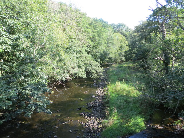
The forest is primarily composed of broadleaf trees, including oak, beech, and birch, which provide a lush and vibrant canopy throughout the year. These trees create a rich habitat for a wide variety of flora and fauna, making Bowtham Wood a popular destination for nature enthusiasts and wildlife lovers.

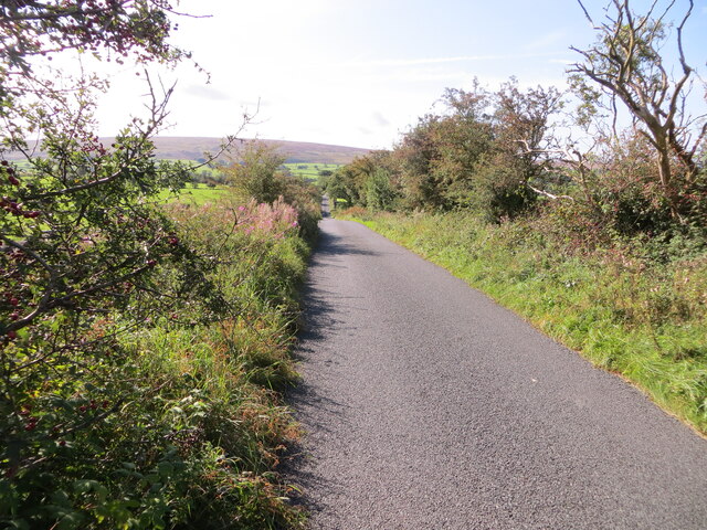
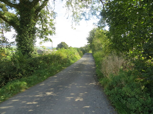
Within the wood, there are several well-marked walking trails that wind through the forest, allowing visitors to explore its hidden treasures. These trails offer stunning views of the surrounding countryside and provide a peaceful and tranquil atmosphere for those seeking solace in nature. Additionally, there are designated picnic areas and benches scattered throughout the wood, providing perfect spots for visitors to relax and enjoy a picnic amidst the natural surroundings.

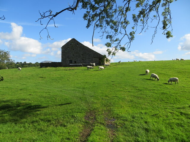
Bowtham Wood is also home to a diverse range of wildlife, including deer, squirrels, and various species of birds. Birdwatchers flock to the forest to catch a glimpse of rare and migratory birds that inhabit the area. The wood also supports a rich insect population, including butterflies and dragonflies, adding to its ecological significance.

Overall, Bowtham Wood is a captivating and enchanting forest that offers a serene escape from the hustle and bustle of everyday life. Its natural beauty and abundant wildlife make it a must-visit destination for anyone seeking a peaceful retreat in the heart of Yorkshire.

If you have any feedback on the listing, please let us know in the comments section below.
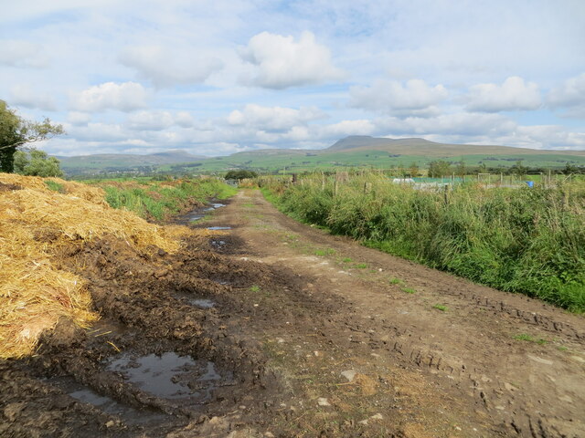
Bowtham Wood Images

Images are sourced within 2km of 54.110138/-2.4919033 or Grid Reference SD6768. Thanks to Geograph Open Source API. All images are credited.

Field at High Bentham The field lies to the north of the railway not far from the village centre of High Bentham.  The east end of Bentham Station's platforms are visible to the right.
The small stone bridge is over Fowgill Beck.  It carried a footpath which crossed over the railway by a footbridge to reach St. Margaret’s Church, partly hidden in the trees.  The footbridge has been demolished, but some of the approach embankment remains.
Two white painted railway boundary markers are visible, one near the centre of the field and one adjacent to the station platform.
Field at High Bentham
The field lies to the north of the railway not far from the village centre of High Bentham. The east end of Bentham Station's platforms are visible to the right. The small stone bridge is over Fowgill Beck. It carried a footpath which crossed over the railway by a footbridge to reach St. Margaret’s Church, partly hidden in the trees. The footbridge has been demolished, but some of the approach embankment remains. Two white painted railway boundary markers are visible, one near the centre of the field and one adjacent to the station platform.
Benchmark, Bentham Methodist Chapel Detail of an Ordnance Survey cut benchmark on the buttress on the northwest angle of the porch of Bentham Methodist Chapel.  The benchmark marks a height of 99.6818m above mean sea level (Ordnance Datum Newlyn) last verified in 1952 (location photograph <a href="https://www.geograph.org.uk/photo/7159110">SD6669 : Bentham Methodist Chapel</a>).
Benchmark, Bentham Methodist Chapel
Detail of an Ordnance Survey cut benchmark on the buttress on the northwest angle of the porch of Bentham Methodist Chapel. The benchmark marks a height of 99.6818m above mean sea level (Ordnance Datum Newlyn) last verified in 1952 (location photograph SD6669 : Bentham Methodist Chapel).
Bentham Methodist Chapel The west front of Bentham Methodist Chapel.
There is an Ordnance Survey cut benchmark on the northwest buttress of the chapel porch (detail photograph <a href="https://www.geograph.org.uk/photo/7158932">SD6669 : Benchmark, Bentham Methodist Chapel</a>).
Bentham Methodist Chapel
The west front of Bentham Methodist Chapel. There is an Ordnance Survey cut benchmark on the northwest buttress of the chapel porch (detail photograph SD6669 : Benchmark, Bentham Methodist Chapel).
Bentham Methodist Chapel The porch on the west front of Bentham Methodist Chapel.
There is an Ordnance Survey cut benchmark on the left face of the buttress nearest the camera (location photograph <a href="https://www.geograph.org.uk/photo/7158952">SD6669 : Bentham Methodist Chapel</a>, detail photograph <a href="https://www.geograph.org.uk/photo/7158932">SD6669 : Benchmark, Bentham Methodist Chapel</a>).
Bentham Methodist Chapel
The porch on the west front of Bentham Methodist Chapel. There is an Ordnance Survey cut benchmark on the left face of the buttress nearest the camera (location photograph SD6669 : Bentham Methodist Chapel, detail photograph SD6669 : Benchmark, Bentham Methodist Chapel).
Station Road, Bentham Station Road slopes up to cross the railway bridge.  South View is the road to the left.
Station Road, Bentham
Station Road slopes up to cross the railway bridge. South View is the road to the left.
Benchmark, High Bentham, former Royal Oak Hotel Detail of the Ordnance Survey 1GL bolt benchmark on the front of the former Royal Oak Hotel, now the Royal Oak Sale Room.  The benchmark marks a height of 102.1446m above sea level (Ordnance Datum Newlyn) last levelled in 1969 and verified in 1970 (location photograph <a href="https://www.geograph.org.uk/photo/7237996">SD6669 : Royal Oak Sale Room</a>).
Benchmark, High Bentham, former Royal Oak Hotel
Detail of the Ordnance Survey 1GL bolt benchmark on the front of the former Royal Oak Hotel, now the Royal Oak Sale Room. The benchmark marks a height of 102.1446m above sea level (Ordnance Datum Newlyn) last levelled in 1969 and verified in 1970 (location photograph SD6669 : Royal Oak Sale Room).
Royal Oak Sale Room Detail of the front of the Royal Oak Sale Room, formerly the Royal Oak Hotel.  There is an Ordnance Survey benchmark on one of the stone quoins beside the archway (detail photograph <a href="https://www.geograph.org.uk/photo/7237957">SD6669 : Benchmark, High Bentham, former Royal Oak Hotel</a>).
Royal Oak Sale Room
Detail of the front of the Royal Oak Sale Room, formerly the Royal Oak Hotel. There is an Ordnance Survey benchmark on one of the stone quoins beside the archway (detail photograph SD6669 : Benchmark, High Bentham, former Royal Oak Hotel).
Benchmark, Butterbur Cottage Detail of the Ordnance Survey cut benchmark on the north-west corner of Butterbur Cottage. The benchmark marks a height of 115.0533m above sea level (Ordnance Datum Newlyn) last verified in 1970 (location photograph <a href="https://www.geograph.org.uk/photo/7244637">SD6669 : Butterbur Cottage</a>).
Benchmark, Butterbur Cottage
Detail of the Ordnance Survey cut benchmark on the north-west corner of Butterbur Cottage. The benchmark marks a height of 115.0533m above sea level (Ordnance Datum Newlyn) last verified in 1970 (location photograph SD6669 : Butterbur Cottage).
Butterbur Cottage There is an Ordnance Survey cut benchmark on the northwest corner of Butterbur Cottage, facing Robin Lane (photograph <a href="https://www.geograph.org.uk/photo/7239365">SD6669 : Benchmark, Butterbur Cottage</a>).
Butterbur Cottage
There is an Ordnance Survey cut benchmark on the northwest corner of Butterbur Cottage, facing Robin Lane (photograph SD6669 : Benchmark, Butterbur Cottage).
Bentham Station with Angus Fire factory behind
Greystonegill Lane approaching High Barn Looking southward. The rounded outline of Burn Moor can be seen in the far distance.
Greystonegill Lane approaching High Barn
Looking southward. The rounded outline of Burn Moor can be seen in the far distance.
River Wenning at Greystonegill Bridge Looking north-eastward upstream.
River Wenning at Greystonegill Bridge
Looking north-eastward upstream.
Pastureland and field barn on Buffet Hill Looking north-eastward.
Pastureland and field barn on Buffet Hill
Looking north-eastward.
Mewith Lane approaching New House Looking eastward.
Mewith Lane approaching New House
Looking eastward.
Hedge-lined land approaching Barnfield Looking north-westward.
Hedge-lined land approaching Barnfield
Looking north-westward.
The former church of St Margaret and part of its burial ground at High Bentham Viewed from the northeast. The church building is now a private housing development although the burial ground remains accessible.
The former church of St Margaret and part of its burial ground at High Bentham
Viewed from the northeast. The church building is now a private housing development although the burial ground remains accessible.
Station Road, High Bentham Looking northward.
Station Road, High Bentham
Looking northward.
Track between piles of maure and Triangulation Pillar at Lingshaw Cross Looking north-eastward.
Track between piles of maure and Triangulation Pillar at Lingshaw Cross
Looking north-eastward.
Show me another place!

Bowtham Wood is located at Grid Ref: SD6768 (Lat: 54.110138, Lng: -2.4919033)

Division: West Riding

Administrative County: North Yorkshire

District: Craven

Police Authority: North Yorkshire

What 3 Words

///acoustics.clogging.town. Near High Bentham, North Yorkshire

Related Wikis

St Margaret's Church, High Bentham

St Margaret's Church is in Station Road, High Bentham, North Yorkshire, England. It is an Anglican parish church in the deanery of Ewecross, the archdeaconry...

Bentham railway station

Bentham is a railway station on the Bentham Line, which runs between Leeds and Morecambe via Skipton. The station, situated 19 miles (31 km) east of Lancaster...
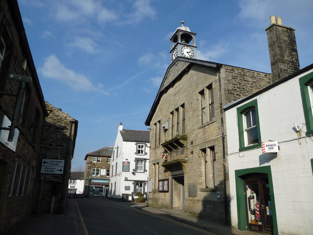
Bentham Town Hall

Bentham Town Hall, also known as High Bentham Town Hall, is a municipal building in Station Road, High Bentham, a town in North Yorkshire, England. The...

Bentham, North Yorkshire

Bentham is a civil parish in North Yorkshire, England, with a population of 3,027 at the 2011 Census. The parish includes the town of High Bentham, occasionally...

Nearby Amenities

Located within 500m of 54.110138,-2.4919033
Barrier: stile
Material: stone
Source: survey;gps
Stile: squeezer
Lat/Long: 54.1082596/-2.4860921
Barrier: stile
Material: stone
Source: survey;gps
Stile: squeezer
Lat/Long: 54.1087324/-2.4889116
Barrier: stile
Material: stone
Source: survey;gps
Stile: squeezer
Lat/Long: 54.1087839/-2.4918017
Barrier: stile
Material: stone
Source: survey;gps
Stile: squeezer
Lat/Long: 54.1104051/-2.4925149
Barrier: stile
Material: stone
Source: survey;gps
Stile: stepover
Lat/Long: 54.1114843/-2.4936415
Barrier: stile
Material: wood
Source: survey;gps
Stile: stepover
Lat/Long: 54.1122639/-2.4923725
Barrier: stile
Material: wood
Source: survey;gps
Stile: stepover
Lat/Long: 54.1140405/-2.4925649
Power: pole
Lat/Long: 54.106253/-2.4955396
Power: pole
Lat/Long: 54.1068203/-2.4968936
Power: pole
Lat/Long: 54.10974/-2.4989635
Power: pole
Lat/Long: 54.1102236/-2.4979675
Power: pole
Lat/Long: 54.1107208/-2.4970207
Power: pole
Lat/Long: 54.1110827/-2.4963359
Power: pole
Lat/Long: 54.1116727/-2.4951583
Power: pole
Lat/Long: 54.1140045/-2.4894581
The data included in this document is from www.openstreetmap.org. The data is made available under ODbL.

Have you been to Bowtham Wood?

Leave your review of Bowtham Wood below (or comments, questions and feedback).