Boundary Wood

Wood, Forest in Cheshire

England

Boundary Wood

Electricity pylons near Wimboldsley
Electricity pylons near Wimboldsley Credit: Roy Hughes

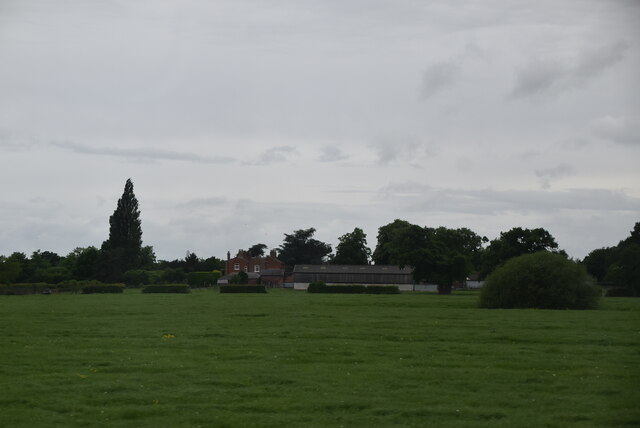
Boundary Wood is a picturesque woodland located in the county of Cheshire, England. Covering an area of approximately 50 acres, it is situated on the eastern edge of the village of Chelford, near the border between Cheshire and Derbyshire. The wood is easily accessible, with a designated parking area and well-maintained footpaths for visitors to explore.

The woodland itself is a mix of deciduous and coniferous trees, including oak, beech, and pine, creating a diverse and vibrant ecosystem. The trees provide a habitat for an array of wildlife, including birds, mammals, and insects. Nature enthusiasts can often spot species such as woodpeckers, squirrels, and butterflies during their visit.

Boundary Wood is not only a haven for wildlife but also a popular destination for outdoor enthusiasts. The wood offers a network of walking trails, suitable for all abilities, allowing visitors to immerse themselves in the tranquility of nature. The paths meander through the trees, with occasional clearings that offer stunning views of the surrounding countryside.

For those seeking a peaceful retreat, Boundary Wood provides an ideal setting. The serene atmosphere, coupled with the soothing sounds of nature, offers a respite from the hustle and bustle of everyday life. Whether it's a leisurely stroll, a family picnic, or wildlife spotting, Boundary Wood offers a delightful experience for all who venture into its enchanting realm.

If you have any feedback on the listing, please let us know in the comments section below.

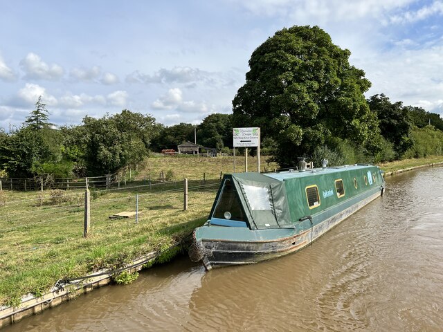
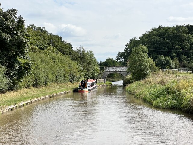
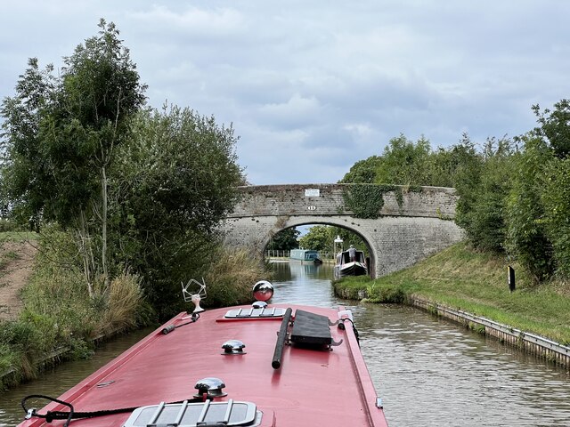
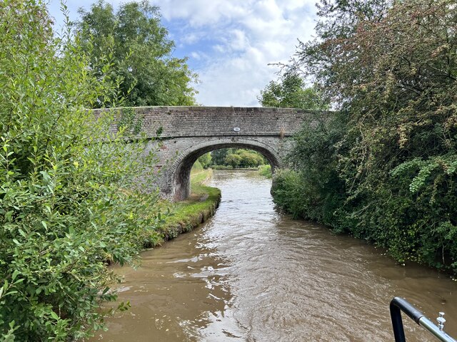
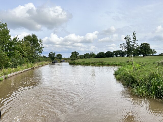
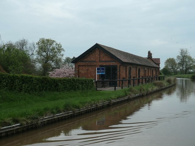
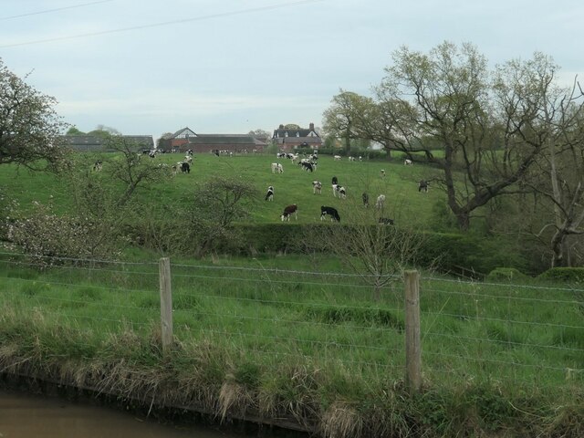
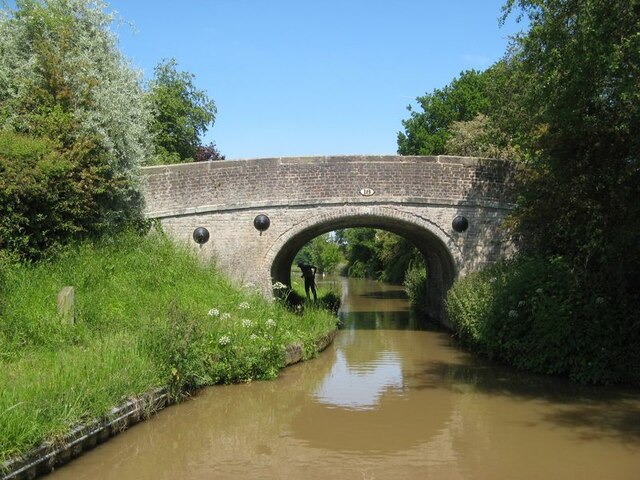
Boundary Wood Images

Images are sourced within 2km of 53.162292/-2.4840742 or Grid Reference SJ6762. Thanks to Geograph Open Source API. All images are credited.

Electricity pylons near Wimboldsley
Middlewich Branch Near Higher Elms Farm.
Middlewich Branch
Near Higher Elms Farm.
Middlewich Branch Near Higher Elms Farm.
Middlewich Branch
Near Higher Elms Farm.
Bridge 15 on the Middlewich Branch Near Higher Elms Farm.
Bridge 15 on the Middlewich Branch
Near Higher Elms Farm.
Hollingshead Bridge Grade II listed. Listing number 1320249. Accommodation bridge. 1827-33. Telford design. Skew built. Washed brick with stone band and copings. Single-basket arch with saw-toothed arch ring, solid parapet and piers. Towpath retaining wall with stone coping.
Hollingshead Bridge
Grade II listed. Listing number 1320249. Accommodation bridge. 1827-33. Telford design. Skew built. Washed brick with stone band and copings. Single-basket arch with saw-toothed arch ring, solid parapet and piers. Towpath retaining wall with stone coping.
Polestead Wood Winding Hole On the Middlewich Branch.
Polestead Wood Winding Hole
On the Middlewich Branch.
Canalside house for sale, Middlewich Branch Former canal stables between bridges 18 and 19. Built between 1897 and 1908.
Canalside house for sale, Middlewich Branch
Former canal stables between bridges 18 and 19. Built between 1897 and 1908.
Cattle grazing near Wimboldsley Hall Cheshire is famous for its dairy industry.
Cattle grazing near Wimboldsley Hall
Cheshire is famous for its dairy industry.
Bridge 19, from the north Carrying a public footpath over the Middlewich Branch of the Shropshire Union canal.
Bridge 19, from the north
Carrying a public footpath over the Middlewich Branch of the Shropshire Union canal.
Bridge 18 Bridge 18 survives, while others on this length have had their arches demolished. It is an accommodation bridge for the local farms only.
Bridge 18
Bridge 18 survives, while others on this length have had their arches demolished. It is an accommodation bridge for the local farms only.
Canal at Wimboldsley Grange Manicured pastures in this area of dairy farms. The distant bridge is number 20.
Canal at Wimboldsley Grange
Manicured pastures in this area of dairy farms. The distant bridge is number 20.
Flag Iris bank In memory, the banks of the Middlewich Branch were busy with Yellow Flag (Iris pseudacorus), and so it proves on this sunny day.
Flag Iris bank
In memory, the banks of the Middlewich Branch were busy with Yellow Flag (Iris pseudacorus), and so it proves on this sunny day.
Railway bridge 22A A Pendolino train belonging to Avanti West Coast hurries north across the canal. Just previously, an intermodal train had passed over slowly as it idled on the slow line at the end of the four-track section which runs out beyond Winsford.
Railway bridge 22A
A Pendolino train belonging to Avanti West Coast hurries north across the canal. Just previously, an intermodal train had passed over slowly as it idled on the slow line at the end of the four-track section which runs out beyond Winsford.
Old Milepost by the A530, Nantwich Road, Wimboldsley Cast iron post by the A530, in parish of Wimboldsley (Vale Royal District), Nantwich Road junction with School Lane, by finger post CH_SJ6863 SJ6863 : Old Direction Sign - Signpost by the A530, Wimboldsley parish, on grass in front of wooden fence, on East side of road. Crested open book iron (D&J), erected by the Nantwich & Middlewich turnpike trust in the 19th century. An earlier photo can be found here <a title="https://www.geograph.org.uk/photo/5622834" href="https://www.geograph.org.uk/photo/5622834">Link</a>.

Inscription reads:-
: NANTWICH / 8 / MILES : : WIMBOLDSLEY / {crest} / TOWNSHIP : : MIDDLEWICH / 2 / MILES :
Maker:-
: DUNN & JOHNSON / LEFTWICH :

Milestone Society National ID: CH_NWMW08
Old Milepost by the A530, Nantwich Road, Wimboldsley
Cast iron post by the A530, in parish of Wimboldsley (Vale Royal District), Nantwich Road junction with School Lane, by finger post CH_SJ6863 SJ6863 : Old Direction Sign - Signpost by the A530, Wimboldsley parish, on grass in front of wooden fence, on East side of road. Crested open book iron (D&J), erected by the Nantwich & Middlewich turnpike trust in the 19th century. An earlier photo can be found here Link. Inscription reads:- : NANTWICH / 8 / MILES : : WIMBOLDSLEY / {crest} / TOWNSHIP : : MIDDLEWICH / 2 / MILES : Maker:- : DUNN & JOHNSON / LEFTWICH : Milestone Society National ID: CH_NWMW08
Canal from Cartwright Bridge The Shropshire Union Canal viewed from Cartwright Bridge. Part of National Cycle Network route 5 runs alongside.
Canal from Cartwright Bridge
The Shropshire Union Canal viewed from Cartwright Bridge. Part of National Cycle Network route 5 runs alongside.
Canal and railway from Cartwright Bridge The Shropshire Union Canal viewed from Cartwright Bridge. In the distance is the 1333 Liverpool Lime Street to Birmingham New Street (1G55) formed of two class 350 units heading between Winsford and Crewe.
Canal and railway from Cartwright Bridge
The Shropshire Union Canal viewed from Cartwright Bridge. In the distance is the 1333 Liverpool Lime Street to Birmingham New Street (1G55) formed of two class 350 units heading between Winsford and Crewe.
Canal from underneath Cartwright Bridge The Shropshire Union Canal viewed from underneath Cartwright Bridge. In the distance is the 1343 Liverpool Lime Street to London Euston (1A35) formed of 390040 heading between Runcorn and Crewe.
Canal from underneath Cartwright Bridge
The Shropshire Union Canal viewed from underneath Cartwright Bridge. In the distance is the 1343 Liverpool Lime Street to London Euston (1A35) formed of 390040 heading between Runcorn and Crewe.
Newfield Hall Farm
Newfield Hall Farm
Show me another place!

Boundary Wood is located at Grid Ref: SJ6762 (Lat: 53.162292, Lng: -2.4840742)

Unitary Authority: Cheshire West and Chester

Police Authority: Cheshire

What 3 Words

///quitter.flats.bundles. Near Winsford, Cheshire

Related Wikis

Minshull Vernon railway station

Minshull Vernon railway station was a station on the Grand Junction Railway serving the villages of Warmington and Minshull Vernon. It opened on 4 July...

Wimboldsley

Wimboldsley is a village and former civil parish, now in the parish of Stanthorne and Wimboldsley, in the Cheshire West and Chester district, in the ceremonial...

Lea Hall, Wimboldsley

Lea Hall is a former country house standing to the northwest of the village of Wimboldsley, Cheshire, England. It dates from the early part of the 18th...

Weaver Hall, Darnhall

Weaver Hall is an English country house in the parish of Darnhall, Cheshire. It was built in the early 17th century, largely rebuilt in the early 18th...

Occlestone Green

Occlestone Green is a small rural settlement in the civil parish of Stanthorne and Wimboldsley, the unitary authority of Cheshire West and Chester and...

Minshull Vernon United Reformed Church

Minshull Vernon United Reformed Church is located in Cross Lane, Minshull Vernon, Cheshire, England. It is recorded in the National Heritage List for England...

1999 Winsford railway accident

On 23 June 1999, a Virgin Trains electric express train from London Euston to Glasgow Central, hauled by Class 87 No 87027 Wolf of Badenoch, ran into an...

St Bartholomew's Church, Church Minshull

St Bartholomew's Church is in the village of Church Minshull, Cheshire, England. It is recorded in the National Heritage List for England as a designated...

Nearby Amenities

Located within 500m of 53.162292,-2.4840742
Barrier: stile
Foot: yes
Lat/Long: 53.1628686/-2.4840937
Turning Loop
Lat/Long: 53.1591234/-2.4865152
Boundary Wood
Natural: wood
Lat/Long: 53.1637131/-2.4876341
The data included in this document is from www.openstreetmap.org. The data is made available under ODbL.

Have you been to Boundary Wood?

Leave your review of Boundary Wood below (or comments, questions and feedback).