Hurdlestone Wood

Wood, Forest in Somerset Mendip

England

Hurdlestone Wood

Humped zebra Not a cross of some African animals but a speed-reducing measure along Anchor Road in Highbury.
Humped zebra Credit: Neil Owen

Hurdlestone Wood is a picturesque woodland located in Somerset, England. Covering an area of approximately 100 acres, it is a popular destination for nature lovers and outdoor enthusiasts. The woodland is situated near the village of Hurdlestone, providing easy access for visitors.

Hurdlestone Wood is characterized by its diverse range of tree species, including oak, beech, and ash. These ancient trees create a dense canopy that provides a cool and shady environment, even on hot summer days. The forest floor is covered in a carpet of wildflowers, creating a vibrant and colorful display in the spring and summer months.

The wood is crisscrossed by a network of well-maintained footpaths and trails, making it an ideal location for walking, jogging, or cycling. Visitors can explore the wood at their own pace, taking in the beauty of their surroundings and breathing in the fresh woodland air. Along the trails, there are several picnic areas, allowing visitors to stop and enjoy a leisurely meal amidst the tranquil surroundings.

Hurdlestone Wood is also home to a variety of wildlife, including squirrels, rabbits, and a wide range of bird species. Birdwatchers will be delighted by the opportunity to spot woodpeckers, nuthatches, and various species of owls. The wood is carefully managed to preserve its natural habitat, and visitors are encouraged to respect the wildlife and refrain from disturbing their natural behavior.

Overall, Hurdlestone Wood offers a peaceful and serene escape from the hustle and bustle of everyday life. Its natural beauty and tranquil atmosphere make it a must-visit destination for nature enthusiasts and those seeking a break from the urban environment.

If you have any feedback on the listing, please let us know in the comments section below.

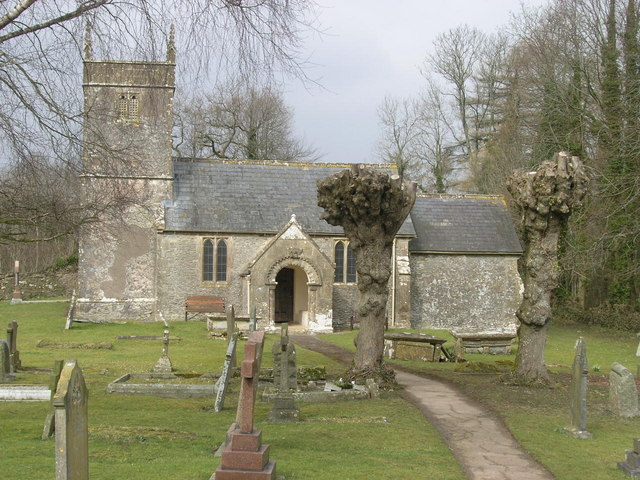
Hurdlestone Wood Images

Images are sourced within 2km of 51.230347/-2.4640062 or Grid Reference ST6748. Thanks to Geograph Open Source API. All images are credited.

Humped zebra Not a cross of some African animals but a speed-reducing measure along Anchor Road in Highbury.
Humped zebra
Not a cross of some African animals but a speed-reducing measure along Anchor Road in Highbury.
The Crossways garage is crushed No more petrol at this station. Having been declared redundant it has been demolished to make room for a new store and a house.
The Crossways garage is crushed
No more petrol at this station. Having been declared redundant it has been demolished to make room for a new store and a house.
A village that remembers Coleford's village signpost also provides room for a silhouette of a soldier. See <a href="https://www.geograph.org.uk/photo/7059790">ST6849 : Welcome to Coleford</a> for a better look at the hanpainted sign. The bench seat beyond marks the  Queen's Diamond Jubilee, 2012.
A village that remembers
Coleford's village signpost also provides room for a silhouette of a soldier. See ST6849 : Welcome to Coleford for a better look at the hanpainted sign. The bench seat beyond marks the Queen's Diamond Jubilee, 2012.
Welcome to Coleford A hand-painted village sign; pity the elements have taken the shine off it as it looks rather fetching. See <a href="https://www.geograph.org.uk/photo/7059781">ST6849 : A village that remembers</a> for a wider view of the roadside position.
Welcome to Coleford
A hand-painted village sign; pity the elements have taken the shine off it as it looks rather fetching. See ST6849 : A village that remembers for a wider view of the roadside position.
A post box remains The village post office was here up until quite recently, but the premises are now a piano shop. However, the postbox and a notice board remain on site.
A post box remains
The village post office was here up until quite recently, but the premises are now a piano shop. However, the postbox and a notice board remain on site.
Coleford Royal British Legion hall The hall was built in 1956, with later extensions. See <a href="https://www.geograph.org.uk/photo/7059810">ST6849 : The Legion scroll</a> for a look at the front sign and legend.
Coleford Royal British Legion hall
The hall was built in 1956, with later extensions. See ST6849 : The Legion scroll for a look at the front sign and legend.
The Legion scroll Coleford Royal British Legion hall has this stone plaque on the front that records the fallen of both world wars. It seems such an obvious place to have a war memorial, yet not many do. See <a href="https://www.geograph.org.uk/photo/7059804">ST6849 : Coleford Royal British Legion hall</a> for a location view.
The Legion scroll
Coleford Royal British Legion hall has this stone plaque on the front that records the fallen of both world wars. It seems such an obvious place to have a war memorial, yet not many do. See ST6849 : Coleford Royal British Legion hall for a location view.
Coleford Gospel Hall The village had held some meetings in various places before a worshipper, Harry Beer, drove a horse and cart to Devizes to purchase an old army hut. The corrugated hut became the first hall for the community by 1920. Later meetings were also held under canvas as the needs outgrew. Today this spacious modern hall welcomes all.
Coleford Gospel Hall
The village had held some meetings in various places before a worshipper, Harry Beer, drove a horse and cart to Devizes to purchase an old army hut. The corrugated hut became the first hall for the community by 1920. Later meetings were also held under canvas as the needs outgrew. Today this spacious modern hall welcomes all.
Coleford and Highbury signpost At the junction of Anchor Road and Church Street. Coleford is nowhere near the sea but presumably Anchor Road is named after the Anchor Inn further up the way.
Coleford and Highbury signpost
At the junction of Anchor Road and Church Street. Coleford is nowhere near the sea but presumably Anchor Road is named after the Anchor Inn further up the way.
Coleford pharmacy At the top of Church Street. Prior to this it was the village fish and chip shop.
Coleford pharmacy
At the top of Church Street. Prior to this it was the village fish and chip shop.
Coleford's K6 This telephone box is now a library and second-hand outlet.
Coleford's K6
This telephone box is now a library and second-hand outlet.
The old Miners Arms Naturally, a mining village would have a pub of this name; sadly, it stood almost opposite another, the Eagle, and lost that battle for customers. Today it has been redeveloped as a small group of apartments with original features and even includes a bar area.
The old Miners Arms
Naturally, a mining village would have a pub of this name; sadly, it stood almost opposite another, the Eagle, and lost that battle for customers. Today it has been redeveloped as a small group of apartments with original features and even includes a bar area.
The Eagle Inn, Coleford This pub has had to bear the brunt of the Covid problem and hence was closed for quite some time as staff were unavailable. It remains in a parlous financial state and there are worries it too will be lost - as was the Miners Arms opposite.

The building is nineteenth century with some unusual additions.
The Eagle Inn, Coleford
This pub has had to bear the brunt of the Covid problem and hence was closed for quite some time as staff were unavailable. It remains in a parlous financial state and there are worries it too will be lost - as was the Miners Arms opposite. The building is nineteenth century with some unusual additions.
The Eagle Inn on Highbury Street One of the last pubs still standing in the village. As mining was the dominant form of employment in the past there were a number of them, but times and tastes have changed.
The Eagle Inn on Highbury Street
One of the last pubs still standing in the village. As mining was the dominant form of employment in the past there were a number of them, but times and tastes have changed.
Coleford recreation ground A small paddock for the more sturdy equipment opened for the Millennium.
Coleford recreation ground
A small paddock for the more sturdy equipment opened for the Millennium.
Breaking the nets The hard court at the back of the Eagle Inn is one of the sports facilities that are part of the recreation ground. Although quiet today it seems to be well used.
Breaking the nets
The hard court at the back of the Eagle Inn is one of the sports facilities that are part of the recreation ground. Although quiet today it seems to be well used.
Left after the match The football pitch in Coleford has kept someone's top. Note the different treatment of parts of the pitch.
Left after the match
The football pitch in Coleford has kept someone's top. Note the different treatment of parts of the pitch.
The changing rooms Coleford's football facilities.
The changing rooms
Coleford's football facilities.
Show me another place!

Hurdlestone Wood is located at Grid Ref: ST6748 (Lat: 51.230347, Lng: -2.4640062)

Administrative County: Somerset

District: Mendip

Police Authority: Avon and Somerset

What 3 Words

///node.anchovies.handrail. Near Chilcompton, Somerset

Nearby Locations

Ham Hurdlestone Wood

Related Wikis

Cook's Wood Quarry

Cook's Wood Quarry also known as Holcombe Quarry (grid reference ST669479) is a 0.8-hectare (2.0-acre) geological Site of Special Scientific Interest near...

Stoke Lane Slocker

Stoke Lane Slocker (grid reference ST66874745) is a cave near Stoke St Michael, in the Carboniferous Limestone of the Mendip Hills, in the English county...

St Dunstan's Well Catchment

St. Dunstan's Well Catchment (grid reference ST668475) is a Site of Special Scientific Interest, covering 39.8 hectares (98.3 acres) near Stoke St Michael...

Edford Woods and Meadows

Edford Woods and Meadows (grid reference ST665485) is a 54.3 hectare (134.1 acre) biological Site of Special Scientific Interest, between Nettlebridge...

Holcombe, Somerset

Holcombe is a small village and civil parish (population 936) in the Mendip local government district of Somerset, England. The parish contains the hamlets...

Stoke St Michael

Stoke St Michael is a village and civil parish on the Mendip Hills 4 miles (6.4 km) north east of Shepton Mallet, and 8 miles (12.9 km) west of Frome,...

Church of St Michael, Stoke St Michael

The Anglican Church of St Michael in Stoke St Michael, Somerset, England was built around 1400. It is a Grade II* listed building. == History == The western...

Coleford, Somerset

Coleford is a village and civil parish in Somerset, England, situated on the Mells River in the Mendip Hills five miles west of Frome. The parish has a...

Nearby Amenities

Located within 500m of 51.230347,-2.4640062
Ele: 199
Natural: peak
Source: NPE
Lat/Long: 51.227665/-2.4586967
Barrier: stile
Foot: yes
Lat/Long: 51.2300081/-2.4599849
The data included in this document is from www.openstreetmap.org. The data is made available under ODbL.

Have you been to Hurdlestone Wood?

Leave your review of Hurdlestone Wood below (or comments, questions and feedback).