St Nicholas's Wood

Wood, Forest in Westmorland Eden

England

St Nicholas's Wood

Ordnance Survey 1GL Bolt This OS bolt can be found on the east face of St Michael's Church. It marks a point 142.838m above mean sea level.
Ordnance Survey 1GL Bolt Credit: Adrian Dust

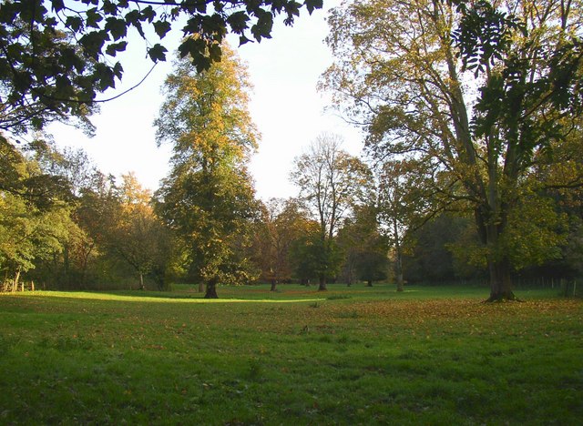
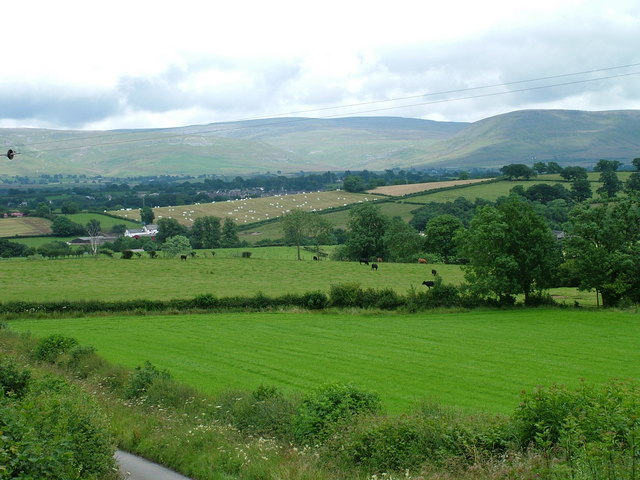
St Nicholas's Wood is a picturesque woodland located in the county of Westmorland, England. Covering a vast area of approximately 200 acres, the wood is a haven of natural beauty and tranquility. It is nestled amidst the rolling hills and lush greenery, offering visitors a peaceful retreat from the hustle and bustle of everyday life.

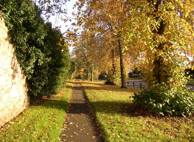
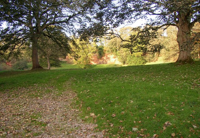
The wood is primarily composed of deciduous trees, with a dense canopy that provides shade during the summer months. Oak, beech, and ash trees dominate the landscape, creating a rich tapestry of colors in autumn. The forest floor is covered with a thick carpet of moss, ferns, and wildflowers, adding to the enchanting atmosphere.

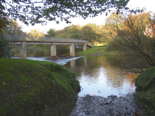
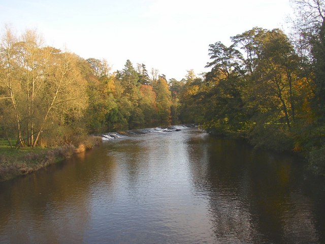
A network of winding trails meanders through St Nicholas's Wood, inviting walkers, hikers, and nature enthusiasts to explore its hidden treasures. These paths lead to various points of interest, including a small pond teeming with aquatic life and a meandering stream that adds to the wood's charm.

The wood is also home to a diverse range of wildlife, making it a paradise for nature lovers. Roe deer, foxes, and badgers can often be spotted roaming the woodlands, while a variety of bird species, such as woodpeckers and owls, can be heard chirping and hooting from the treetops.

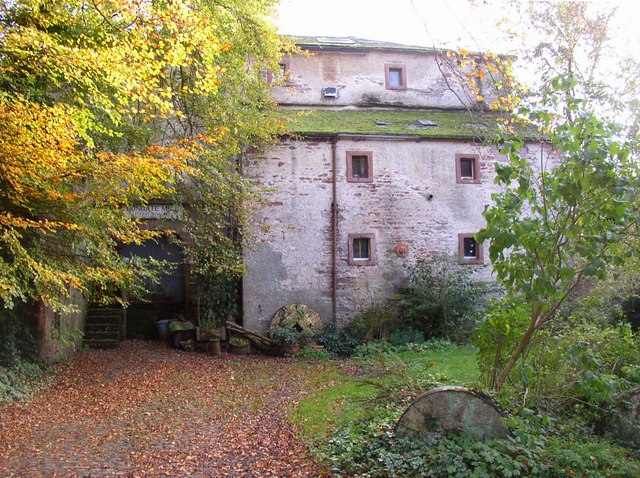
St Nicholas's Wood is not only a sanctuary for flora and fauna but also a place of historical significance. It is believed to have been part of a medieval hunting ground and still retains remnants of ancient boundary walls and ditches.

Visiting St Nicholas's Wood offers a unique opportunity to immerse oneself in the beauty of nature while exploring the rich history of Westmorland.

If you have any feedback on the listing, please let us know in the comments section below.

St Nicholas's Wood Images

Images are sourced within 2km of 54.585138/-2.5035223 or Grid Reference NY6721. Thanks to Geograph Open Source API. All images are credited.

Ordnance Survey 1GL Bolt This OS bolt can be found on the east face of St Michael's Church. It marks a point 142.838m above mean sea level.
Ordnance Survey 1GL Bolt
This OS bolt can be found on the east face of St Michael's Church. It marks a point 142.838m above mean sea level.
Ordnance Survey Cut Mark This OS cut mark can be found on the building NE side of Scattergate. It marks a point 145.460m above mean sea level.
Ordnance Survey Cut Mark
This OS cut mark can be found on the building NE side of Scattergate. It marks a point 145.460m above mean sea level.
Appleby Castle Caesar's Tower at Appleby Castle built it is thought on the site of a Roman tower.
Appleby Castle
Caesar's Tower at Appleby Castle built it is thought on the site of a Roman tower.
Pennines from brackenslack
Margarets Way, Appleby-in-Westmorland
Verge, Scattergate, Appleby This is the road to Orton, behind the castle.  Part of the wall around the castle grounds is on the left.
Verge, Scattergate, Appleby
This is the road to Orton, behind the castle. Part of the wall around the castle grounds is on the left.
Bongate Scar, Appleby Not marked as a quarry on the 6" map of 1863, so presumably a natural cliff of red sandstone. The information board by the footbridge reads "The same geological formation that contains oil under the North Sea.  One of the few places in the World where this type of formation is visible." Unfortunately it is in a field with a 'keep out' notice.
Bongate Scar, Appleby
Not marked as a quarry on the 6" map of 1863, so presumably a natural cliff of red sandstone. The information board by the footbridge reads "The same geological formation that contains oil under the North Sea. One of the few places in the World where this type of formation is visible." Unfortunately it is in a field with a 'keep out' notice.
St Michael's Church, Bongate, Appleby The north doorway has a Saxon hogsback gravestone re-used as a lintel.  Bongate was called 'Old Appleby' in medieval times, and is considered to have been the Anglo-saxon settlement that existed before the Normans came.  The south arcade and transept are in the Early Decorated style.  The north tower is an addition of 1885-6.  There are wall-paintings of c.1900 on the west wall and chancel north wall.
St Michael's Church, Bongate, Appleby
The north doorway has a Saxon hogsback gravestone re-used as a lintel. Bongate was called 'Old Appleby' in medieval times, and is considered to have been the Anglo-saxon settlement that existed before the Normans came. The south arcade and transept are in the Early Decorated style. The north tower is an addition of 1885-6. There are wall-paintings of c.1900 on the west wall and chancel north wall.
Riverside field off Castle Bank, Appleby This looks to be parkland belonging to the castle, but also a water meadow that could be flooded when the river level is high.
Riverside field off Castle Bank, Appleby
This looks to be parkland belonging to the castle, but also a water meadow that could be flooded when the river level is high.
Ford and Jubilee Footbridge, Appleby This is a replacement, built in 1971, of the original Jubilee Bridge that was destroyed by a flood in 1968.
Ford and Jubilee Footbridge, Appleby
This is a replacement, built in 1971, of the original Jubilee Bridge that was destroyed by a flood in 1968.
Weir for Bongate Mill, Appleby This crosses the River Eden on a long diagonal, and still looks to be in good condition although the mill closed many years ago.
Weir for Bongate Mill, Appleby
This crosses the River Eden on a long diagonal, and still looks to be in good condition although the mill closed many years ago.
Bongate Mill, Appleby An 18C mill building, Grade II listed. The mill wheel, now removed, was in a big sandstone arch.  It has been a pottery and gallery, but this looks to be closed now.
Bongate Mill, Appleby
An 18C mill building, Grade II listed. The mill wheel, now removed, was in a big sandstone arch. It has been a pottery and gallery, but this looks to be closed now.
Primrose Stone, Appleby One of ten sculptures along the River Eden, commissioned in the late 20C by the East Cumbria Countryside Project. The Primrose Stone is by Joss Smith.
Primrose Stone, Appleby
One of ten sculptures along the River Eden, commissioned in the late 20C by the East Cumbria Countryside Project. The Primrose Stone is by Joss Smith.
Monument, Bongate, Appleby Presumably a War Memorial, but captioned 'Monument' on the 1915 1:2500 map.
Monument, Bongate, Appleby
Presumably a War Memorial, but captioned 'Monument' on the 1915 1:2500 map.
Appleby Castle On top of a hill with views of the Pennines and Eden Valley since Norman times, the privately owned Appleby Castle is possibly only best photographed from this vantage point.
<span class="nowrap"><a title="http://www.visitcumbria.com/pen/appbcas.htm" rel="nofollow ugc noopener" href="http://www.visitcumbria.com/pen/appbcas.htm">Link</a><img style="margin-left:2px;" alt="External link" title="External link - shift click to open in new window" src="https://s1.geograph.org.uk/img/external.png" width="10" height="10"/></span>
Appleby Castle
On top of a hill with views of the Pennines and Eden Valley since Norman times, the privately owned Appleby Castle is possibly only best photographed from this vantage point. LinkExternal link
Nether Hoff and Bandley Wood
St Michael's Church, Bongate, Appleby
St. Michael's Church, Appleby-in-Westmorland The church dates from the 12th and 13th centuries and is a listed building, but is now a private residence.
St. Michael's Church, Appleby-in-Westmorland
The church dates from the 12th and 13th centuries and is a listed building, but is now a private residence.
Show me another place!

St Nicholas's Wood is located at Grid Ref: NY6721 (Lat: 54.585138, Lng: -2.5035223)

Administrative County: Cumbria

District: Eden

Police Authority: Cumbria

What 3 Words

///slanting.prude.flown. Near Appleby-in-Westmorland, Cumbria

Related Wikis

Appleby Horse Fair

The Appleby Horse Fair, also known as Appleby New Fair, is "an annual gathering of Gypsies and Travellers in the town of Appleby-in-Westmorland in Cumbria...

Appleby Grammar School

Appleby Grammar School is a mixed secondary school and sixth form in Appleby-in-Westmorland for students aged 11 to 18. Since 2011, it has been an Academy...

Crackenthorpe

Crackenthorpe is a village and civil parish in the Eden District of Cumbria, England. It is about 12 miles (19 km) south east of Penrith. The village was...

Appleby Friary

Appleby Friary was a friary in Cumbria, England.

North Westmorland Rural District

North Westmorland was a rural district in Westmorland, England from 1935 to 1974. It now forms part of the Eden district of Cumbria. It was formed in...

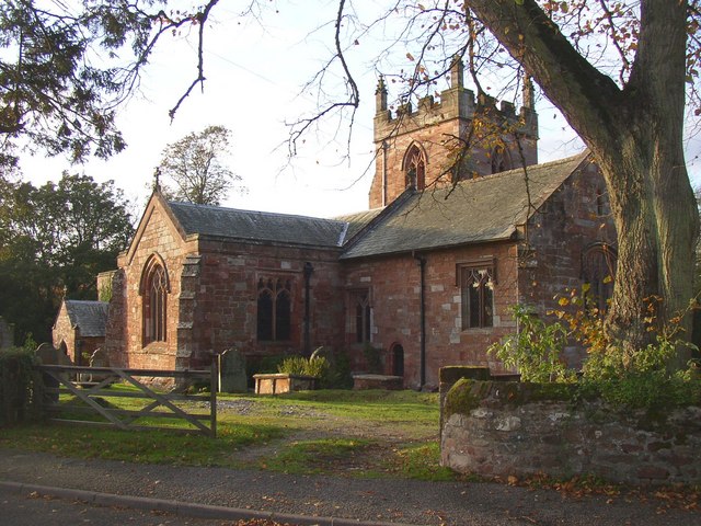
St Lawrence's Church, Appleby

St Lawrence's Church is in Boroughgate, Appleby-in-Westmorland, Cumbria, England. It is an active Anglican parish church in the deanery of Appleby, the...

Moot Hall, Appleby-in-Westmorland

The Moot Hall is a municipal building in Boroughgate, Appleby-in-Westmorland, Cumbria, England. The building, which is currently used as the meeting place...

Appleby railway station

Appleby is a railway station on the Settle and Carlisle Line, which runs between Carlisle and Leeds via Settle. The station, situated 30 miles 60 chains...

Nearby Amenities

Located within 500m of 54.585138,-2.5035223
Motorway Junction
Lat/Long: 54.5876544/-2.4981335
Power: pole
Lat/Long: 54.5835018/-2.5000703
Power: pole
Lat/Long: 54.5819786/-2.4982658
Power: pole
Lat/Long: 54.5864272/-2.5034666
Power: pole
Lat/Long: 54.5849629/-2.5017761
Material: wood
Power: pole
Lat/Long: 54.5882766/-2.4998503
Power: pole
Lat/Long: 54.5868375/-2.5065806
Power: pole
Lat/Long: 54.5884446/-2.4989176
Power: pole
Lat/Long: 54.5867753/-2.500433
Power: pole
Lat/Long: 54.5869525/-2.5079915
Power: pole
Lat/Long: 54.5828226/-2.4992495
Power: pole
Lat/Long: 54.5866727/-2.5045817
Material: wood
Power: pole
Lat/Long: 54.5877474/-2.5000522
Power: pole
Lat/Long: 54.586536/-2.5008836
Power: pole
Lat/Long: 54.5841951/-2.5009152
Power: pole
Lat/Long: 54.58708/-2.5096491
Power: pole
Lat/Long: 54.5856671/-2.5025734
Power: pole
Lat/Long: 54.5861132/-2.5016963
St Nicholas's Hill
Ele: 162
Natural: peak
Lat/Long: 54.5854208/-2.4986703
Power: pole
Lat/Long: 54.5820204/-2.5004551
The data included in this document is from www.openstreetmap.org. The data is made available under ODbL.

Have you been to St Nicholas's Wood?

Leave your review of St Nicholas's Wood below (or comments, questions and feedback).