Haie Grove

Wood, Forest in Gloucestershire Forest of Dean

England

Haie Grove

Dean Heritage Centre Ducks on the pond beside the centre.
Dean Heritage Centre Credit: Richard Sutcliffe

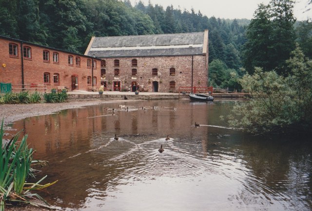
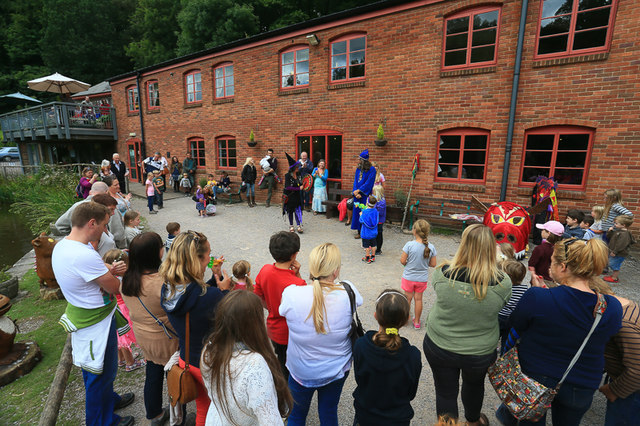
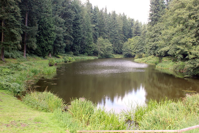
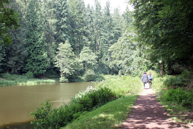
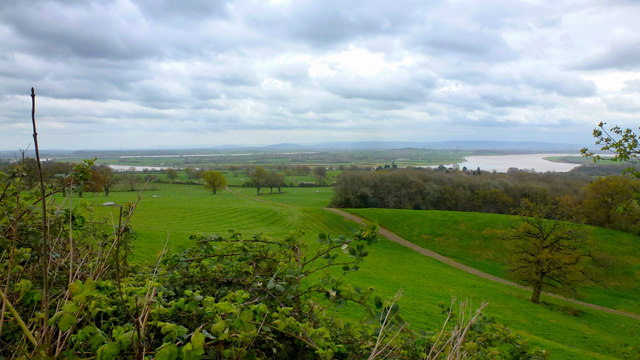
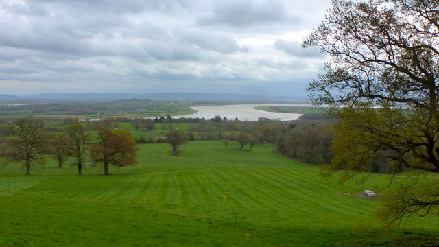
Haie Grove is a picturesque woodland area located in the county of Gloucestershire, England. Situated near the village of Wood, this enchanting forest is a popular destination for nature lovers and outdoor enthusiasts. The grove covers an expansive area and is characterized by its dense foliage, towering trees, and tranquil atmosphere.

One of the key features of Haie Grove is its diverse ecosystem. The forest is home to a wide variety of plant and animal species, making it an ideal spot for wildlife enthusiasts and birdwatchers. Visitors can expect to encounter species such as deer, foxes, squirrels, and a plethora of bird species.

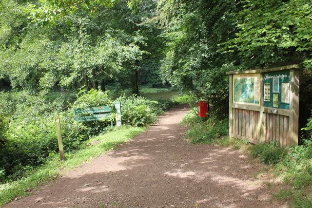
The grove offers a range of activities for visitors to enjoy. There are numerous walking trails that wind through the forest, allowing visitors to explore the natural beauty at their own pace. These trails vary in difficulty, catering to both casual strollers and avid hikers. Along the way, visitors can enjoy the serenity of the forest, listen to the soothing sounds of nature, and soak in the breathtaking views.

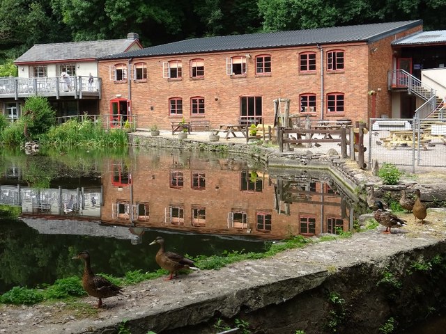
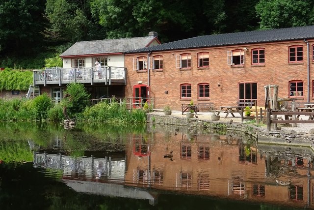
Haie Grove also provides opportunities for picnicking, photography, and simply immersing oneself in the peaceful ambiance. The forest is well-maintained, with clear signage and designated picnic areas, ensuring a pleasant experience for all visitors.

Overall, Haie Grove in Gloucestershire is a captivating woodland destination that offers a serene escape from the hustle and bustle of everyday life. With its natural beauty, diverse wildlife, and recreational activities, it is a must-visit location for anyone seeking a rejuvenating connection with nature.

If you have any feedback on the listing, please let us know in the comments section below.
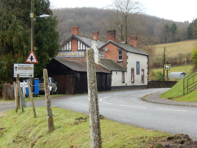
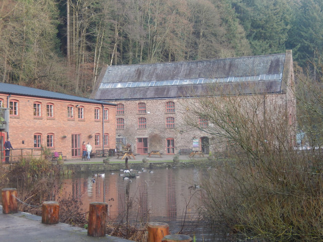
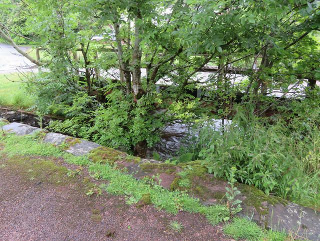
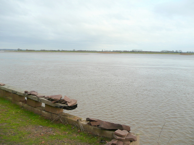
Haie Grove Images

Images are sourced within 2km of 51.783982/-2.4752774 or Grid Reference SO6709. Thanks to Geograph Open Source API. All images are credited.

Dean Heritage Centre Ducks on the pond beside the centre.
Dean Heritage Centre
Ducks on the pond beside the centre.
Children's activities at Dean Heritage Centre Same facade as <a href="https://www.geograph.org.uk/photo/1723623">SO6610 : Forest of Dean Heritage Centre</a> but from a different angle.
Children's activities at Dean Heritage Centre
Same facade as SO6610 : Forest of Dean Heritage Centre but from a different angle.
The White Horse Inn, Upper Soudley Village pub on Church Road apparently noted for snail racing.
The White Horse Inn, Upper Soudley
Village pub on Church Road apparently noted for snail racing.
Top Road, Upper Soudley Looking towards the White Horse Inn with a still functioning telephone box. There are plans to close the box, a controversial move because mobile reception is poor in this area.
Top Road, Upper Soudley
Looking towards the White Horse Inn with a still functioning telephone box. There are plans to close the box, a controversial move because mobile reception is poor in this area.
Church Road, Upper Soudley Ahead is the White Horse Inn. The road through the heart of the Forest of Dean is designated a scenic route. The entrance on the immediate left gives access to the pub car park but at one time there was a station here on the long-closed Cinderford branch.
Church Road, Upper Soudley
Ahead is the White Horse Inn. The road through the heart of the Forest of Dean is designated a scenic route. The entrance on the immediate left gives access to the pub car park but at one time there was a station here on the long-closed Cinderford branch.
Dean Heritage Centre The Dean Heritage Centre was established in 1983 in Camp Mill, a former corn mill in Soudley. It houses a museum explaining the history of the Forest of Dean.
Dean Heritage Centre
The Dean Heritage Centre was established in 1983 in Camp Mill, a former corn mill in Soudley. It houses a museum explaining the history of the Forest of Dean.
Entrance to Soudley Ponds The entrance to Soudley Ponds (also known as Sutton Ponds).

Wikipedia <span class="nowrap"><a title="https://en.wikipedia.org/wiki/Soudley_Ponds" rel="nofollow ugc noopener" href="https://en.wikipedia.org/wiki/Soudley_Ponds">Link</a><img style="margin-left:2px;" alt="External link" title="External link - shift click to open in new window" src="https://s1.geograph.org.uk/img/external.png" width="10" height="10"/></span>
Entrance to Soudley Ponds
The entrance to Soudley Ponds (also known as Sutton Ponds). Wikipedia LinkExternal link
Soudley Ponds, Forest of Dean Soudley Ponds (also known as Sutton Ponds) comprise of four linked man-made ponds lined in succession through the narrow Sutton Valley.

Wikipedia <span class="nowrap"><a title="https://en.wikipedia.org/wiki/Soudley_Ponds" rel="nofollow ugc noopener" href="https://en.wikipedia.org/wiki/Soudley_Ponds">Link</a><img style="margin-left:2px;" alt="External link" title="External link - shift click to open in new window" src="https://s1.geograph.org.uk/img/external.png" width="10" height="10"/></span>
Soudley Ponds, Forest of Dean
Soudley Ponds (also known as Sutton Ponds) comprise of four linked man-made ponds lined in succession through the narrow Sutton Valley. Wikipedia LinkExternal link
Path and weir at Soudley Ponds Soudley Ponds (also known as Sutton Ponds) comprise of four linked man-made ponds lined in succession through the narrow Sutton Valley.

Wikipedia <span class="nowrap"><a title="https://en.wikipedia.org/wiki/Soudley_Ponds" rel="nofollow ugc noopener" href="https://en.wikipedia.org/wiki/Soudley_Ponds">Link</a><img style="margin-left:2px;" alt="External link" title="External link - shift click to open in new window" src="https://s1.geograph.org.uk/img/external.png" width="10" height="10"/></span>
Path and weir at Soudley Ponds
Soudley Ponds (also known as Sutton Ponds) comprise of four linked man-made ponds lined in succession through the narrow Sutton Valley. Wikipedia LinkExternal link
Dean Heritage Centre Dean Heritage Centre reflected in a mill pond.  In the foreground ducks sit beside the mill race.
Dean Heritage Centre
Dean Heritage Centre reflected in a mill pond. In the foreground ducks sit beside the mill race.
Buildings at Dean Heritage Centre Buildings at Dean Heritage Centre reflected in the waters of the mill.
Buildings at Dean Heritage Centre
Buildings at Dean Heritage Centre reflected in the waters of the mill.
View to The Severn, 1 From near The Haie, the whole of the Arlingham bend can be seen.
Lush green spring pasture in between.
View to The Severn, 1
From near The Haie, the whole of the Arlingham bend can be seen. Lush green spring pasture in between.
View to The Severn, 2 The Severn estuary seen from near The Haie.
Lush spring pastures in the foreground.
View to The Severn, 2
The Severn estuary seen from near The Haie. Lush spring pastures in the foreground.
Bench mark in Upper Soudley, Forest of Dean This Ordnance Survey bench mark is on the remaining bridge support that once carried the G.W.R. Forest of Dean Branch through Upper Soudley.  See also: <a href="https://www.geograph.org.uk/photo/6182266">SO6510 : Former railway bridge support in Upper Soudley</a>
Bench mark in Upper Soudley, Forest of Dean
This Ordnance Survey bench mark is on the remaining bridge support that once carried the G.W.R. Forest of Dean Branch through Upper Soudley. See also: SO6510 : Former railway bridge support in Upper Soudley
Former railway bridge support in Upper Soudley The remaining bridge support that once carried the G.W.R. Forest of Dean Branch through Upper Soudley.  There is an Ordnance Survey bench mark on the short face facing the camera: <a href="https://www.geograph.org.uk/photo/6182260">SO6510 : Bench mark in Upper Soudley, Forest of Dean</a>
Former railway bridge support in Upper Soudley
The remaining bridge support that once carried the G.W.R. Forest of Dean Branch through Upper Soudley. There is an Ordnance Survey bench mark on the short face facing the camera: SO6510 : Bench mark in Upper Soudley, Forest of Dean
A rivet-less rivet bench mark on Soudley Bridge, Forest of Dean This indistinct rivet bench mark is on the low east parapet on the older of the two bridges over Soudley Brook, Upper Soudley. The older bridge has now been by-passed providing safer access to the village hall. See also <a href="https://www.geograph.org.uk/photo/6182288">SO6510 : Soudley bridges over Soudley Brook</a>
A rivet-less rivet bench mark on Soudley Bridge, Forest of Dean
This indistinct rivet bench mark is on the low east parapet on the older of the two bridges over Soudley Brook, Upper Soudley. The older bridge has now been by-passed providing safer access to the village hall. See also SO6510 : Soudley bridges over Soudley Brook
Soudley bridges over Soudley Brook Part of the older of the two Soudley Bridges, with the more modern, and safer one behind the trees.  There is a rivet bench mark cut into the low parapet in front of the camera: <a href="https://www.geograph.org.uk/photo/6182279">SO6510 : A rivet-less rivet bench mark on Soudley Bridge, Forest of Dean</a>
Soudley bridges over Soudley Brook
Part of the older of the two Soudley Bridges, with the more modern, and safer one behind the trees. There is a rivet bench mark cut into the low parapet in front of the camera: SO6510 : A rivet-less rivet bench mark on Soudley Bridge, Forest of Dean
Show me another place!

Haie Grove is located at Grid Ref: SO6709 (Lat: 51.783982, Lng: -2.4752774)

Administrative County: Gloucestershire

District: Forest of Dean

Police Authority: Gloucestershire

What 3 Words

///clotting.ruffling.below. Near Cinderford, Gloucestershire

Nearby Locations

Haie Grove Bennet's Grove

Related Wikis

Nearby Amenities

Located within 500m of 51.783982,-2.4752774
Wenslark House
Place: locality
Source: OS Opendata Streetview
Lat/Long: 51.7858451/-2.4734752
Design: triangle
Material: metal
Power: pole
Structure: lattice
Lat/Long: 51.7869643/-2.4804667
Design: triangle
Material: metal
Power: pole
Structure: lattice
Lat/Long: 51.7856519/-2.4805176
Design: triangle
Material: metal
Power: pole
Structure: lattice
Lat/Long: 51.7852188/-2.4805418
Design: triangle
Material: metal
Power: pole
Structure: lattice
Lat/Long: 51.7839445/-2.4815154
The data included in this document is from www.openstreetmap.org. The data is made available under ODbL.

Have you been to Haie Grove?

Leave your review of Haie Grove below (or comments, questions and feedback).