Birch Wood

Wood, Forest in Northumberland

England

Birch Wood

Lambley Viaduct A former railway viaduct, built in 1852 to take the line across the South Tyne valley.  There is a footpath along the top, but it is not open to cyclists, who can however use the old railway trackbed further up the valley from where this photo was taken. The viaduct is Grade 2* listed (list entry number 1042918).
Lambley Viaduct Credit: Stephen Craven

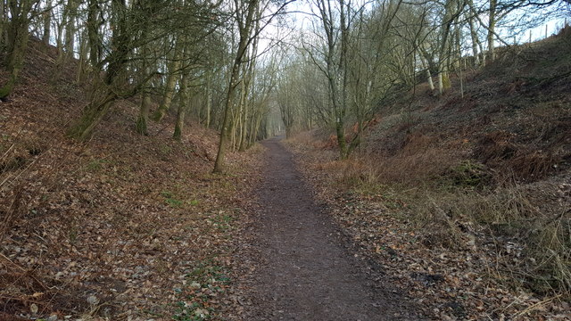
Birch Wood is a captivating forest located in the county of Northumberland, England. Spanning an area of approximately 500 acres, this woodland is known for its abundant growth of birch trees, which give it its name. The wood is situated near the picturesque village of Rothbury, surrounded by breathtaking landscapes and rolling hills.

The forest boasts a diverse range of flora and fauna, making it a popular destination for nature enthusiasts and wildlife lovers. The birch trees dominate the landscape with their slender trunks and distinctive white bark, creating a stunning visual display throughout the year. In spring, the wood is transformed into a carpet of bluebells, creating a picturesque scene that attracts photographers and visitors alike.

Birch Wood is home to a variety of wildlife species, including red squirrels, deer, and a wide array of birdlife. Birdwatchers can spot species such as woodpeckers, owls, and various songbirds in the forest's dense canopy. The wood's tranquil atmosphere and diverse ecosystem make it an ideal location for hiking, birdwatching, or simply immersing oneself in nature.

Additionally, Birch Wood offers several well-maintained walking trails that wind through its verdant surroundings. These paths cater to different levels of difficulty, allowing visitors to explore the wood at their own pace. There are also designated picnic areas, providing a serene spot for families and friends to enjoy a leisurely lunch amidst the natural beauty.

Overall, Birch Wood in Northumberland offers a remarkable experience for those seeking solace in nature. Its striking birch trees, abundant wildlife, and well-maintained trails make it a must-visit destination for anyone with an appreciation for the great outdoors.

If you have any feedback on the listing, please let us know in the comments section below.

Birch Wood Images

Images are sourced within 2km of 54.929273/-2.5140401 or Grid Reference NY6759. Thanks to Geograph Open Source API. All images are credited.

Lambley Viaduct A former railway viaduct, built in 1852 to take the line across the South Tyne valley.  There is a footpath along the top, but it is not open to cyclists, who can however use the old railway trackbed further up the valley from where this photo was taken. The viaduct is Grade 2* listed (list entry number 1042918).
Lambley Viaduct
A former railway viaduct, built in 1852 to take the line across the South Tyne valley. There is a footpath along the top, but it is not open to cyclists, who can however use the old railway trackbed further up the valley from where this photo was taken. The viaduct is Grade 2* listed (list entry number 1042918).
Lambley Viaduct
Lambley Viaduct
Lambley Viaduct, 1966 View northward along the River South Tyne. At that time (1966), the ex-NER branch line, Haltwhistle - Alston, was still working, being closed 3/5/76. Since 1983 the railway has been partly restored from Alston as the heritage narrow-gauge South Tynedale Railway, albeit not yet over this viaduct.
Lambley Viaduct, 1966
View northward along the River South Tyne. At that time (1966), the ex-NER branch line, Haltwhistle - Alston, was still working, being closed 3/5/76. Since 1983 the railway has been partly restored from Alston as the heritage narrow-gauge South Tynedale Railway, albeit not yet over this viaduct.
The South Tyne Trail near Coanwood The South Tyne Trail is also part of National Cycle Network Route 68 and follows the course of the former Haltwhistle to Alston railway
The South Tyne Trail near Coanwood
The South Tyne Trail is also part of National Cycle Network Route 68 and follows the course of the former Haltwhistle to Alston railway
The South Tyne Trail near Coanwood The old buffers from image <a href="https://www.geograph.org.uk/photo/4348918">NY6759 : Buffers on disused railway north of Coanwood</a> can be also seen.
The South Tyne Trail near Coanwood
The old buffers from image NY6759 : Buffers on disused railway north of Coanwood can be also seen.
Lambley Viaduct on the South Tyne Trail or National Cycle Network Route 68
Panorama of Lambley viaduct
Along the former railway line The car park that gives access to the South Tyne Trail
Along the former railway line
The car park that gives access to the South Tyne Trail
Lane through Thorneyhole Wood
Tree lined lane
Tree lined lane
Fingerpost for Lambley Viaduct There are two ways to cross the river at Lambley - the old railway viaduct, and a footbridge in the bottom of the valley.  The path to the two diverges here.
Fingerpost for Lambley Viaduct
There are two ways to cross the river at Lambley - the old railway viaduct, and a footbridge in the bottom of the valley. The path to the two diverges here.
South Tyne Trail The embankment of the former railway line has been reinforced after storms like Desmond over the last few years by rock dumping in a most sympathetic style
South Tyne Trail
The embankment of the former railway line has been reinforced after storms like Desmond over the last few years by rock dumping in a most sympathetic style
Seed pods by the trail
Former railway line
Former railway line
Footpath The former railway line leaves the station site at Coanwood
Footpath
The former railway line leaves the station site at Coanwood
House at Coanwood The former station at Coanwood
House at Coanwood
The former station at Coanwood
The house at Coanwood The former station location on the South Tyne Trail
The house at Coanwood
The former station location on the South Tyne Trail
Former railway platform Coanwood station, as was
Former railway platform
Coanwood station, as was
Show me another place!

Birch Wood is located at Grid Ref: NY6759 (Lat: 54.929273, Lng: -2.5140401)

Unitary Authority: Northumberland

Police Authority: Northumbria

What 3 Words

///trickled.river.untruth. Near Greenhead, Northumberland

Related Wikis

Coanwood railway station

Coanwood was a railway station on the Alston Branch Line, which ran between Haltwhistle and Alston. The station, situated 4 miles (6 km) south-west of...

Coanwood

Coanwood is a village in Northumberland, England, and is part of the Parish of Haltwhistle. It is about four miles (6 km) to the south-west of Haltwhistle...

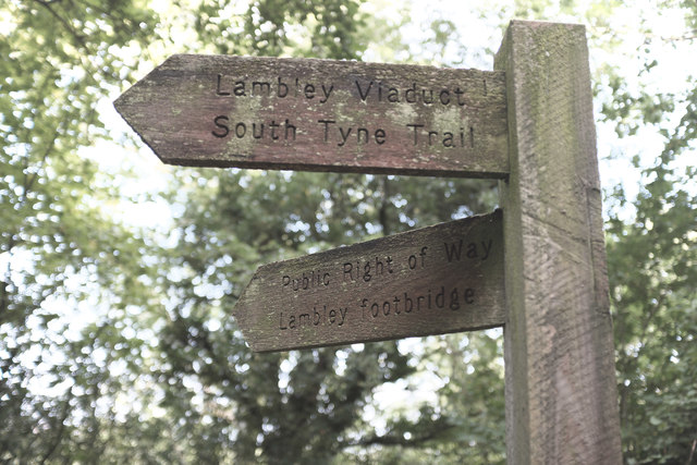
Lambley, Northumberland

Lambley, formerly known as Harper Town, is a village and former civil parish, now in the parish of Coanwood, in Northumberland, England about four miles...

Lambley railway station

Lambley was a railway station on the Alston Branch Line, which ran between Haltwhistle and Alston. The station, situated 4+3⁄4 miles (8 km) south-west...

Featherstone, Northumberland

Featherstone is a village in Northumberland, England about 17 miles (27 km) west of Hexham, and about 3 kilometres (2 mi) south of Greenhead. == Featherstone... ==

Featherstone Castle

Featherstone Castle, a Grade I listed building, is a large Gothic style country mansion situated on the bank of the River South Tyne about 3 miles (5 km...

Featherstone Park railway station

Featherstone Park was a railway station on the Alston Branch Line, which ran between Haltwhistle and Alston. The station, situated 3 miles (5 km) south...

Rowfoot

Rowfoot is a hamlet in Northumberland, England at grid reference NY6849860722. == External links == Media related to Rowfoot at Wikimedia Commons

Nearby Amenities

Located within 500m of 54.929273,-2.5140401
The data included in this document is from www.openstreetmap.org. The data is made available under ODbL.

Have you been to Birch Wood?

Leave your review of Birch Wood below (or comments, questions and feedback).