Cunnery Rough

Wood, Forest in Shropshire

England

Cunnery Rough

Detail of St Gregory, Morville Stained glass.
Detail of St Gregory, Morville Credit: Stephen Richards

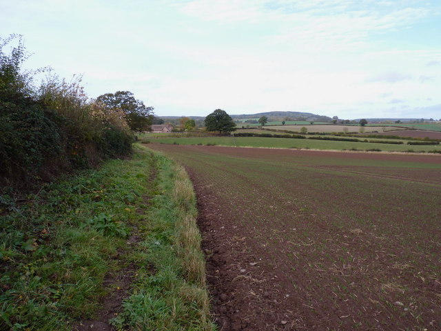
Cunnery Rough is a picturesque woodland located in the county of Shropshire, England. Situated near the town of Wood, this forested area spans over a vast expanse of approximately 500 acres. The rough itself is part of a larger forest complex that covers the rolling landscape of Shropshire.

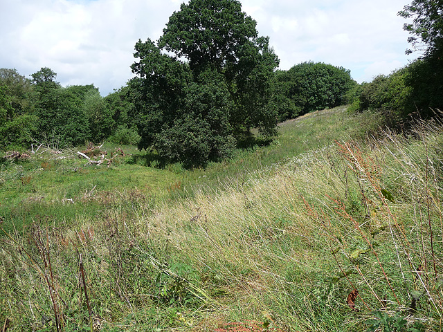
The woodland is characterized by its diverse and vibrant ecosystem, boasting a rich variety of flora and fauna. The area is predominantly populated by native broadleaf trees such as oak, beech, and birch, which create a dense canopy overhead, providing shade and shelter for the undergrowth below. This lush vegetation supports a wide array of wildlife, including deer, badgers, and a range of bird species.

Cunnery Rough offers a haven for nature enthusiasts and outdoor adventurers alike. It is a popular destination for hikers, walkers, and joggers, who can explore the well-maintained trails that wind through the forest, offering breathtaking views of the surrounding countryside. The forest also features designated picnic areas and camping spots, allowing visitors to immerse themselves in the peaceful ambiance of the woodland.

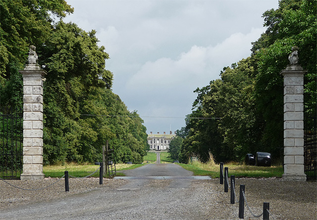
Aside from its natural beauty, Cunnery Rough holds historical significance. The forest has witnessed human activity dating back centuries, with remnants of ancient settlements and structures still visible in some areas. These archaeological sites serve as a reminder of the deep-rooted heritage of the region.

Overall, Cunnery Rough in Shropshire is a captivating woodland that offers visitors a chance to experience the tranquility of nature, explore its historical treasures, and revel in the beauty of the English countryside.

If you have any feedback on the listing, please let us know in the comments section below.

Cunnery Rough Images

Images are sourced within 2km of 52.548261/-2.4940246 or Grid Reference SO6694. Thanks to Geograph Open Source API. All images are credited.

Detail of St Gregory, Morville Stained glass.
Detail of St Gregory, Morville
Stained glass.
Gate piers near Morville A view up the long avenue of limes towards Aldenham Park (<a href="https://www.geograph.org.uk/photo/3435659">SO6795 : Aldenham Park, Morville</a>) framed by the tall, early-C18th gate piers topped by lions. Grade II listed.
The fine gates, missing when this photo was taken, have since returned: <a href="https://www.geograph.org.uk/photo/7024598">SO6694 : Ornate gates and avenue to Aldenham Park</a>.
Gate piers near Morville
A view up the long avenue of limes towards Aldenham Park (SO6795 : Aldenham Park, Morville) framed by the tall, early-C18th gate piers topped by lions. Grade II listed. The fine gates, missing when this photo was taken, have since returned: SO6694 : Ornate gates and avenue to Aldenham Park.
Gate piers, Morville The entrance to Morville Hall (<a href="https://www.geograph.org.uk/photo/3437252">SO6693 : Morville Hall, Morville</a>). Plain piers with ball finials, and smaller ball finials on top of those. Grade II listed.
Gate piers, Morville
The entrance to Morville Hall (SO6693 : Morville Hall, Morville). Plain piers with ball finials, and smaller ball finials on top of those. Grade II listed.
Path, Morville Admittedly hard to discern but it heads towards the trees at top-right, providing a short cut between the B4368 and A458 before heading further north.
Path, Morville
Admittedly hard to discern but it heads towards the trees at top-right, providing a short cut between the B4368 and A458 before heading further north.
The Acton Arms, Morville
Restored gravel pit workings at Morville Since closure a few years ago, the former gravel pit has mostly been restored, but it looks like there's still some work to do.
Restored gravel pit workings at Morville
Since closure a few years ago, the former gravel pit has mostly been restored, but it looks like there's still some work to do.
Former weighbridge at Morville gravel pit
Morville gravel pit
Morville gravel pit
The workings in Morville gravel pit Not much left here apart from a dilapidated piece of screening equipment with a small conveyor attached. All the signs are that the site's aggregate permission has been worked out.
The workings in Morville gravel pit
Not much left here apart from a dilapidated piece of screening equipment with a small conveyor attached. All the signs are that the site's aggregate permission has been worked out.
Morville crossroads A crossing of minor roads, near the main A458 from Bridgnorth to Much Wenlock.
Morville crossroads
A crossing of minor roads, near the main A458 from Bridgnorth to Much Wenlock.
Farmland north of Morville Heath
Bridleway and entrance to The Croft farm
Barn conversions at The Croft A bridleway runs right through the farmyard, past these rather good conversions.
Barn conversions at The Croft
A bridleway runs right through the farmyard, past these rather good conversions.
The bridleway to The Croft
Lane to Morville near the gravel pit
Lane crossroads near Lye Bridge
Long straight on the plateau east of Morville
A458 at The Acton Arms pub, Morville
Show me another place!

Cunnery Rough is located at Grid Ref: SO6694 (Lat: 52.548261, Lng: -2.4940246)

Unitary Authority: Shropshire

Police Authority: West Mercia

What 3 Words

///zebra.unclaimed.imagined. Near Bridgnorth, Shropshire

Related Wikis

Morville, Shropshire

Morville is a village and civil parish about 3 miles west of Bridgnorth, in the Shropshire district, in the county of Shropshire, England. In 2011, the...
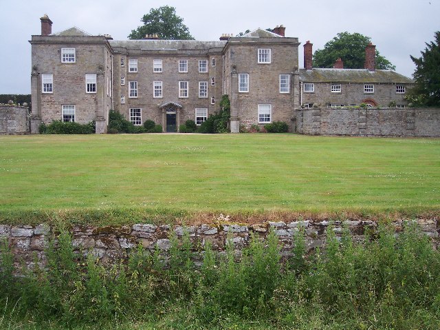
Morville Hall

Morville Hall is a grade I listed country house and gardens in the care of the National Trust in the county of Shropshire, England, United Kingdom. Morville...
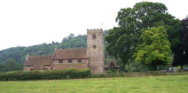
Morville Priory

Morville Priory was a small Benedictine monastery in Shropshire, England, a cell of Shrewsbury Abbey. == Location == Morville today is a hamlet on the...

Aldenham Park, Morville

Aldenham Park, also known as Aldenham Hall, is a late 17th-century country house in Morville, near Bridgnorth, Shropshire, England which stands in 12 hectares...

Nearby Amenities

Located within 500m of 52.548261,-2.4940246
Ashbridge Bungalow
Addr City: Bridgnorth
Addr Postcode: WV16 6XD
Building: house
Lat/Long: 52.5471297/-2.495589
Generator Method: photovoltaic
Generator Output Electricity: yes
Generator Source: solar
Generator Type: solar_photovoltaic_panel
Location: roof
Power: generator
Lat/Long: 52.5444492/-2.4915026
Access: yes
Barrier: stile
Bicycle: no
Description: collapsed as of Nov 2022
Foot: yes
Horse: no
Material: wood
Motor Vehicle: yes
Stile: stepover
Lat/Long: 52.5471766/-2.4924339
Access: yes
Barrier: stile
Bicycle: no
Foot: designated
Horse: no
Material: wood
Motor Vehicle: no
Stile: stepover
Lat/Long: 52.5453857/-2.4929695
Barrier: stile
Bicycle: no
Foot: designated
Horse: no
Material: wood
Motor Vehicle: no
Stile: stepover
Lat/Long: 52.5478997/-2.4915748
Information: route_marker
Lat/Long: 52.5526202/-2.494748
The data included in this document is from www.openstreetmap.org. The data is made available under ODbL.

Have you been to Cunnery Rough?

Leave your review of Cunnery Rough below (or comments, questions and feedback).