Childer Wood

Wood, Forest in Herefordshire

England

Childer Wood

Driveway leading to Upleadon Farm
Driveway leading to Upleadon Farm Credit: Philip Halling

Childer Wood is a beautiful woodland located in Herefordshire, England. Covering an area of approximately 50 hectares, this ancient forest is a haven for wildlife and a popular destination for nature lovers and outdoor enthusiasts. The wood is predominantly made up of oak, beech, and ash trees, creating a diverse and vibrant ecosystem.

Visitors to Childer Wood can explore the numerous walking trails that wind their way through the forest, providing opportunities to spot a variety of birds, insects, and small mammals. The wood is also home to a rich array of plant species, including bluebells, primroses, and ferns, which carpet the forest floor in spring and summer.

In addition to its natural beauty, Childer Wood has a rich cultural history, with evidence of human habitation dating back to the Iron Age. Archaeological sites within the forest include ancient burial mounds and remnants of old settlements, adding an extra layer of interest for visitors.

Overall, Childer Wood is a peaceful and enchanting woodland that offers a tranquil escape from the hustle and bustle of modern life. Whether exploring the forest on foot, birdwatching, or simply enjoying a picnic among the trees, visitors are sure to be captivated by the beauty and serenity of this special place.

If you have any feedback on the listing, please let us know in the comments section below.
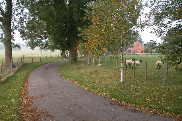
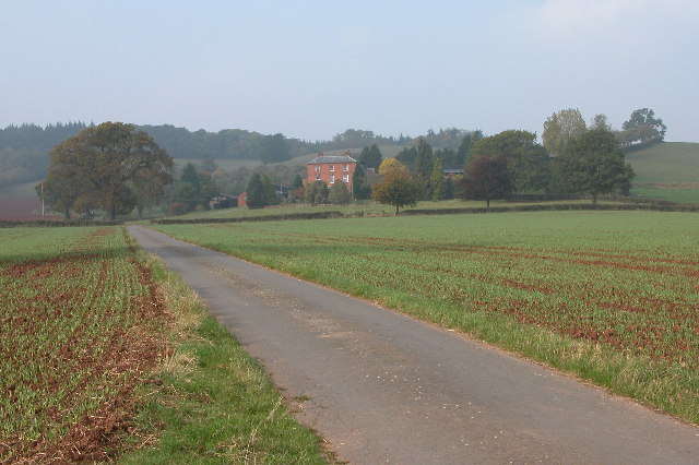
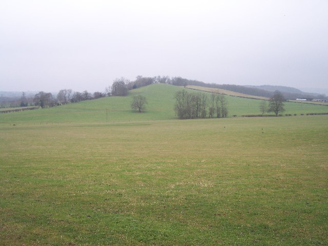
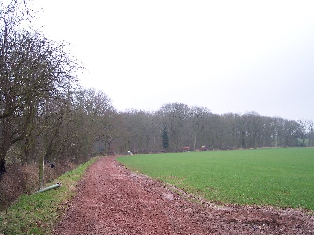
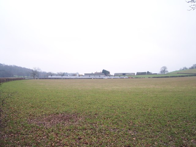
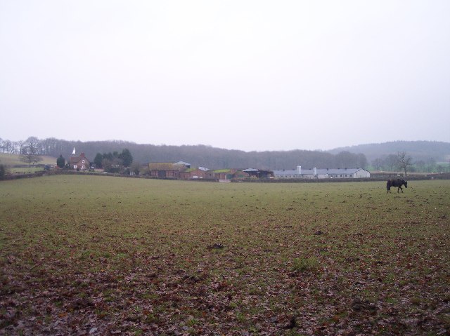
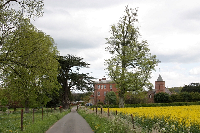
Childer Wood Images

Images are sourced within 2km of 52.08952/-2.4946173 or Grid Reference SO6643. Thanks to Geograph Open Source API. All images are credited.

Driveway leading to Upleadon Farm
Farm Buildings near Upleadon Court
Upleadon Court near Ashperton Near Ashperton there is an Upleadon Court and Upleadon Farm, no where near the village of Upleadon which is in Gloucestershire. The court in this picture is in grid square SO6642, however, the photograph is taken from the bottom of the drive which is in the neighbouring grid square.
Upleadon Court near Ashperton
Near Ashperton there is an Upleadon Court and Upleadon Farm, no where near the village of Upleadon which is in Gloucestershire. The court in this picture is in grid square SO6642, however, the photograph is taken from the bottom of the drive which is in the neighbouring grid square.
Farm building near Canon Frome
Millend Farm, Castle Frome Millend Farm viewed through a hop field.
Millend Farm, Castle Frome
Millend Farm viewed through a hop field.
The Hill, Castle Frome The Malvern Hills can be seen in the distance.
The Hill, Castle Frome
The Malvern Hills can be seen in the distance.
Old barns at Catley Farms, Bosbury
Rear entrance to Canon Frome Court
Un-named Knoll near Redcastle Farm Viewed from the side of Gold Hill looking SW across pasture.
Un-named Knoll near Redcastle Farm
Viewed from the side of Gold Hill looking SW across pasture.
Highlea Wood Looking SE along the access track.
Highlea Wood
Looking SE along the access track.
Edge of Childer Wood Looking NNW along the edge of the wood.
Edge of Childer Wood
Looking NNW along the edge of the wood.
Redcastle Farm Viewed from the west from near the corner of Childer Wood.
Redcastle Farm
Viewed from the west from near the corner of Childer Wood.
Walsopthorne Walsopthorne is a moated site. It is a gentry property, and was owned by the Pichards of Suckley in Worcestershire during the late 15th and early 16th centuries. The moat is substantial, with an outer enclosure which may have held a garden. The timber-framed house was built c.1600.
Walsopthorne
Walsopthorne is a moated site. It is a gentry property, and was owned by the Pichards of Suckley in Worcestershire during the late 15th and early 16th centuries. The moat is substantial, with an outer enclosure which may have held a garden. The timber-framed house was built c.1600.
New and Old Birchend Farms Viewed from the west across the square from the bridleway from Childer wood to millend.
New and Old Birchend Farms
Viewed from the west across the square from the bridleway from Childer wood to millend.
Spoil Heaps Above the Ashperton Tunnel The Hereford & Gloucester Canal travelled through a 400yd tunnel beneath this line of earth mounds. For more info : <span class="nowrap"><a title="http://www.smr.herefordshire.gov.uk/post-medieval/canals/hereford_gloucester.htm" rel="nofollow ugc noopener" href="http://www.smr.herefordshire.gov.uk/post-medieval/canals/hereford_gloucester.htm">Link</a><img style="margin-left:2px;" alt="External link" title="External link - shift click to open in new window" src="https://s1.geograph.org.uk/img/external.png" width="10" height="10"/></span>
Spoil Heaps Above the Ashperton Tunnel
The Hereford & Gloucester Canal travelled through a 400yd tunnel beneath this line of earth mounds. For more info : LinkExternal link
Hansnett Wood Viewed from near Walsopthorne
Hansnett Wood
Viewed from near Walsopthorne
Redcastle Farm from the North Viewed from the footpath by Yewtree Coppice. The sprawl of farm buildings extends downhill away from the farm house.
Redcastle Farm from the North
Viewed from the footpath by Yewtree Coppice. The sprawl of farm buildings extends downhill away from the farm house.
Footpath to Cold Green Farm Looking SW along the well marked path across a freshly ploughed and planted field towards an unnamed (on the O.S. 1:25000 maps) copse.
Footpath to Cold Green Farm
Looking SW along the well marked path across a freshly ploughed and planted field towards an unnamed (on the O.S. 1:25000 maps) copse.
Show me another place!

Childer Wood is located at Grid Ref: SO6643 (Lat: 52.08952, Lng: -2.4946173)

Unitary Authority: County of Herefordshire

Police Authority: West Mercia

What 3 Words

///scarecrow.baking.apprehend. Near Evesbatch, Herefordshire

Nearby Locations

Highlea Wood Childer Wood

Related Wikis

Upleadon Preceptory

Upleadon Preceptory was a priory in Herefordshire, England at grid reference SO66504270. == References ==

Canon Frome

Canon Frome is a hamlet and small rural parish on the River Frome, 5 miles northwest of Ledbury, Herefordshire, England with a population of 139. Its most...

Eggleton, Herefordshire

Eggleton (or Egleton) is a small civil parish in Herefordshire, England. Its main centres of population are Lower Eggleton and Upper Eggleton. The parish...

Ashperton

Ashperton is a small village, parish and former manor about twelve miles east of the City of Hereford, in Herefordshire, England. The village is on the...

Nearby Amenities

Located within 500m of 52.08952,-2.4946173
The data included in this document is from www.openstreetmap.org. The data is made available under ODbL.

Have you been to Childer Wood?

Leave your review of Childer Wood below (or comments, questions and feedback).