Meephill Coppice

Wood, Forest in Herefordshire

England

Meephill Coppice

Gateway to Canon Frome Court This grand entrance leads to the church as well as the Georgian mansion, which has served as a County Secondary School but is now flats.  Note that the car park for the church is a narrow right turn just before the gates leading into the curtilage of the house, beyond which tourists are not welcome!
Gateway to Canon Frome Court Credit: Humphrey Bolton

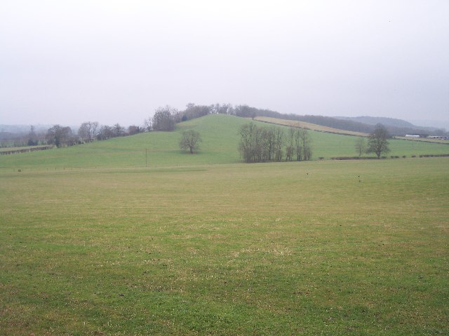
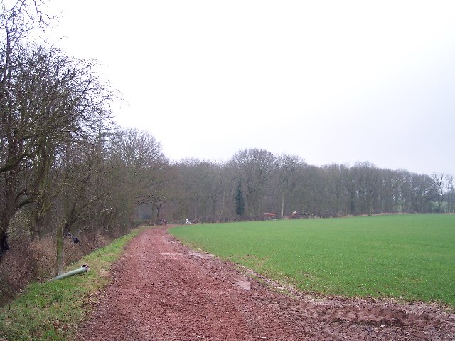
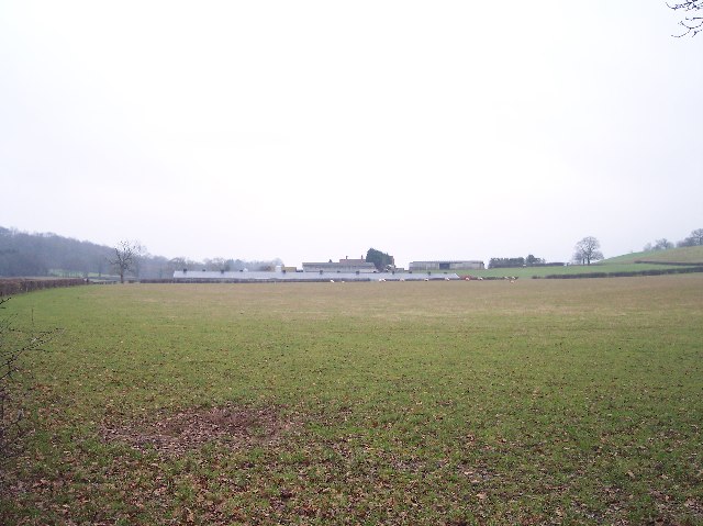
Meephill Coppice is a picturesque woodland located in the county of Herefordshire, England. Covering an area of approximately 50 acres, it is a tranquil haven for nature enthusiasts and hikers alike. The coppice is situated in close proximity to the village of Meephill, which lends its name to this enchanting forest.

The woodland is predominantly composed of deciduous trees, such as oak, ash, and beech, which create a vibrant and ever-changing canopy throughout the seasons. The dense vegetation provides shelter to a diverse range of wildlife, including deer, foxes, badgers, and various species of birds. Birdwatchers are particularly drawn to Meephill Coppice due to the abundance of songbirds, woodpeckers, and owls that inhabit the area.

A network of well-maintained footpaths winds its way through the forest, allowing visitors to explore its natural beauty at their own pace. The paths lead to charming clearings and hidden glades, where one can pause and immerse oneself in the peaceful ambiance of the woodland. In springtime, the forest floor is adorned with a colorful carpet of wildflowers, adding a touch of vibrancy to the already breathtaking scenery.

Meephill Coppice is also steeped in history, with evidence of human habitation dating back centuries. Archaeological remains, such as ancient boundary markers and remnants of old settlements, can be found scattered throughout the woodland, providing intriguing insights into the area's past.

Overall, Meephill Coppice offers a harmonious blend of natural beauty, wildlife, and historical significance, making it a must-visit destination for those seeking a serene escape in the heart of Herefordshire.

If you have any feedback on the listing, please let us know in the comments section below.

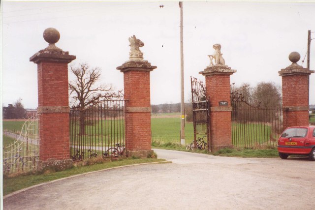
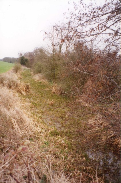
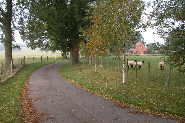
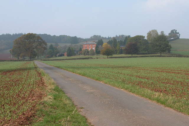
Meephill Coppice Images

Images are sourced within 2km of 52.090137/-2.5016008 or Grid Reference SO6543. Thanks to Geograph Open Source API. All images are credited.

Gateway to Canon Frome Court This grand entrance leads to the church as well as the Georgian mansion, which has served as a County Secondary School but is now flats.  Note that the car park for the church is a narrow right turn just before the gates leading into the curtilage of the house, beyond which tourists are not welcome!
Gateway to Canon Frome Court
This grand entrance leads to the church as well as the Georgian mansion, which has served as a County Secondary School but is now flats. Note that the car park for the church is a narrow right turn just before the gates leading into the curtilage of the house, beyond which tourists are not welcome!
Disused Canal, Canon Frome This was taken looking SE from the road bridge.
Disused Canal, Canon Frome
This was taken looking SE from the road bridge.
Driveway leading to Upleadon Farm
Upleadon Court near Ashperton Near Ashperton there is an Upleadon Court and Upleadon Farm, no where near the village of Upleadon which is in Gloucestershire. The court in this picture is in grid square SO6642, however, the photograph is taken from the bottom of the drive which is in the neighbouring grid square.
Upleadon Court near Ashperton
Near Ashperton there is an Upleadon Court and Upleadon Farm, no where near the village of Upleadon which is in Gloucestershire. The court in this picture is in grid square SO6642, however, the photograph is taken from the bottom of the drive which is in the neighbouring grid square.
Farm building near Canon Frome
Millend Farm, Castle Frome Millend Farm viewed through a hop field.
Millend Farm, Castle Frome
Millend Farm viewed through a hop field.
Old barns at Catley Farms, Bosbury
Rear entrance to Canon Frome Court
Un-named Knoll near Redcastle Farm Viewed from the side of Gold Hill looking SW across pasture.
Un-named Knoll near Redcastle Farm
Viewed from the side of Gold Hill looking SW across pasture.
Highlea Wood Looking SE along the access track.
Highlea Wood
Looking SE along the access track.
Half Timbered House and Orchard Looking north from the access road to "New House" the house in the photograph is off the bridleway to Hutt Farm.
Half Timbered House and Orchard
Looking north from the access road to "New House" the house in the photograph is off the bridleway to Hutt Farm.
Edge of Childer Wood Looking NNW along the edge of the wood.
Edge of Childer Wood
Looking NNW along the edge of the wood.
Redcastle Farm Viewed from the west from near the corner of Childer Wood.
Redcastle Farm
Viewed from the west from near the corner of Childer Wood.
Walsopthorne Walsopthorne is a moated site. It is a gentry property, and was owned by the Pichards of Suckley in Worcestershire during the late 15th and early 16th centuries. The moat is substantial, with an outer enclosure which may have held a garden. The timber-framed house was built c.1600.
Walsopthorne
Walsopthorne is a moated site. It is a gentry property, and was owned by the Pichards of Suckley in Worcestershire during the late 15th and early 16th centuries. The moat is substantial, with an outer enclosure which may have held a garden. The timber-framed house was built c.1600.
New and Old Birchend Farms Viewed from the west across the square from the bridleway from Childer wood to millend.
New and Old Birchend Farms
Viewed from the west across the square from the bridleway from Childer wood to millend.
Spoil Heaps Above the Ashperton Tunnel The Hereford & Gloucester Canal travelled through a 400yd tunnel beneath this line of earth mounds. For more info : <span class="nowrap"><a title="http://www.smr.herefordshire.gov.uk/post-medieval/canals/hereford_gloucester.htm" rel="nofollow ugc noopener" href="http://www.smr.herefordshire.gov.uk/post-medieval/canals/hereford_gloucester.htm">Link</a><img style="margin-left:2px;" alt="External link" title="External link - shift click to open in new window" src="https://s1.geograph.org.uk/img/external.png" width="10" height="10"/></span>
Spoil Heaps Above the Ashperton Tunnel
The Hereford & Gloucester Canal travelled through a 400yd tunnel beneath this line of earth mounds. For more info : LinkExternal link
Canon Frome CC Pitch, Ashperton The bench bears a plaque with the inscription " Presented to C.F.C.C. by the Eclectics 1973-1997 = 25* Tours"
Canon Frome CC Pitch, Ashperton
The bench bears a plaque with the inscription " Presented to C.F.C.C. by the Eclectics 1973-1997 = 25* Tours"
Flytipping into Canal This is where the Hereford & Gloucester Canal emerges from the western end of the Ashperton Tunnel
Flytipping into Canal
This is where the Hereford & Gloucester Canal emerges from the western end of the Ashperton Tunnel
Show me another place!

Meephill Coppice is located at Grid Ref: SO6543 (Lat: 52.090137, Lng: -2.5016008)

Unitary Authority: County of Herefordshire

Police Authority: West Mercia

What 3 Words

///scariest.gained.dispenser. Near Evesbatch, Herefordshire

Related Wikis

Canon Frome

Canon Frome is a hamlet and small rural parish on the River Frome, 5 miles northwest of Ledbury, Herefordshire, England with a population of 139. Its most...

Upleadon Preceptory

Upleadon Preceptory was a priory in Herefordshire, England at grid reference SO66504270. == References ==

Eggleton, Herefordshire

Eggleton (or Egleton) is a small civil parish in Herefordshire, England. Its main centres of population are Lower Eggleton and Upper Eggleton. The parish...

Ashperton

Ashperton is a small village, parish and former manor about twelve miles east of the City of Hereford, in Herefordshire, England. The village is on the...

Nearby Amenities

Located within 500m of 52.090137,-2.5016008
Grain Drier
Naptan AtcoCode: 2090A20239
Naptan Bearing: SW
Naptan BusStopType: CUS
Naptan CommonName: Grain Drier
Naptan Indicator: opp
Naptan Landmark: Grain Drier.
Naptan NaptanCode: herapdgd
Naptan Street: Castle Frome to Canon Frome Road
Naptan Verified: no
Source: naptan_import
Lat/Long: 52.0927755/-2.5072078
Grain Drier
Naptan AtcoCode: 2090A20241
Naptan Bearing: NE
Naptan BusStopType: CUS
Naptan CommonName: Grain Drier
Naptan Indicator: adj
Naptan Landmark: Grain Drier
Naptan NaptanCode: herapdgj
Naptan Street: Canon Frome to Castle Frome Road
Naptan Verified: no
Source: naptan_import
Lat/Long: 52.092928/-2.5072826
White House
Place: hamlet
Lat/Long: 52.0861608/-2.5017666
White House Canon Frome
Power: pole
Transformer: distribution
Voltage Primary: 11000
Lat/Long: 52.0863014/-2.5025245
Black House
Power: pole
Transformer: distribution
Voltage Primary: 11000
Lat/Long: 52.0861284/-2.5040849
Power: pole
Lat/Long: 52.0943482/-2.5039326
Power: pole
Lat/Long: 52.0941467/-2.5046106
Power: pole
Lat/Long: 52.0938369/-2.5056798
Power: pole
Lat/Long: 52.0934239/-2.5063051
Power: pole
Lat/Long: 52.0930216/-2.5068938
Power: pole
Lat/Long: 52.0926793/-2.5070333
Power: pole
Lat/Long: 52.0919011/-2.5073618
Power: pole
Lat/Long: 52.0911216/-2.5076918
Power: pole
Lat/Long: 52.0903561/-2.5080639
Power: pole
Lat/Long: 52.08972/-2.5082912
Power: pole
Lat/Long: 52.0890888/-2.5085554
The data included in this document is from www.openstreetmap.org. The data is made available under ODbL.

Have you been to Meephill Coppice?

Leave your review of Meephill Coppice below (or comments, questions and feedback).