Cosby

Settlement in Leicestershire Blaby

England

Cosby

Display at the Cosby Yarn Bomb 2021 On the corner of Park Road and the Main Street. This installation is a reference to the Cosby Victory Show, which takes place in September.
Display at the Cosby Yarn Bomb 2021 Credit: Mat Fascione

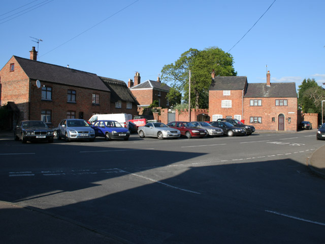
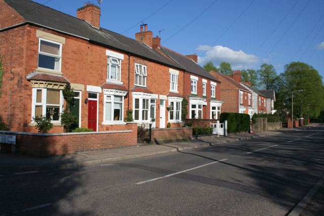
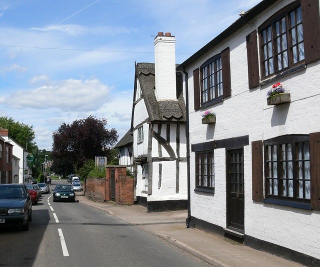
Cosby is a small village located in the county of Leicestershire, England. Situated approximately 8 miles southwest of Leicester, it is nestled in the beautiful countryside of the East Midlands region. The village is part of the Blaby District and has a population of around 3,000 residents.

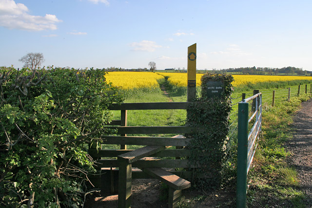
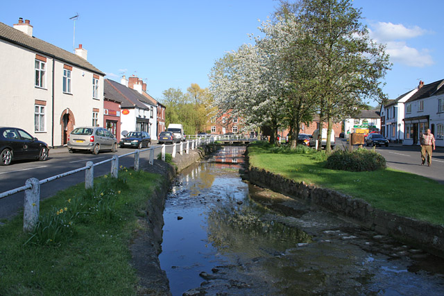
Historically, Cosby dates back to the Roman period, with evidence of settlements and artifacts found in the area. The village grew during the medieval period and became an important agricultural center, known for its farming and livestock production. Today, Cosby still retains its rural charm, with picturesque landscapes, fields, and farmland surrounding the village.

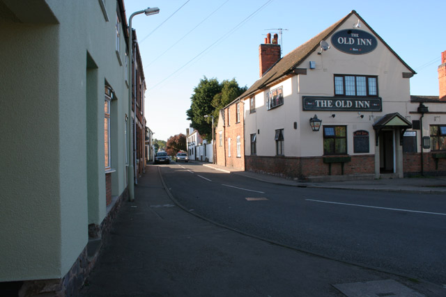
The village itself offers a range of amenities and facilities for its residents. It has a primary school, a medical center, a post office, and a few local shops and businesses. There are also a number of pubs and restaurants, providing a cozy atmosphere and traditional English dining options.

Cosby is well-connected to nearby towns and cities, with good transportation links. It is conveniently located near the M1 motorway, allowing easy access to Leicester and other major cities in the region. The village is served by several bus routes, enabling residents to travel to neighboring areas.

Despite its small size, Cosby boasts a strong sense of community, with various local events and activities taking place throughout the year. The village has a number of sports clubs and recreational facilities, including a cricket club and a local golf course.

Overall, Cosby offers a tranquil and idyllic setting for those seeking a peaceful retreat in the heart of the Leicestershire countryside.

If you have any feedback on the listing, please let us know in the comments section below.
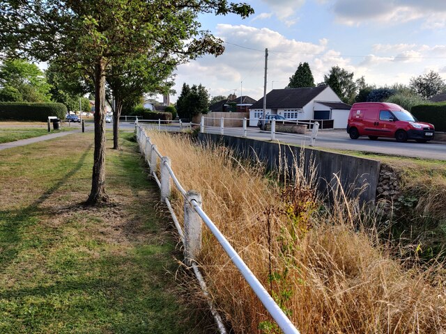
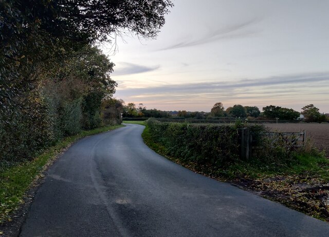
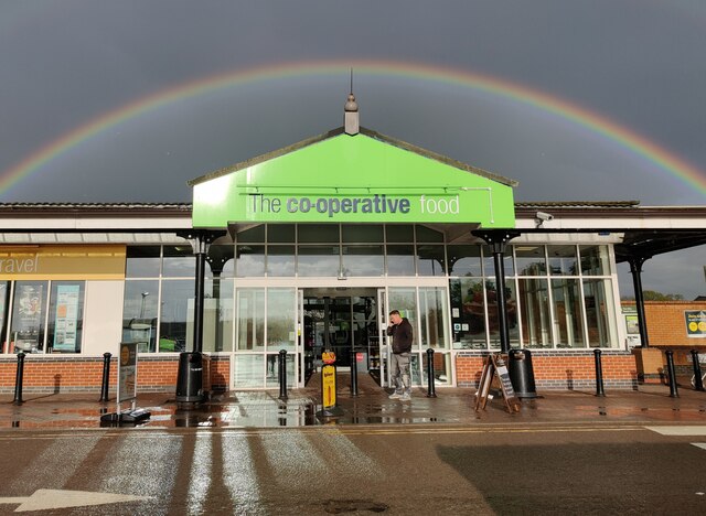
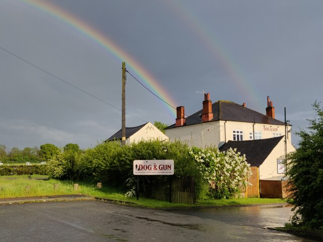
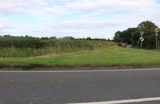
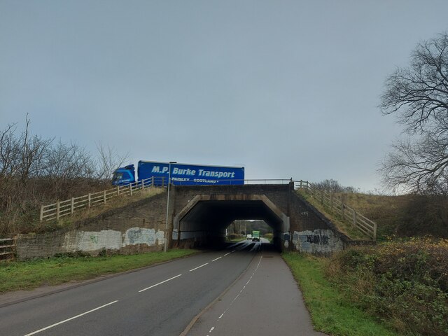
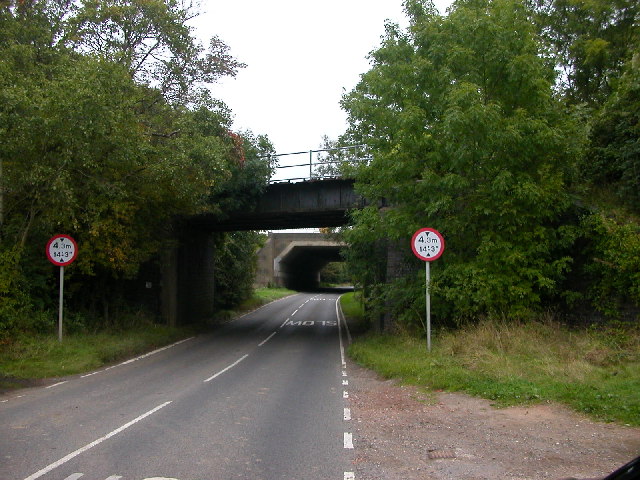
Cosby Images

Images are sourced within 2km of 52.549383/-1.193163 or Grid Reference SP5494. Thanks to Geograph Open Source API. All images are credited.

Display at the Cosby Yarn Bomb 2021 On the corner of Park Road and the Main Street. This installation is a reference to the Cosby Victory Show, which takes place in September.
Display at the Cosby Yarn Bomb 2021
On the corner of Park Road and the Main Street. This installation is a reference to the Cosby Victory Show, which takes place in September.
Along Cosby Brook in Cosby The brook is next to Main Street.
Along Cosby Brook in Cosby
The brook is next to Main Street.
Farmland at Whetstone Gorse
Whetstone Gorse Lane
Hill Lane near Countesthorpe
Rainbow over the Whetstone Co-operative store
Rainbow over the Dog and Gun public house
Lutterworth Road, Countesthorpe Hill Lane is on the right.
Lutterworth Road, Countesthorpe
Hill Lane is on the right.
Lutterworth Road, Countesthorpe
Lutterworth Road, Whetstone
Warwick Road passing below the M1, heading towards Whetstone
Country road, Cosby
Country road, Cosby
Cosby Old Central Railway and M1 Motorway cross the road leading out of the village to the A426 Leicester --Rugby Rd.
Cosby
Old Central Railway and M1 Motorway cross the road leading out of the village to the A426 Leicester --Rugby Rd.
Station Road, Littlethorpe, Leicestershire Looking towards Narborough
Station Road, Littlethorpe, Leicestershire
Looking towards Narborough
The Square, Littlethorpe, Leicestershire A small village near Narborough sandwiched between the old Fosse Way and the M1.
The Square, Littlethorpe, Leicestershire
A small village near Narborough sandwiched between the old Fosse Way and the M1.
Through the rape field This public footpath cuts a swath through the crop at White Barn Farm, on the edge of Littlethorpe.
Through the rape field
This public footpath cuts a swath through the crop at White Barn Farm, on the edge of Littlethorpe.
Narborough Road, Cosby, Leicestershire Small Victorian terraced houses opposite Victory Park.
Narborough Road, Cosby, Leicestershire
Small Victorian terraced houses opposite Victory Park.
The Nook, Cosby, Leicestershire Cosby Brook meanders through the village. It makes a focal point at The Nook and is crossed by a footbridge.
The Nook, Cosby, Leicestershire
Cosby Brook meanders through the village. It makes a focal point at The Nook and is crossed by a footbridge.
Show me another place!

Cosby is located at Grid Ref: SP5494 (Lat: 52.549383, Lng: -1.193163)

Administrative County: Leicestershire

District: Blaby

Police Authority: Leicestershire

What 3 Words

///smart.wicked.lucky. Near Cosby, Leicestershire

Nearby Locations

Cosby Cosby

Related Wikis

Cosby, Leicestershire

Cosby is a village in the English county of Leicestershire. Cosby is located in the south of the county near the larger villages and towns of Whetstone...

Saffron Dynamo F.C.

Saffron Dynamo Football Club is a football club based in Cosby, Leicestershire, England. They are currently members of the United Counties League Division...

Leicestershire and Rutland Wildlife Trust

The Leicestershire and Rutland Wildlife Trust (LRWT) is one of 46 wildlife trusts across the United Kingdom. It manages nature reserves in Leicestershire...

Leicestershire and Rutland County Football Association

The Leicestershire and Rutland County Football Association, also simply known as the Leicestershire & Rutland CFA, Leicestershire FA or LRCFA, is the governing...

Littlethorpe, Leicestershire

Littlethorpe is a small village approximately six miles (ten kilometres) south of Leicester, separated from the village of Narborough by the Leicester...

Blaby & Whetstone Athletic F.C.

Blaby & Whetstone Athletic Football Club is a football club based in Whetstone, near Leicester, Leicestershire, England. They play at Warwick Road. �...

Countesthorpe Academy

Countesthorpe Academy (formerly Countesthorpe Leysland Community College) is a coeducational secondary school situated on the western edge of Countesthorpe...

Leysland High School

Leysland High School was a coeducational middle school with academy status, located in Countesthorpe, Leicestershire, England. It was open for students...

Nearby Amenities

Located within 500m of 52.549383,-1.193163
Mini Roundabout
Direction: clockwise
Lat/Long: 52.552167/-1.193784
Cosby
Is In County: Leicestershire
Is In District: Blaby
Place: village
Lat/Long: 52.551051/-1.1926746
Restaurant
Bangla Spice
Addr City: Cosby
Addr Country: GB
Addr Housename: The Blacksmiths
Addr Housenumber: 77
Addr Postcode: LE9 1UW
Addr Street: Main Street
Fhrs Authority: Blaby
Fhrs Id: 1202043
Fhrs Local Authority Id: 45431
Note: Closed
Lat/Long: 52.5479086/-1.194031
Library
Cosby Public Library
Wikidata: Q55121818
Lat/Long: 52.5521509/-1.1942702
Bus Stop
Victory Park
Bench: yes
Bus: yes
Naptan AtcoCode: 260003305
Naptan Bearing: NE
Naptan CommonName: Victory Park
Naptan Indicator: outside
Naptan Landmark: Victory Park entrance
Naptan NaptanCode: leidjdgp
Naptan Notes: Hourly - County
Naptan Street: Park Road
Naptan Verified: no
Public Transport: platform
Shelter: yes
Source: naptan_import
Lat/Long: 52.5518498/-1.1943092
Bus Stop
Park Road
Bus: yes
Naptan AtcoCode: 260003306
Naptan Bearing: SW
Naptan CommonName: Park Road
Naptan Indicator: opposite
Naptan Landmark: 18 Park Road
Naptan NaptanCode: leidjadj
Naptan Notes: Hourly - County
Naptan Street: Park Road
Naptan Verified: no
Public Transport: platform
Shelter: no
Source: naptan_import
Lat/Long: 52.5512411/-1.1946891
Bus Stop
Park Road
Bus: yes
Naptan AtcoCode: 260003307
Naptan Bearing: N
Naptan CommonName: Park Road
Naptan Indicator: outside
Naptan Landmark: 50 Park Road
Naptan NaptanCode: leidjdgt
Naptan Notes: Hourly - County
Naptan Street: Park Road
Naptan Verified: no
Public Transport: platform
Source: naptan_import
Lat/Long: 52.5501704/-1.1958886
Bus Stop
Park Road
Bus: yes
Naptan AtcoCode: 260003308
Naptan Bearing: SW
Naptan CommonName: Park Road
Naptan Indicator: adj
Naptan Landmark: 39A Park Road
Naptan NaptanCode: leidjadm
Naptan Notes: Hourly - County
Naptan Street: Park Road
Naptan Verified: no
Public Transport: platform
Source: naptan_import
Lat/Long: 52.5491574/-1.19632
Bus Stop
The Nook
Alt Name: Cosby - Croft Road
Bus: yes
Naptan AltCommonName: Cosby - Croft Road
Naptan AtcoCode: 260003309
Naptan Bearing: NW
Naptan CommonName: The Nook
Naptan Indicator: opposite
Naptan Landmark: Mercury News Shop
Naptan NaptanCode: leidjdgw
Naptan Notes: Hourly - County
Naptan Street: Croft Road
Naptan Verified: no
Public Transport: platform
Source: naptan_import
Lat/Long: 52.5482151/-1.1965732
Bus Stop
Chapel Lane
Alt Name: Cosby - Brookfield House
Bus: yes
Naptan AltCommonName: Cosby - Brookfield House
Naptan AtcoCode: 260003310
Naptan Bearing: SW
Naptan CommonName: Chapel Lane
Naptan Indicator: adjacent
Naptan Landmark: Chapel Lane
Naptan NaptanCode: leidjadt
Naptan Notes: Hourly - County
Naptan Street: Broughton Road
Naptan Verified: no
Public Transport: platform
Source: naptan_import
Lat/Long: 52.546484/-1.1971652
Bus Stop
Chapel Lane
Bus: yes
Naptan AtcoCode: 260003311
Naptan Bearing: NE
Naptan CommonName: Chapel Lane
Naptan Indicator: opposite
Naptan Landmark: Chapel Lane
Naptan NaptanCode: leidjdjd
Naptan Notes: Hourly - County
Naptan Street: Broughton Road
Naptan Verified: no
Public Transport: platform
Source: naptan_import
Lat/Long: 52.5461818/-1.1976721
Bus Stop
The Nook
Bus: yes
Naptan AtcoCode: 260003312
Naptan Bearing: E
Naptan CommonName: The Nook
Naptan Indicator: opp
Naptan Landmark: 24 The Nook
Naptan NaptanCode: leidjadp
Naptan Notes: Hourly - County
Naptan Street: The Nook
Naptan Verified: no
Public Transport: platform
Source: naptan_import
Lat/Long: 52.5477189/-1.1949895
Crossing
Crossing: zebra
Lat/Long: 52.5483069/-1.196694
Spar
Addr City: Cosby
Addr Country: GB
Addr Postcode: LE9 1RE
Addr Street: Croft Road
Brand: Spar
Brand Wikidata: Q610492
Brand Wikipedia: en:SPAR (retailer)
Fhrs Authority: Blaby
Fhrs Id: 1201882
Fhrs Local Authority Id: 35634
Shop: convenience
Lat/Long: 52.548477/-1.1965319
Crossing
Crossing: zebra
Crossing Island: no
Lat/Long: 52.5476065/-1.1948878
Atm
Lat/Long: 52.5496642/-1.1928834
Pub
Cosby Working Mens Club
Addr City: Cosby
Addr Country: GB
Addr Housenumber: 75
Addr Postcode: LE9 1UW
Addr Street: Main Street
Fhrs Authority: Blaby
Fhrs Id: 1201591
Fhrs Local Authority Id: 2072
Lat/Long: 52.5482693/-1.1944346
Pharmacy
Cosby Pharmacy
Healthcare: pharmacy
Lat/Long: 52.5480303/-1.1938606
Community Centre
Bunning Memorial Hall
Addr City: Cosby
Addr Country: GB
Addr Postcode: LE9 1UW
Addr Street: Main Street
Fhrs Authority: Blaby
Fhrs Id: 1201881
Fhrs Local Authority Id: 3563
Opening Hours: "Only when hired"
Lat/Long: 52.5493017/-1.1933899
Mr Clutton
Addr City: Cosby
Addr Country: GB
Addr Housenumber: 13
Addr Postcode: LE9 1UA
Addr Street: Ash Tree Road
Fhrs Authority: Blaby
Fhrs Id: 1201582
Fhrs Local Authority Id: 2041
Shop: butcher
Lat/Long: 52.551528/-1.1924149
M J Supermarket
Brand: Premier
Brand Wikidata: Q7240340
Opening Hours: Mo-Sa 07:00-22:00; Su 07:00-20:00
Payment Cash: yes
Payment Contactless: yes
Payment Credit Cards: yes
Payment Debit Cards: yes
Payment Mastercard: yes
Payment Visa: yes
Shop: convenience
Website: https://www.premier-stores.co.uk/our-stores/m-j-supermarket
Lat/Long: 52.5515011/-1.1923143
Mohini
Shop: hairdresser
Lat/Long: 52.5514701/-1.1922017
Pub
The Bulls Head
Addr City: Cosby
Addr Country: GB
Addr Housenumber: 2
Addr Postcode: LE9 1RQ
Addr Street: The Nook
Fhrs Authority: Blaby
Fhrs Id: 1201592
Fhrs Local Authority Id: 2084
Lat/Long: 52.5473347/-1.1940779
Anji Draycott Hair
Shop: hairdresser
Lat/Long: 52.5474856/-1.194676
Russell Smith Butchers
Addr City: Cosby
Addr Country: GB
Addr Housenumber: 20
Addr Postcode: LE9 1RQ
Addr Street: The Nook
Fhrs Authority: Blaby
Fhrs Id: 1201593
Fhrs Local Authority Id: 2088
Shop: butcher
Lat/Long: 52.5475011/-1.1947042
Restaurant
The Cook In The Nook
Addr City: Cosby
Addr Country: GB
Addr Housenumber: 24
Addr Postcode: LE9 1RQ
Addr Street: The Nook
Fhrs Authority: Blaby
Fhrs Id: 1158505
Fhrs Local Authority Id: 19/0027/CP
Lat/Long: 52.54755/-1.1948785
Hair Club 24 Design
Shop: hairdresser
Lat/Long: 52.5478061/-1.1943072
Post Office
Cosby Post Office
Lat/Long: 52.5478485/-1.1948624
Fast Food
The Nook Fish Bar
Lat/Long: 52.5479203/-1.1951682
Community Centre
Cosby Village Hall
Addr City: Cosby
Addr Country: GB
Addr Postcode: LE9 1RN
Addr Street: Park Road
Community Centre: village_hall
Fhrs Authority: Blaby
Fhrs Id: 1201595
Fhrs Local Authority Id: 2095
Lat/Long: 52.5515867/-1.194849
Place Of Worship
Cosby Methodist Church
Building: chapel
Denomination: methodist
Religion: christian
Lat/Long: 52.5493719/-1.1960024
Bar
Cosby Golf Club
Addr City: Cosby
Addr Country: GB
Addr Postcode: LE9 1RG
Addr Street: Chapel Lane
Fhrs Authority: Blaby
Fhrs Id: 1201584
Fhrs Local Authority Id: 2048
Lat/Long: 52.545578/-1.1966112
Place Of Worship
Cosby Community Church
Building: chapel
Religion: christian
Lat/Long: 52.5484748/-1.1973408
Community Centre
Cosby Toc-H
Lat/Long: 52.5483345/-1.1963403
Kerb: raised
Lat/Long: 52.5521232/-1.1916623
Defibrillator
Booth: K6
Covered: booth
Defibrillator Location: inside red phone box, Main Street, Cosby
Disused Amenity: telephone
Emergency: defibrillator
Listed Status: Grade II
Man Made: telephone_box
Lat/Long: 52.5475948/-1.1950824
Simplyfresh
Shop: convenience
Lat/Long: 52.5483896/-1.1971262
Crossing
Crossing: zebra
Crossing Island: yes
Tactile Paving: yes
Lat/Long: 52.5522719/-1.1939239
Bench
Backrest: yes
Lat/Long: 52.5502612/-1.1932469
Bench
Backrest: yes
Lat/Long: 52.5504411/-1.1933393
Post Box
Post Box Type: pillar
Royal Cypher: EIIR
Royal Cypher Wikidata: Q33102113
Lat/Long: 52.5476695/-1.1948029
The data included in this document is from www.openstreetmap.org. The data is made available under ODbL.

Have you been to Cosby?

Leave your review of Cosby below (or comments, questions and feedback).