Atgrove Wood

Wood, Forest in Somerset

England

Atgrove Wood

Small bridge
Small bridge Credit: don cload

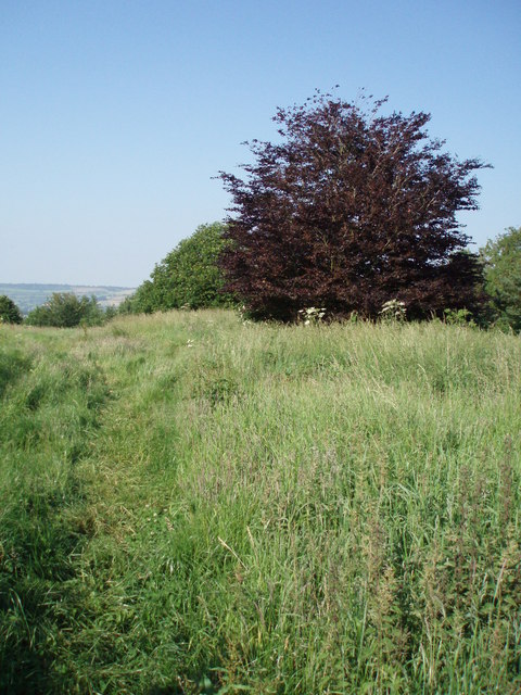
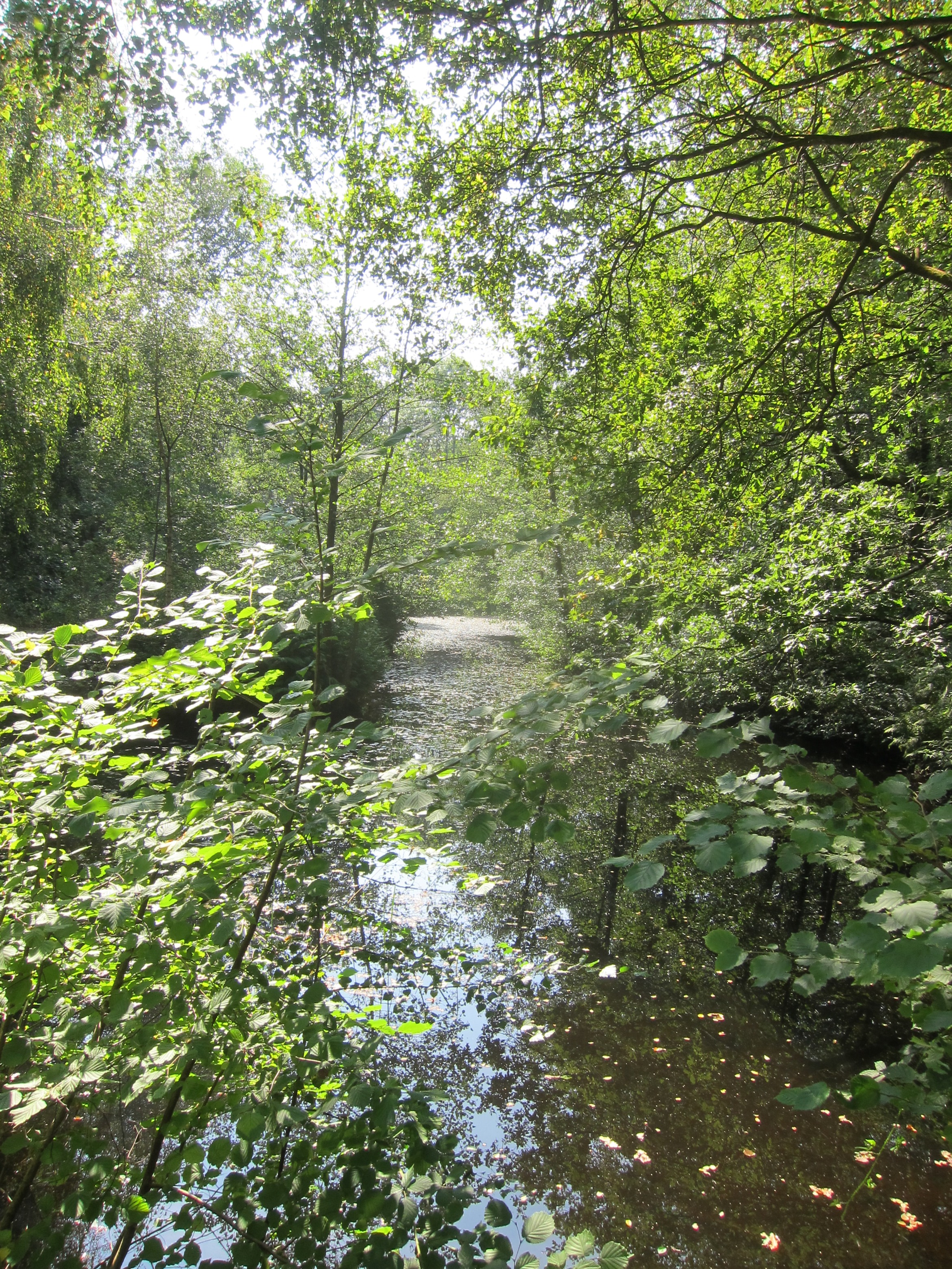
Atgrove Wood is a picturesque woodland located in Somerset, England. Covering an area of approximately 50 hectares, it is a popular destination for nature enthusiasts and outdoor lovers. The wood is primarily composed of deciduous trees, including oak, beech, and ash, which create a vibrant canopy during the summer months.

The woodland is known for its diverse flora and fauna, providing a habitat for a variety of wildlife species. Visitors may spot deer, squirrels, badgers, and numerous bird species while exploring the wood's well-maintained trails. The tranquil atmosphere and peaceful surroundings make Atgrove Wood a perfect spot for birdwatching and wildlife observation.

The wood is managed by the local authorities, who ensure the preservation of its natural beauty and protect the wildlife within. It is open to the public throughout the year, providing ample opportunities for recreational activities such as walking, jogging, and cycling.

Atgrove Wood is also an ideal location for nature photography, with its picturesque landscapes and seasonal changes. The vibrant autumn colors and the carpet of bluebells in spring make it a favorite spot for photographers.

There are designated picnic areas within the wood, allowing visitors to take a break and enjoy a meal amidst nature. Additionally, educational programs and guided walks are organized from time to time to raise awareness about wildlife conservation and the importance of preserving natural habitats.

Overall, Atgrove Wood offers a serene escape from the hustle and bustle of city life, providing a tranquil retreat for nature lovers and anyone seeking solace in the beauty of the great outdoors.

If you have any feedback on the listing, please let us know in the comments section below.

Atgrove Wood Images

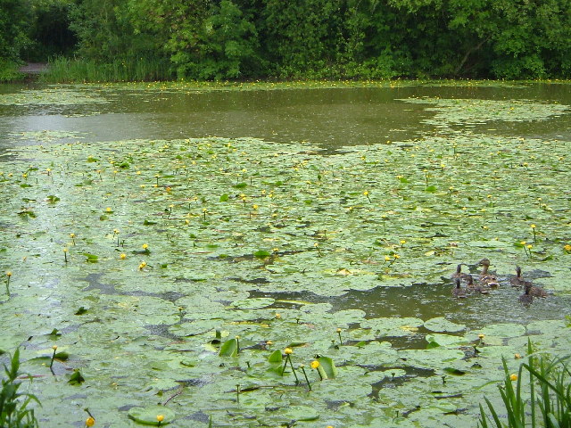
Images are sourced within 2km of 51.365879/-2.4972925 or Grid Reference ST6563. Thanks to Geograph Open Source API. All images are credited.

Small bridge
Small bridge
Ordnance Survey Cut Mark This OS cut mark can be found on the SW angle of St Mary's Church. It marks a point 25.853m above mean sea level.
Ordnance Survey Cut Mark
This OS cut mark can be found on the SW angle of St Mary's Church. It marks a point 25.853m above mean sea level.
Ordnance Survey Cut Mark This OS cut mark can be found on the west parapet of the bridge on Culverhay Road. It marks a point 22.442m above mean sea level.
Ordnance Survey Cut Mark
This OS cut mark can be found on the west parapet of the bridge on Culverhay Road. It marks a point 22.442m above mean sea level.
Ordnance Survey Rivet This damaged  OS rivet can be found on the south parapet of the bridge. It marks a point 27.655m above mean sea level.
Ordnance Survey Rivet
This damaged OS rivet can be found on the south parapet of the bridge. It marks a point 27.655m above mean sea level.
Ordnance Survey Cut Mark This OS cut mark can be found on the wall north side of the road. It marks a point 120.250m above mean sea level.
Ordnance Survey Cut Mark
This OS cut mark can be found on the wall north side of the road. It marks a point 120.250m above mean sea level.
Ordnance Survey Cut Mark This OS cut mark can be found on the NW angle of St Peter's Church. It marks a point 123.834m above mean sea level.
Ordnance Survey Cut Mark
This OS cut mark can be found on the NW angle of St Peter's Church. It marks a point 123.834m above mean sea level.
Ford on Bathford Brook This ford on the Bathford Brook is found at Tuckingmill near Compton Dando. A video of the ford can be viewed at:

<span class="nowrap"><a title="https://youtu.be/Q56WbYovyYI" rel="nofollow ugc noopener" href="https://youtu.be/Q56WbYovyYI">Link</a><img style="margin-left:2px;" alt="External link" title="External link - shift click to open in new window" src="https://s1.geograph.org.uk/img/external.png" width="10" height="10"/></span>

I shall probably never forget our visit here, not for the delightful ford but because I parked the Landcruiser on the grass verge at the top of the track and on leaving managed to ‘pop’ the bottom arm of the drive shaft and spent the next 15 hours waiting to be recovered by the RAC. Many thanks to all the helpful villagers and the tenant farmer who kept checking up on us as well as the local community police officers. We were fortunate it didn’t happen on one of the tracks and that there was the Compton Inn close by to provide us with a hearty meal.
Ford on Bathford Brook
This ford on the Bathford Brook is found at Tuckingmill near Compton Dando. A video of the ford can be viewed at: LinkExternal link I shall probably never forget our visit here, not for the delightful ford but because I parked the Landcruiser on the grass verge at the top of the track and on leaving managed to ‘pop’ the bottom arm of the drive shaft and spent the next 15 hours waiting to be recovered by the RAC. Many thanks to all the helpful villagers and the tenant farmer who kept checking up on us as well as the local community police officers. We were fortunate it didn’t happen on one of the tracks and that there was the Compton Inn close by to provide us with a hearty meal.
Fayre Day Compton Dando village fayre is under way. Plenty of stalls, classic cars and all sorts of fun to be had this afternoon.
Fayre Day
Compton Dando village fayre is under way. Plenty of stalls, classic cars and all sorts of fun to be had this afternoon.
Open for light refreshments The village hall offers some tasty home cooking and tea on the day of the fair. All proceeds to the parish.
Open for light refreshments
The village hall offers some tasty home cooking and tea on the day of the fair. All proceeds to the parish.
A drowned crown On the day of the village fair, a golden crown rests in the stream by the hall. Has some king befallen trouble of perhaps a child's toy?
A drowned crown
On the day of the village fair, a golden crown rests in the stream by the hall. Has some king befallen trouble of perhaps a child's toy?
Rounding up the ducks Barriers are in place in front of the grating: the village fair duck race will end here by the hall.
Rounding up the ducks
Barriers are in place in front of the grating: the village fair duck race will end here by the hall.
Music at the fair Compton Dando band brings some classic sounds to the big day.
Music at the fair
Compton Dando band brings some classic sounds to the big day.
Rustic skittles at the fair Compton Dando enjoys some splendid sunshine and the games are on.
Rustic skittles at the fair
Compton Dando enjoys some splendid sunshine and the games are on.
Steam up at the fair A vintage machine is one of the agricultural displays. It was built by McLaren of Leeds in 1916.
Steam up at the fair
A vintage machine is one of the agricultural displays. It was built by McLaren of Leeds in 1916.
Power at the village fair Compton Dando is a largely agricultural village, set in the Chew Valley. On the day of the fair, it is no surprise to see some modern farm vehicles.

The Kubota tractor is fitted with the LA 1854 loader on the front. It has a lifting capacity of 1810 kg (3990 lbs), at a height of 3.7m (145.7") and can carry a range of buckets.
Power at the village fair
Compton Dando is a largely agricultural village, set in the Chew Valley. On the day of the fair, it is no surprise to see some modern farm vehicles. The Kubota tractor is fitted with the LA 1854 loader on the front. It has a lifting capacity of 1810 kg (3990 lbs), at a height of 3.7m (145.7") and can carry a range of buckets.
Raining down from Heaven A notice on the door warns of loose roof tiles. By the time you get up to it you will be in the danger zone.
Raining down from Heaven
A notice on the door warns of loose roof tiles. By the time you get up to it you will be in the danger zone.
Losing the railings Some of the iron railings in St Mary's churchyard have rotted away. Presumably they are quite old.
Losing the railings
Some of the iron railings in St Mary's churchyard have rotted away. Presumably they are quite old.
Restacking the tins A Tin Can Alley stall is a busy place for the operators.
Restacking the tins
A Tin Can Alley stall is a busy place for the operators.
Show me another place!

Atgrove Wood is located at Grid Ref: ST6563 (Lat: 51.365879, Lng: -2.4972925)

Unitary Authority: Bath and North East Somerset

Police Authority: Avon and Somerset

What 3 Words

///doped.putts.cheering. Near Compton Dando, Somerset

Nearby Locations

Atgrove Wood

Related Wikis

Hunstrete

Hunstrete (grid reference ST625643) is a small village on the River Chew in the Chew Valley, Bath and North East Somerset, England. It falls within the...

Hunstrete Lake

Hunstrete Lake (grid reference ST646622) is a mature lake of 5 acres (20,000 m2). Two new lakes of 3.5 acres (14,000 m2) were constructed alongside in...

Church of St Peter, Marksbury

The Church of St Peter in Marksbury, Somerset, England dates from the 12th century, although most of the current fabric is from the 15th century and is...

Marksbury

Marksbury is a small village and civil parish on the eastern edge of the affluent Chew Valley in Somerset, about 4 miles (6.4 km) from Keynsham and 7 miles...

Compton Dando

Compton Dando is a small village and civil parish on the River Chew in the affluent Chew Valley in England. It is in the Bath and North East Somerset council...

Church of St Mary, Compton Dando

The Anglican Church of St Mary in Compton Dando within the English county of Somerset dates from the 14th century. It is a Grade II* listed building.The...

Stantonbury Camp

Stantonbury Camp is the site of an Iron Age hill fort near Stanton Prior within the parish of Marksbury in Somerset, England. It is a Scheduled Ancient...

Lord's Wood, Pensford

Lord's Wood is a woodland southeast of the village of Pensford in the Chew Valley, south of Bristol, England. The wood largely consists of planted conifers...

Nearby Amenities

Located within 500m of 51.365879,-2.4972925
Barrier: kissing_gate
Lat/Long: 51.3633058/-2.4979409
Barrier: kissing_gate
Lat/Long: 51.3629265/-2.4955976
Barrier: kissing_gate
Lat/Long: 51.3628438/-2.4953258
Power: pole
Lat/Long: 51.3625215/-2.5018522
Power: pole
Lat/Long: 51.3631878/-2.5013115
Power: pole
Lat/Long: 51.3638605/-2.5007423
Power: pole
Lat/Long: 51.364702/-2.5000065
Power: pole
Lat/Long: 51.3655536/-2.4992544
Power: pole
Lat/Long: 51.3663658/-2.4985409
Power: pole
Lat/Long: 51.3670105/-2.4979615
Power: pole
Lat/Long: 51.3676311/-2.4974025
Power: pole
Lat/Long: 51.3683875/-2.496746
Power: pole
Lat/Long: 51.3691565/-2.4961016
Power: pole
Lat/Long: 51.369634/-2.495633
The data included in this document is from www.openstreetmap.org. The data is made available under ODbL.

Have you been to Atgrove Wood?

Leave your review of Atgrove Wood below (or comments, questions and feedback).