Harryhill Plantation

Wood, Forest in Gloucestershire Forest of Dean

England

Harryhill Plantation

Jubilee Road, Mitcheldean Looking north towards Plump Hill.
Jubilee Road, Mitcheldean Credit: Jonathan Billinger

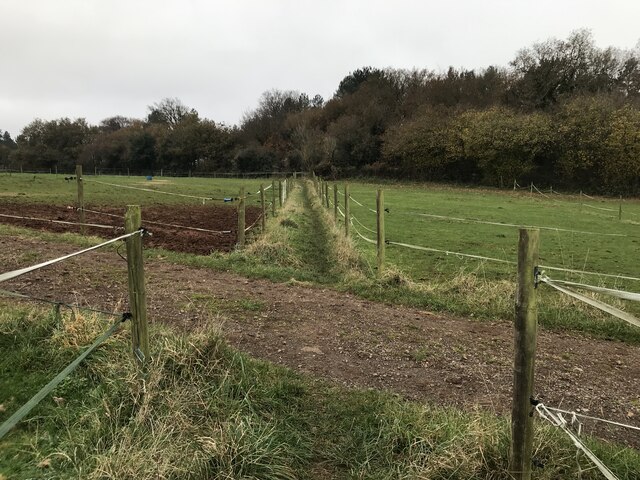
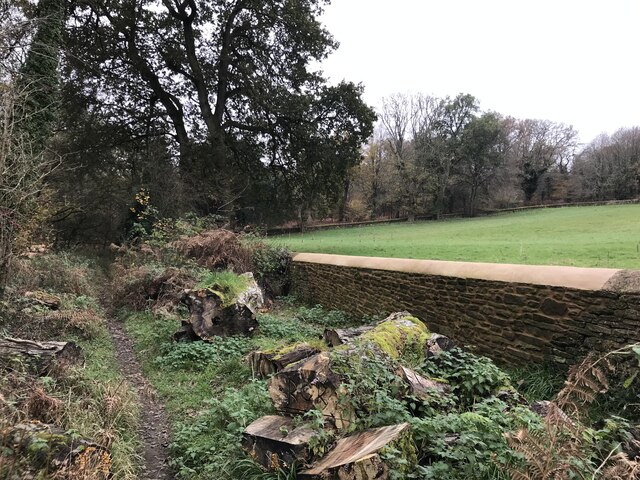
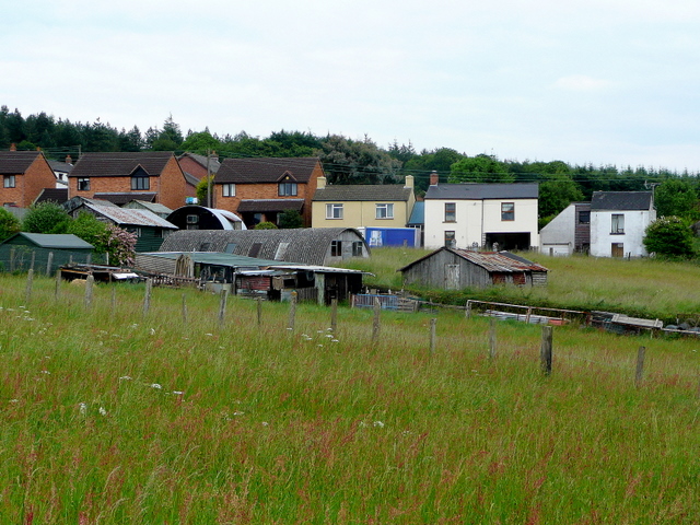
Harryhill Plantation is a picturesque woodland located in Gloucestershire, England. Situated in the heart of the county, it covers an area of approximately 100 acres and is known for its diverse range of plant and animal species.

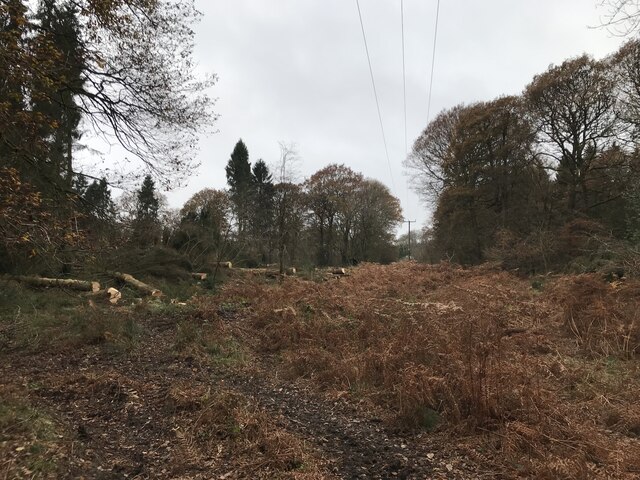
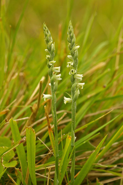
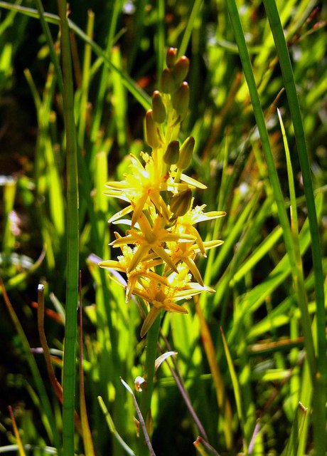
The plantation is predominantly made up of ancient woodland, boasting a mix of deciduous and coniferous trees, including oak, beech, ash, and Scots pine. These towering trees provide a dense canopy, creating a serene and peaceful atmosphere for visitors to enjoy. The forest floor is adorned with a vibrant carpet of wildflowers and ferns, adding to the natural beauty of the area.

The woodland is home to a variety of wildlife, making it a popular spot for nature enthusiasts and birdwatchers. Visitors may catch a glimpse of native species such as deer, foxes, badgers, and rabbits, as well as a wide array of bird species, including woodpeckers, owls, and various songbirds.

For those seeking outdoor activities, Harryhill Plantation offers several walking trails, allowing visitors to explore the woodland's hidden gems. These trails are well-maintained and provide stunning views of the surrounding countryside. Additionally, the plantation has designated picnic areas, providing a perfect spot for families and friends to relax and enjoy a meal amidst nature.

Overall, Harryhill Plantation is a remarkable natural asset in Gloucestershire, offering a tranquil escape from the bustling city life. Its rich biodiversity, scenic beauty, and recreational opportunities make it a must-visit destination for nature lovers and those looking to reconnect with the great outdoors.

If you have any feedback on the listing, please let us know in the comments section below.

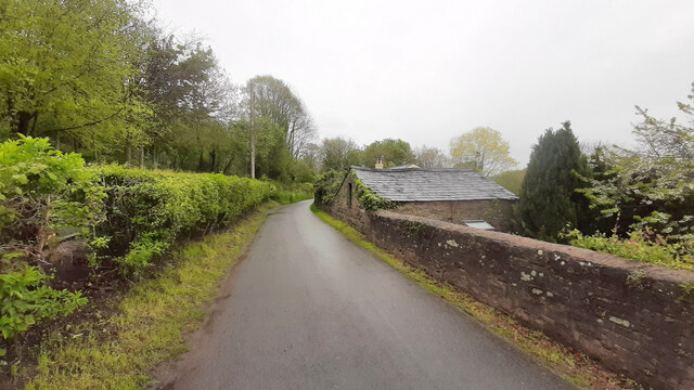
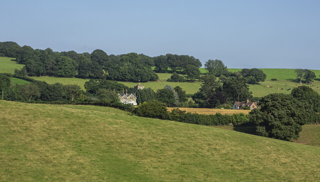
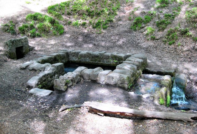
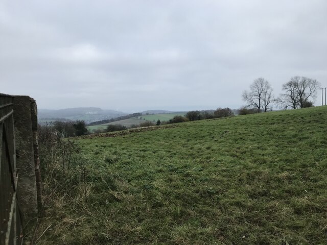
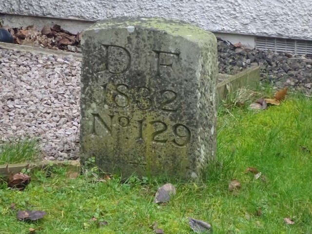
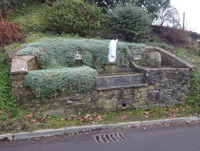
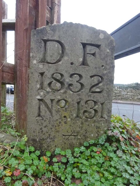
Harryhill Plantation Images

Images are sourced within 2km of 51.848732/-2.5040941 or Grid Reference SO6516. Thanks to Geograph Open Source API. All images are credited.

Jubilee Road, Mitcheldean Looking north towards Plump Hill.
Jubilee Road, Mitcheldean
Looking north towards Plump Hill.
View towards Abenhall Looking east from Jubilee Road with the tower of Abenhall church visible in the late afternoon sunshine.
View towards Abenhall
Looking east from Jubilee Road with the tower of Abenhall church visible in the late afternoon sunshine.
St Anthony's Well Image of the historic well in woodland North-west of Flaxley.
St Anthony's Well
Image of the historic well in woodland North-west of Flaxley.
Grassy hillside
Grassy hillside
Between paddocks
Between paddocks
Overgrown pathway
Overgrown pathway
Repaired wall
Repaired wall
Felled trees
Felled trees
Newtown Road, Steam Mills Post-industrial landscape.
Newtown Road, Steam Mills
Post-industrial landscape.
Machinery in the woods Various pieces of equipment litter the woodland at the end of Jubilee Lane.
Machinery in the woods
Various pieces of equipment litter the woodland at the end of Jubilee Lane.
Toll House, Gloucester Road A Toll House, now an extension of Forest House. At the junction of Gloucester Road, Merrin Street, New Road and Abbenhall Road. Served Huntley and Mitcheldean Turnpike Trust.
In the wall next to the lamppost is the milestone see <a href="https://www.geograph.org.uk/photo/6035328">SO6618 : Old Milestone by the A4136, Gloucester Road, Mitcheldean</a>. Gloucestershire HER Nᴼ. 5863 see <span class="nowrap"><a title="https://www.heritagegateway.org.uk/Gateway/Results_Single.aspx?uid=5863&resourceID=108" rel="nofollow ugc noopener" href="https://www.heritagegateway.org.uk/Gateway/Results_Single.aspx?uid=5863&resourceID=108">Link</a><img style="margin-left:2px;" alt="External link" title="External link - shift click to open in new window" src="https://s1.geograph.org.uk/img/external.png" width="10" height="10"/></span>

Milestone Society National ID: GL.MDE01
Toll House, Gloucester Road
A Toll House, now an extension of Forest House. At the junction of Gloucester Road, Merrin Street, New Road and Abbenhall Road. Served Huntley and Mitcheldean Turnpike Trust. In the wall next to the lamppost is the milestone see SO6618 : Old Milestone by the A4136, Gloucester Road, Mitcheldean. Gloucestershire HER Nᴼ. 5863 see LinkExternal link Milestone Society National ID: GL.MDE01
Toll House, A4136, Plump Hill Within the parish of Mitcheldean. The frontage was replaced in 1893 when the building was re-named Grove Cottage. The visible parts of the side and rear are clearly much older and would have been the building depicted on 1877 maps as the Plumphill Gate (TP) when it had a part of the building extending to the road. The flat roof extension is modern. Served the Huntley and Mitcheldean Turnpike Trust.

Inscription: Grove Cottage / 1893

Milestone Society National ID: GL.MIT
Toll House, A4136, Plump Hill
Within the parish of Mitcheldean. The frontage was replaced in 1893 when the building was re-named Grove Cottage. The visible parts of the side and rear are clearly much older and would have been the building depicted on 1877 maps as the Plumphill Gate (TP) when it had a part of the building extending to the road. The flat roof extension is modern. Served the Huntley and Mitcheldean Turnpike Trust. Inscription: Grove Cottage / 1893 Milestone Society National ID: GL.MIT
Old Boundary Stone, Mitcheldean One of the many boundary stone delineating the periphery of the "Forest of Dean". The "Forest" is very specific because resident have "rights in common" like grazing sheep and coal mining, though you may have to be born there to classify as a "free miner". This is on the Northern verge of "The Stenders". Mitcheldean is to the East, while East Dean parish is to the West. The boundary runs along the road from the next <a href="https://www.geograph.org.uk/photo/7295087">SO6518 : Modern Boundary Stone, Mitcheldean</a> and turns North here.

Inscription: D.F / 1832 / N. 180

Milestone Society National ID: GL_DFMITC180em
Old Boundary Stone, Mitcheldean
One of the many boundary stone delineating the periphery of the "Forest of Dean". The "Forest" is very specific because resident have "rights in common" like grazing sheep and coal mining, though you may have to be born there to classify as a "free miner". This is on the Northern verge of "The Stenders". Mitcheldean is to the East, while East Dean parish is to the West. The boundary runs along the road from the next SO6518 : Modern Boundary Stone, Mitcheldean and turns North here. Inscription: D.F / 1832 / N. 180 Milestone Society National ID: GL_DFMITC180em
Modern Boundary Stone, Mitcheldean One of the many replacement boundary stone delineating the periphery of the "Forest of Dean". The "Forest" is very specific because resident have "rights in common" like grazing sheep and coal mining, though you may have to be born there to classify as a "free miner". This is on the Southern verge of "The Stenders". Mitcheldean is to the East, while East Dean parish is to the West. The boundary runs along the road from the next <a href="https://www.geograph.org.uk/photo/7295071">SO6518 : Old Boundary Stone, Mitcheldean</a> and turns South here.

Inscription: D. F. / 2011 / Nᴼ. 181

Milestone Society National ID: GL_DFMITC181em
Modern Boundary Stone, Mitcheldean
One of the many replacement boundary stone delineating the periphery of the "Forest of Dean". The "Forest" is very specific because resident have "rights in common" like grazing sheep and coal mining, though you may have to be born there to classify as a "free miner". This is on the Southern verge of "The Stenders". Mitcheldean is to the East, while East Dean parish is to the West. The boundary runs along the road from the next SO6518 : Old Boundary Stone, Mitcheldean and turns South here. Inscription: D. F. / 2011 / Nᴼ. 181 Milestone Society National ID: GL_DFMITC181em
Boundary Stone, Ruardean Walk Forest of Dean boundary marker in the garden of "Morse View" on the North side of Spout Lane.

Inscription: D. F. / 1832 / Nᴼ. 129

Milestone Society National ID: GL_DFDRRU129em
Boundary Stone, Ruardean Walk
Forest of Dean boundary marker in the garden of "Morse View" on the North side of Spout Lane. Inscription: D. F. / 1832 / Nᴼ. 129 Milestone Society National ID: GL_DFDRRU129em
Boundary Stone & horse trough, Swish Lane Modern horse trough (2003) and Forest of Dean boundary stone set in a feature garden with hanging evergreen plants. And aphorisms. In the Ruardean Hill/Ruardean Walk area.

Inscription: D. F. / 1832 / Nᴼ. 130 / ―

Milestone Society National ID: GL_DFDRRU130em
Boundary Stone & horse trough, Swish Lane
Modern horse trough (2003) and Forest of Dean boundary stone set in a feature garden with hanging evergreen plants. And aphorisms. In the Ruardean Hill/Ruardean Walk area. Inscription: D. F. / 1832 / Nᴼ. 130 / ― Milestone Society National ID: GL_DFDRRU130em
Boundary Stone, Ruardean Hill Forest of Dean boundary stone at the apex of the junction between Batts Lane and Morse Road. Despit the date on the inscription, this is from a more recent century, probably the 20ᵗʰ. 

Inscription: D. F. / 1832 / Nᴼ. 131 / ―

Milestone Society National ID: GL_DFDRYB131em
Boundary Stone, Ruardean Hill
Forest of Dean boundary stone at the apex of the junction between Batts Lane and Morse Road. Despit the date on the inscription, this is from a more recent century, probably the 20ᵗʰ. Inscription: D. F. / 1832 / Nᴼ. 131 / ― Milestone Society National ID: GL_DFDRYB131em
Boundary Stone, field, Morse Road Forest of Dean boundary stone in a field in the area described on old maps as The Morse. Looking from Morse Road the stone is maybe 100 yds from the road, ie private land.

Inscription (assumed): D. F. / 1832 / Nᴼ. 133 

Milestone Society National ID: GL_DFDRRU133em
Boundary Stone, field, Morse Road
Forest of Dean boundary stone in a field in the area described on old maps as The Morse. Looking from Morse Road the stone is maybe 100 yds from the road, ie private land. Inscription (assumed): D. F. / 1832 / Nᴼ. 133 Milestone Society National ID: GL_DFDRRU133em
Show me another place!

Harryhill Plantation is located at Grid Ref: SO6516 (Lat: 51.848732, Lng: -2.5040941)

Administrative County: Gloucestershire

District: Forest of Dean

Police Authority: Gloucestershire

What 3 Words

///prosper.searching.formed. Near Drybrook, Gloucestershire

Nearby Locations

Harryhill Plantation

Related Wikis

Harrow Hill, Gloucestershire

Harrow Hill is a village situated in the Forest of Dean in Gloucestershire, England. It is contiguous with the larger village of Drybrook. Originally,...

Edgehills Quarry

Edgehills Quarry (grid reference SO660167) is a 0.4-hectare (0.99-acre) geological Site of Special Scientific Interest in Gloucestershire, notified in...

Plump Hill Dolomite Quarry

Plump Hill Dolomite Quarry (grid reference SO661171) is a 4.5-hectare (11-acre) nature reserve in Gloucestershire in the Forest of Dean.The site is managed...

Westbury Brook Ironstone Mine

Westbury Brook Ironstone Mine (grid reference SO662166) is a 15.69-hectare (38.8-acre) biological Site of Special Scientific Interest in Gloucestershire...

Nailbridge Halt railway station

Nailbridge Halt railway station served the suburb of Nailbridge, Gloucestershire, England, from 1907 to 1930 on the Mitcheldean Road and Forest of Dean...

Steam Mills Crossing Halt railway station

Steam Mills Crossing Halt railway station served the village of Steam Mills, Gloucestershire, England, from 1907 to 1930 on the Mitcheldean Road and Forest...

Steam Mills

Steam Mills is a village in the Forest of Dean, west Gloucestershire, England. During the 18th and 19th centuries there were local coal mines and a steam...

Mitcheldean Meend Marsh

Mitcheldean Meend Marsh (grid reference SO647180) is a 0.7-hectare (1.7-acre) nature reserve in Gloucestershire in the Forest of Dean. The site is listed...

Nearby Amenities

Located within 500m of 51.848732,-2.5040941
Power: pole
Source: Bing
Lat/Long: 51.8509185/-2.4992917
Fairplay Cottages
Brand: National Grid
Brand Wikidata: Q1465461
Operator: National Grid Electricity Distribution Plc
Operator Old: Western Power Distribution
Operator Wikidata: Q7988183
Owner: National Grid Electricity Distribution (West Midlands) Plc
Owner Wikidata: Q114397791
Power: pole
Ref GB Wpd Site: 781928
Source: Bing
Transformer: distribution
Voltage: 33000
Lat/Long: 51.8477471/-2.4976569
Power: pole
Source: Bing
Lat/Long: 51.8480752/-2.4984722
Power: pole
Lat/Long: 51.8517319/-2.5057682
Power: pole
Lat/Long: 51.852826/-2.5039716
Power: pole
Lat/Long: 51.8503007/-2.5063615
Power: pole
Lat/Long: 51.8494781/-2.5067025
Power: pole
Lat/Long: 51.8524412/-2.5008316
Power: pole
Lat/Long: 51.852152/-2.5019042
Loquiers Farm Mitcheldean
Brand: National Grid
Brand Wikidata: Q1465461
Operator: National Grid Electricity Distribution Plc
Operator Old: Western Power Distribution
Operator Wikidata: Q7988183
Owner: National Grid Electricity Distribution (West Midlands) Plc
Owner Wikidata: Q114397791
Power: pole
Ref GB Wpd Site: 780609
Transformer: yes
Lat/Long: 51.8518931/-2.5028531
The data included in this document is from www.openstreetmap.org. The data is made available under ODbL.

Have you been to Harryhill Plantation?

Leave your review of Harryhill Plantation below (or comments, questions and feedback).