Goldsmith's Plantation

Wood, Forest in Dorset

England

Goldsmith's Plantation

Martinstown, Dorset - St Martin's Church
Martinstown, Dorset - St Martin's Church Credit: Colin Park

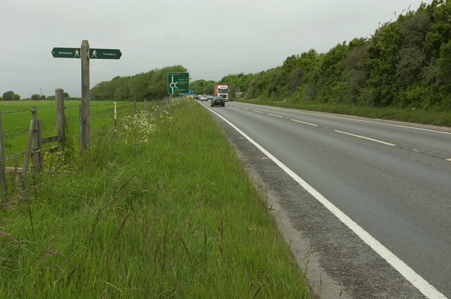
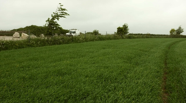
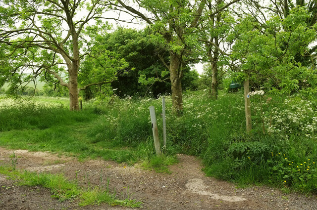
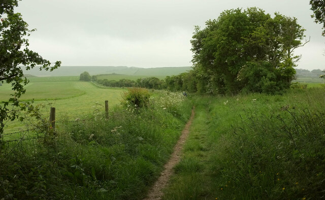
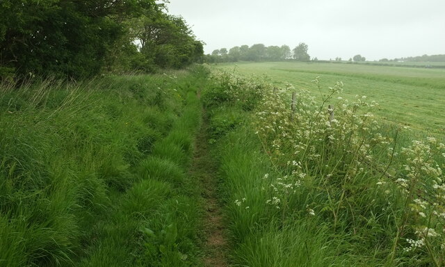
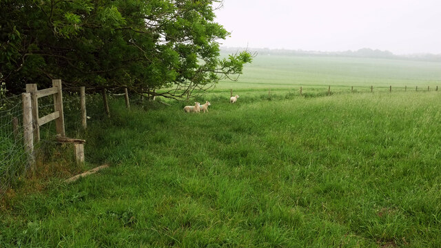
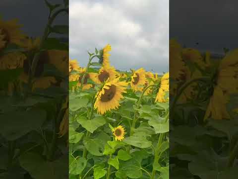
Goldsmith's Plantation is a scenic woodland area located in Dorset, England. Encompassing a vast expanse of lush greenery and towering trees, this plantation is a haven for nature enthusiasts and hikers alike. Situated within the larger Dorset Forest, Goldsmith's Plantation offers a serene and tranquil escape from the hustle and bustle of city life.

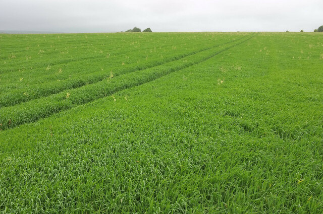
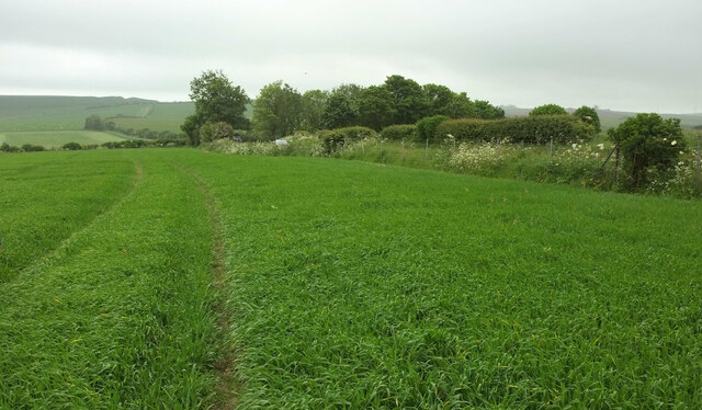
The plantation is known for its diverse range of tree species, including oak, beech, and fir, which create a picturesque landscape all year round. In spring, the plantation is transformed by the blooming of vibrant wildflowers, adding a splash of color to the surroundings. This natural beauty attracts a wide array of wildlife, making it a popular spot for birdwatchers and nature photographers.

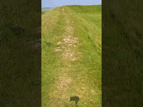
The well-maintained trails that crisscross the plantation offer visitors the opportunity to explore its hidden treasures. As they meander through the woodlands, visitors might stumble upon a glistening stream or stumble upon a clearing with a breathtaking view. The plantation is also home to several picnic areas, providing visitors with the perfect spot to relax and enjoy the peaceful ambiance.

Goldsmith's Plantation is easily accessible, with ample parking and well-marked signposts guiding visitors to the entrance. The plantation is open year-round, allowing visitors to experience its beauty in every season. Whether it is a leisurely stroll or an adventurous hike, Goldsmith's Plantation offers an unforgettable experience in the heart of Dorset's natural wonders.

If you have any feedback on the listing, please let us know in the comments section below.

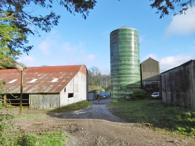
Goldsmith's Plantation Images

Images are sourced within 2km of 50.713991/-2.4961235 or Grid Reference SY6590. Thanks to Geograph Open Source API. All images are credited.

Martinstown, Dorset - St Martin's Church
Challacombe Street, Poundbury From the green open space seen on the left of <a href="https://www.geograph.org.uk/photo/7632875">SY6790 : Woodlands Crescent, Poundbury</a>, across the junction with Woodlands Crescent.
Challacombe Street, Poundbury
From the green open space seen on the left of SY6790 : Woodlands Crescent, Poundbury, across the junction with Woodlands Crescent.
Footpath sign on A35 at Poundbury This is probably Dorset's busiest main road, but where a footpath crosses it there is not even any sort of pedestrian refuge. After a steep and very awkward descent on footpath S2 51, it was daunting to face crossing an A road with fast traffic in both directions. The path to the left, S57 6, is supposed to cross Fordington Field in a straightish line to meet the road to Martinstown at an appropriate bend. However, the farmer has failed to provide a route through their crop, requiring a detour along tramlines, This is not developing into a good walk.

The A35 is approaching the Monkey's Jump roundabout.
Footpath sign on A35 at Poundbury
This is probably Dorset's busiest main road, but where a footpath crosses it there is not even any sort of pedestrian refuge. After a steep and very awkward descent on footpath S2 51, it was daunting to face crossing an A road with fast traffic in both directions. The path to the left, S57 6, is supposed to cross Fordington Field in a straightish line to meet the road to Martinstown at an appropriate bend. However, the farmer has failed to provide a route through their crop, requiring a detour along tramlines, This is not developing into a good walk. The A35 is approaching the Monkey's Jump roundabout.
Crop, Fordington Field Footpath S57 6 should be heading towards those trees left of centre, and indeed I see that satellite images, taken presumably after harvesting, show a straight line leading to them. However, no footpath route has been left, forcing those who would be unhappy to damage the crop to follow tramlines which take one on a rather longer route. See <a href="https://www.geograph.org.uk/photo/7634816">SY6690 : Footpath sign on A35 at Poundbury</a>; perhaps this walk will improve as we progress. Spoiler alert: it rained for most of the way.
Crop, Fordington Field
Footpath S57 6 should be heading towards those trees left of centre, and indeed I see that satellite images, taken presumably after harvesting, show a straight line leading to them. However, no footpath route has been left, forcing those who would be unhappy to damage the crop to follow tramlines which take one on a rather longer route. See SY6690 : Footpath sign on A35 at Poundbury; perhaps this walk will improve as we progress. Spoiler alert: it rained for most of the way.
Crop, Fordington Field Heading to meet the road on the right (from Poundbury to Martinstown) by the trees, where footpath S57 6 meets it. See <a href="https://www.geograph.org.uk/photo/7634854">SY6690 : Crop, Fordington Field</a>; we shouldn't be here, but no route through the crop along the correct line of the path has been provided, so we've had to walk further than anticipated.
Crop, Fordington Field
Heading to meet the road on the right (from Poundbury to Martinstown) by the trees, where footpath S57 6 meets it. See SY6690 : Crop, Fordington Field; we shouldn't be here, but no route through the crop along the correct line of the path has been provided, so we've had to walk further than anticipated.
Crop, Fordington Field This looks the other way from <a href="https://www.geograph.org.uk/photo/7634874">SY6690 : Crop, Fordington Field</a>. Trees bend as wind and rain arrive. The huge rocks on the left are at the start of the entrance road to the anaerobic digestion plant at Rainbarrow Farm.
Crop, Fordington Field
This looks the other way from SY6690 : Crop, Fordington Field. Trees bend as wind and rain arrive. The huge rocks on the left are at the start of the entrance road to the anaerobic digestion plant at Rainbarrow Farm.
Farmland southwest of Poundbury From where footpath S57 6 meets the road from Poundbury to Martinstown. Some seagulls are following the tractor beyond the hedge.
Farmland southwest of Poundbury
From where footpath S57 6 meets the road from Poundbury to Martinstown. Some seagulls are following the tractor beyond the hedge.
Bridleway to Maiden Castle So that's not the field access track leading off to the left, but the path on the other side of it, which is bridleway S57 5.
Bridleway to Maiden Castle
So that's not the field access track leading off to the left, but the path on the other side of it, which is bridleway S57 5.
Bridleway to Maiden Castle Bridleway S57 5 follows a field boundary southwards. The field boundary is also the parish boundary between Winterborne Monkton (this side) and Winterborne St Martin. It's poor visibility but the outline of Maiden Castle is on the horizon.
Bridleway to Maiden Castle
Bridleway S57 5 follows a field boundary southwards. The field boundary is also the parish boundary between Winterborne Monkton (this side) and Winterborne St Martin. It's poor visibility but the outline of Maiden Castle is on the horizon.
Bridleway towards Poundbury Bridleway S57 5 heads along the edge of field towards its junction with the road from Martinstown to Poundbury. The field boundary on the left is the parish boundary between Winterborne Monkton (this side) and Winterborne St Martin.
Bridleway towards Poundbury
Bridleway S57 5 heads along the edge of field towards its junction with the road from Martinstown to Poundbury. The field boundary on the left is the parish boundary between Winterborne Monkton (this side) and Winterborne St Martin.
Sheep north east of Clandon Farm The stile is covered in barbed wire. I can't remember, but I assume there was a proper gate, this being a bridleway (S57 5).
Sheep north east of Clandon Farm
The stile is covered in barbed wire. I can't remember, but I assume there was a proper gate, this being a bridleway (S57 5).
Bradford Peverell, permissive bridleway According to a noticeboard, part of a scheme to restore the area with natural grass and woodland.
Bradford Peverell, permissive bridleway
According to a noticeboard, part of a scheme to restore the area with natural grass and woodland.
Bradford Deverell, field centre Residential and day field centre with nature reserve: <span class="nowrap"><a title="http://www.newbarn.co.uk/" rel="nofollow ugc noopener" href="http://www.newbarn.co.uk/">Link</a><img style="margin-left:2px;" alt="External link" title="External link - shift click to open in new window" src="https://s1.geograph.org.uk/img/external.png" width="10" height="10"/></span>
Bradford Deverell, field centre
Residential and day field centre with nature reserve: LinkExternal link
Bradford Peverell, farm road Road and bridleway, from Muckleford to Bridport Road.
Bradford Peverell, farm road
Road and bridleway, from Muckleford to Bridport Road.
Bradford Peverell, cropland Winter cereals.
Bradford Peverell, cropland
Winter cereals.
Bradford Peverell, Lower Skippet Farm
Bradford Peverell, grazing Black sheep and horses grazing together in a field at Lower Skippet Farm.
Bradford Peverell, grazing
Black sheep and horses grazing together in a field at Lower Skippet Farm.
Bradford Peverell, Park Belt A belt of trees screening the West side of Westwood House.
Bradford Peverell, Park Belt
A belt of trees screening the West side of Westwood House.
Show me another place!

Goldsmith's Plantation is located at Grid Ref: SY6590 (Lat: 50.713991, Lng: -2.4961235)

Unitary Authority: Dorset

Police Authority: Dorset

What 3 Words

///career.shepherds.grills. Near Charminster, Dorset

Nearby Locations

Goldsmith's Plantation

Related Wikis

Winterborne St Martin

Winterborne St Martin, commonly known as Martinstown, is a village and civil parish in southwest Dorset, England, situated 4 miles (6.4 km) southwest of...

Clandon Barrow

Clandon Barrow is a very large bowl barrow dating from the Bronze Age, which overlooks the village of Martinstown, near Dorchester in Dorset, and which...
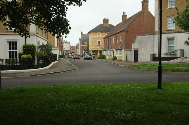
Poundbury

Poundbury is an experimental urban extension on the western outskirts of Dorchester in the county of Dorset, England. The development is led by the Duchy...

Grimstone, Dorset

Grimstone is a hamlet at the confluence of Sydling Water and the River Frome in the western part of the civil parish of Stratton, Dorset. The Great Western...

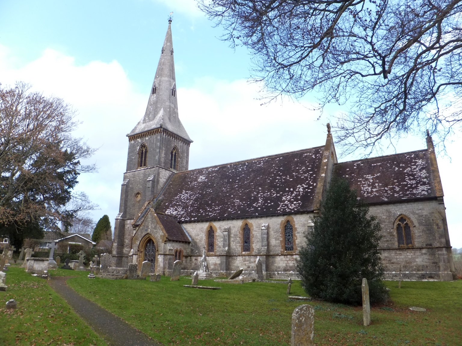
St Mary's Church, Bradford Peverell

St Mary's Church is a Church of England parish church in Bradford Peverell, Dorset, England. It was designed by Decimus Burton and built in 1849–50. The...

Winterbourne Steepleton

Winterbourne Steepleton is a village and civil parish in south west Dorset, England, situated in a winterbourne valley 5 miles (8.0 km) west of Dorchester...

Bradford Peverell

Bradford Peverell is a village and civil parish in the English county of Dorset, 2 miles (3.2 km) north-west of the county town Dorchester. It is sited...

Maiden Castle, Dorset

Maiden Castle is an Iron Age hillfort 1.6 mi (2.6 km) southwest of Dorchester, in the English county of Dorset. Hill forts were fortified hill-top settlements...

Related Videos

Poundbury - The Town Built by The King

Shop Our Favourites ⭐https://www.amazon.co.uk/shop/emmajon-yourewelcome If you would like to support the channel you can ...

Maiden Castle - LARGEST hillfort in the UK!

Maiden Castle is one of the UK's oldest and largest Iron Age Hillforts, spanning a huge 47 acres across Dorset land. Built in the ...

Nearby Amenities

Located within 500m of 50.713991,-2.4961235
Man Made: tower
Source: bing
Tower Construction: lattice
Tower Type: communication
Lat/Long: 50.7128926/-2.4893242
Direction: 185
Generator Method: photovoltaic
Generator Output Electricity: yes
Generator Solar Modules: 16
Generator Source: solar
Generator Type: solar_photovoltaic_panel
Location: roof
Power: generator
Lat/Long: 50.7111698/-2.4996264
Direction: 175
Generator Method: photovoltaic
Generator Output Electricity: yes
Generator Solar Modules: 4
Generator Source: solar
Generator Type: solar_photovoltaic_panel
Location: roof
Power: generator
Lat/Long: 50.7115804/-2.4995667
Direction: 175
Generator Method: photovoltaic
Generator Output Electricity: yes
Generator Solar Modules: 4
Generator Source: solar
Generator Type: solar_photovoltaic_panel
Location: roof
Power: generator
Lat/Long: 50.711577/-2.4996686
Direction: 175
Generator Method: photovoltaic
Generator Output Electricity: yes
Generator Solar Modules: 6
Generator Source: solar
Generator Type: solar_photovoltaic_panel
Location: roof
Power: generator
Lat/Long: 50.7115199/-2.4997756
The data included in this document is from www.openstreetmap.org. The data is made available under ODbL.

Have you been to Goldsmith's Plantation?

Leave your review of Goldsmith's Plantation below (or comments, questions and feedback).