Corston

Settlement in Wiltshire

England

Corston

Old Milestone, A429 1 km SW of Corston on the SE verge. Cut Benchmark representing 79.9 m ASL at 0.1 m GL but currently below ground level. Map designates mileage as "Malmesbury 3 / Chippenham 7"

Inscription (was): CHIPPENᴹ/ VII / MILES / MALMES.RY / III / MILES

Grade II listed, see <span class="nowrap"><a title="https://historicengland.org.uk/listing/the-list/list-entry/1284671" rel="nofollow ugc noopener" href="https://historicengland.org.uk/listing/the-list/list-entry/1284671">Link</a><img style="margin-left:2px;" alt="External link" title="External link - shift click to open in new window" src="https://s1.geograph.org.uk/img/external.png" width="10" height="10"/></span>


Milestone Society National ID: WI_CPMY07
Old Milestone, A429 Credit: Mr Red

Corston is a small village located in the county of Wiltshire, England. Situated approximately six miles northwest of the city of Bath, it is nestled in the beautiful countryside of the Avon Valley. Corston is part of the civil parish of Corston and Rodden, with an estimated population of around 500 residents.

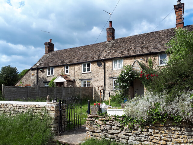
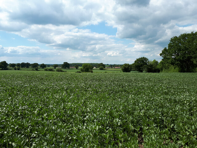
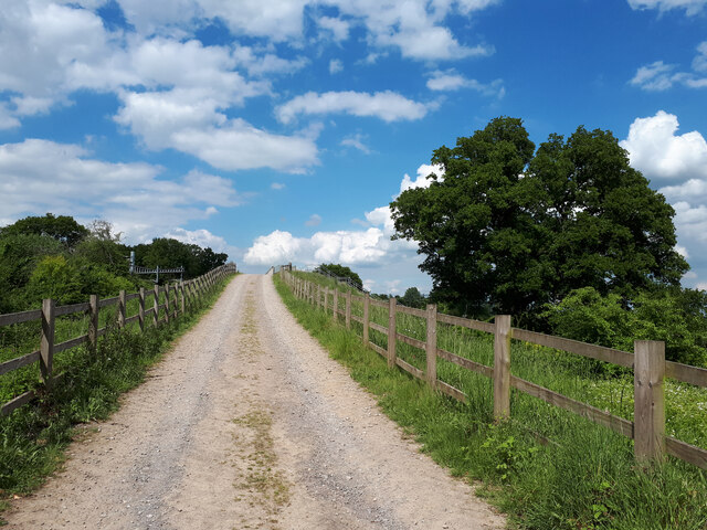
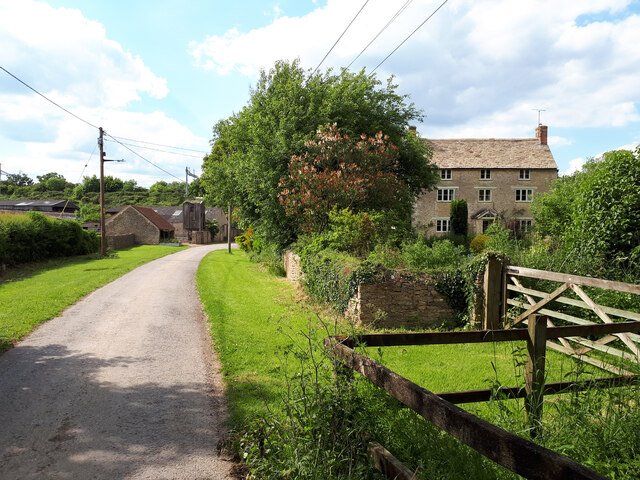
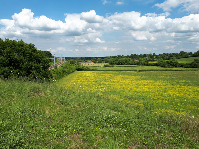
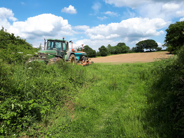
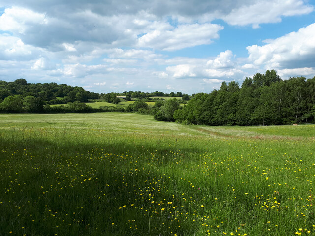
The village is known for its picturesque setting, with rolling green hills, charming cottages, and a tranquil atmosphere. The River Avon flows nearby, offering scenic views and opportunities for outdoor activities such as fishing and walking along the riverbanks. The surrounding countryside is dotted with farms and fields, adding to the rural charm of the area.

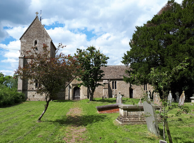
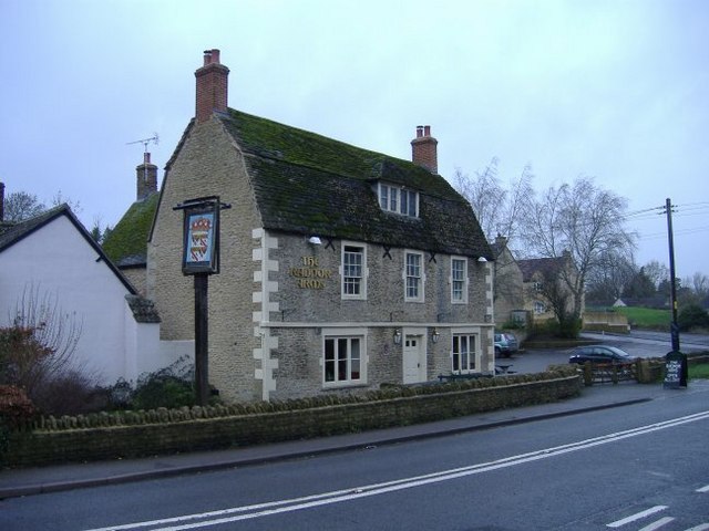
Corston has a long history, dating back to at least the Domesday Book of 1086 when it was recorded as "Corsitone." The village features a mix of architectural styles, including a 12th-century parish church, St Mary's, which is a Grade I listed building. Other notable landmarks include Corston House, a Georgian manor house, and Corston Mill, a former watermill that has been converted into residential properties.

Although Corston is a small village, it benefits from its proximity to Bath, which offers a wide range of amenities including shopping centers, restaurants, and cultural attractions. The village has a strong sense of community and hosts various events throughout the year, such as the Corston Village Fete and the annual Christmas Market.

Overall, Corston is a charming and idyllic village that appeals to those seeking a peaceful rural lifestyle, while still being within easy reach of nearby towns and cities.

If you have any feedback on the listing, please let us know in the comments section below.
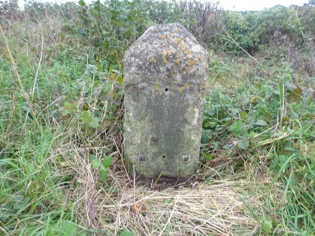
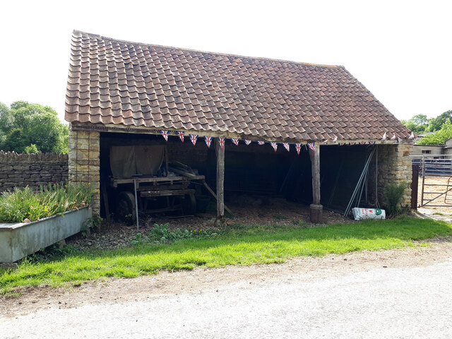
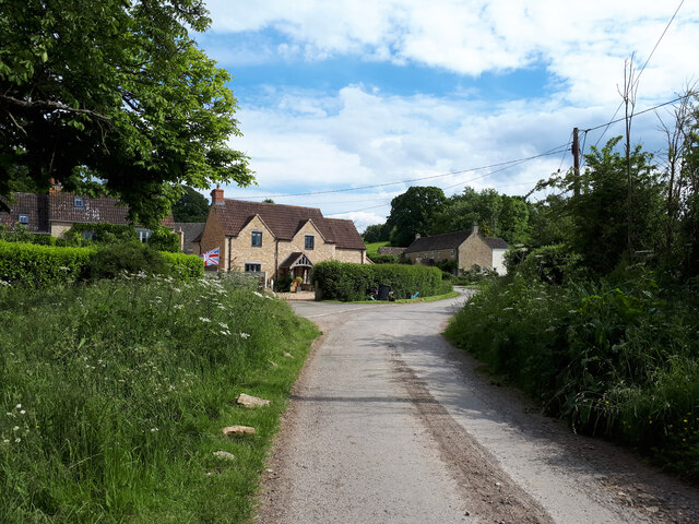
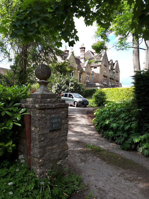
Corston Images

Images are sourced within 2km of 51.556046/-2.107861 or Grid Reference ST9284. Thanks to Geograph Open Source API. All images are credited.

Old Milestone, A429 1 km SW of Corston on the SE verge. Cut Benchmark representing 79.9 m ASL at 0.1 m GL but currently below ground level. Map designates mileage as "Malmesbury 3 / Chippenham 7"

Inscription (was): CHIPPENᴹ/ VII / MILES / MALMES.RY / III / MILES

Grade II listed, see <span class="nowrap"><a title="https://historicengland.org.uk/listing/the-list/list-entry/1284671" rel="nofollow ugc noopener" href="https://historicengland.org.uk/listing/the-list/list-entry/1284671">Link</a><img style="margin-left:2px;" alt="External link" title="External link - shift click to open in new window" src="https://s1.geograph.org.uk/img/external.png" width="10" height="10"/></span>


Milestone Society National ID: WI_CPMY07
Old Milestone, A429
1 km SW of Corston on the SE verge. Cut Benchmark representing 79.9 m ASL at 0.1 m GL but currently below ground level. Map designates mileage as "Malmesbury 3 / Chippenham 7" Inscription (was): CHIPPENᴹ/ VII / MILES / MALMES.RY / III / MILES Grade II listed, see LinkExternal link Milestone Society National ID: WI_CPMY07
Looking across a bean field towards Corston
Approaching Cabbage Lane rail overbridge
Bottom Farm, Pound Hill
View from Cabbage Lane towards Bottom Farm Buttercup meadow alongside the Swindon to the recently electrified Bristol Parkway railway line.
View from Cabbage Lane towards Bottom Farm
Buttercup meadow alongside the Swindon to the recently electrified Bristol Parkway railway line.
Tractor near field entrance on footpath to Cleeve House
Pound Hill railway bridge
Old farm building, Bottom Farm, Pound Hill With an old waggon inside. The building is decorated with bunting for the Queen's Platinum Jubilee.
Old farm building, Bottom Farm, Pound Hill
With an old waggon inside. The building is decorated with bunting for the Queen's Platinum Jubilee.
Rodbourne Bottom
Rodbourne Bottom
Cleeve House Former children's home.
Cleeve House
Former children's home.
Holy Rood Church
Holy Rood Church
View towards Cabbage Lane railway overbridge from footpath to Cleeve House
Old Milestone A429, Corston Modern image of <a href="https://www.geograph.org.uk/photo/6035268">ST9284 : Old Milestone by the A429, Corston</a>.
The plate has disappeared since 1970.
Malmesbury First Roman stone and plate, by the A429, in parish of St Paul Malmesbury Without (North Wiltshire District), Malmesbury Road, North East side of the village, by the North West side of road.
There is most likely an OS Benchmark representing 75.1 m ASL on the front face under the soil.

Inscription reads: CHIPPENᴹ. /  VIII / MILES / MALMSRY. / II /MILES

Grade II listed. July 1987 Number: 1284651 <span class="nowrap"><a title="https://historicengland.org.uk/listing/the-list/list-entry/1284651" rel="nofollow ugc noopener" href="https://historicengland.org.uk/listing/the-list/list-entry/1284651">Link</a><img style="margin-left:2px;" alt="External link" title="External link - shift click to open in new window" src="https://s1.geograph.org.uk/img/external.png" width="10" height="10"/></span>

Milestone Society National ID: WI_CPMY08
Old Milestone A429, Corston
Modern image of ST9284 : Old Milestone by the A429, Corston. The plate has disappeared since 1970. Malmesbury First Roman stone and plate, by the A429, in parish of St Paul Malmesbury Without (North Wiltshire District), Malmesbury Road, North East side of the village, by the North West side of road. There is most likely an OS Benchmark representing 75.1 m ASL on the front face under the soil. Inscription reads: CHIPPENᴹ. / VIII / MILES / MALMSRY. / II /MILES Grade II listed. July 1987 Number: 1284651 LinkExternal link Milestone Society National ID: WI_CPMY08
Village church in Corston The village church, visible from the road through the village, is on the crest of the small hill and built out of Cotswold Stone.
Village church in Corston
The village church, visible from the road through the village, is on the crest of the small hill and built out of Cotswold Stone.
The Road to Startley The road drops down the hill, and disappears under the Great Western Mainline to the West country and South Wales. An Inter City Express can be seen speeding westward.
The Road to Startley
The road drops down the hill, and disappears under the Great Western Mainline to the West country and South Wales. An Inter City Express can be seen speeding westward.
All Saints Church, Corston
Straw bales in storage An old barn near Rodbourne is full of cylindrical straw bales. The road to Malmesbury passes uphill towards the main Paddington to South Wales railway line.
Straw bales in storage
An old barn near Rodbourne is full of cylindrical straw bales. The road to Malmesbury passes uphill towards the main Paddington to South Wales railway line.
Show me another place!

Corston is located at Grid Ref: ST9284 (Lat: 51.556046, Lng: -2.107861)

Unitary Authority: Wiltshire

Police Authority: Wiltshire

What 3 Words

///blackmail.kettles.amicably. Near Malmesbury, Wiltshire

Nearby Locations

Corston

Related Wikis

Corston, Wiltshire

Corston is a small village on the A429 road in Wiltshire, England, in the civil parish of St Paul Malmesbury Without, approximately 3 miles (4.8 km) south...

St Paul Malmesbury Without

St Paul Malmesbury Without is a civil parish surrounding Malmesbury, Wiltshire, England. Its main settlements are the village of Corston and the hamlets...

Rodbourne, St Paul Malmesbury Without

Rodbourne is a small village in Wiltshire, England, in the civil parish of St Paul Malmesbury Without about 2.5 miles (4.0 km) south of the town of Malmesbury...

Cole Park

Cole Park is a Grade II* listed moated country house off Grange Lane, in the parish of St Paul Malmesbury Without, about 1+1⁄4 miles (2.0 km) south of...

Nearby Amenities

Located within 500m of 51.556046,-2.107861
Corston
Is In: Wiltshire, England, UK
Place: village
Wikidata: Q5173196
Lat/Long: 51.5555875/-2.1094918
Public Bookcase
Corston VIllage Book Exchange
Defibrillator
Booth: K6
Covered: booth
Defibrillator Location: In old red Telephone now used as book swap
Disused Amenity: telephone
Emergency: defibrillator
Indoor: yes
Man Made: telephone_box
Public Bookcase Type: phone_box
Ref: CHT-9610
Lat/Long: 51.5551373/-2.1102581
Post Box
Collection Times: Mo-Fr 09:00; Sa 07:00
Post Box Type: lamp
Ref: SN16 212D
Royal Cypher: EIIR
Royal Cypher Wikidata: Q33102113
Lat/Long: 51.5551805/-2.1102986
Tourism: picnic_site
Lat/Long: 51.5560896/-2.1131365
Historic: memorial
Memorial: war_memorial
Lat/Long: 51.554202/-2.1094799
Bus Stop
Radnor Arms (Northbound)
Bench: yes
Bin: yes
Bus: yes
Check Date Shelter: 2022-12-26
Lit: yes
Naptan AtcoCode: 4600WIA11206
Naptan Bearing: NW
Naptan CommonName: Radnor Arms
Naptan Indicator: NW-bound
Naptan NaptanCode: wilamtjg
Naptan Street: Main Road
Naptan Verified: no
Network: 92
Operator: Coachstyle
Public Transport: platform
Ref: wilamtjw
Shelter: yes
Tactile Paving: no
Lat/Long: 51.5551697/-2.1102745
Bus Stop
Radnor Arms
Bench: yes
Bin: yes
Bus: yes
Check Date Shelter: 2022-12-26
Lit: yes
Naptan AtcoCode: 4600WIA11205
Naptan Bearing: SE
Naptan CommonName: Radnor Arms
Naptan Indicator: SE-bound
Naptan NaptanCode: wilamtjw
Naptan Street: Main Road
Naptan Verified: no
Network: 92
Operator: Coachstyle
Public Transport: platform
Ref: wilamtjw
Shelter: yes
Tactile Paving: no
Lat/Long: 51.5544797/-2.1095078
Material: wood
Power: pole
Lat/Long: 51.5522111/-2.105113
Material: wood
Power: pole
Lat/Long: 51.5531009/-2.1050593
Material: wood
Power: pole
Lat/Long: 51.5540323/-2.1049896
Material: wood
Power: pole
Lat/Long: 51.5552064/-2.1049091
Material: wood
Power: pole
Lat/Long: 51.5562186/-2.105695
Material: wood
Power: pole
Lat/Long: 51.5571975/-2.1065185
Material: wood
Power: pole
Lat/Long: 51.5581798/-2.1072748
Material: wood
Power: pole
Lat/Long: 51.5585166/-2.1075162
Material: wood
Power: pole
Lat/Long: 51.5596572/-2.1084362
Material: wood
Power: pole
Lat/Long: 51.5604459/-2.1090746
Material: wood
Power: pole
Lat/Long: 51.5589795/-2.1093269
Material: wood
Power: pole
Lat/Long: 51.5583205/-2.1100223
Material: wood
Power: pole
Lat/Long: 51.5588434/-2.1109412
Material: wood
Power: pole
Lat/Long: 51.557009/-2.1076545
Material: wood
Power: pole
Lat/Long: 51.5564704/-2.1084002
Material: wood
Power: pole
Lat/Long: 51.5544212/-2.1053757
Material: wood
Power: pole
Lat/Long: 51.5537566/-2.1063207
Material: wood
Power: pole
Lat/Long: 51.555172/-2.1064381
Material: wood
Power: pole
Lat/Long: 51.5548889/-2.1055823
Material: wood
Power: pole
Lat/Long: 51.5539283/-2.1052022
Material: wood
Power: pole
Lat/Long: 51.5560086/-2.109042
Bus Stop
Foxley Turn
Bench: no
Bin: no
Bus: yes
Lit: yes
Naptan AtcoCode: 4600WIA11208
Naptan Bearing: SW
Naptan BusStopType: CUS
Naptan CommonName: Foxley Turn
Naptan Indicator: SW-bound
Naptan NaptanCode: wilamtjt
Naptan Street: Main Road
Naptan Verified: no
Public Transport: platform
Ref: wilamtjt
Shelter: no
Source: naptan;bing;naptan_compare_tool
Tactile Paving: no
Lat/Long: 51.5572048/-2.1095547
Barrier: stile
Lat/Long: 51.5552369/-2.1134725
Bench
Lat/Long: 51.5577299/-2.1112886
Bench
Lat/Long: 51.5580063/-2.1118995
Information: board
Tourism: information
Lat/Long: 51.5580841/-2.1119645
Barrier: swing_gate
Lat/Long: 51.5580973/-2.1120203
Bus Stop
Foxley Turn
Bench: no
Bin: no
Bus: yes
Lit: yes
Naptan AtcoCode: 4600WIA11207
Naptan Bearing: NE
Naptan CommonName: Foxley Turn
Naptan Indicator: NE-bound
Naptan NaptanCode: wilamtjp
Naptan Street: Main Road
Naptan Verified: no
Public Transport: platform
Ref: wilamtjt
Shelter: no
Source: naptan;bing;naptan_compare_tool
Tactile Paving: no
Lat/Long: 51.5572478/-2.109686
Parking
Parking: layby
Source: video_survey; gps_survey
Lat/Long: 51.5579242/-2.1083953
Crossing
Crossing: traffic_signals
Crossing Ref: pelican
Source: video_survey; gps_survey
Lat/Long: 51.5553348/-2.1102923
Bus Stop
Covered: yes
Shelter: yes
Lat/Long: 51.5544817/-2.1095386
The data included in this document is from www.openstreetmap.org. The data is made available under ODbL.

Have you been to Corston?

Leave your review of Corston below (or comments, questions and feedback).